Touring Red Hill
The district Red Hill of Brisbane in Brisbane (Queensland) is a subburb located in Australia about 587 mi north of Canberra, the country's capital place.
Need some hints on where to stay? We compiled a list of available hotels close to the map centre further down the page.
Being here already, you might want to pay a visit to some of the following locations: Sunshine Coast, Carrolls Creek, , and . To further explore this place, just scroll down and browse the available info.
Local weather forecast
Todays Local Weather Conditions & Forecast: 23°C / 73 °F
| Morning Temperature | 15°C / 59 °F |
| Evening Temperature | 20°C / 69 °F |
| Night Temperature | 18°C / 65 °F |
| Chance of rainfall | 0% |
| Air Humidity | 60% |
| Air Pressure | 1025 hPa |
| Wind Speed | Gentle Breeze with 8 km/h (5 mph) from North-West |
| Cloud Conditions | Broken clouds, covering 53% of sky |
| General Conditions | Light rain |
Monday, 29th of April 2024
24°C (75 °F)
18°C (64 °F)
Sky is clear, gentle breeze, clear sky.
Tuesday, 30th of April 2024
23°C (74 °F)
18°C (64 °F)
Light rain, gentle breeze, broken clouds.
Wednesday, 1st of May 2024
23°C (73 °F)
18°C (64 °F)
Light rain, gentle breeze, scattered clouds.
Hotels and Places to Stay
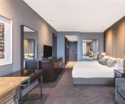
GAMBARO HOTEL
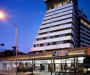
HOTEL URBAN BRISBANE
Hotel Jen (formerly Traders Brisbane)
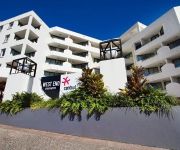
WEST END CENTRAL
SOUTH CENTRAL APARTMENTS
Milton Motel Apartments
Milton Motel Apartments
WATERMARK HOTEL BRISBANE
PARK REGIS NORTH QUAY
METROPOLITAN MOTOR INN
Videos from this area
These are videos related to the place based on their proximity to this place.
47 Wilden Street Paddington 4064 QLD by Mark Te Whare
This high set original home with impressive city views is within metres from Latrobe Terrace and strolling distance to Rosalie village, it offers the quintessential Paddington lifestyle.The...
Shops 2 and 3 FOR LEASE 257 Given Terrace Paddington COMMERCIAL PROPERTY by RE/MAX Commercial CITY
Shops 2 &3/257 Given Terrace, Paddington: Geoff Esdale 0408 787 082 Given Tce Paddington is one of Brisbane's oldest and most popular fashion and food thoughafairs. Running from the very edge.
21 Surrey Street Red Hill 4059 QLD by Glynis Austin
City Views are just the beginning with this stylish home on Paddington's fringe. This delightful residence with clean modern lines is sure to impress those seeking a carefree and easy Inner...
Unit 6, 25 Upper Clifton Terrace - Red Hill (4059) Queenslan...
Property Video shoot of Unit 6, 25 Upper Clifton Terrace - Red Hill (4059) Queensland by PlatinumHD http://www.platinumhd.tv for Harcourts Solutions Inner City.
Sold by Grant Penrose RE/MAX Profile Red Hill QLD Real estate 0418 747 035 Smakk Media Video
This property has been Sold 14/109 Musgrave Road Red Hill QLD 4059 property for sale and proudly marketed by Grant Penrose Mobile 0418 747 997 RE/MAX Profile. Directions: ...
17 Jay Street - Red Hill (4059) Queensland by Glynis Austin
Throughout this remarkable home you'll find great care and attention down to the finest detail. Upmarket and stylish, every inch of this inner-city abode is finished with the latest and...
Speed Skating the Hill - Paddington
Nothing special again, the first and last clips are the hill outside my front door. it's been staring at me the whole time and finally got the balls to give it a go. felt quick. just having...
KPB101 The Lost Phone
Siobhan comes back from the 24 hour computer lab at Kelvin Grove Campus. She heads on to the shaded table for a break and as she sits down she looks for her phone and realizes that she has...
For Rent - 20/11 Glin Avenue Newmarket - Property Management Newmarket
http://rentalexpresspropertymanagement.com.au/rental-properties/rental-display/3-bedroom-townhouse-for-rent-newmarket,5357 Stylish and Contemporary Town house with Private Courtyard 3 KM ...
44 Park Street Kelvin Grove (4059)
Kelvin Grove is an inner northern suburb of Brisbane. When I think of the area, I think of modern institutions like QUT or Brisbane Hospital... But for true Brisbane locals, pictures of renovated...
Videos provided by Youtube are under the copyright of their owners.
Attractions and noteworthy things
Distances are based on the centre of the city/town and sightseeing location. This list contains brief abstracts about monuments, holiday activities, national parcs, museums, organisations and more from the area as well as interesting facts about the region itself. Where available, you'll find the corresponding homepage. Otherwise the related wikipedia article.
Castlemaine Perkins
Castlemaine Perkins is a brewery located in Milton, Brisbane, Australia. It is a wholly owned entity of the Japanese-controlled Lion Nathan company.
Lang Park
Lang Park is the original name of the site located in the Brisbane suburb of Milton, Queensland, Australia, now occupied by the major sports facility known by its sponsorship name, Suncorp Stadium (formerly Suncorp-Metway Stadium). Lang Park is also known as Brisbane Stadium when in use during AFC competitions due to conflicting sponsorship reasons. The current facility comprises a three tiered rectangular sporting stadium with a capacity of 52,500 people.
Milton railway station, Brisbane
Milton Station is a railway station in Milton, Brisbane, Australia on the Ipswich and Rosewood and Springfield lines. The station includes a walkbridge to Suncorp Stadium and is also immediately adjacent the famous Castlemaine Perkins brewery in Milton.
Kelvin Grove, Queensland
Kelvin Grove is an inner northern suburb of Brisbane, Queensland, Australia located approximately 3 km from the CBD. This hilly suburb takes its name from Kelvingrove Park in Glasgow, Scotland. It is primarily residential with tree-lined streets and some commercial and light industrial activities along its main thoroughfare, Kelvin Grove Road. It is the location of La Boite Theatre, Queensland's second largest theatre company.
Ashgrove, Queensland
Ashgrove is an inner suburb of Brisbane in Queensland, Australia, located approximately 4 km north-west of the Brisbane CBD. Ashgrove is a leafy residential suburb, characterised by its hilly terrain and characteristic Ashgrovian houses built in the early 20th century.
Paddington tram depot fire
The Paddington tram depot in Brisbane, Australia was destroyed by fire on the night of 28 September 1962, one of the largest fires in Brisbane's history. Sixty-five of Brisbane's trams were destroyed.
Kelvin Grove State College
Kelvin Grove State College is located at Kelvin Grove, Queensland three kilometres from Brisbane’s central business district and adjacent the Kelvin Grove campus of Queensland University of Technology (QUT). It formed in 2002 with the amalgamation of Kelvin Grove State High School and Kelvin Grove State School and is one of the largest government educational institutions in Australia.
Normanby busway station
The Normanby Busway Station is part of the Northern Busway in Brisbane, Australia. It is adjacent to Brisbane Grammar School and the Inner City Bypass. It is in Zone 1/2 of the TransLink integrated public transport system.
QUT Kelvin Grove busway station
The QUT Kelvin Grove Busway Station is part of the Northern Busway. It is adjacent to Queensland University of Technology's Kelvin Grove campus in Brisbane, Australia. It is in Zone 1 of the TransLink integrated public transport system.
Whiskey Au Go Go fire
The Whiskey Au Go Go fire was a fire that occurred at 2.10 am on Thursday 8 March 1973, in the Whiskey Au Go Go nightclub in Fortitude Valley, Brisbane, Australia that killed 15 people. The building is at 356 St Pauls Terrace, Fortitude Valley (on the corner of Amelia Street and St Paul's Terrace) and still stands as of 2013.
Paddington, Queensland
Paddington is an inner suburb of Brisbane, Australia located 2 km west of the Brisbane CBD. As is common with other suburbs in the area, Paddington is located on a number of steep ridges and hills. It was originally settled in the 1860s. Many original and distinctive Queenslander homes can be found in the suburb. Houses are frequently built on stumps, owing to the steep nature of their blocks. In recent years, Paddington has become a very desirable residential location.
Red Hill, Queensland
Red Hill is an inner suburb of Brisbane, Australia 3 km north-west of the Brisbane CBD. The suburb is very hilly and mainly residential, with shops and small businesses located on Musgrave and Waterworks Roads. Until August 1968 electric trams ran along these roads, as well as Enoggera Terrace. Red Hill has gained some literary significance, thanks to the Nick Earls novel "Zig Zag Street", set in the Red Hill street of the same name.
Caxton Street, Brisbane
Caxton Street is a street in Brisbane, Queensland, Australia located in the suburb of Paddington. Since the mid-19th century it has been one of Brisbane’s iconic precincts. The area prospered due to the local army barracks with Trams running along the street and establishments like the Caxton Street Hotel, Ithaca Baths (now demolished), and the Caxton Street Hall (now demolished).
Holloway Field
Holloway Field is home to the Windsor Royals baseball club in Newmarket, Queensland, Australia. It is regarded as the home of baseball in Brisbane.
Brisbane Grammar School
Brisbane Grammar School (BGS) is an independent, non-denominational, day and boarding school for boys, located in Spring Hill, an inner suburb of Brisbane, Queensland, Australia. It is the oldest secondary boys school in Brisbane. Established in 1868 under the Grammar Schools Act which was passed by the Queensland Government in 1860, the school has a non-selective enrolment policy and currently caters for approximately 1424 students from Years 6 to 12, including 135 boarders.
Town of Ithaca
Ithaca was a local government area of Queensland, located in western Brisbane. The Division of Ithaca was first proclaimed in 1879, and originally covered an area that stretched from Windsor, Kelvin Grove and Milton in the east, through to The Gap and beyond the Enoggera Dam in the west. In 1887 the division was split into the Shire of Windsor and the Division of Enoggera, with the remainder in the south east becoming the Shire of Ithaca.
Lucerne on Fernberg
Lucerne is a heritage-listed property in Paddington, Brisbane the capital city of Queensland, Australia. It was built between 1859 and 1862 and is believed to be the oldest privately owned residence in Brisbane.
Marist Brothers College Rosalie
Sacred Heart College, also known as Marist Brothers Rosalie, was a Catholic boys' college located in Paddington, an inner western suburb of Brisbane, Queensland, Australia. The college had been a high school for students in grades 8 to 12, but was closed at the end of 2008.
Queensland Academy for Creative Industries
The Queensland Academy for Creative Industries (QACI) is a selective high school in Queensland, Australia which offers the IB Diploma Programme. The school aims to provide a platform for students intending to pursue careers in the fields of film and television, music, visual art, and the performing arts. Students are selected through a process of testing, interviews and auditions to ensure that they are suited to the demands of the academy.
Legacy Way
The M5 Legacy Way (formerly Northern Link Tunnel) is the fourth of five components of Brisbane City Council's TransApex Project. The project involves two bored tunnels carrying two motorway grade lanes of traffic in each direction from the Western Freeway in Toowong to the Inner City Bypass at Kelvin Grove. The tunnel will be approximately 5.5 km long and will be tolled for approximately 45 years.
Northern University Games
The Northern University Games (NUG) is an Australian inter-varsity multi-sport competition held annually in mid-year break (June/July in Australia) between universities and tertiary institutions from Queensland, Northern Territory and northern New South Wales. The games attract on average 600 competitors every year across seven different sports. It was first held in 2005.
Victoria Barracks, Brisbane
Victoria Barracks is an Australian Army base in the Brisbane suburb of Petrie Terrace in Queensland. The Victoria Barracks Museum is located on the site, and contains a large collection of replica and service medals covering the Army's involvement in the Boer War, World War I and World War II. Recently, a portion of the western part of Victoria Barracks has been redeveloped as a retail district called "The Barracks".
CARRS-Q
The Centre for Accident Research and Road Safety - Queensland (CARRS-Q) is a research centre established in 1996. It is based at the Kelvin Grove campus of Queensland University of Technology (QUT) in Queensland, Australia and is part of both the Faculty of Health and the Institute of Health and Biomedical Innovation (IHBI).
Enoggera Road, Brisbane
Enoggera Road is one of Brisbane's main roads which connects to the City, which is the main access road for residents of north west Brisbane. Enoggera Road is also home to the Reading Newmarket Shopping Centre, one of the first North-side Brisbane McDonalds located at Newmarket and the Newmarket public pool located at Alderley.
Queensland Stock Institute
The Queensland Stock Institute was a government scientific facility in Brisbane, Queensland, Australia, for the research and prevention of disease in agricultural animals relevant to Queensland. Established in 1893, it was the first research institution in Queensland dedicated to the investigation of disease. In 1900 it was renamed the Bacteriological Institute when activities were officially extended to include human pathology.


