Delve into Kangaroo Point
The district Kangaroo Point of in Brisbane (Queensland) is a subburb in Australia about 587 mi north-east of Canberra, the country's capital town.
If you need a hotel, we compiled a list of available hotels close to the map centre further down the page.
While being here, you might want to pay a visit to some of the following locations: Brisbane, Sunshine Coast, Carrolls Creek, and . To further explore this place, just scroll down and browse the available info.
Local weather forecast
Todays Local Weather Conditions & Forecast: 23°C / 73 °F
| Morning Temperature | 15°C / 59 °F |
| Evening Temperature | 20°C / 69 °F |
| Night Temperature | 18°C / 65 °F |
| Chance of rainfall | 0% |
| Air Humidity | 60% |
| Air Pressure | 1025 hPa |
| Wind Speed | Gentle Breeze with 8 km/h (5 mph) from North-West |
| Cloud Conditions | Broken clouds, covering 53% of sky |
| General Conditions | Light rain |
Monday, 29th of April 2024
24°C (75 °F)
18°C (64 °F)
Sky is clear, gentle breeze, clear sky.
Tuesday, 30th of April 2024
23°C (74 °F)
18°C (64 °F)
Light rain, gentle breeze, broken clouds.
Wednesday, 1st of May 2024
23°C (73 °F)
18°C (64 °F)
Light rain, gentle breeze, scattered clouds.
Hotels and Places to Stay
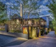
Spicers Balfour Hotel
The Point Brisbane
The Sebel Quay West Brisbane
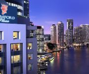
Stamford Plaza Brisbane
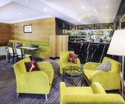
Capri by Fraser
Oaks 212 Margaret
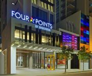
Four Points by Sheraton Brisbane
Central Dockside
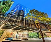
MANTRA MIDTOWN
Oaks Aurora
Videos from this area
These are videos related to the place based on their proximity to this place.
Walking down (Australia) Brisbane's new Riverwalk 2014
New Farm Riverwalk replacement project The resurrected Riverwalk will opened on Sunday, September 21, three and a half years after the original floating structure washed away in the 2011 floods....
New Farm, Brisbane
New Farm is an inner city village steeped in historical charm and revived youthful energy. Shaded streets feature pop-up markets, cafes, lifestyle boutiques and artistic talent at the iconic...
Brisbane City In The Sun
Original 1954 synopsis: A portrait of the sub-tropical city of Brisbane, Queensland. Queensland's capital city lies near the sub-tropical parts of Australia and its way-of-life has a more leisurely...
Chicco Australia Cortina Travel System
Chicco Cortina Travel System - check out the latest deals at http://babynurseryonline.com.au/prod667.htm The Chicco Cortina Travel System is super light and comes loaded with features both...
Cute Lizard @ Brisbane City Botanic Gardens with Lumix FZ200
Trying out my new camera on a Sunday afternoon - Panasonic Lumix FZ200. First time to edit a video, enjoy! :) I am very impressed by the quality of this super zoom constant F2.8 camera. Still...
Bribie Island 4WD Day Trip 2
Sunday 6th November, 2011. Headed up to Bribie Island for a 2nd time. This time we got away very early in the morning so as to enjoy a full day of fishing, 4Beeing and swimming as well as checking...
Dust Storm, Brisbane, Australia September 23, 2009
Very sorry about the terrible audio, I had a window open. This is taken driving across the riverside expressway. On the right the buildings of the city are usually clearly visable and on...
654/420 Queen Street - Brisbane (4000) Queensland by Nigel Summerville
Property Video shoot of 654 Aurora Towers : 420 Queen Street - Brisbane (4000) Queensland by PlatinumHD http://www.platinumhd.tv for.
Videos provided by Youtube are under the copyright of their owners.
Attractions and noteworthy things
Distances are based on the centre of the city/town and sightseeing location. This list contains brief abstracts about monuments, holiday activities, national parcs, museums, organisations and more from the area as well as interesting facts about the region itself. Where available, you'll find the corresponding homepage. Otherwise the related wikipedia article.
Story Bridge
The Story Bridge is a steel cantilever bridge spanning the Brisbane River that carries vehicular, bicycle and pedestrian traffic between the northern and the southern suburbs of Brisbane, Queensland, Australia. It is the longest cantilever bridge in Australia. The bridge is part of Bradfield Highway (15) and connects Fortitude Valley to Kangaroo Point. It is named for John Douglas Story.
Brisbane
Brisbane is the capital and most populous city in the Australian state of Queensland and the third most populous city in Australia. Brisbane's metropolitan area has a population of 2.15 million, and the South East Queensland urban conurbation, centered on Brisbane, encompasses a population of more than 3 million.
Queensland University of Technology
Queensland University of Technology (QUT) is a major Australian university with a strong focus on applied research. Based in Brisbane, it has about 40,000 students, including 6,000 international students, with over 4,000 staff members, and an annual budget of more than A$750 million. QUT ranks within the top 10 Australian Universities and upper 3% world-wide.
Kangaroo Point, Queensland
Kangaroo Point is a suburb of Brisbane, Queensland, Australia located directly east across the Brisbane River from the Brisbane central business district. At the 2011 Australian Census the suburb recorded a population of 7,000. The suburb features two prominent attractions, the Story Bridge and Kangaroo Point Cliffs.
City Botanic Gardens
The City Botanic Gardens (formerly the Brisbane Botanic Gardens) is located on a point known as Gardens Point on the Brisbane River adjacent to the central business district of the city of Brisbane. The gardens area has frontages on both Alice Street and George Street. The roughly triangular park is bordered by the Brisbane River on one side, and the grounds of Parliament House and the Queensland University of Technology's Gardens Point campus on another.
Kangaroo Point Cliffs
The Kangaroo Point Cliffs are located at Kangaroo Point just across the Brisbane River from the Brisbane CBD in Queensland, Australia. A popular recreation spot, they are conveniently close to the city and the South Bank Parklands. It can be reached by the Pacific Motorway, South-East Busway or a ferry to Thornton Street Wharf. The Cliffs are situated on the east bank of the river north of the Maritime Museum and opposite the Queensland University of Technology.
QUT Business School
The QUT Business School is one of the five schools in the Faculty of Business at the Queensland University of Technology. The university was established in 1908 and QUT Business School (then Brisbane Graduate School of Business) was established in 1995. The school offers a Master of Business Administration program and a Graduate Certificate in Business Administration. QUT Business School also administers the discipline based Masters of Business and Graduate Certificate in Business programs.
1974 Brisbane flood
The 1974 Brisbane flood occurred in January 1974 in Brisbane, Queensland, Australia, when waterways in the city experienced significant flooding. The Brisbane River, which runs through the heart of the city, broke its banks and flooded the surrounding areas.
Post Office Square, Brisbane
Post Office Square is a public square which is built over a collection of shops. The square is situated between Queen Street and Adelaide Street, Brisbane, Queensland, Australia. Post Office Square was opened on 5 April 1984. The Post Office Square park area is on the Queen Street level, while the Post Office Square shops are on the Adelaide Street level.
Clem Jones Tunnel
The M7 Clem Jones Tunnel (CLEM7), known during its development as the North-South Bypass Tunnel (NSBT), is a A$3.2 billion motorway grade toll road built under the Brisbane River, which crosses between the suburbs of Woolloongabba and Bowen Hills in Brisbane, Queensland. The CLEM7 Community Open Day, a public open day which included a tunnel run and walk, was held on 28 February 2010.
Mowbray Park ferry wharf
Mowbray Park is a ferry wharf in the suburb of East Brisbane used by the CityCat on the Brisbane River. Mowbray Park is named for Thomas Mowbray, a presbyterian minister who had been minister at Blackridge Parish Church, Scotland. In January 2011 the wharf sustained a moderate damage during the devastating floods; it was repaired and reopened on 14 February 2011.
Sydney Street ferry wharf
Sydney Street is a ferry wharf in the suburb of New Farm used by the CityCat and the CityFerry on the Brisbane River. In January 2011 the wharf was destroyed during the devastating floods, but was rebuilt shortly after, re-opening on the 18th of April 2011.
Dockside ferry wharf
Dockside is a ferry wharf in the suburb of Kangaroo Point used by the CityFerry on the Brisbane River. In January 2011 the wharf sustained a minor damage during the devastating floods; it was repaired and reopened on 14 February 2011.
Holman Street ferry wharf
Holman Street is a ferry wharf in the suburb of Kangaroo Point used by the CityFerry on the Brisbane River. On January 12, 2011, most of the wharf was destroyed and washed away during flooding of the Brisbane River and the rebuilding works are expected to take months.
Eagle Street Pier ferry wharf
Eagle Street Pier ferry wharf is a ferry wharf in the Brisbane CBD used by the CityFerry on the Brisbane River. In January 2011 the wharf sustained a moderate damage during the devastating floods; it was repaired and reopened on 14 February 2011.
Riverside ferry wharf
Riverside is a ferry wharf in the Brisbane CBD used by the CityCat on the Brisbane River. It is part of the Riverside Centre, in the heart of the financial district of the Brisbane central business district and immediately adjacent to the Brisbane Stock Exchange. In January 2011 the wharf sustained a moderate damage during the devastating floods but was repaired and reopened on 14 February 2011.
Thornton Street ferry wharf
Thornton Street is a ferry wharf in the Brisbane CBD used by the CityFerry on the Brisbane River. In January 2011 the wharf sustained a moderate damage during the devastating floods and was repaired and reopened on 14 February 2011.
Shafston College
Shafston International College is a private education institution for international students located in Brisbane, Australia. It offers certificate, diploma and English language programs. Shafston was established in 1996 and has grown rapidly with over 50,000 students having attended since its inception. Shafston has a diverse student population with over 36 different nationalities on campus at any given time.
Alice Street, Brisbane
Alice Street is a central road in Brisbane, Australia. It is the most southern major road in the city's central business district, running parallel to the other female named streets in the city. In a pocket of land between a curve of the Brisbane River and Alice Street is the Brisbane City Botanic Gardens and the Parliament House. Access to the Gardens Point QUT campus and the Riverside Expressway is provided at the western end of the street.
Margaret Street, Brisbane
Margaret Street is a major road in the central business district of Brisbane. The street is one of a number that were named after female members of the royal family shortly after the penal colony was settled. Alice Street lies to the south, while Mary Street runs parallel to the north. Traffic flow along the street is restricted to one direction, towards the north east. From the south an exit ramp from the Riverside Expressway becomes Margaret Street at the William Street intersection.
Charlotte Street, Brisbane
Charlotte Street is a road in the central business district of Brisbane. The street is one of a number that were named after female queens and princesses of the royal family shortly after the penal colony was settled. Mary Street runs parallel to the south and Elizabeth Street is the next street to the north. The one-directional road begins at a T-intersection where Creek Street becomes Eagle Street, close to the Brisbane River.
Mary Street, Brisbane
Mary Street is a major road in the Brisbane central business district. The street is one of a number that were named after female queens and princesses of the royal family shortly after the penal colony was settled. Charlotte Street is positioned parallel to the north and Margaret Street runs next to the south. Mary Street begins in the Government Precinct at a T-intersection with George Street opposite the Executive Building.
Metro Arts Theatre
The Metro Arts Theatre is a performing arts venue located in Edward Street in Brisbane, Australia. The building contains two performance venues, the Sue Benner Theatre and the Studio. The theatre emerged as a community arts centre in the mid 1970s, and was purchased by Metro Arts in 2001. The Metro Arts building currently supports more than 30 creative businesses, individual artist studios and retail outlets.
Howard Smith Wharves
Howard Smith Wharves is a wharf site on the Brisbane River in Brisbane, Queensland, Australia. The 3.5 ha site is culturally and historically significant and is one of the last undeveloped riverfront locations in Brisbane. Brisbane City Council had initially proposed an extensive commercial development of the site that includes hotel, sport and entertainment facilities in new or refurbished old buildings.
Central Plaza Complex
The Central Plaza Complex consists of three commercial office buildings located in the Central Business District of Brisbane, Queensland, Australia. The complex was constructed in three phases with Central Plaza 1 completed first in 1988, followed by Central Plaza 2 in 1990 and Central Plaza 3 in 2008. Central Plaza 1 is the tallest of the three buildings, as well as the fifth tallest building in Brisbane.


