Explore Upper Kedron
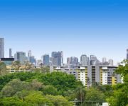
The district Upper Kedron of Brisbane in Brisbane (Queensland) is located in Australia about 587 mi north of Canberra, the country's capital.
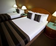
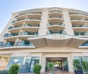
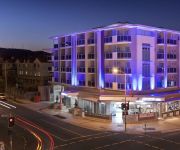
If you need a place to sleep, we compiled a list of available hotels close to the map centre further down the page.
Depending on your travel schedule, you might want to pay a visit to some of the following locations: Sunshine Coast, Carrolls Creek, , and . To further explore this place, just scroll down and browse the available info.
Local weather forecast
Todays Local Weather Conditions & Forecast: 24°C / 75 °F
| Morning Temperature | 16°C / 60 °F |
| Evening Temperature | 22°C / 71 °F |
| Night Temperature | 18°C / 64 °F |
| Chance of rainfall | 0% |
| Air Humidity | 50% |
| Air Pressure | 1024 hPa |
| Wind Speed | Gentle Breeze with 6 km/h (4 mph) from West |
| Cloud Conditions | Few clouds, covering 13% of sky |
| General Conditions | Few clouds |
Tuesday, 30th of April 2024
24°C (75 °F)
17°C (63 °F)
Light rain, gentle breeze, few clouds.
Wednesday, 1st of May 2024
23°C (73 °F)
17°C (63 °F)
Light rain, gentle breeze, broken clouds.
Thursday, 2nd of May 2024
22°C (72 °F)
17°C (62 °F)
Light rain, gentle breeze, overcast clouds.
Hotels and Places to Stay
RENDEZVOUS BRISBANE ON GEORGE
Central Cosmo
Toowong Villas
JEPHSON HOTEL
Milton Motel Apartments
Milton Motel Apartments
THE OASIS APARTMENTS
Brook Hotel
Toowong Central Motel Apartments
TOOWONG INN AND SUITES
Videos from this area
These are videos related to the place based on their proximity to this place.
6 Havelock Court Camp Mountain Qld 4520
Welcome to a unique real estate opportunity. For the first time on the market in over thirty years, we present “Bleak House” - an elegant, two story Victorian residence, on two picturesque...
Sold by Vicki Harper 0417 771 397 & Marc Gregory 0417 407 437 LJ Hooker Albany creek Smakk Media
20 Tarcoola Avenue Ferny Hills property for sale by LJ Hooker Albany Creek. Call Vicki Harper today on 0417 771 397 or Marc Gregory on 0417 407 437 With a solid structure this home is crying...
Bunya Landfill Blasting February 2012
Blasting of rock material for the new landfill cell at the Bunya Waste Facility.
Discover Travel and Cruise Insight Tours Early Bird Deal (conditions apply) Brisbane Travel Agents
This video is about Discover Travel and Cruise - Insight Tours Early Bird Deal. This is one of Brisbane's best Travel Agents and have multiple offices on Brisbane's north side. We also have...
Discover Travel & Cruise Client recommendations, Member of Travellers Choice Travel Agents
Discover Travel & Cruise is independently owned and operated by Denise Falsay. Denise started her travel career as an office junior at the age of sixteen in a travel agency in Glasgow, Scotland...
Effects of a Circular Polarizer
A circular polarizer is a great tool in landscape photography. This video is an infield demonstration of the effects of a circular polarizer on water with glare. More tutorials and videos...
Red Light Runner Ferny Grove
915 RXB firstly creeping through the train intersection while the lights are still flashing, clearly going past the visible stop line, then proceeding down the road and running a red light...
RGTV - Tim Effeney - Cyclones Summer Series (Ferny Grove State High School) Qualification
gopro HD Hero 3 Silver Edition worn by Queensland Cyclones member Tim Effeney at a local orienteering event in Brisbane. (Best viewed in HD) Date: 23 Februar...
Videos provided by Youtube are under the copyright of their owners.
Attractions and noteworthy things
Distances are based on the centre of the city/town and sightseeing location. This list contains brief abstracts about monuments, holiday activities, national parcs, museums, organisations and more from the area as well as interesting facts about the region itself. Where available, you'll find the corresponding homepage. Otherwise the related wikipedia article.
B105 FM
B105 is a commercial FM radio station broadcasting on 105.3 MHz in Brisbane, Australia. It is part of the Austereo Radio Network. B105's primary audience is 10 to 24 age group.
Oxford Park railway station
Oxford Park is a railway station on the Ferny Grove Line of Brisbane, Australia. It is part of the Queensland Rail City network. It is in Zone 3 of the TransLink integrated public transport system.
Keperra railway station
Keperra is a railway station on the Ferny Grove Line of Brisbane, Australia. It is part of the Queensland Rail City network. It is in Zone 3 of the TransLink integrated public transport system.
Grovely railway station
Grovely is a railway station on the Ferny Grove Line of Brisbane, Australia. It is part of the Queensland Rail City network. It is in Zone 3 of the TransLink integrated public transport system.
Ferny Grove railway station
Ferny Grove is a railway station on the Ferny Grove Line of Brisbane, Australia. It is part of the Queensland Rail City network. It is the terminus for the Ferny Grove Line. It is in Zone 3 of the TransLink integrated public transport system. The Brisbane Tramway Museum is a short walk south of the station. The line formerly extended to Dayboro, but was cut back to Ferny Grove in 1955, as part of a larger rationalisation by the Queensland Government of its railway lines.
4ZZZ
4ZZZ (pronounced "Four Triple Zed" or simply "Triple Zed") is an independent community radio station operating in Brisbane, Queensland, Australia, at the frequency 102.1 FM. As a community radio station, 4ZZZ is a member of the Community Broadcasting Association of Australia. The station broadcasts to much of South-East Queensland, parts of Northern NSW and web streams from its website.
Camp Mountain rail accident
The Camp Mountain rail accident occurred at approximately 9:48am on 5 May 1947 when a crowded picnic train derailed on a sharp left-hand curve between Ferny Grove and Camp Mountain stations on the now-closed Dayboro line, approximately 15 km northwest of Brisbane, the state capital of Queensland, Australia.
The Gap, Queensland
The Gap is a leafy and hilly suburb of Brisbane, in Queensland, Australia, located approximately 11 km west of the Brisbane CBD.
Nova 106.9
Nova 106.9 is a commercial radio station operating in Brisbane, Australia, owned by the DMG Radio Network. DMG Radio purchased the Brisbane FM licence for $80 million in April 2004 to complete their national network of Nova stations. Nova 106.9's studios are located at 130 Commercial Road in Teneriffe.
Brisbane Tramway Museum
Brisbane Tramway Museum is a transport museum which preserves and displays trams and trolley-buses, most of which operated in Brisbane, Queensland, Australia. The museum also has a collection of vehicles and other equipment used in maintaining Brisbane's electric street transport system which operated from 1897 to 1969. The Museum is located at Ferny Grove, a north-west suburb of Brisbane. The museum is operated by the Brisbane Tramway Museum Society, a not-for-profit public company.
Brisbane Forest Park
Brisbane Forest Park (now officially the southern part of D'Aguilar National Park), is located on parts of the D'Aguilar Range. The large nature reserve lies on the western boundary of Brisbane, Queensland, Australia, in Enoggera Reservoir, adjacent to The Gap and between the Mount Coot-tha Reserve on the Taylor Range and higher peaks to the north. Brisbane Forest Park supports plants and animals and is essential to their survival.
Ferny Grove State High School
Ferny Grove State High School is a public high school in the suburb of Ferny Grove, in Brisbane, Australia. The school has 1476 students enrolled as of the end of 2010. In 2007, the school won the award for the most innovative music program in Queensland. Ferny Grove has also won the award for the cleanest school for the last 8 years, With the latest Green and Healthy Schools award being won in 2010.
Ferny Grove, Queensland
Ferny Grove is a residential suburb in north-west Brisbane, Queensland, Australia. It lies entirely within the Brisbane-metropolitan area administered by the Brisbane City Council.
Keperra, Queensland
Keperra is a suburb in Brisbane, Queensland, Australia which is located approximately 9 kilometres north-west of the CBD. It has a deep and rich history, with some thinking that the name was based upon the Aboriginal term for “Kipper” (a young tribe member who has reached initiation age). Two bora rings used to be located within the suburb, one near the corner of Samford Road and Keperra Street (now under housing) and one which disappeared with the construction of the Keperra Country Club.
Upper Kedron, Queensland
Upper Kedron is an outer suburb of Brisbane, Australia located 15 km north-west of the Brisbane CBD. Upper Kedron is a residential suburb on the edge of the Brisbane Forest Park. The suburb contains the headwaters of the two tributaries of Kedron Brook, namely Kedron Creek and Cedar Creek.
Enoggera Reservoir, Queensland
Enoggera Reservoir is an outer suburb of Brisbane, Queensland, Australia, which is located 8 kilometres north-west of the CBD and bordering the Moreton Bay Region and The Gap. It contains Peewee Bend. The Enoggera Reservoir suburb is named after the Enoggera Reservoir Dam. As of 12 February 2011, sufficient water inflows returned the reservoir to usable levels, and water is now used to supply neighbouring suburbs.
Arana Hills, Queensland
Arana Hills is a suburb within Moreton Bay, 12 km north-west of Brisbane, the capital city of Queensland, Australia on the edge of the Bunyaville Forest Reserve. Its local government area is the Moreton Bay Region.
Bunya, Queensland
Bunya is a suburb north-west of Brisbane, the capital city of Queensland, Australia. Its local government area is the Moreton Bay Region. Bunya is home to the Bunyaville Forest Reserve, operated by the Queensland Parks and Wildlife Service. Spotted gum, grey ironbark, narrow-leaved ironbark, white mahogany, tallowwood, forest red gum, grey gum and brush box grow in the open forests.
Ferny Hills, Queensland
Ferny Hills is an outer suburb north-west of Brisbane, Australia, and is located along Samford Road at the edge of the Brisbane Forest Park. Its local government area is the Moreton Bay Region. Ferny Hills is almost entirely a residential suburb. It contains two primary schools, Ferny Hills State School, which opened in 1970 and is among the last Queensland primary schools to be built in the more traditional high-set format, and Patricks Road State School, which opened in 1977.
Camp Mountain, Queensland
Camp Mountain is a rural locality northwest of Brisbane, Queensland, Australia, near Samford. It is 20 km north-west of the Brisbane central business district. Parts of it are within the Brisbane Forest Park and a lookout and recreation area is accessible off Mount Nebo Road. Until 1955 the train line to Dayboro traversed the area and in 1947 was the location of Queensland's worst railway accident. \t\t \t\t\tView-of-Brisbane-city-from-Camp-Mountain.
4MBS
4MBS Classic FM is a Brisbane community radio station that broadcasts classical music, jazz and nostalgia throughout South East Queensland. It is broadcast at a frequency of 103.7 MHz. Its operations are conducted by volunteers and a small number of paid staff. Operational funding is principally derived from commercial sponsorship, listener subscriptions, a ticketing service, occasional sales of second-hand LPs, and an annual classical music festival.
Enoggera Hill
Enoggera Hill is a small mountain of the Taylor Range in the Brisbane suburb of Enoggera. Enoggera Hill is close to Mount Coot-tha and like this peak, it is mostly covered by bushland. The hill is located within the grounds of the Enoggera Barracks.
96five Family FM
96five is a community broadcast radio station operated by Family Radio Ltd in Brisbane, Australia. The radio stations continued operation is supported by sponsorship, fundraising and pledges.
4EB
4EB FM is an ethnic community radio station broadcasting to the Brisbane, Queensland area. Its output is multicultural, facilitating over 55 language groups from around the world.
98.9 FM (Brisbane)
98.9 FM (callsign 4AAA) is a community radio station that caters to the Aboriginal and Torres Strait Islander communities in metropolitan Brisbane, Queensland.


