Touring Arana Hills
The district Arana Hills of in Moreton Bay (Queensland) is a subburb located in Australia about 590 mi north of Canberra, the country's capital place.
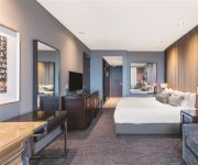
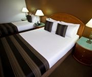
Need some hints on where to stay? We compiled a list of available hotels close to the map centre further down the page.
Being here already, you might want to pay a visit to some of the following locations: Brisbane, Sunshine Coast, Carrolls Creek, and . To further explore this place, just scroll down and browse the available info.
Local weather forecast
Todays Local Weather Conditions & Forecast: 24°C / 74 °F
| Morning Temperature | 17°C / 62 °F |
| Evening Temperature | 19°C / 66 °F |
| Night Temperature | 17°C / 63 °F |
| Chance of rainfall | 6% |
| Air Humidity | 61% |
| Air Pressure | 1019 hPa |
| Wind Speed | Light breeze with 4 km/h (2 mph) from South-West |
| Cloud Conditions | Few clouds, covering 23% of sky |
| General Conditions | Moderate rain |
Monday, 6th of May 2024
22°C (71 °F)
17°C (63 °F)
Sky is clear, gentle breeze, clear sky.
Tuesday, 7th of May 2024
24°C (75 °F)
18°C (64 °F)
Light rain, moderate breeze, few clouds.
Wednesday, 8th of May 2024
22°C (72 °F)
18°C (64 °F)
Light rain, gentle breeze, broken clouds.
Hotels and Places to Stay
GAMBARO HOTEL
PARK REGIS NORTH QUAY
RENDEZVOUS BRISBANE ON GEORGE
THE OASIS APARTMENTS
BEST WESTERN GREGORY TERRACE BRISBANE
WATERMARK HOTEL BRISBANE
Oaks Mews Apartments
Central Cosmo
Milton Motel Apartments
Milton Motel Apartments
Videos from this area
These are videos related to the place based on their proximity to this place.
Sold by Vicki Harper 0417 771 397 & Marc Gregory 0417 407 437 LJ Hooker Albany creek Smakk Media
20 Tarcoola Avenue Ferny Hills property for sale by LJ Hooker Albany Creek. Call Vicki Harper today on 0417 771 397 or Marc Gregory on 0417 407 437 With a solid structure this home is crying...
Agama A8 PHDR New LAYOUT Zac Ryan doing two laps
http://www.pinehillsdirtracing.com Zac does two laps on the new layout i helped design.
Bunya Landfill Blasting February 2012
Blasting of rock material for the new landfill cell at the Bunya Waste Facility.
HD Brisbane Dirt Racing Promo Video with crashes and cars
see all the cars and crashes be had at http://www.brisbanedirtracing.com.
Aerial of BDR Track RC flycamone
Taken with a Trex 450se V2, Aerial of the Brisbane Dirt Racing Track Australia.
Commuter Train near Brisbane from DJi Phantom Drone
Filmed by myself with Cams Drone (GoPro) Only my Second Flight.... no FPV ... but still impressed how easy it was to get this shot. The train is leaving Mitchelton Station in the Brisbane...
QORF FINAL CUT 2013 - HITTING THE TRAILS - BUNYAVILLE TRAIL RUNNERS
QORF FINAL CUT 2013 BUNYAVILLE TRAIL RUNNERS - HITTING THE TRAILS - BUNYAVILLE TRAIL RUNNERS - TRAIL RUNNING - BRISBANE - QUEENSLAND - AUSTRALIA.
Mitchelton Real Estate | 1800-839-910 | Real Estate Agents Mitchelton
Are you looking for a Real Estate Agent in Mitchelton? Well you have come to the right place - http://solutions.harcourts.com.au/ We are local expert Real Estate agents in Mitchelton and have...
Videos provided by Youtube are under the copyright of their owners.
Attractions and noteworthy things
Distances are based on the centre of the city/town and sightseeing location. This list contains brief abstracts about monuments, holiday activities, national parcs, museums, organisations and more from the area as well as interesting facts about the region itself. Where available, you'll find the corresponding homepage. Otherwise the related wikipedia article.
Gaythorne railway station
Gaythorne is a railway station on the Ferny Grove Line of Brisbane, Australia. It is part of the Queensland Rail City network. It is in a transition precinct between Zone 2 and Zone 3 of the TransLink integrated public transport system.
Oxford Park railway station
Oxford Park is a railway station on the Ferny Grove Line of Brisbane, Australia. It is part of the Queensland Rail City network. It is in Zone 3 of the TransLink integrated public transport system.
Keperra railway station
Keperra is a railway station on the Ferny Grove Line of Brisbane, Australia. It is part of the Queensland Rail City network. It is in Zone 3 of the TransLink integrated public transport system.
Grovely railway station
Grovely is a railway station on the Ferny Grove Line of Brisbane, Australia. It is part of the Queensland Rail City network. It is in Zone 3 of the TransLink integrated public transport system.
Ferny Grove railway station
Ferny Grove is a railway station on the Ferny Grove Line of Brisbane, Australia. It is part of the Queensland Rail City network. It is the terminus for the Ferny Grove Line. It is in Zone 3 of the TransLink integrated public transport system. The Brisbane Tramway Museum is a short walk south of the station. The line formerly extended to Dayboro, but was cut back to Ferny Grove in 1955, as part of a larger rationalisation by the Queensland Government of its railway lines.
Mitchelton railway station
Mitchelton is a railway station on the Ferny Grove Line of Brisbane, Australia. It is part of the Queensland Rail City network. It is in Zone 3 of the TransLink integrated public transport system.
Mitchelton, Queensland
Michelton is a suburb of Brisbane, in Queensland, Australia. The suburb is located 8 kilometres from the Brisbane central business district some areas of Mitchelton can be 6 km to the Brisbane central business district. Mitchelton is part of the northwestern suburbs. It is a growing suburb with many Queenslander style houses and leafy streets. The area is quite hilly and most of the suburb is on a north-facing slope.
Gaythorne, Queensland
Gaythorne is a suburb of Brisbane, Queensland, Australia. It is located seven kilometres north-west of the Brisbane central business district. Gaythorne is situated on the slopes of Enoggera Hill. It shares some streets with the neighbouring suburb of Mitchelton. In the late 1990s it was split from Enoggera, a much larger suburb and a suburb it still shares its postcode with. It is a leafy, residential suburb with the dominant architectural style being "Queenslander" architecture.
Brisbane Tramway Museum
Brisbane Tramway Museum is a transport museum which preserves and displays trams and trolley-buses, most of which operated in Brisbane, Queensland, Australia. The museum also has a collection of vehicles and other equipment used in maintaining Brisbane's electric street transport system which operated from 1897 to 1969. The Museum is located at Ferny Grove, a north-west suburb of Brisbane. The museum is operated by the Brisbane Tramway Museum Society, a not-for-profit public company.
McDowall, Queensland
McDowall is a northern suburb within the city of Brisbane, the capital city of Queensland, Australia. McDowall is notable for the Raven Street Reserve, which is a 24.3 hectare bushland area surrounded by urban housing and busy roads. It is part of a long stretch of forest and green areas going from the mountains in the west to the mangrove areas on the coast.
Ferny Grove State High School
Ferny Grove State High School is a public high school in the suburb of Ferny Grove, in Brisbane, Australia. The school has 1476 students enrolled as of the end of 2010. In 2007, the school won the award for the most innovative music program in Queensland. Ferny Grove has also won the award for the cleanest school for the last 8 years, With the latest Green and Healthy Schools award being won in 2010.
Ferny Grove, Queensland
Ferny Grove is a residential suburb in north-west Brisbane, Queensland, Australia. It lies entirely within the Brisbane-metropolitan area administered by the Brisbane City Council.
Keperra, Queensland
Keperra is a suburb in Brisbane, Queensland, Australia which is located approximately 9 kilometres north-west of the CBD. It has a deep and rich history, with some thinking that the name was based upon the Aboriginal term for “Kipper” (a young tribe member who has reached initiation age). Two bora rings used to be located within the suburb, one near the corner of Samford Road and Keperra Street (now under housing) and one which disappeared with the construction of the Keperra Country Club.
Hillbrook Anglican School
Hillbrook Anglican School is a co-educational, Anglican independent school, in Brisbane, Australia. The school is one of the few Anglican schools in Brisbane which specialises in high school education only.
Everton Park, Queensland
Everton Park is a suburb of Brisbane, Queensland, Australia. It is about eight kilometres north of the Brisbane CBD. This suburb is predominantly residential, with more than a quarter of the population residing in semi-detached and higher density dwellings.
Enoggera, Queensland
Enoggera is a suburb of Brisbane, in Queensland, Australia 6 km north-west of the Brisbane CBD.
Brookside Shopping Centre
Brookside Shopping Centre is the largest shopping centre in Brisbane's north-west, situated in Mitchelton, a suburb of Brisbane, Queensland, Australia.
Arana Hills, Queensland
Arana Hills is a suburb within Moreton Bay, 12 km north-west of Brisbane, the capital city of Queensland, Australia on the edge of the Bunyaville Forest Reserve. Its local government area is the Moreton Bay Region.
Bunya, Queensland
Bunya is a suburb north-west of Brisbane, the capital city of Queensland, Australia. Its local government area is the Moreton Bay Region. Bunya is home to the Bunyaville Forest Reserve, operated by the Queensland Parks and Wildlife Service. Spotted gum, grey ironbark, narrow-leaved ironbark, white mahogany, tallowwood, forest red gum, grey gum and brush box grow in the open forests.
Ferny Hills, Queensland
Ferny Hills is an outer suburb north-west of Brisbane, Australia, and is located along Samford Road at the edge of the Brisbane Forest Park. Its local government area is the Moreton Bay Region. Ferny Hills is almost entirely a residential suburb. It contains two primary schools, Ferny Hills State School, which opened in 1970 and is among the last Queensland primary schools to be built in the more traditional high-set format, and Patricks Road State School, which opened in 1977.
Everton Hills, Queensland
Everton Hills is a suburb north-west of Brisbane, in Queensland, Australia. The suburb extends northwest from Everton Park; this separation of suburbs is marked by a park called 'Boundary Park'. It is also located at the edge of the Bunyaville Forest Reserve. Everton Hills is a suburb that is a part of Pine Rivers Shire, a council which controls multiple suburbs.
Mt Maria College
Mt Maria College is a Catholic, Secondary Coeducational College located in northside Brisbane on two campuses. It offers both an OP course and a VET course for students. It is part of Brisbane Catholic Education. Mt Maria College Location Mitchelton & Enoggera, Queensland, Australia Information Type Private School, Roman Catholic, Coeducational, Secondary.
Enoggera Hill
Enoggera Hill is a small mountain of the Taylor Range in the Brisbane suburb of Enoggera. Enoggera Hill is close to Mount Coot-tha and like this peak, it is mostly covered by bushland. The hill is located within the grounds of the Enoggera Barracks.
McDowall State School
McDowall State School is a state primary school located on the north side of Brisbane, Queensland in the suburb of McDowall. Established in 1975, the McDowall State School caters for students from prep to grade 7 with approximately 850 students in the whole school. McDowall State School is administered by Education Queensland.
Prince of Peace Lutheran College
Established in 1984, Prince of Peace Lutheran College is a co-educational Christian College for students in Kindergarten to Year 12 based on two closely located campuses in Everton Hills, North Brisbane. The Junior Campus on Rogers Parade West, is the home to 500 students in Prep to Year 6. The Kindergarten and Outside Hours School Care facilities are also based on the Junior Campus and run on behalf of the College by Queensland Lutheran Early Childhood Services.


