Discover Fig Tree Pocket
The district Fig Tree Pocket of Brisbane in Brisbane (Queensland) is a subburb in Australia about 581 mi north of Canberra, the country's capital city.
If you need a hotel, we compiled a list of available hotels close to the map centre further down the page.
While being here, you might want to pay a visit to some of the following locations: Sunshine Coast, Carrolls Creek, , and . To further explore this place, just scroll down and browse the available info.
Local weather forecast
Todays Local Weather Conditions & Forecast: 24°C / 75 °F
| Morning Temperature | 16°C / 60 °F |
| Evening Temperature | 22°C / 71 °F |
| Night Temperature | 18°C / 64 °F |
| Chance of rainfall | 0% |
| Air Humidity | 50% |
| Air Pressure | 1024 hPa |
| Wind Speed | Gentle Breeze with 6 km/h (4 mph) from West |
| Cloud Conditions | Few clouds, covering 13% of sky |
| General Conditions | Few clouds |
Tuesday, 30th of April 2024
24°C (75 °F)
17°C (63 °F)
Light rain, gentle breeze, few clouds.
Wednesday, 1st of May 2024
23°C (73 °F)
17°C (63 °F)
Light rain, gentle breeze, broken clouds.
Thursday, 2nd of May 2024
22°C (72 °F)
17°C (62 °F)
Light rain, gentle breeze, overcast clouds.
Hotels and Places to Stay
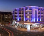
MT OMMANEY HOTEL APARTMENTS
Toowong Villas
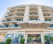
Arena Apartments
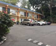
Milton Motel Apartments
Milton Motel Apartments
THE OASIS APARTMENTS
Central Cosmo
PARKVIEW APARTMENTS
JEPHSON HOTEL
Southbank Motel
Videos from this area
These are videos related to the place based on their proximity to this place.
ROCK n ROLL - AROUND THE WORLD.flv
Reasonably advanced move especially with the technique, looks easy, but co-ordination & timing is essential! www.sunshinerockers.com Learn to Dance DvDs..Dvds available in any region format!
SlowSwing - Move -BALL CHANGE SHUFFLE.flv
Slow Swing move of our own design - based on triple Step Swing - slow to moderate tempo - performed in a slotted concept ( in a line) This is one of many moves we teach in this style. www.sunshiner...
For Rent - 2/97 Primrose Street Sherwood - Property Management Sherwood
http://rentalexpresspropertymanagement.com.au/rental-properties/rental-display/3-bedroom-unit-for-rent-sherwood,5569 Simply spacious, this 3 bedroom 2 bathroom town home is a streamlined ...
49 Blackwood Street Sherwood 4075 QLD by David Gowdie
Property Video shoot of 49 Blackwood Street Sherwood 4075 QLD by PlatinumHD http://www.platinumhd.tv for Harcourts Solutions Graceville.
2 532 Oxley Road Sherwood 4075 QLD by Peter Edwards
Property Video shoot of 2 532 Oxley Road Sherwood 4075 QLD by PlatinumHD http://www.platinumhd.tv for Harcourts Solutions Graceville.
Sherwood Arboretum flyover with DJI Inspire
No a great day for it but it was raining last weekend. I rode down to the Sherwood Arboretum for an early morning fly and there were a group of runners about to get off. Still learning the...
Cockatoos at Sherwood
ON a recent visit to Sherwood Arboretum, there were a few groups of Sulphur-crested cockatoos milling about on the lawn. Since it was just on dusk, and a little too dark for decent photos,...
All in a Days Work || Longboarding || Brisbane Public Holiday
brisbane longboarders on anzac day public holiday. all the crpasrks are closed (to cars) all the roads are empty, all the thane is building up oscar, benji, lochie gilling, lachie cramond,...
Australian Wood Duckling
Emma and I visited Sherwood Arboretum recently, and there were a few duck families wandering about. In particular, this one (and one Pacific Black duck family) had very curious ducklings that...
Lone Pine Koala Sanctuary (1), Brisbane, Queensland, Australia
Trip to Lone Pine Koala Sanctuary, Brisbane, Queensland, Australia (Part 1) (July 2008)
Videos provided by Youtube are under the copyright of their owners.
Attractions and noteworthy things
Distances are based on the centre of the city/town and sightseeing location. This list contains brief abstracts about monuments, holiday activities, national parcs, museums, organisations and more from the area as well as interesting facts about the region itself. Where available, you'll find the corresponding homepage. Otherwise the related wikipedia article.
Walter Taylor Bridge
The Walter Taylor Bridge is a suspension bridge crossing the Brisbane River between Indooroopilly and Chelmer in Brisbane, Queensland, Australia. It is shared by motor traffic and pedestrians and is the only habitable bridge in the Southern Hemisphere.
Centenary Bridge
The Centenary Bridge is a motorway crossing of the Brisbane River. As it forms part of Brisbane's Centenary Motorway it is used primarily by vehicular traffic, although it includes footpaths for pedestrian traffic. Built to service the new "Centenary" suburbs of Jindalee, Mount Ommaney and Westlake, the original two lane bridge opened in 1964. It was subsequently duplicated in the 1980s. During the 1974 floods, the bridge was badly damaged when a barge rammed into its upstream side.
Albert Bridge, Brisbane
The Albert Bridge is a railway bridge of steel truss design crossing the Brisbane River, Queensland, Australia. The Albert Bridge links Indooroopilly and Chelmer stations, and has two long spans with one central pier. The structure consists of two steel spans supported by masonry abutments and a central concrete pier that is encased in an iron caisson. A footway was positioned on the upstream side.
Jack Pesch Bridge
The Jack Pesch Bridge is a bridge for pedestrians and cyclists which crosses the Brisbane River. The bridge is named in honour of Jack Pesch, a cycling champion during the 1930s. He subsequently ran a bicycle shop in Petrie Terrace Brisbane until the mid-1990s, selling and servicing his own 'Rocket' cycles and cycle parts. The bridge crosses the Indooroopilly Reach of the River, linking Chelmer and Indooroopilly. It is immediately adjacent to the Albert and Walter Taylor Bridges.
Indooroopilly railway station
Indooroopilly is a railway station in Indooroopilly, Queensland, Australia, on the Ipswich and Rosewood and Springfield lines. It is located in Zone 2 of the TransLink integrated public transport system, and is part of the Queensland Rail city network. Immediately south of the station, the line crosses the Brisbane River on the Albert Bridge, next to the Walter Taylor Bridge.
Chelmer railway station
Chelmer is a railway station in Chelmer, a suburb of Brisbane, Australia, on the Ipswich and Rosewood and Springfield lines. It is located in Zone 2 of the TransLink integrated public transport system, and is part of the Queensland Rail city network.
Graceville railway station
Graceville is a railway station in Graceville, a suburb of Brisbane, Australia, on the Ipswich and Rosewood and Springfield lines. It is in a transition precinct between Zone 2 and Zone 3 of the TransLink integrated public transport system.
Sherwood railway station, Brisbane
Sherwood (formerly Oxley West) is a railway station located in the Brisbane suburb of Sherwood, Queensland, Australia, on the Ipswich and Rosewood and Springfield lines. It is located in Zone 3 of the TransLink integrated public transport system, and is part of the Queensland Rail city network.
Corinda railway station
Corinda is a railway station on the Ipswich and Rosewood and Springfield lines in Corinda, a suburb of Brisbane, Australia. It is located in Zone 3 of the TransLink integrated public transport system, and is part of the Queensland Rail city network. During peak hour on weekdays, trains ran between Brisbane Central and Corinda via Tennyson and Yeerongpilly until the line closed in June 2011. These services have been replaced by Brisbane Transport's Route 104 RailBus.
Oxley railway station
Oxley is a railway station on the Ipswich and Rosewood and Springfield lines in Oxley, a suburb of Brisbane, Australia. It is located in Zone 3 of the TransLink integrated public transport system, and is part of the Queensland Rail city network.
Lone Pine Koala Sanctuary
Lone Pine Koala Sanctuary is a 4.6-hectare Koala Sanctuary located in the Brisbane suburb of Fig Tree Pocket in Queensland, Australia. Founded in 1927, it is the world's oldest and largest Koala sanctuary.
Sinnamon Park, Queensland
Sinnamon Park is a suburb of Brisbane, Australia located 14 km south-west of the Brisbane CBD. Sinnamon Park is named for the pioneering Sinnamon Family. The land occupied by Sinnamon Village retirement complex and the river flats east of the Centenary Freeway were formerly the family farm. The suburb's northern boundary is marked by the Brisbane River. At the 2011 Australian Census the suburb recorded a population of 6,362.
Rocks Riverside Park
Rocks Riverside Park is a large, well designed park by the Brisbane River in outer south west Brisbane. The park was opened on 7 December 2003, and features industrial artefacts from its previous use as a cement quarry. Public art which draws upon the park's industrial heritage are also featured throughout, as is a crop patch which reflects the site's farming days. Rocks Riverside Park is the largest riverfront park in Brisbane.
Chelmer, Queensland
Chelmer is an inner suburb of Brisbane, Australia 7 km west of the Brisbane CBD on the Brisbane River. Chelmer is zoned as a residential area, and consists of low-density housing. It has many fine Queenslanders, characterised by wooden verandahs, wide stairways and roofing of galvanized iron, but in recent years solid brick homes have been built also. It suffered badly from the 2011 Queensland floods, with many homes submerged by the rising river.
Corinda, Queensland
Corinda is a suburb in Brisbane, Australia, located approximately 9 km southwest of the Brisbane central business district. At the 2011 Australian Census the suburb recorded a population of 4,695. It is believed that the name Corinda originates from a local cattle station owned by Sir Arthur Palmer, which he named after his Corinda pastoral station near Aramac.
St Peters Lutheran College
St Peters Lutheran College is an independent, co-educational, Lutheran, day and boarding school, situated on a 21 hectares campus in Indooroopilly, an inner suburb of Brisbane, Queensland, Australia. Established in 1945, St Peters currently caters for approximately 2,000 students from Prep to Year 12, including 150 boarders from Years 6 to 12. In January 2008, a Springfield campus opened with up almost 100 students from Prep to Year 8 in multi-age classes.
Graceville, Queensland
Graceville is a suburb in Brisbane, Queensland, Australia. It is located 8 km south-west of the Brisbane CBD. Graceville is bordered by the Brisbane River to the North-East and West, Oxley Creek to the East, Chelmer to the North and Sherwood to the South. At the 2011 Australian Census the suburb recorded a population of 4,213. The suburb is centred around its own railway station on the Ipswich railway line.
Kenmore, Queensland
Kenmore is a suburb of Brisbane, Australia located on the Brisbane River, 10 km south-west of the Brisbane CBD. Kenmore is a leafy suburb with a high number of professional residents and families. It is dominated by detached housing - units and townhouses are rare. Kenmore has benefited greatly from the Centenary Highway which gives it direct access to the city via Milton Road or Coronation Drive.
Sherwood, Queensland
Sherwood is a suburb of Brisbane, Australia. It is 9 km south west of the CBD and borders the Brisbane River. The suburb is mostly low and medium density housing with a retail strip centered along Sherwood Road.
Seventeen Mile Rocks, Queensland
Seventeen Mile Rocks is a suburb of Brisbane, Australia located 11 kilometres south-west of the Brisbane CBD on the Brisbane River. Seventeen Mile Rocks is named after a collection of rocks that marked a distance of 17 miles from the mouth of the Brisbane River. These rocks were largely removed to widen the river and allow access for marine vessels to further reaches of the river.
Nudgee Junior College
Nudgee Junior College (in full, St Joseph's Nudgee Junior College) is an independent Catholic boy's primary (years 4 to 7) school in Indooroopilly, Queensland, Australia. It is administered by Edmund Rice Education Australia, an organization established by the Congregation of Christian Brothers.
St Aidan's Anglican Girls' School
St Aidan’s Anglican Girls' School is an independent, Anglican, day school for girls, located in Corinda, a western suburb of Brisbane, Queensland, Australia. It was named after Aidan of Lindisfarne, an Irish saint. Founded in 1929 by the Sisters of the Society of the Sacred Advent, the school has a non-selective enrolment policy and caters for approximately 857 students from Prep to Year 12.
Indooroopilly Railway Bridge
The Indooroopilly Railway Bridge is a railway bridge of steel truss design which crosses the Brisbane River, Queensland, Australia. The Indooroopilly Railway Bridge links Indooroopilly and Chelmer stations, and has two long spans with one central pier. It was built just upstream and parallel to the Albert Bridge as part of the quadruplication of the Ipswich Line between 1955–1957.
Mount Ommaney Shopping Centre
Mount Ommaney Shopping Centre is located on Dandenong Road in the suburb of Mount Ommaney in the southwest of Brisbane. After a major expansion, which was completed in 2010, the centre now has 170 stores. Major tenants include Big W, Coles, Kmart Australia, Target Australia, Woolworths and Aldi and JB Hi-Fi.
Corinda State High School
Corinda State High School (CSHS) is a non-selective, co-educational, state secondary school, located in Corinda, Queensland, Australia.


