Explore Geebung
The district Geebung of Brisbane in Brisbane (Queensland) is located in Australia about 593 mi north of Canberra, the country's capital.
If you need a place to sleep, we compiled a list of available hotels close to the map centre further down the page.
Depending on your travel schedule, you might want to pay a visit to some of the following locations: Sunshine Coast, Carrolls Creek, , and . To further explore this place, just scroll down and browse the available info.
Local weather forecast
Todays Local Weather Conditions & Forecast: 24°C / 75 °F
| Morning Temperature | 16°C / 62 °F |
| Evening Temperature | 21°C / 70 °F |
| Night Temperature | 18°C / 65 °F |
| Chance of rainfall | 0% |
| Air Humidity | 56% |
| Air Pressure | 1024 hPa |
| Wind Speed | Gentle Breeze with 7 km/h (4 mph) from West |
| Cloud Conditions | Few clouds, covering 10% of sky |
| General Conditions | Light rain |
Tuesday, 30th of April 2024
24°C (74 °F)
18°C (65 °F)
Light rain, gentle breeze, clear sky.
Wednesday, 1st of May 2024
23°C (73 °F)
19°C (66 °F)
Light rain, gentle breeze, broken clouds.
Thursday, 2nd of May 2024
22°C (72 °F)
18°C (65 °F)
Light rain, moderate breeze, overcast clouds.
Hotels and Places to Stay
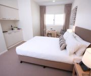
DOMAIN SERVICED APARTMENTS
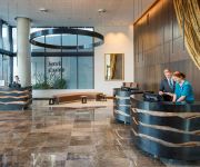
Pullman Brisbane Airport
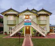
Murphys Bed and Breakfast
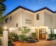
QUEST ASCOT SERVICED APTS
Quest Chermside
Pegasus Motor Inn and Serviced Apartments
Essence Serviced Apartments
Comfort Inn & Suites Northgate Airport
BEST WESTERN AIRPORT 85 MOTEL
Domain Serviced Apartments
Videos from this area
These are videos related to the place based on their proximity to this place.
burnout Our Wedding Car
Burnout at My wedding. Note rough time of day by amount of cars on Sandgate Road!!!
Nudgee College Fodder Drive & Baked Relief 2014 - Thankyou
Thankyou to all the families and the Nudgee College Community #lovetothewest.
2014 Nudgee College Senior Investiture
A new year with new students from Years 5 - 12 and new group of College Leaders.
Tony's 4th of July to September 1975.m4v
Tony's Trip to Australia (Brisbane in Queensland with Lone Pine Koala Sanctuary, Fig Tree Pocket, Brisbane - Currumbin Wildlife Sanctuary, Gold Coast Beach - Bullen's African Lion Safari Park,...
Timelapse movie // placement of Shipping Containers as office for Royal Wolf // Cargotecture
Ducon Construction was proud to work in partnership with Royal Wolf and Room11 Architects on this innovative project. We have a long standing interest in the reuse of shipping containers....
Photo Shoot Behind the Scenes
Sally's Photo Shoot for Formal Superstore 16 Morrisby Street Geebung Qld 4034 Ph. 07 3865 2007 Call for appointment or enquiries Open 7 Days.
Virginia Weight Loss - Lose Weight Virginia Diet Tips.
F-R-E-E http://www.GenuineWeightLoss.info F-R-E-E Information Virginia Weight Loss - Lose Weight Virginia Diet Tips. Get instant access now to a 20 minute information video that contains...
Macrorhabdus and Cochlosoma
Macrorhabdus ornithogaster (formally known as megabacteria and avuan gastric yeast) can be easily identified in this video as the large rod shaped organisms. It is a faculative anaerobic fungus...
Videos provided by Youtube are under the copyright of their owners.
Attractions and noteworthy things
Distances are based on the centre of the city/town and sightseeing location. This list contains brief abstracts about monuments, holiday activities, national parcs, museums, organisations and more from the area as well as interesting facts about the region itself. Where available, you'll find the corresponding homepage. Otherwise the related wikipedia article.
Nundah railway station
Nundah (formerly German) is a railway station in Brisbane, Queensland, Australia. A part of the Queensland Rail City network, it is located in Zone 2 of the TransLink integrated public transport system. The station was opened in 1882 and named German, but was renamed Nundah only six weeks of opening.
Northgate railway station
Northgate is a railway station at Northgate, Brisbane, the state capital of Queensland, Australia. It is part of the Queensland Rail City network, in a transition precinct between Zone 2 and Zone 3 of the TransLink integrated public transport system. The station forms the branching point between the Caboolture and Shorncliffe lines.
Bindha railway station
Bindha is a railway station on the Shorncliffe Line in Banyo, a northern suburb of Brisbane, the state capital of Queensland, Australia. It is part of the Queensland Rail City network, within Zone 3 of the TransLink integrated public transport system. The station is built directly behind the Golden Circle cannery, and the station was originally built to provide a stop for the many factory workers.
Banyo railway station
Banyo is a railway station on the Shorncliffe Line of Brisbane, Australia. It is part of the Queensland Rail City network, falling within Zone 3 of the TransLink integrated public transport system.
Virginia railway station
Virginia Station is a railway station at Virginia on the Caboolture Line of Brisbane, Australia. It is part of the QR Citytrain network. The station is in Zone 3 of the TransLink integrated public transport system.
Geebung railway station
Geebung station is a railway station on the Caboolture line as a part of the Queensland Rail train network in Brisbane, Australia. The station is located in zone 3 of the TransLink integrated public transport system.
Sunshine railway station, Brisbane
Sunshine Station is a railway station on the Caboolture Line of Brisbane, Australia. It is part of the QR Citytrain network. The station is in Zone 3 of the TransLink integrated public transport system.
Zillmere railway station
Zillmere Station is a railway station on the Caboolture Line of Brisbane, Australia. It is part of the QR Citytrain network. The station is in a transition precinct between Zone 3 and Zone 4 of the TransLink integrated public transport system.
Aspley, Queensland
Aspley is a suburb of Brisbane, Queensland, Australia about 13 kilometres north and about a half-hour drive north of the Central Business District of Brisbane. It is positioned on flat ground south of Cabbage Tree Creek, centred on Little Cabbage Tree Creek and on the surrounding hills to the east and south.
Geebung, Queensland
Geebung is a suburb of northern Brisbane, Australia. It is centred around its railway station on the Caboolture railway line. The suburb is named after the Geebung tree of the genus Persoonia which was previously known as the Geebong. The name change came about due to handwritten addresses on letters being incorrectly sent to Geelong.
Chermside, Queensland
Chermside is a suburb on the north side of Brisbane, Queensland, Australia. Chermside is a key destination along Queensland Transport's future Northern Busway. Chermside is home to Queensland's largest shopping centre which contains a 3 story Myer and a 16 screen cinema complex. Together with Indooroopilly, in the west; Carindale, in the southeast; and Mount Gravatt, on the south side; the suburb has been described as a mini-CBD.
Division of Lilley
The Division of Lilley is an Australian Electoral Division in Queensland. The division was first proclaimed in 1913. The division is named after Sir Charles Lilley, a former Premier of Queensland and a former Chief Justice in the Supreme Court of Queensland. The Division of Lilley includes sparsely populated areas of Brisbane Airport, tidal wetlands around Boondall and industrial areas around Pinkenba.
Boondall
Boondall is a northern suburb of Brisbane, Queensland, Australia, formerly known as Cabbage Tree Creek (after the creek that flows through the area). Situated approximately 20 km north of Brisbane near Moreton Bay, almost half way between Brisbane and the coastal city of Redcliffe. Bounded on the north by Deagon, Sandgate and Shorncliffe, on the east by Nudgee and Nudgee Beach, on the south by Banyo, Geebung and Virginia and on the west by Taigum and Zillmere.
Fitzgibbon, Queensland
Fitzgibbon is a suburb north of the Brisbane central business district in Queensland, Australia. The suburb is one of the smallest suburbs in Brisbane and was named after Abram Fitzgibbon, who was chief engineer of railways in Queensland in the 1860s. The suburb is roughly triangular in shape, and is bounded by the North Coast railway, Cabbage Tree Creek, and Telegraph Road. It is a rather new residential area, having been mostly subdivided in the 1980s and 1990s.
Banyo, Queensland
Banyo is a northern suburb of Brisbane, Queensland. It is a community split between residential and industrial land usage, the latter being attracted by the accessibility of local transport, including the Gateway Motorway.
Zillmere, Queensland
Zillmere is a suburb 14 km north of the Brisbane central business district in Queensland, Australia.
Westfield Chermside
Westfield Chermside is the largest shopping centre in Queensland, located in Brisbane's inner northern suburbs, the third-largest in Australia, behind Westfield Fountain Gate and Chadstone Shopping Centre, both in Melbourne, and is operated by the Westfield Group. Entertainment facilities include an Event Cinemas 16-screen cinema complex and a 26 lane Hyperbowl Bowling Centre. The centre contains the Chermside bus station, a major hub for buses north of Brisbane.
Taigum, Queensland
Taigum is a northern suburb of Brisbane in Queensland in Australia. It is about 13 kilometres north of the Brisbane central business district|CBD. It is predominantly a residential area. The suburb contains a Centro shopping centre, which is similar to another shopping centre in Victoria Point, both of which opened in late 2003. The Taigum area was first developed around 1891, as part of a subdivision of the Nundah Divisional board.
Northgate, Queensland
Northgate is a suburb of Brisbane, Australia located 9 km north of the Brisbane CBD. The land area comprises industrial and residential areas. Inter war homes can be found on Northgate Hill—elevated land that rises west of the railway station; and post World War II real estate on "the flat" -- the large arc of flat land that extends to Moreton Bay at Nudgee Beach with most of the housing stock being post WWII.
Virginia, Queensland
Virginia is a suburb in Brisbane, Queensland, Australia. It is located 10 km north of the Brisbane central business district. It is primarily a residential suburb with many timber and tin Queenslander style housing. The suburb was named after the Virginia Brick Company, founded in 1897, near the Virginia Railway Station, which the station opened in 1888. One of Brisbane Transport's bus depots is based in Virginia.
The Prince Charles Hospital
The Prince Charles Hospital is a major teaching hospital in Brisbane's northside with an emphasis in cardiac and respiratory medicine and cardio-thoracic surgery. It also has geriatric and rehabilitation services, elective orthopaedic services and cardiothoracic services, an in-patient psychiatric unit and a 16 bed palliative care unit. In 2007, a major upgrade of the hospital was completed and general medical and general surgical services have been introduced in a newly constructed building.
Gympie Road, Brisbane
Gympie Road is a major road in the northern suburbs of Brisbane, Queensland, Australia. The road forms part of the main road route from the Brisbane Central Business District (CBD) to the northern suburbs, Sunshine Coast and east coast of Queensland. Gympie road is designated A3 from Lutwyche Road, Kedron to the Gympie Arterial Road, Bald Hills. The road then continues as State Route 58 to Dayboro Road, Petrie. Gympie Road is named after the town of Gympie, north of the Sunshine Coast.
Wavell State High School
Wavell State High School is a high school in Wavell Heights, Queensland, Australia, a suburb of Brisbane. Founded in 1959, it is named after the community where it is located, Wavell Heights. The suburb, in turn, is named after Field Marshal Archibald Percival Wavell, 1st Earl Wavell (5 May 1883 – 24 May 1950), a World War II veteran and former Viceroy of India. Wavell state High school currently has about 1300 students and is an excellence school in Netball, Rugby League and Music
Centro Taigum
Centro Taigum is a sub-regional shopping centre located in Taigum, a suburb of Brisbane in the state of Queensland, Australia. Owned by Centro Properties Group, the centre is located on Beams Road, providing access via Gympie and Sandgate Roads. It is anchored by Woolworths, Big W, Homeart and Best & Less, and incorporates 65 stores on the premises.
Boondall State School
Boondall State School is a public primary school located in Brisbane, Queensland, in the suburb of Boondall. The school is run by the Queensland State Government.


