Discover Cannon Hill
The district Cannon Hill of Brisbane in Brisbane (Queensland) with it's 4,507 citizens Cannon Hill is a district in Australia about 588 mi north-east of Canberra, the country's capital city.
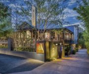
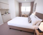
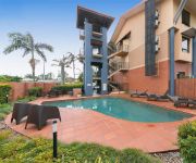
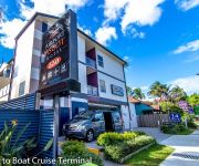
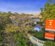
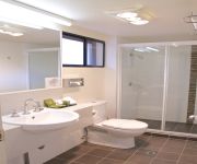
Looking for a place to stay? we compiled a list of available hotels close to the map centre further down the page.
When in this area, you might want to pay a visit to some of the following locations: Sunshine Coast, Carrolls Creek, , and . To further explore this place, just scroll down and browse the available info.
Local weather forecast
Todays Local Weather Conditions & Forecast: 24°C / 75 °F
| Morning Temperature | 16°C / 61 °F |
| Evening Temperature | 22°C / 71 °F |
| Night Temperature | 18°C / 65 °F |
| Chance of rainfall | 0% |
| Air Humidity | 51% |
| Air Pressure | 1024 hPa |
| Wind Speed | Gentle Breeze with 7 km/h (4 mph) from West |
| Cloud Conditions | Few clouds, covering 14% of sky |
| General Conditions | Few clouds |
Tuesday, 30th of April 2024
24°C (75 °F)
18°C (64 °F)
Light rain, gentle breeze, few clouds.
Wednesday, 1st of May 2024
23°C (73 °F)
18°C (64 °F)
Light rain, gentle breeze, broken clouds.
Thursday, 2nd of May 2024
22°C (72 °F)
17°C (63 °F)
Light rain, gentle breeze, overcast clouds.
Hotels and Places to Stay
Spicers Balfour Hotel
DOMAIN SERVICED APARTMENTS
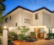
QUEST ASCOT SERVICED APTS
KINGSFORD SMITH MOTEL
Airport Ascot Motel
Heal House
Quality Hotel Airport International
Goldsborough Place Apartments
Pegasus Motor Inn and Serviced Apartments
Domain Serviced Apartments
Videos from this area
These are videos related to the place based on their proximity to this place.
Dash cam video of tram line and reserve at Belmont Terminus, Carina. 27 Jan 2015
A short video I took following the only, substantial, existing section of visible tram line left uncovered and intact from Brisbane's tram network which closed down in 1969. Heritage listed,...
Tingalpa Model Aero Club Scale Day June 2013 - F-16 Fighting Falcon
A short video of a remote control F-16 Fighting Falcon taking off, fly past, landing and being manhandled off the strip. For more 3D videos please visit my YouTube channel at; http://www.youtube....
PADI Open Water Diver Course with Brisbane Dive Academy 20-5-12.MP4
Are you looking for something different? A little bit extreme? Well you've come to the right place. Welcome to the world of scuba diving! Have you ever looked at the ocean and wondered what...
Lawn Mowing Services review | East Brisbane, Cannon Hill, Morningside, Hawthorne
Lawn mowing East Brisbane http://micksmowingandmore.com Cutting grass, cutting gardens, hedge trimming, pruning, trimming and edging garden lawns.
3 Yass Street Carina 4152 QLD by Reese Smith
The owners are committed to selling, their situation has changed and they need this home sold. This property is rock solid, situated in a picturesque and elevated location with nothing left...
Energy Solutions - Factory built solutions: Electrical infrastructure
Ergon Energy's specialist Energy Solutions division provides a one-supplier solution for custom energy infrastructure and service solutions. Watch our factory built solutions: electrical infrastru...
F/A-18 Super Hornet Flypast over Brisbane River
The Royal Australian Air Force celebrated the delivery of the last four F-18F Super Hornets fighter jets by having a flypast over Brisbane.
Chicco Liteway Plus Travel System
Watch our review of the Chicco Liteway Plus Travel System - Including the Chicco Liteway Plus Stroller and the Latest Chicco Keyfit Capsule by Bubs n Grubs.
Chicco Cortina Magic Travel System Review by Bubs n Grubs
The Chicco Cortina Magic Travel System is super light and comes loaded with features both mother and baby will love and enjoy. http://www.youtube.com/watch?v=KQJQtIW3w14 The Chicco Cortina...
42 City View Road - Camp Hill (4152) Queensland by Steve Goodson
Property Video shoot of 42 City View Road - Camp Hill (4152) Queensland by PlatinumHD http://www.platinumhd.tv for.
Videos provided by Youtube are under the copyright of their owners.
Attractions and noteworthy things
Distances are based on the centre of the city/town and sightseeing location. This list contains brief abstracts about monuments, holiday activities, national parcs, museums, organisations and more from the area as well as interesting facts about the region itself. Where available, you'll find the corresponding homepage. Otherwise the related wikipedia article.
Sir Leo Hielscher Bridges
The Sir Leo Hielscher Bridges are a pair of road bridges on the Gateway Motorway (M1), which skirts the eastern suburbs of Brisbane, Queensland, Australia. They are the most eastern crossing of the Brisbane River, the closest to Moreton Bay, crossing at the Quarries Reach, between Eagle Farm and Murarrie. The original bridge (formerly named the Gateway Bridge) was opened on 11 January 1986 and cost A$140 million to build. The duplicate bridge was opened in May 2010.
Morningside, Queensland
Morningside is a suburb in the south-east of Brisbane, Australia, surrounded by Cannon Hill, Norman Park and Hawthorne. Morningside's postal code is 4170. The old suburb of Colmslie was merged into Morningside. At the corner of Bennetts and Wynnum Roads is the historic Bulimba Cemetery (also known as the Balmoral Cemetery) dating from 1875. Morningside started off as a rural area with small dairy and tobacco farms before becoming a popular residential area in the post-war boom.
Morningside railway station
Morningside Station is a railway station on the Cleveland Line in Brisbane, Australia. It is part of the QR Citytrain network. It is in Zone 2 of the TransLink integrated public transport system.
Murarrie railway station
Murrarie Station is a railway station on the Cleveland Line of Brisbane, Australia. It is part of the Queensland Rail City network. It is in Zone 3 of the TransLink integrated public transport system.
Cannon Hill railway station
Cannon Hill Station is a railway station on the Cleveland Line of Brisbane, Australia. It lies in the suburb of the same name and is part of the QR Citytrain network. It is in a transition precinct between Zone 2 and Zone 3 of the TransLink integrated public transport system. It is located on Barrack Road, near the Barrack Road corner store.
Bulimba Creek
The Bulimba Creek catchment has it sources in the marshy parts of the suburbs of Runcorn and Kuraby in the south of Brisbane. It then flows in a northerly direction through the suburbs of Mansfield, Mackenzie, Carindale, Murarrie and Lytton, before meeting the Brisbane River along the Lytton Reach. The creek was originally known as Doboy Creek.
Carina, Queensland
Carina is an eastern suburb of Brisbane, Queensland, Australia about 7 kilometres from the Central Business District. It adjoins the suburbs of Carindale, Carina Heights, Cannon Hill and Camp Hill. It is predominantly residential and was developed in the 1950s and 1960s. There are 4 schools in the suburb of Carina including St Martins primary school (Catholic Primary School), Carina State School, Mayfield State School and San Sisto College (Girls Catholic Secondary School).
Camp Hill, Queensland
Camp Hill is a largely residential suburb in the south-east of Brisbane, Queensland, Australia. It is located approximately 4 km from the Brisbane central business district and, as its name suggests, is elevated and commands fine views of the CBD. It has an area of 4.6 square kilometres.
Carindale, Queensland
Carindale is a suburb of the city of Brisbane, which has a population of approximately 15,135 people and contains around 4,976 dwellings. The greater area was formerly known as Belmont. In 1973 Carindale Nursing Home was opened in Foxglove St, Mt Gravatt East and in 1978 permission was granted to the developers to use Carindale as the name of the new shopping centre. In 1980 the suburb of Carindale was created.
Seven Hills, Queensland
Seven Hills is a suburb located on the inner eastern side of Brisbane, surrounded by the suburbs of Norman Park, Morningside and Carina. Between 1912 and 1926 the southern edge of the suburb was serviced by a steam tram which connected with the Queensland Government Railway at Norman Park. Initially the service was operated by the Belmont Shire Council. The service was suspended in 1924.
Murarrie, Queensland
Murarrie is a suburb of Brisbane, Australia. It is located in the eastern suburbs on the southern bank of the Brisbane River adjacent to the Gateway Bridge. Murarrie has both residential and industrial sections. Brisbane's two newspapers, The Courier-Mail and The Sunday Mail, are published at News Corporation's printing facility in Murarrie. Murarrie's postcode is 4172.
Carindale bus station
The Carindale Bus Station, at Westfield Carindale, is serviced by TransLink bus routes. It is in Zone 3 of the TransLink integrated public transport system. The station serves as a regional transport hub with services connecting to many major destinations including Brisbane City, Redland City, Brisbane Airport (DFO), the University of Queensland and Griffith University.
Norman Park, Queensland
Norman Park is a suburb in Brisbane, Australia. It is located 4 km east of the Brisbane central business district. Norman Park has numerous parks and recreational areas for residents in the area. Bordered by East Brisbane, Coorparoo, Camp Hill, Morningside and Hawthorne, Norman Park offers limited housing along the Brisbane River.
Morningside Australian Football Club
Morningside Australian Football Club, also known as Morningside AFC or the Panthers, is an Australian Rules football club based at Jack Esplen Oval in the suburb of Hawthorne in Brisbane. The club consists of both Junior and Senior football sections. Its senior team competes in the AFL Queensland Australian rules football competition, while its junior sides compete in the AFL Brisbane Juniors (AFLBJ) competition.
Metroad 1 (Brisbane)
Metroad 1 in Brisbane, Queensland, Australia, is the former designation of the major urban road corridor. It connects Bald Hills to the southern suburb of Beenleigh via the following corridors. Gateway Motorway between Bald Hills and Eight Mile Plains Pacific Motorway between Eight Mile Plains and Beenleigh Due to the recent resigning of Metroad 1 as the M1 of the new alphanumeric road system, this corridor is still undergoing new signage.
4RPH
Radio 4RPH 1296 kHz is a volunteer manned community radio station in Brisbane, Queensland, Australia. Radio 4RPH is a member of the Radio Print Handicapped Network. Its catch-phrases are, Your information station and Turning print into sound, and it is intended to serve all those who are, for any reason, handicapped from reading printed material. Newspapers, magazines, books, and other printed material are read to air.
Westfield Carindale
Westfield Carindale is a shopping centre located in the suburb of Carindale, east of Brisbane. The centre became become the sixth-largest shopping centre in Australia on completion of redevelopment in 2012.
Balmoral, Queensland
Balmoral is an inner suburb of Brisbane, Australia, located 9 kilometres east of the CBD. Balmoral is an anglicisation of Baile Mhoireil' which is Scottish Gaelic for ‘beautiful residence’ or ‘majestic castle’. Balmoral has one high school called Balmoral State High School. A famous person to come out of this particular suburb is Laurel Edwards who is a presenter on the 4KQ Brisbane Breakfast Show and also a presenter on Channel 7's The Great South East.
Cannon Hill, Queensland
Cannon Hill is an inner suburb of Brisbane, Queensland, Australia located in the City of Brisbane. It is located 7 kilometres east of the Brisbane CBD. Cannon Hill was named after the Weedon family home 'Cannon Hill House'. Built in 1867, the house, which had extensive grounds and a maze, burnt down in 1927.
Carindale busway station
The Carindale Busway Station is a proposed bus stop at Carindale in Brisbane, Australia. The station will be a major stop serviced by TransLink routes travelling on the proposed Eastern Busway. The station will be in Zone 3 of the Translink integrated public transport system.
Balmoral State High School
Balmoral State High School is a secondary school situated in Balmoral, Queensland, Australia. The school opened in January 1958 having been built as part of the rush for science of that area. It currently services over five hundred and fifty students and is a part of the Gateway Learning Community. (GLC) The GLC consists of seven local schools; six primary and Balmoral State High School. The GLC is committed to improving education and learning throughout the local community.
Cannon Hill Anglican College
Cannon Hill Anglican College (familiarly known as CHAC) is an independent, co-educational, day school affiliated with the Anglican Church of Australia.
Queensland State Hockey Centre
Queensland State Hockey Centre is a multi-purpose stadium in Brisbane, Australia. It is currently used for field hockey and is home to the Queensland Blades who play in the Australian Hockey League.
City of Brisbane
The City of Brisbane is the local government area that has jurisdiction over the inner portion of the metropolitan area of Brisbane, Queensland, Australia. Unlike LGAs in the other mainland state capitals, which are generally responsible only for the central business districts and inner neighbourhoods of those cities, the City of Brisbane administers a significant portion of the Brisbane metropolitan area. As such, it has a larger population than any other local government area in Australia.
Carmichael Park, Tingalpa
Carmichael Park is a multi-sport venue located at Tingalpa, Queensland. It is home to Brisbane Wolves.


