Discover Seven Hills
The district Seven Hills of in Brisbane (Queensland) with it's 2,028 citizens Seven Hills is a subburb in Australia about 587 mi north-east of Canberra, the country's capital city.
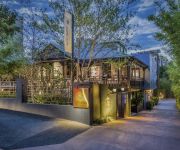
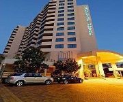
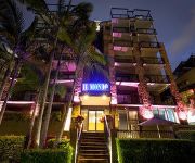
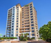
If you need a hotel, we compiled a list of available hotels close to the map centre further down the page.
While being here, you might want to pay a visit to some of the following locations: Brisbane, Sunshine Coast, Carrolls Creek, and . To further explore this place, just scroll down and browse the available info.
Local weather forecast
Todays Local Weather Conditions & Forecast: 24°C / 75 °F
| Morning Temperature | 16°C / 61 °F |
| Evening Temperature | 22°C / 71 °F |
| Night Temperature | 18°C / 65 °F |
| Chance of rainfall | 0% |
| Air Humidity | 51% |
| Air Pressure | 1024 hPa |
| Wind Speed | Gentle Breeze with 7 km/h (4 mph) from West |
| Cloud Conditions | Few clouds, covering 14% of sky |
| General Conditions | Few clouds |
Tuesday, 30th of April 2024
24°C (75 °F)
18°C (64 °F)
Light rain, gentle breeze, few clouds.
Wednesday, 1st of May 2024
23°C (73 °F)
18°C (64 °F)
Light rain, gentle breeze, broken clouds.
Thursday, 2nd of May 2024
22°C (72 °F)
17°C (63 °F)
Light rain, gentle breeze, overcast clouds.
Hotels and Places to Stay
Spicers Balfour Hotel
The Point Brisbane
Central Dockside
QUEST ON STORY BRIDGE SERVICED APTS
Il Mondo Boutique Hotel
BRIDGEWATER APARTMENTS
The Docks on Goodwin
Gabba Central Apartments
Hotel Chino
Central Dockside Apartment Hotel
Videos from this area
These are videos related to the place based on their proximity to this place.
Dash cam video of tram line and reserve at Belmont Terminus, Carina. 27 Jan 2015
A short video I took following the only, substantial, existing section of visible tram line left uncovered and intact from Brisbane's tram network which closed down in 1969. Heritage listed,...
42 City View Road - Camp Hill (4152) Queensland by Steve Goodson
Property Video shoot of 42 City View Road - Camp Hill (4152) Queensland by PlatinumHD http://www.platinumhd.tv for.
28 Arrol Street Camp Hill (4152)
Camp Hill is a quiet neighborhood with much to offer. It's just minutes away from Westfield Carindale and has easy access to public transport. There are plenty of outdoor areas...
Unit 5, 262 Cavendish Road - Coorparoo (4151) Queensland by ...
Property Video shoot of Unit 5, 262 Cavendish Road - Coorparoo (4151) Queensland by PlatinumHD http://www.platinumhd.tv for Harcourts Solutions Inner City.
39 Salaria Drive, Seven Hills, QLD 4170 (AU) by Roger Carr
Architecturally designed contemporary family home has been completed with sophisticated designer fine finishes. Spread over three levels, this brand new residence is perfect for entertaining...
The Life of Jaylan
The Life of Humans is a series of documentaries on various species of human. Today, we observe a very rare species of human known as the Jaylan. During this video, I will be taking you through...
Sold by Grant Penrose 0418 747 887 RE/MAX Profile Bardon Real estate video by Smakk Media
Sold 25 Gotha Street, Camp Hill, Marketed by Grant Penrose 0418 747 997 YouTube: http://www.youtube.com/GrantPenroseRemax Subscribe NOW: ...
7 Doyle Street Coorparoo 4151 QLD by Tanya Douglas
Set in the ever popular suburb of Coorparoo, this stylish and generously proportioned home embraces modern design principles and top-quality finishes.A desirable position complemented by sleek...
84 Watson Street Camp Hill 4152 QLD by Judy Goodger
PLANEWF_Watson_84 Filming 10/3/15 11am This original Queenslander is a testament to classic design standing proudly on 1882m2 allotment with 45m frontage. Family-fr...
51 D Arcy Road, Seven Hills QLD By Ian Thompson
Property Video shoot of 51 D Arcy Road, Seven Hills QLD by PlatinumHD http://www.platinumhd.tv for Ian Thompson Properties.
Videos provided by Youtube are under the copyright of their owners.
Attractions and noteworthy things
Distances are based on the centre of the city/town and sightseeing location. This list contains brief abstracts about monuments, holiday activities, national parcs, museums, organisations and more from the area as well as interesting facts about the region itself. Where available, you'll find the corresponding homepage. Otherwise the related wikipedia article.
Morningside, Queensland
Morningside is a suburb in the south-east of Brisbane, Australia, surrounded by Cannon Hill, Norman Park and Hawthorne. Morningside's postal code is 4170. The old suburb of Colmslie was merged into Morningside. At the corner of Bennetts and Wynnum Roads is the historic Bulimba Cemetery (also known as the Balmoral Cemetery) dating from 1875. Morningside started off as a rural area with small dairy and tobacco farms before becoming a popular residential area in the post-war boom.
Division of Griffith
The Division of Griffith is an Australian Electoral Division in Queensland. The division was created in 1934, when the old seat of Oxley was abolished, and is named for Sir Samuel Griffith, 9th Premier of Queensland and principal author of the Constitution of Australia. It has been represented since 1998 by Kevin Rudd, who served as Prime Minister of Australia from 2007 until 2010.
Coorparoo, Queensland
Coorparoo is a southern suburb of Brisbane, Queensland, Australia, located approximately four kilometres from the city. Surrounding suburbs include Camp Hill, Holland Park, Greenslopes, East Brisbane, Norman Park and Seven Hills.
Coorparoo railway station
Coorparoo Station is a railway station on the Cleveland Line of Brisbane, Australia. It is part of the Queensland Rail City network. It is in Zone 2 of the TransLink integrated public transport system.
Norman Park railway station
Norman Park Station is a railway station on the Cleveland Line of Brisbane, Australia. It is part of the Queensland Rail City network. It is in Zone 2 of the TransLink integrated public transport system. Between 1912 and 1926 it was the junction for the Belmont Tramway. The steam tram was inititally operated by the Belmont Shire Council and after 1925 by the Brisbane City Council.
Morningside railway station
Morningside Station is a railway station on the Cleveland Line in Brisbane, Australia. It is part of the QR Citytrain network. It is in Zone 2 of the TransLink integrated public transport system.
Cannon Hill railway station
Cannon Hill Station is a railway station on the Cleveland Line of Brisbane, Australia. It lies in the suburb of the same name and is part of the QR Citytrain network. It is in a transition precinct between Zone 2 and Zone 3 of the TransLink integrated public transport system. It is located on Barrack Road, near the Barrack Road corner store.
Anglican Church Grammar School
The Anglican Church Grammar School (ACGS), commonly referred to as Churchie, is an independent, Anglican, day and boarding school for boys, located in East Brisbane, an inner suburb of Brisbane, Queensland, Australia. Founded in 1912 by Canon William Perry French Morris, Churchie has a non-selective enrolment policy and currently caters for approximately 1,750 students from Reception to Year 12, including 150 boarders from Years 8 to 12.
Carina, Queensland
Carina is an eastern suburb of Brisbane, Queensland, Australia about 7 kilometres from the Central Business District. It adjoins the suburbs of Carindale, Carina Heights, Cannon Hill and Camp Hill. It is predominantly residential and was developed in the 1950s and 1960s. There are 4 schools in the suburb of Carina including St Martins primary school (Catholic Primary School), Carina State School, Mayfield State School and San Sisto College (Girls Catholic Secondary School).
New Farm Park
New Farm Park is a public park located in the suburb of New Farm, in Brisbane, Queensland, Australia. The park covers 15 hectares and is situated at the south-eastern end of the New Farm peninsula on a bend in the Brisbane River. The Powerhouse arts centre is located at the eastern end of the park.
Camp Hill, Queensland
Camp Hill is a largely residential suburb in the south-east of Brisbane, Queensland, Australia. It is located approximately 4 km from the Brisbane central business district and, as its name suggests, is elevated and commands fine views of the CBD. It has an area of 4.6 square kilometres.
Villanova College
Villanova College is a private and catholic school for boys located in Coorparoo, a southern suburb of Brisbane, Queensland, Australia. The school has a non-selective enrolment policy for all years and caters for approximately 1,150 boys in three schools, Junior, Middle and Senior from year five to twelve. Established in 1948 by six Irish Priests, led by Fr Ben O'Donnell, who were from the Order of Saint Augustine, at 'Whinstanes' in the suburb of Hamilton.
Seven Hills, Queensland
Seven Hills is a suburb located on the inner eastern side of Brisbane, surrounded by the suburbs of Norman Park, Morningside and Carina. Between 1912 and 1926 the southern edge of the suburb was serviced by a steam tram which connected with the Queensland Government Railway at Norman Park. Initially the service was operated by the Belmont Shire Council. The service was suspended in 1924.
Norman Park, Queensland
Norman Park is a suburb in Brisbane, Australia. It is located 4 km east of the Brisbane central business district. Norman Park has numerous parks and recreational areas for residents in the area. Bordered by East Brisbane, Coorparoo, Camp Hill, Morningside and Hawthorne, Norman Park offers limited housing along the Brisbane River.
Morningside Australian Football Club
Morningside Australian Football Club, also known as Morningside AFC or the Panthers, is an Australian Rules football club based at Jack Esplen Oval in the suburb of Hawthorne in Brisbane. The club consists of both Junior and Senior football sections. Its senior team competes in the AFL Queensland Australian rules football competition, while its junior sides compete in the AFL Brisbane Juniors (AFLBJ) competition.
New Farm Park ferry wharf
New Farm Park is a ferry wharf in the suburb of New Farm used by the CityCat and the CityFerry on the Brisbane River. In January 2011 the wharf sustained a moderate damage during the devastating floods; it was repaired and reopened on 14 February 2011.
East Brisbane, Queensland
East Brisbane is an inner suburb of Brisbane, Australia located 3 km east of the Brisbane CBD. It is predominantly residential, with some original "Queenslander" style homes, but with an increasing number of apartment blocks. Major roads include Lytton Road, Wellington Road and Latrobe Street in the north and Vulture Street and Stanley Street in the south of the suburb.
Hawthorne, Queensland
Hawthorne is an inner suburb of Brisbane, Queensland, Australia located in the City of Brisbane. It is 4 kilometres east of the Brisbane central business district. Hawthorne started as a farming district in the 1860s, and was gradually subdivided as Brisbane grew. This was helped by the introduction of ferry and tram services. The suburb's name is from Hawthorne Bushes that were planted in on Galloways hill by the original settler William Baynes.
Cannon Hill, Queensland
Cannon Hill is an inner suburb of Brisbane, Queensland, Australia located in the City of Brisbane. It is located 7 kilometres east of the Brisbane CBD. Cannon Hill was named after the Weedon family home 'Cannon Hill House'. Built in 1867, the house, which had extensive grounds and a maze, burnt down in 1927.
Norman Park ferry wharf
Norman Park is a ferry wharf in the suburb of Norman Park used by the CityFerry on the Brisbane River. The wharf and cross river service closed in 2000 due to poor patronage, but reopened on 15 January 2007.
Cannon Hill Anglican College
Cannon Hill Anglican College (familiarly known as CHAC) is an independent, co-educational, day school affiliated with the Anglican Church of Australia.
Loreto College Coorparoo
Loreto College Coorparoo is a Roman Catholic, day school for girls, located in Coorparoo, a suburb on the inner south side of Brisbane, Queensland, Australia. Loreto College Coorparoo has a non-selective enrolment policy and currently caters for approximately 710 girls. The founder and role model for Loreto schools is Mary Ward. The school is affiliated with the Association of Heads of Independent Schools of Australia (AHISA).
Norman Creek
Norman Creek is a small tributary of the Brisbane River. The headwaters of the creek are located on the northern slopes of Toohey Mountain and Mount Gravatt in southern Brisbane. Edmund Lockyer named the waterway Norman Creek in 1825. The creek drains the suburbs of Tarragindi and Holland Park West then flows northwards through Greenslopes, Norman Park and East Brisbane before entering the Brisbane River at Humbug Reach. The total catchment area is 29.8 km².
Coronet Flats
Coronet Flats (also known as Coronet Court) is a residential apartment building on the corner of Brunswick Street and Elystan Road, New Farm, Queensland, Australia. With its prominent siting, unusual form, and striking art deco style, Coronet Flats is considered one of the most beautiful and recognisable private buildings of the 1930s in Brisbane.
Heath Park (Brisbane)
Heath Park is a multi-sport venue located at East Brisbane, Queensland. It is home to Eastern Suburbs F.C.


