Touring Carindale
The district Carindale of in Brisbane (Queensland) with it's 15,135 residents Carindale is a subburb located in Australia about 586 mi north-east of Canberra, the country's capital place.
Need some hints on where to stay? We compiled a list of available hotels close to the map centre further down the page.
Being here already, you might want to pay a visit to some of the following locations: Brisbane, Sunshine Coast, Carrolls Creek, and . To further explore this place, just scroll down and browse the available info.
Local weather forecast
Todays Local Weather Conditions & Forecast: 23°C / 73 °F
| Morning Temperature | 14°C / 57 °F |
| Evening Temperature | 22°C / 72 °F |
| Night Temperature | 18°C / 64 °F |
| Chance of rainfall | 0% |
| Air Humidity | 49% |
| Air Pressure | 1023 hPa |
| Wind Speed | Light breeze with 5 km/h (3 mph) from North-West |
| Cloud Conditions | Few clouds, covering 11% of sky |
| General Conditions | Few clouds |
Wednesday, 15th of May 2024
22°C (72 °F)
18°C (65 °F)
Light rain, gentle breeze, overcast clouds.
Thursday, 16th of May 2024
19°C (66 °F)
16°C (61 °F)
Light rain, gentle breeze, overcast clouds.
Friday, 17th of May 2024
21°C (69 °F)
17°C (62 °F)
Light rain, light breeze, overcast clouds.
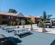
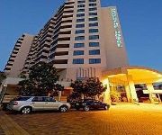
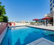
Hotels and Places to Stay
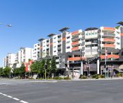
The Point Brisbane
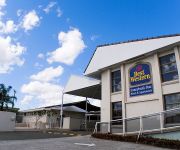
Comfort Inn & Suites Robertson Gardens
Link Portside Apart'Hotel
Central Dockside
Central Dockside Apartment Hotel
Hotel Chino
Gabba Central Apartments
BEST WESTERN SUNNYBANK STAR
Holland Park Motel
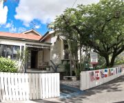
Bowen Terrace Accommodation Brisbane
Videos from this area
These are videos related to the place based on their proximity to this place.
Dash cam video of tram line and reserve at Belmont Terminus, Carina. 27 Jan 2015
A short video I took following the only, substantial, existing section of visible tram line left uncovered and intact from Brisbane's tram network which closed down in 1969. Heritage listed,...
35 Eversholt Street Belmont (4153)
Whether it's picnicking in the park, fishing on the bayside or window shopping at Westfield Carindale, there's plenty of things to do on the weekend in the Brisbane suburb of Belmont. So no...
Our Trip to Australia 2012: Part 1: The Target at Westfield Carindale!
Hope you guys are having fun just by watching these videos! Do Stay Tuned for more videos of our Australia Trip right here on the SpongeBob Channel! Thanks for watching another video by ...
Our Trip to Australia 2012: Part 2: The Big W at Westfield Carindale!
Hope you guys are having fun just by watching these videos! Do Stay Tuned for more videos of our Australia Trip right here on the SpongeBob Channel! Thanks for watching another video by ...
HIGH CARB WORK DAY | highcarbhealth
Day 11 of #1VIDaDAY Today I take you on a journey into... my work day! haha I hope you enjoy it as much as I do ;) #cutcarbscutlife #highcarbhealth Inspired to bring awareness of positive...
6 Bickle Pl, Mount Gravatt East, QLD. - SOLD by Dean McClare of Ray White Holland Park
Property address: 6 Bickle Pl, Mount Gravatt East, QLD. Ray White Holland Park is part Australia's largest Real Estate group for residential commercial or rural property. To buy , sell or...
13 Bentley Court Mansfield by James Bell
The James Bell Team is pleased to present to the market this Low maintenance property to the market surrounded by quality home in the ever popular Montclair Estate. This is two storey living...
Videos provided by Youtube are under the copyright of their owners.
Attractions and noteworthy things
Distances are based on the centre of the city/town and sightseeing location. This list contains brief abstracts about monuments, holiday activities, national parcs, museums, organisations and more from the area as well as interesting facts about the region itself. Where available, you'll find the corresponding homepage. Otherwise the related wikipedia article.
Mansfield, Queensland
Mansfield is a suburb of Brisbane, Australia, situated approximately 11 kilometres south-east of the CBD. It is located in the region of the city which is now colloquially known as the "Bible Belt" due to the large number of people who have settled there to be close to Fundamentalist Christian schools and churches. It was named in 1967, after the Queensland governor of the time Sir Alan Mansfield. The suburb recorded a population of 8,473 at the 2011 Australian Census.
Coorparoo, Queensland
Coorparoo is a southern suburb of Brisbane, Queensland, Australia, located approximately four kilometres from the city. Surrounding suburbs include Camp Hill, Holland Park, Greenslopes, East Brisbane, Norman Park and Seven Hills.
Murarrie railway station
Murrarie Station is a railway station on the Cleveland Line of Brisbane, Australia. It is part of the Queensland Rail City network. It is in Zone 3 of the TransLink integrated public transport system.
Division of Bonner
The Division of Bonner is an Australian Electoral Division in Queensland. The division was created in 2004 and is named after Neville Bonner, the first Aborigine to serve in the Australian Parliament. Bonner served in the federal Senate as a Queensland Liberal Senator. Apart from Bonner there are only three other divisions which bear the names of Aboriginal people, Bennelong in New South Wales, Blair in Queensland and Lingiari in the Northern Territory.
Carina, Queensland
Carina is an eastern suburb of Brisbane, Queensland, Australia about 7 kilometres from the Central Business District. It adjoins the suburbs of Carindale, Carina Heights, Cannon Hill and Camp Hill. It is predominantly residential and was developed in the 1950s and 1960s. There are 4 schools in the suburb of Carina including St Martins primary school (Catholic Primary School), Carina State School, Mayfield State School and San Sisto College (Girls Catholic Secondary School).
Holland Park, Queensland
Holland Park is a suburb of Brisbane, the capital city of Queensland, Australia, that is situated approximately 8 km south of the Brisbane central business district. Holland Park is an older suburb made of largely post-World War II wooden homes. In fact over 89% of dwellings are houses. Logan Road, one of Brisbane's first major roads, bisects this slightly hilly suburb. Trams operated by the Brisbane City Council operated along Logan Road until 13 April 1969.
Camp Hill, Queensland
Camp Hill is a largely residential suburb in the south-east of Brisbane, Queensland, Australia. It is located approximately 4 km from the Brisbane central business district and, as its name suggests, is elevated and commands fine views of the CBD. It has an area of 4.6 square kilometres.
Whites Hill
Whites Hill is a hill and public reserve situated in Holland Park in Brisbane’s South East. The reserve covers an area of 53 acres (21.5 hectares) bound by the surrounding suburbs of Camp Hill, Coorparoo, Carina Heights and Mount Gravatt East. The site is popular with locals, with the reserve offering many sporting and recreational facilities.
Carindale, Queensland
Carindale is a suburb of the city of Brisbane, which has a population of approximately 15,135 people and contains around 4,976 dwellings. The greater area was formerly known as Belmont. In 1973 Carindale Nursing Home was opened in Foxglove St, Mt Gravatt East and in 1978 permission was granted to the developers to use Carindale as the name of the new shopping centre. In 1980 the suburb of Carindale was created.
Mansfield State High School
Mansfield State High School is a co-educational government secondary school of approximately 1700 students. It is located in Mansfield, a suburb in the south of Brisbane, Australia. Opened in 1974, the school in more recent years has become known for its exceptional music, information technology, and french immersion programs. The previous principal, Murray Kay, joined the school in 1990, the same year that the French Immersion program began.
Seven Hills, Queensland
Seven Hills is a suburb located on the inner eastern side of Brisbane, surrounded by the suburbs of Norman Park, Morningside and Carina. Between 1912 and 1926 the southern edge of the suburb was serviced by a steam tram which connected with the Queensland Government Railway at Norman Park. Initially the service was operated by the Belmont Shire Council. The service was suspended in 1924.
Cavendish Road State High School
Cavendish Road State High School is a co-educational, state secondary school located in Holland Park, Brisbane, Queensland, Australia. Established in 1952, Cavendish Road State High School was the second state high school to be built in the suburbs of Brisbane. The school is a short distance from the Brisbane CBD. The school motto, Nil sine pulvere, translates from Latin as "Nothing without effort".
Carindale bus station
The Carindale Bus Station, at Westfield Carindale, is serviced by TransLink bus routes. It is in Zone 3 of the TransLink integrated public transport system. The station serves as a regional transport hub with services connecting to many major destinations including Brisbane City, Redland City, Brisbane Airport (DFO), the University of Queensland and Griffith University.
Brisbane Adventist College
Brisbane Adventist College is a Preschool to Year 12 independent school with two campuses located in the Brisbane suburbs of Mansfield (primary school) and Wishart (secondary school). It is part of the Seventh-day Adventist Church education system. Brisbane Adventist College started as a Primary School in 1966. The Primary School was one of the first established in the Mt Gravatt area. A Secondary School was established in 1972 along Wishart Road.
Westfield Carindale
Westfield Carindale is a shopping centre located in the suburb of Carindale, east of Brisbane. The centre became become the sixth-largest shopping centre in Australia on completion of redevelopment in 2012.
Holland Park West, Queensland
Holland Park West is a suburb of Brisbane, Queensland, Australia. The suburb was gazetted in 1972. It is located in the inner suburbs south-east of the Brisbane central business district between the Pacific Motorway and Logan Road.
Belmont, Queensland
Belmont is an outer suburb of Brisbane, Australia. It is 12 km south-east of the CBD. Belmont is named after the original estate in 1876, the estate grew and became the Belmont Shire in 1901. The shire originally covered a larger area than the current suburb. While much of the suburb remains as undeveloped blocks of bush mixed with large rural properties, some areas have built-up residential estates. The public school for the area is Belmont State Primary School.
Mount Gravatt East, Queensland
Mount Gravatt East is a suburb of Brisbane, Australia, located 8 kilometres southeast of the central business district. Named after Mount Gravatt, a nearby landmark, the suburb was first gazetted in 1967. It is also home to a variety of hills, one of them being Mount Thompson. On land owned by Boral along Pine Mountain Road, an old quarry has filled with water. Despite being fenced off, trespasser have gained access and use the dam as a swimming hole.
Cannon Hill, Queensland
Cannon Hill is an inner suburb of Brisbane, Queensland, Australia located in the City of Brisbane. It is located 7 kilometres east of the Brisbane CBD. Cannon Hill was named after the Weedon family home 'Cannon Hill House'. Built in 1867, the house, which had extensive grounds and a maze, burnt down in 1927.
Carina Heights, Queensland
Carina Heights is a suburb of Brisbane, Australia. It is 7.5 kilometres south-east of the CBD. Surrounding suburbs include Camp Hill, Holland Park, Mount Gravatt East, Carina and Carindale. Carina Heights is named after the neighbouring suburb Carina.
Citipointe Church
Citipointe Church (formerly Christian Outreach Centre Mansfield) is a Pentecostal Christian church founded in 1974. It is the founding church of the Christian Outreach Centre movement. The founding campus is located in the Brisbane suburb of Mansfield, in Australia. The church's senior pastors are Mark and Leigh Ramsey, who have held the position since September 2000.
Carindale busway station
The Carindale Busway Station is a proposed bus stop at Carindale in Brisbane, Australia. The station will be a major stop serviced by TransLink routes travelling on the proposed Eastern Busway. The station will be in Zone 3 of the Translink integrated public transport system.
Loreto College Coorparoo
Loreto College Coorparoo is a Roman Catholic, day school for girls, located in Coorparoo, a suburb on the inner south side of Brisbane, Queensland, Australia. Loreto College Coorparoo has a non-selective enrolment policy and currently caters for approximately 710 girls. The founder and role model for Loreto schools is Mary Ward. The school is affiliated with the Association of Heads of Independent Schools of Australia (AHISA).
Christian Outreach College Brisbane
Christian Outreach College Brisbane (known as COCB) is now known as Citipointe Christian College the Christian Outreach College Brisbane, a Christian independent day school located in Carindale, Queensland. The school has a population of around 1700 students from preparatory to Year 12, including students in the International College. There are over 170 staff members employed by the school.
City of Brisbane
The City of Brisbane is the local government area that has jurisdiction over the inner portion of the metropolitan area of Brisbane, Queensland, Australia. Unlike LGAs in the other mainland state capitals, which are generally responsible only for the central business districts and inner neighbourhoods of those cities, the City of Brisbane administers a significant portion of the Brisbane metropolitan area. As such, it has a larger population than any other local government area in Australia.


