Explore Holland Park West
The district Holland Park West of Brisbane in Brisbane (Queensland) is located in Australia about 584 mi north-east of Canberra, the country's capital.
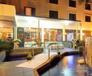
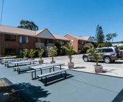
If you need a place to sleep, we compiled a list of available hotels close to the map centre further down the page.
Depending on your travel schedule, you might want to pay a visit to some of the following locations: Sunshine Coast, Carrolls Creek, , and . To further explore this place, just scroll down and browse the available info.
Local weather forecast
Todays Local Weather Conditions & Forecast: 24°C / 76 °F
| Morning Temperature | 16°C / 61 °F |
| Evening Temperature | 22°C / 71 °F |
| Night Temperature | 18°C / 64 °F |
| Chance of rainfall | 0% |
| Air Humidity | 50% |
| Air Pressure | 1024 hPa |
| Wind Speed | Gentle Breeze with 7 km/h (4 mph) from West |
| Cloud Conditions | Few clouds, covering 14% of sky |
| General Conditions | Few clouds |
Tuesday, 30th of April 2024
24°C (76 °F)
17°C (63 °F)
Light rain, gentle breeze, few clouds.
Wednesday, 1st of May 2024
23°C (73 °F)
17°C (63 °F)
Light rain, gentle breeze, broken clouds.
Thursday, 2nd of May 2024
22°C (72 °F)
17°C (63 °F)
Light rain, gentle breeze, overcast clouds.
Hotels and Places to Stay
BEST WESTERN SUNNYBANK STAR
Hotel Chino
Swiss-Belhotel Brisbane
Sudima Suites
Gabba Central Apartments
BEST WESTERN PLUS HOTEL DIANA
Comfort Inn & Suites Robertson Gardens
Holland Park Motel
Buranda Lodge
The Cliff House
Videos from this area
These are videos related to the place based on their proximity to this place.
35 Pope Street, Tarragindi, Queensland
http://www.platinumre.com.au/property/details/908 An opportunity too good to pass up! This gorgeous two story rendered home with detached flat in trendy Tarragindi is sure to impress, and we...
ATC3K Action Camera First Test
Testing out my new ATC3K action camera at the old quarry near my house. (Being responsible in the work car of course)
House for Rent in Annerley Annerley House 3BR/1BA by West End Property Management
Click http://www.metrocityrealty.com.au/ to visit Metrocity Realty for your "Brisbane Property Management" needs! You may also visit http://www.metrocityrealty.com.au/search/rentals for a list...
114 Wilgarning St Hi res YouTube
Magnificent Mansion With Million Dollar Views Boasting some of the best City views and panorama from the Ridge in Stafford Heights, this architecturally designed home comes to the market seeking...
23 Hillock Street Coorparoo (4151)
I've just arrived in Coorparoo to meet with McGraths Gemma Konst. It's an elevated and leafy suburb. Just before we turned into Hillock street, I caught a glimpse of the city skyline.. Reminding...
15 Stonyfell Ct, Holland Park, QLD. - SOLD by Dianne Deem of Ray White Holland Park
Property address: 15 Stonyfell Ct, Holland Park, QLD Ray White Holland Park is part Australia's largest Real Estate group for residential commercial or rural property. To buy , sell or have...
12 Sirius Street Coorparoo 4151 QLD by Luke Croft
Once every while there is a home that comes to the market that you get excited about,12 Sirius Street is that home. Unquestionably one of Coorparoo's most sought after addresses. Boasting a...
62 Mar St, Holland Park, QLD. - SOLD by Pam Clauss of Ray White Holland Park
62 Mar St, Holland Park, QLD. LIKE us on Facebook: http://www.facebook.com/hollandpark.qld?ref=hl Follow us on TWITTER: http://twitter.com/raywhiteholland/ pin us on pinterest: http://pinterest.c...
Videos provided by Youtube are under the copyright of their owners.
Attractions and noteworthy things
Distances are based on the centre of the city/town and sightseeing location. This list contains brief abstracts about monuments, holiday activities, national parcs, museums, organisations and more from the area as well as interesting facts about the region itself. Where available, you'll find the corresponding homepage. Otherwise the related wikipedia article.
Griffith University
Griffith University is a public research university in the southeastern region of the Australian state of Queensland. The university has five campuses located in the Gold Coast, Logan City and in the Brisbane suburbs of Mount Gravatt, Nathan and South Bank. Current total enrolment is approximately 43,000 with 4,000 full-time equivalent staff.
Tarragindi, Queensland
Tarragindi is a suburb on the southern side of Brisbane, Queensland, Australia. It is represented through the Holland Park and Moorooka Ward councillors on the Brisbane City Council.
Coorparoo, Queensland
Coorparoo is a southern suburb of Brisbane, Queensland, Australia, located approximately four kilometres from the city. Surrounding suburbs include Camp Hill, Holland Park, Greenslopes, East Brisbane, Norman Park and Seven Hills.
South East Busway
The South East Busway is a grade separated bus-only corridor running south from the Brisbane CBD to Eight Mile Plains, in South East Queensland. Service providers using the Busway operate under the TransLink system. The Busway was completed to Woolloongabba in September 2000 and to Eight Mile Plains in April 2001.
Mount Gravatt, Queensland
Mount Gravatt is the name of both a major suburb of Brisbane, Queensland, Australia and a prominent hill in this suburb. The suburb is situated in the south-east of the city and was one of Brisbane's largest. This was before it was divided into Mount Gravatt East, Upper Mount Gravatt and Mount Gravatt South; the last being changed to Wishart in the early 1990s.
Holland Park, Queensland
Holland Park is a suburb of Brisbane, the capital city of Queensland, Australia, that is situated approximately 8 km south of the Brisbane central business district. Holland Park is an older suburb made of largely post-World War II wooden homes. In fact over 89% of dwellings are houses. Logan Road, one of Brisbane's first major roads, bisects this slightly hilly suburb. Trams operated by the Brisbane City Council operated along Logan Road until 13 April 1969.
Toohey Mountain
Toohey Mountain is a medium sized mountain at the eastern side of the City of Brisbane's suburb of Moorooka. The rise was named after James Toohey, an Irish born Sydneysider who made his wealth in the California gold rush, before settling in the newly formed state of Queensland. To the north of the mountain is Tarragindi Hill and Wellers Hill. Grass Tree Ridge was the name given to the tall and long ridge that extends through parts of Tarragindi, Salisbury and Nathan, towards Sunnybank.
Camp Hill, Queensland
Camp Hill is a largely residential suburb in the south-east of Brisbane, Queensland, Australia. It is located approximately 4 km from the Brisbane central business district and, as its name suggests, is elevated and commands fine views of the CBD. It has an area of 4.6 square kilometres.
Villanova College
Villanova College is a private and catholic school for boys located in Coorparoo, a southern suburb of Brisbane, Queensland, Australia. The school has a non-selective enrolment policy for all years and caters for approximately 1,150 boys in three schools, Junior, Middle and Senior from year five to twelve. Established in 1948 by six Irish Priests, led by Fr Ben O'Donnell, who were from the Order of Saint Augustine, at 'Whinstanes' in the suburb of Hamilton.
Whites Hill
Whites Hill is a hill and public reserve situated in Holland Park in Brisbane’s South East. The reserve covers an area of 53 acres (21.5 hectares) bound by the surrounding suburbs of Camp Hill, Coorparoo, Carina Heights and Mount Gravatt East. The site is popular with locals, with the reserve offering many sporting and recreational facilities.
Hillsong Brisbane Campus
Hillsong Brisbane Campus (formerly Garden City Christian Church) is an interstate campus of Sydney based Hillsong Church, a Pentecostal Christian church affiliated with Australian Christian Churches, the Assemblies of God in Australia. The Church was without a Senior Pastor and Brian Houston and his wife Bobbie Houston accepted the nomination of the Board for appointment as Senior Pastors of the Church by an extraordinary general meeting of members that was held on Sunday 26 April 2009.
Cavendish Road State High School
Cavendish Road State High School is a co-educational, state secondary school located in Holland Park, Brisbane, Queensland, Australia. Established in 1952, Cavendish Road State High School was the second state high school to be built in the suburbs of Brisbane. The school is a short distance from the Brisbane CBD. The school motto, Nil sine pulvere, translates from Latin as "Nothing without effort".
Holland Park West busway station
The Holland Park West Busway Station, at Holland Park West, is part of the South East Busway serviced by TransLink bus routes. It is in Zone 3 of the TransLink integrated public transport system. In addition to South East Busway services, Holland Park West is also serviced by routes travelling to UQ Lakes via the Eastern Busway and the cross-town Route 77 service, which travels via the Clem Jones Tunnel.
Greenslopes busway station
The Greenslopes Busway Station, in Greenslopes, Queensland Australia, is part of the South East Busway serviced by TransLink bus routes. It is in Zone 2 of the TransLink integrated public transport system.
Griffith University busway station
The Griffith University Busway Station, at Mount Gravatt, is part of the South East Busway serviced by TransLink bus routes. It serves the Griffith University campuses at Mount Gravatt and Nathan. It is in Zone 3 of the TransLink integrated public transport system. Services to and from the Mains Road corridor join the busway at this station.
Greenslopes, Queensland
Greenslopes is a moderately sized suburb of the city of Brisbane, state capital of Queensland, Australia. "Greenslopes" is also the name of a Queensland state electorate. The electorate contains only a small fraction of the suburb of the same name. The current Member for Greenslopes is Ian Kaye of the Liberal National Party of Queensland.
Nathan, Queensland
Nathan is a southern suburb of Brisbane, Australia. It was named in 1967 after Sir Matthew Nathan, Governor of Queensland from 1920 to 1926. Nathan is home to Toohey Forest Conservation Park, Griffith University's Nathan campus and the Queensland Sport and Athletics Centre which hosted the opening ceremony of the 1982 Commonwealth Games. The Queensland Academy of Sport currently uses the facilities located at the stadium. The Mount Gravatt Cemetery is part of Nathan.
Holland Park West, Queensland
Holland Park West is a suburb of Brisbane, Queensland, Australia. The suburb was gazetted in 1972. It is located in the inner suburbs south-east of the Brisbane central business district between the Pacific Motorway and Logan Road.
Logan Road, Brisbane
Logan Road 25px 25px is a major road in Brisbane, Queensland. It runs 16 km from Springwood in Logan City to Woolloongabba in Brisbane, with most of the route signed as state route 95. The route was formerly the main route to the Gold Coast from Brisbane, until the South East Freeway was built. The road provides the quickest access to Mount Gravatt from the south, as well as being the main access road for the Westfield Garden City Shopping Centre.
Mount Gravatt East, Queensland
Mount Gravatt East is a suburb of Brisbane, Australia, located 8 kilometres southeast of the central business district. Named after Mount Gravatt, a nearby landmark, the suburb was first gazetted in 1967. It is also home to a variety of hills, one of them being Mount Thompson. On land owned by Boral along Pine Mountain Road, an old quarry has filled with water. Despite being fenced off, trespasser have gained access and use the dam as a swimming hole.
Queensland Institute of Business and Technology
The Queensland Institute of Business and Technology (QIBT) is a higher education institution delivering programs as a registered Higher Education Provider approved by the Australian Government’s Department of Education, Employment and Workplace Relations. QIBT is registered on the Commonwealth Register of Institutions and Courses for Overseas Students (CRICOS Provider Code 07137F) as required by the Education Services for Overseas Students (ESOS) Act 2000.
Mount Gravatt State High School
Mount Gravatt State High School is a co-educational government secondary school of about 1000 students is located in Mount Gravatt, a suburb in the south of Brisbane, Australia. The school was opened in 1960. Mount Gravatt State High School is a Registered Training Organization (RTO) and is able to issue Australian Qualification Framework qualifications in the vocational education and training vector and to deliver and/or assess associated training.
Loreto College Coorparoo
Loreto College Coorparoo is a Roman Catholic, day school for girls, located in Coorparoo, a suburb on the inner south side of Brisbane, Queensland, Australia. Loreto College Coorparoo has a non-selective enrolment policy and currently caters for approximately 710 girls. The founder and role model for Loreto schools is Mary Ward. The school is affiliated with the Association of Heads of Independent Schools of Australia (AHISA).
Stones Corner busway station
The Stones Corner Busway Station is a busway station at Stones Corner in Brisbane, Australia. The station is serviced by TransLink routes travelling on the proposed Eastern Busway. The station is in Zone 2 of the Translink integrated public transport system. The station is a short distance from the Stones Corner dining and retail precinct.
Langlands Park busway station
The Langlands Park Busway Station is a busway station near Main Avenue at Coorparoo in Brisbane, Australia. The station is serviced by TransLink routes travelling on the proposed Eastern Busway. The station is in Zone 2 of the Translink integrated public transport system.


