Delve into Tarragindi
The district Tarragindi of in Brisbane (Queensland) with it's 9,439 habitants Tarragindi is a subburb in Australia about 583 mi north-east of Canberra, the country's capital town.
If you need a hotel, we compiled a list of available hotels close to the map centre further down the page.
While being here, you might want to pay a visit to some of the following locations: Brisbane, Sunshine Coast, Carrolls Creek, and . To further explore this place, just scroll down and browse the available info.
Local weather forecast
Todays Local Weather Conditions & Forecast: 21°C / 70 °F
| Morning Temperature | 13°C / 56 °F |
| Evening Temperature | 20°C / 69 °F |
| Night Temperature | 17°C / 62 °F |
| Chance of rainfall | 0% |
| Air Humidity | 45% |
| Air Pressure | 1019 hPa |
| Wind Speed | Gentle Breeze with 6 km/h (4 mph) from East |
| Cloud Conditions | Clear sky, covering 0% of sky |
| General Conditions | Sky is clear |
Tuesday, 14th of May 2024
23°C (73 °F)
17°C (62 °F)
Few clouds, gentle breeze.
Wednesday, 15th of May 2024
24°C (75 °F)
17°C (63 °F)
Light rain, gentle breeze, broken clouds.
Thursday, 16th of May 2024
19°C (67 °F)
17°C (63 °F)
Light rain, gentle breeze, overcast clouds.
Hotels and Places to Stay
BEST WESTERN PLUS HOTEL DIANA
Comfort Inn & Suites Robertson Gardens
Hotel Chino
Swiss-Belhotel Brisbane
Sudima Suites
Gabba Central Apartments
Annerley Motor Inn
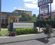
Paramount Motel
Franklin Villa
Kangaroo Point Central
Videos from this area
These are videos related to the place based on their proximity to this place.
4x100M M Secondary Schools Queensland Track Classic 2014 034
Queensland Sport/Athl. Centre - Site License 29/03/2014 - 9:54 PM 2014 Queensland Track Classic Brisbane, Qld, Australia...
100M B So Chun Hong 10.70 Queensland Track Classic 2014 021
Queensland Sport/Athl. Centre - Site License 29/03/2014 - 9:53 PM 2014 Queensland Track Classic Brisbane, Qld, Australia...
2008 Students World Cup, Round 2 Australia v Scotland
Relive the 2008 Round 2 clash of the Students Rugby League World Cup, played between Australian Universities and Scotland Students at Griffith University July 9 2008. To find out more about...
35 Pope Street, Tarragindi, Queensland
http://www.platinumre.com.au/property/details/908 An opportunity too good to pass up! This gorgeous two story rendered home with detached flat in trendy Tarragindi is sure to impress, and we...
Condev Construction - Yeronga Village Crane Assembly
This is a Timelapse video of the assembly of the tower crane at Condev Construction's Yeronga Village Building Site.
5212 Tennyson Reach 197 King Arthur Terrace, Tennyson Q...
Property Video shoot of 5212 Tennyson Reach 197 King Arthur Terrace, Tennyson Queensland by PlatinumHD http://www.platinumhd.tv for Mirvac Group.
5302 Tennyson Reach 197 King Arthur Terrace, Tennyson Q...
Property Video shoot of 5302 Tennyson Reach 197 King Arthur Terrace, Tennyson Queensland by PlatinumHD http://www.platinumhd.tv for Mirvac Group.
SOLD: Country Quilt Doubletail Halfmoon Betta Pair
TO BUY - READ BELOW Gorgeous pair with great volume. Imported from select breeders in Thailand. Offered for sale $100AU/pr email to purchase. Details below. http://www.fishchick.com.au...
5115 Tennyson Reach 197 King Arthur Terrace, Tennyson Q...
Property Video shoot of 5115 Tennyson Reach 197 King Arthur Terrace, Tennyson Queensland by PlatinumHD http://www.platinumhd.tv for Mirvac Group.
46 Sherley St, Moorooka RE/MAX Simon Au Properties
Address : 46 Sherley St. Moorooka Price : $489k+ Luxury Townhomes on Prestige Clifton Hill + City Views! REMAX SIMON AU presents this new luxury townhomes development on the prestige Clifton...
Videos provided by Youtube are under the copyright of their owners.
Attractions and noteworthy things
Distances are based on the centre of the city/town and sightseeing location. This list contains brief abstracts about monuments, holiday activities, national parcs, museums, organisations and more from the area as well as interesting facts about the region itself. Where available, you'll find the corresponding homepage. Otherwise the related wikipedia article.
Griffith University
Griffith University is a public research university in the southeastern region of the Australian state of Queensland. The university has five campuses located in the Gold Coast, Logan City and in the Brisbane suburbs of Mount Gravatt, Nathan and South Bank. Current total enrolment is approximately 43,000 with 4,000 full-time equivalent staff.
Tarragindi, Queensland
Tarragindi is a suburb on the southern side of Brisbane, Queensland, Australia. It is represented through the Holland Park and Moorooka Ward councillors on the Brisbane City Council.
Fairfield railway station, Brisbane
Fairfield is a railway station on the Beenleigh Line of Brisbane, Australia. It is part of the Queensland Rail City network. It is in Zone 2 of the TransLink integrated public transport system. Fairfield station is located close to Fairfield Gardens Shopping Centre.
Yeronga railway station
Yeronga is a railway station on the Beenleigh Line of Brisbane, Australia. It is part of the Queensland Rail City network. It is in Zone 2 of the TransLink integrated public transport system.
Yeerongpilly railway station
Yeerongpilly is a railway station on the Beenleigh line. It is part of the Queensland Rail City network. It is in a transition precinct between Zone 2 and Zone 3 of the TransLink integrated public transport system. It was also the last station at which one could change trains to travel on the Corinda line, which is now closed.
Tennyson railway station
Tennyson Station is a disused railway station on the Corinda via South Brisbane Line of Brisbane, Australia. It is part of the Queensland Rail City network. Prior to the opening of the Merivale Bridge in 1978, through trains ran from South Brisbane to Darra and Ipswich via Tennyson plus a local shuttle service between Yeerongpilly and Corinda calling at Tennyson. After 1978 the line lost some of its importance and most through trains were withdrawn.
Moorooka railway station
Moorooka is a railway station on the Beenleigh Line of Brisbane, Australia. It is part of the Queensland Rail City network. It is in Zone 3 of the TransLink integrated public transport system. It was the first Queensland station to experience an act of civil disobedience, when in 1976, young people took to protesting social ills on its platforms.
Rocklea railway station
Rocklea is a railway station on the Beenleigh Line of Brisbane, Australia. It is part of the Queensland Rail City network. It is in Zone 3 of the TransLink integrated public transport system.
Salisbury railway station, Brisbane
Salisbury is a railway station on the Beenleigh Line of Brisbane, Australia. It is part of the QR Citytrain network. It is in Zone 3 of the TransLink integrated public transport system. There are two entrances via sets of stairs coming from Lillian Avenue and Dollis Street, unfortunately meaning there is no easy wheelchair/disabled access to this station. The station has an intensive surveillance system with cameras surrounding the station and the nearby carpark (off Lillian Avenue).
South East Busway
The South East Busway is a grade separated bus-only corridor running south from the Brisbane CBD to Eight Mile Plains, in South East Queensland. Service providers using the Busway operate under the TransLink system. The Busway was completed to Woolloongabba in September 2000 and to Eight Mile Plains in April 2001.
Moorooka, Queensland
Moorooka is a suburb of Brisbane, the state capital of Queensland, Australia. It is seven kilometres south of Brisbane's central business district. At the 2011 Australian census the suburb had a population of 9,984. The suburb was originally founded as a stop-over for journeys from Brisbane south (Logan and Albert river valleys) and south-west. A section of the suburb's eastern boundary lies adjacent to Toohey Forest Park.
Fairfield, Queensland
Fairfield is a suburb of Brisbane, Australia located 5 km south of the Brisbane CBD on the Brisbane River. The suburb is mainly residential with house and unit accommodation.
Toohey Mountain
Toohey Mountain is a medium sized mountain at the eastern side of the City of Brisbane's suburb of Moorooka. The rise was named after James Toohey, an Irish born Sydneysider who made his wealth in the California gold rush, before settling in the newly formed state of Queensland. To the north of the mountain is Tarragindi Hill and Wellers Hill. Grass Tree Ridge was the name given to the tall and long ridge that extends through parts of Tarragindi, Salisbury and Nathan, towards Sunnybank.
John Tonge Centre
The John Tonge Centre is the mortuary for Queensland Health Forensic and Scientific Services (FSS - formerly Queensland Health Scientific Services) and responsible for conducting autopsies in Brisbane on people whose deaths make them subject to the Coroner's Act. Such deaths include accidents, suicides, homicides, deaths during surgery and anything for which a doctor is unwilling to issue a medical cause of death certificate for.
Holland Park West busway station
The Holland Park West Busway Station, at Holland Park West, is part of the South East Busway serviced by TransLink bus routes. It is in Zone 3 of the TransLink integrated public transport system. In addition to South East Busway services, Holland Park West is also serviced by routes travelling to UQ Lakes via the Eastern Busway and the cross-town Route 77 service, which travels via the Clem Jones Tunnel.
Greenslopes busway station
The Greenslopes Busway Station, in Greenslopes, Queensland Australia, is part of the South East Busway serviced by TransLink bus routes. It is in Zone 2 of the TransLink integrated public transport system.
Yeronga, Queensland
Yeronga is a suburb of Brisbane, Queensland, Australia located on the Brisbane River 7 km south of the Brisbane CBD. Yeronga is a residential suburb. It is home to the Yeronga Devils.
Yeronga Park
Yeronga Memorial Park was one of Brisbane's second earliest parks, originally reserved in 1888. The sprawling park caters for sports and recreational activities and is a significant World War I and World War II place of remembrance. Yeronga Park is situated on Ipswich Road in the suburb of Yeronga. A Brisbane City Council 50 m swimming pool complex is situated on the southern edge of the park. Also nearby, the Yeronga railway station is about 500 m to the west of the park.
Nathan, Queensland
Nathan is a southern suburb of Brisbane, Australia. It was named in 1967 after Sir Matthew Nathan, Governor of Queensland from 1920 to 1926. Nathan is home to Toohey Forest Conservation Park, Griffith University's Nathan campus and the Queensland Sport and Athletics Centre which hosted the opening ceremony of the 1982 Commonwealth Games. The Queensland Academy of Sport currently uses the facilities located at the stadium. The Mount Gravatt Cemetery is part of Nathan.
Yeerongpilly, Queensland
Yeerongpilly is a suburb of in Brisbane, Australia. It is eight km south of the Brisbane central business district. The suburb had a population of 1,984 at the 2011 Australian census. Has a large Asian population and a growing Sub-Saharan African population. Yeerongpilly is derived from the Aboriginal words "yarung" meaning sandy or gravelly or "yurong" meaning rain and "pilly" meaning gully or watercourse. Yeerongpilly grew from an area named Boggo, which was logged for timber for Brisbane.
Salisbury, Queensland
Salisbury is a suburb of Brisbane, Australia. It is 11 kilometres south of the Brisbane central business district. Salisbury was named after the residence of William Coote, an early Brisbane journalist and political figure, who lived in the area. The name was selected by the railway department when the Sunnybank/South Coast Railway Line opened in 1885. The book publishing company Boolarong Press has its headquarters in the suburb.
Queensland Tennis Centre
Queensland Tennis Centre, known during its development as the Tennyson Tennis Centre, is a tennis venue in Tennyson, Brisbane, Australia. It is a A$82 million state-of-the-art tennis facility opened on 2 January 2009. It was designed by internationally recognised stadium designers HOK Sport Venue Event and The Mirvac Group's in-house architectural practice, HPA Pty Ltd and constructed by Mirvac as part of the Tennyson Riverside development.
Brisbane International
The Brisbane International is a professional tennis tournament played on outdoor hard courts in Brisbane, Queensland. It is currently part of the ATP World Tour 250 series of the Association of Tennis Professionals (ATP) World Tour and of the WTA Premier tournaments of the Women's Tennis Association (WTA) Tour. It is held annually in January at the Queensland Tennis Centre just before the first Grand Slam tournament of the season, the Australian Open.
Shire of Stephens
The Shire of Stephens was a local government area in the inner southern suburbs of Brisbane, Queensland. The shire, administered from Annerley, covered an area of 9 square miles, and existed as a local government entity from 1886 until 1925, when it was amalgamated into the City of Brisbane under the City of Brisbane Act 1924.
Nyanda railway station
Nyanda is a disused railway station on QR Citytrain suburban network in Brisbane, the state capital of Queensland, Australia. It is located between Rocklea and Salisbury stations on the Beenleigh line. It opened in 1885 as Nyanda Crossing and was positioned so one person could manage the station and attend to the Beaudesert Road level crossing.


