Discover Greenslopes
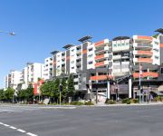
The district Greenslopes of in Brisbane (Queensland) with it's 8,565 citizens Greenslopes is a district in Australia about 585 mi north-east of Canberra, the country's capital city.
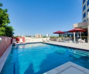
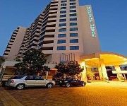
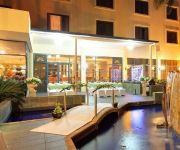
Looking for a place to stay? we compiled a list of available hotels close to the map centre further down the page.
When in this area, you might want to pay a visit to some of the following locations: Brisbane, Sunshine Coast, Carrolls Creek, and . To further explore this place, just scroll down and browse the available info.
Local weather forecast
Todays Local Weather Conditions & Forecast: 21°C / 70 °F
| Morning Temperature | 16°C / 61 °F |
| Evening Temperature | 20°C / 68 °F |
| Night Temperature | 18°C / 64 °F |
| Chance of rainfall | 3% |
| Air Humidity | 76% |
| Air Pressure | 1022 hPa |
| Wind Speed | Moderate breeze with 11 km/h (7 mph) from North-West |
| Cloud Conditions | Broken clouds, covering 62% of sky |
| General Conditions | Light rain |
Wednesday, 8th of May 2024
23°C (73 °F)
18°C (64 °F)
Light rain, moderate breeze, overcast clouds.
Thursday, 9th of May 2024
23°C (73 °F)
17°C (63 °F)
Light rain, moderate breeze, scattered clouds.
Friday, 10th of May 2024
21°C (69 °F)
17°C (62 °F)
Light rain, moderate breeze, overcast clouds.
Hotels and Places to Stay
The Point Brisbane
Hotel Chino
Central Dockside Apartment Hotel
Central Dockside
Gabba Central Apartments
BEST WESTERN PLUS HOTEL DIANA
Swiss-Belhotel Brisbane
Sudima Suites
Holland Park Motel
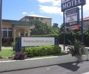
Paramount Motel
Videos from this area
These are videos related to the place based on their proximity to this place.
35 Pope Street, Tarragindi, Queensland
http://www.platinumre.com.au/property/details/908 An opportunity too good to pass up! This gorgeous two story rendered home with detached flat in trendy Tarragindi is sure to impress, and we...
SOLD: Country Quilt Doubletail Halfmoon Betta Pair
TO BUY - READ BELOW Gorgeous pair with great volume. Imported from select breeders in Thailand. Offered for sale $100AU/pr email to purchase. Details below. http://www.fishchick.com.au...
House for Rent in Annerley Annerley House 3BR/1BA by West End Property Management
Click http://www.metrocityrealty.com.au/ to visit Metrocity Realty for your "Brisbane Property Management" needs! You may also visit http://www.metrocityrealty.com.au/search/rentals for a list...
House for Rent in Coorparoo Coorparoo House 3BR/1BA by West End Property Management
Click http://www.metrocityrealty.com.au/ to visit Metrocity Realty for your "Brisbane Property Management" needs! You may also visit http://www.metrocityrealty.com.au/search/rentals for a list...
Unit for Rent in Annerley Annerley Unit 2BR/1BA by West End Property Management
Click http://www.metrocityrealty.com.au/ to visit Metrocity Realty for your "Brisbane Property Management" needs! You may also visit http://www.metrocityrealty.com.au/search/rentals for a list...
History of the Dutton Park War Memorial
Video of Nowell Taylor on Anzac Day 2014 giving a speech about the history of the Gair Park War Memorial in Dutton Park, Brisbane, Australia.
Thompsons~Strathpine Coach 17 - Denning Manufacturing Phoenix Silver
Resurrected from the now defunct elevatorman555 account! An immaculate coach operating on behalf of Queensland Rail during trackwork on the Cleveland Railway Line. The driver at the beginning...
5 Grattan Street - Woolloongabba (4102) Queensland by Treston Bamber
Property Video shoot of 5 Grattan Street - Woolloongabba (4102) Queensland by platinumhd http://www.platinumhd.tv for.
139/803 Stanley Street, Woolloongabba QLD By Sherrie Storor
Property Video shoot of 139/803 Stanley Street, Woolloongabba QLD by platinumhd http://www.platinumhd.tv for Place New Farm.
Videos provided by Youtube are under the copyright of their owners.
Attractions and noteworthy things
Distances are based on the centre of the city/town and sightseeing location. This list contains brief abstracts about monuments, holiday activities, national parcs, museums, organisations and more from the area as well as interesting facts about the region itself. Where available, you'll find the corresponding homepage. Otherwise the related wikipedia article.
Park Road railway station
Park Road is a railway station in Brisbane, Queensland, Australia. It is part of the Queensland Rail City network. It is in a transition precinct between Zone 1 and Zone 2 of the TransLink integrated public transport system. The station forms the branching point for the Beenleigh/Gold Coast and Cleveland railway lines. Platform 4 of this station was intended for use by Gold Coast trains but the curvature of the platform has proved to be unsafe for commuter train usage.
Buranda railway station
Buranda is a railway station on the Cleveland Line, 3.4 km south-southeast from Brisbane (6.2 km from Central station by rail), the state capital of Queensland, Australia. It is part of the QR Citytrain network. It is in Zone 2 of the TransLink integrated public transport system. The station forms an interchange with Buranda busway station on the South East Busway and Eastern Busway, allowing easy access to the southern suburbs and into the Brisbane central business district.
Princess Alexandra Hospital
The Princess Alexandra Hospital (PAH) is on Ipswich Road in Woolloongabba, Australia. It is one of the major hospitals in Brisbane and is a teaching hospital of the University of Queensland. It is a tertiary level teaching hospital with all major medical and surgical specialities onsite except for obstetrics, gynaecology and paediatrics. A new building was opened in 2000 to replace the ageing red-brick PA Hospital complex built in the 1950s.
Coorparoo, Queensland
Coorparoo is a southern suburb of Brisbane, Queensland, Australia, located approximately four kilometres from the city. Surrounding suburbs include Camp Hill, Holland Park, Greenslopes, East Brisbane, Norman Park and Seven Hills.
Coorparoo railway station
Coorparoo Station is a railway station on the Cleveland Line of Brisbane, Australia. It is part of the Queensland Rail City network. It is in Zone 2 of the TransLink integrated public transport system.
Dutton Park railway station
Dutton Park is a railway station on the Beenleigh Line of Brisbane, Australia. It is part of the Queensland Rail City network. It is in Zone 2 of the TransLink integrated public transport system. Dutton Park was the junction of the Wooloongabba Branch from 1884 until 1989.
Fairfield railway station, Brisbane
Fairfield is a railway station on the Beenleigh Line of Brisbane, Australia. It is part of the Queensland Rail City network. It is in Zone 2 of the TransLink integrated public transport system. Fairfield station is located close to Fairfield Gardens Shopping Centre.
South East Busway
The South East Busway is a grade separated bus-only corridor running south from the Brisbane CBD to Eight Mile Plains, in South East Queensland. Service providers using the Busway operate under the TransLink system. The Busway was completed to Woolloongabba in September 2000 and to Eight Mile Plains in April 2001.
Holland Park, Queensland
Holland Park is a suburb of Brisbane, the capital city of Queensland, Australia, that is situated approximately 8 km south of the Brisbane central business district. Holland Park is an older suburb made of largely post-World War II wooden homes. In fact over 89% of dwellings are houses. Logan Road, one of Brisbane's first major roads, bisects this slightly hilly suburb. Trams operated by the Brisbane City Council operated along Logan Road until 13 April 1969.
Langlands Park
Langlands Park is a sporting venue in the Brisbane suburb of Coorparoo, close to Stones Corner. It is the home ground of the Easts Tigers, a rugby league team that competes in the Queensland Cup.
Villanova College
Villanova College is a private and catholic school for boys located in Coorparoo, a southern suburb of Brisbane, Queensland, Australia. The school has a non-selective enrolment policy for all years and caters for approximately 1,150 boys in three schools, Junior, Middle and Senior from year five to twelve. Established in 1948 by six Irish Priests, led by Fr Ben O'Donnell, who were from the Order of Saint Augustine, at 'Whinstanes' in the suburb of Hamilton.
Cavendish Road State High School
Cavendish Road State High School is a co-educational, state secondary school located in Holland Park, Brisbane, Queensland, Australia. Established in 1952, Cavendish Road State High School was the second state high school to be built in the suburbs of Brisbane. The school is a short distance from the Brisbane CBD. The school motto, Nil sine pulvere, translates from Latin as "Nothing without effort".
Buranda busway station
The Buranda Busway Station, at Buranda, is part of the South East Busway serviced by TransLink bus routes. The busway station is beneath the Buranda Railway Station on the Cleveland Line. It is in Zone 2 of the TransLink integrated public transport system.
Holland Park West busway station
The Holland Park West Busway Station, at Holland Park West, is part of the South East Busway serviced by TransLink bus routes. It is in Zone 3 of the TransLink integrated public transport system. In addition to South East Busway services, Holland Park West is also serviced by routes travelling to UQ Lakes via the Eastern Busway and the cross-town Route 77 service, which travels via the Clem Jones Tunnel.
Greenslopes busway station
The Greenslopes Busway Station, in Greenslopes, Queensland Australia, is part of the South East Busway serviced by TransLink bus routes. It is in Zone 2 of the TransLink integrated public transport system.
Greenslopes, Queensland
Greenslopes is a moderately sized suburb of the city of Brisbane, state capital of Queensland, Australia. "Greenslopes" is also the name of a Queensland state electorate. The electorate contains only a small fraction of the suburb of the same name. The current Member for Greenslopes is Ian Kaye of the Liberal National Party of Queensland.
Holland Park West, Queensland
Holland Park West is a suburb of Brisbane, Queensland, Australia. The suburb was gazetted in 1972. It is located in the inner suburbs south-east of the Brisbane central business district between the Pacific Motorway and Logan Road.
Logan Road, Brisbane
Logan Road 25px 25px is a major road in Brisbane, Queensland. It runs 16 km from Springwood in Logan City to Woolloongabba in Brisbane, with most of the route signed as state route 95. The route was formerly the main route to the Gold Coast from Brisbane, until the South East Freeway was built. The road provides the quickest access to Mount Gravatt from the south, as well as being the main access road for the Westfield Garden City Shopping Centre.
Loreto College Coorparoo
Loreto College Coorparoo is a Roman Catholic, day school for girls, located in Coorparoo, a suburb on the inner south side of Brisbane, Queensland, Australia. Loreto College Coorparoo has a non-selective enrolment policy and currently caters for approximately 710 girls. The founder and role model for Loreto schools is Mary Ward. The school is affiliated with the Association of Heads of Independent Schools of Australia (AHISA).
Buranda, Queensland
Buranda is a locality in the southern Brisbane suburbs of Greenslopes and Woolloongabba in Brisbane, the capital of Queensland, Australia. The location is an important transport hub for southern Brisbane. Logan Road and Ipswich Road pass through the area as does the South East Busway with a station called Buranda busway station. The Pacific Motorway passes through the area. There is also the Buranda railway station on the Cleveland railway line.
Princess Alexandra Hospital busway station
The Princes Alexandra Busway Station is serviced by TransLink bus routes travelling on the Eastern busway. It is located opposite O'Keefe Street. It is in Zone 2 of the TransLink integrated public transport system.
Boggo Road busway station
The Boggo Road Busway Station is serviced by TransLink bus routes travelling via the Eastern busway. It is located adjacent to the Park Road railway station. It is in Zone 2 of the TransLink integrated public transport system.
Shire of Stephens
The Shire of Stephens was a local government area in the inner southern suburbs of Brisbane, Queensland. The shire, administered from Annerley, covered an area of 9 square miles, and existed as a local government entity from 1886 until 1925, when it was amalgamated into the City of Brisbane under the City of Brisbane Act 1924.
Stones Corner busway station
The Stones Corner Busway Station is a busway station at Stones Corner in Brisbane, Australia. The station is serviced by TransLink routes travelling on the proposed Eastern Busway. The station is in Zone 2 of the Translink integrated public transport system. The station is a short distance from the Stones Corner dining and retail precinct.
Langlands Park busway station
The Langlands Park Busway Station is a busway station near Main Avenue at Coorparoo in Brisbane, Australia. The station is serviced by TransLink routes travelling on the proposed Eastern Busway. The station is in Zone 2 of the Translink integrated public transport system.


