Discover Enoggera
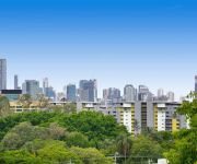
The district Enoggera of Brisbane in Brisbane (Queensland) is a district in Australia about 588 mi north of Canberra, the country's capital city.
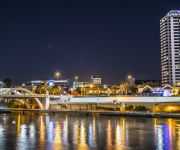
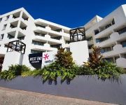
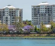
Looking for a place to stay? we compiled a list of available hotels close to the map centre further down the page.
When in this area, you might want to pay a visit to some of the following locations: Sunshine Coast, Carrolls Creek, , and . To further explore this place, just scroll down and browse the available info.
Local weather forecast
Todays Local Weather Conditions & Forecast: 24°C / 75 °F
| Morning Temperature | 16°C / 61 °F |
| Evening Temperature | 22°C / 71 °F |
| Night Temperature | 18°C / 64 °F |
| Chance of rainfall | 0% |
| Air Humidity | 52% |
| Air Pressure | 1024 hPa |
| Wind Speed | Gentle Breeze with 6 km/h (4 mph) from West |
| Cloud Conditions | Few clouds, covering 14% of sky |
| General Conditions | Light rain |
Tuesday, 30th of April 2024
24°C (75 °F)
18°C (64 °F)
Light rain, gentle breeze, clear sky.
Wednesday, 1st of May 2024
23°C (73 °F)
18°C (65 °F)
Light rain, gentle breeze, broken clouds.
Thursday, 2nd of May 2024
22°C (72 °F)
17°C (63 °F)
Light rain, gentle breeze, overcast clouds.
Hotels and Places to Stay
GAMBARO HOTEL
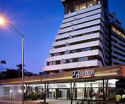
HOTEL URBAN BRISBANE
Riverside Hotel South Bank
SUMMIT APARTMENTS
Grand Chancellor Brisbane
PARK REGIS NORTH QUAY
WEST END CENTRAL
THE OASIS APARTMENTS
WATERMARK HOTEL BRISBANE
Toowong Villas
Videos from this area
These are videos related to the place based on their proximity to this place.
Commuter Train near Brisbane from DJi Phantom Drone
Filmed by myself with Cams Drone (GoPro) Only my Second Flight.... no FPV ... but still impressed how easy it was to get this shot. The train is leaving Mitchelton Station in the Brisbane...
Lily the Aussie Chihuahua - Everton Park - Brisbane
Lovely Lily the Aussie Chihuahua - Everton Park - Brisbane Lou and Cams super cute Pet.... we miss all three of them...
Brisbane Australia
My week in Brisbane City. February 2014. -Queen Street Mall -Lone Pine Koala Sanctuary -Sunshine Coast -Noosa National Park -The Gallery of Modern Art Brisbane -Southbank -Gold Coast -Surfers ...
Discover Travel and Cruise Insight Tours Early Bird Deal (conditions apply) Brisbane Travel Agents
This video is about Discover Travel and Cruise - Insight Tours Early Bird Deal. This is one of Brisbane's best Travel Agents and have multiple offices on Brisbane's north side. We also have...
Mitchelton Real Estate | 1800-839-910 | Real Estate Agents Mitchelton
Are you looking for a Real Estate Agent in Mitchelton? Well you have come to the right place - http://solutions.harcourts.com.au/ We are local expert Real Estate agents in Mitchelton and have...
Discover Travel & Cruise Client recommendations, Member of Travellers Choice Travel Agents
Discover Travel & Cruise is independently owned and operated by Denise Falsay. Denise started her travel career as an office junior at the age of sixteen in a travel agency in Glasgow, Scotland...
162 Osbourne Road Mitchelton 4053 QLD by Diana Mitchell
Property Video shoot of 162 Osbourne Road Mitchelton 4053 QLD by PlatinumHD http://www.platinumhd.tv for Harcourts Solutions Inner City.
Kedron Brook Flooding - Mitchelton 11.01.11
The Kedron Brook flooded its banks in Teralba Park Mitchelton, Brisbane. This is the waterline peak at 2pm.
Videos provided by Youtube are under the copyright of their owners.
Attractions and noteworthy things
Distances are based on the centre of the city/town and sightseeing location. This list contains brief abstracts about monuments, holiday activities, national parcs, museums, organisations and more from the area as well as interesting facts about the region itself. Where available, you'll find the corresponding homepage. Otherwise the related wikipedia article.
Enoggera railway station
Enoggera is a railway station on the Ferny Grove Line of Brisbane, Australia. It is part of the Queensland Rail City network. It is in Zone 2 of the TransLink integrated public transport system.
Gaythorne railway station
Gaythorne is a railway station on the Ferny Grove Line of Brisbane, Australia. It is part of the Queensland Rail City network. It is in a transition precinct between Zone 2 and Zone 3 of the TransLink integrated public transport system.
Oxford Park railway station
Oxford Park is a railway station on the Ferny Grove Line of Brisbane, Australia. It is part of the Queensland Rail City network. It is in Zone 3 of the TransLink integrated public transport system.
Keperra railway station
Keperra is a railway station on the Ferny Grove Line of Brisbane, Australia. It is part of the Queensland Rail City network. It is in Zone 3 of the TransLink integrated public transport system.
Grovely railway station
Grovely is a railway station on the Ferny Grove Line of Brisbane, Australia. It is part of the Queensland Rail City network. It is in Zone 3 of the TransLink integrated public transport system.
Mitchelton railway station
Mitchelton is a railway station on the Ferny Grove Line of Brisbane, Australia. It is part of the Queensland Rail City network. It is in Zone 3 of the TransLink integrated public transport system.
Alderley railway station, Brisbane
Alderley is a railway station on the Ferny Grove Line of Brisbane, Australia. It is part of the Queensland Rail City network. It is in Zone 2 of the TransLink integrated public transport system.
Alderley, Queensland
Alderley is a suburb of Brisbane, Queensland, Australia. It is 7 kilometres north-west of the CBD. It is surrounded by Newmarket in the south, Ashgrove and Enoggera in the west, Grange and Stafford in the east and Kedron and Everton Park in the north. At the 2006 census, it had a populatio of 5,068. In prehistory, the area was inhabited by the Turrbal Aboriginal clan. Corroborees were held at Sedgeley Park estate.
Mitchelton, Queensland
Michelton is a suburb of Brisbane, in Queensland, Australia. The suburb is located 8 kilometres from the Brisbane central business district some areas of Mitchelton can be 6 km to the Brisbane central business district. Mitchelton is part of the northwestern suburbs. It is a growing suburb with many Queenslander style houses and leafy streets. The area is quite hilly and most of the suburb is on a north-facing slope.
The Gap, Queensland
The Gap is a leafy and hilly suburb of Brisbane, in Queensland, Australia, located approximately 11 km west of the Brisbane CBD.
Ashgrove, Queensland
Ashgrove is an inner suburb of Brisbane in Queensland, Australia, located approximately 4 km north-west of the Brisbane CBD. Ashgrove is a leafy residential suburb, characterised by its hilly terrain and characteristic Ashgrovian houses built in the early 20th century.
Bardon, Queensland
Bardon is an inner suburb of Brisbane, Australia approximately 5 km west of the Brisbane CBD. Bardon is a leafy residential suburb, much of which nestles into the foothills of Mount Coot-tha.
Gaythorne, Queensland
Gaythorne is a suburb of Brisbane, Queensland, Australia. It is located seven kilometres north-west of the Brisbane central business district. Gaythorne is situated on the slopes of Enoggera Hill. It shares some streets with the neighbouring suburb of Mitchelton. In the late 1990s it was split from Enoggera, a much larger suburb and a suburb it still shares its postcode with. It is a leafy, residential suburb with the dominant architectural style being "Queenslander" architecture.
Marist College Ashgrove
Marist College Ashgrove is a Roman Catholic day and boarding school for boys, located in Ashgrove, a northern suburb of Brisbane, Queensland, Australia. The college has a primary school for students in grades 5 to 7, and a high school for students in grades 8 to 12.
Keperra, Queensland
Keperra is a suburb in Brisbane, Queensland, Australia which is located approximately 9 kilometres north-west of the CBD. It has a deep and rich history, with some thinking that the name was based upon the Aboriginal term for “Kipper” (a young tribe member who has reached initiation age). Two bora rings used to be located within the suburb, one near the corner of Samford Road and Keperra Street (now under housing) and one which disappeared with the construction of the Keperra Country Club.
Hillbrook Anglican School
Hillbrook Anglican School is a co-educational, Anglican independent school, in Brisbane, Australia. The school is one of the few Anglican schools in Brisbane which specialises in high school education only.
Enoggera, Queensland
Enoggera is a suburb of Brisbane, in Queensland, Australia 6 km north-west of the Brisbane CBD.
Brookside Shopping Centre
Brookside Shopping Centre is the largest shopping centre in Brisbane's north-west, situated in Mitchelton, a suburb of Brisbane, Queensland, Australia.
St Johns Wood, Queensland
St Johns Wood is a locality within the suburb of Ashgrove in Brisbane, Australia. A small residential pocket at the base of Taylor Range, it is embraced by a loop of Enoggera Creek and by the Ashgrove Golf Club, Brisbane City Council Reserve and the Enoggera Barracks. The locality was originally inhabited by the Indigenous Turrbal people before it opened up to European Settlement during the second land-sales of the District in 1858, with the homestead called The Granite House founded in 1864.
Newmarket State High School
Newmarket State High School was a secondary school in the suburb of Newmarket in Brisbane, Queensland, Australia. From its establishment in 1963 until its closure in 1996, it was located on land between Banks St. and Brent St. in what is now Laurence St. , Daniel Pl. , Nelson Pl. and associated housing developments.
Mt Maria College
Mt Maria College is a Catholic, Secondary Coeducational College located in northside Brisbane on two campuses. It offers both an OP course and a VET course for students. It is part of Brisbane Catholic Education. Mt Maria College Location Mitchelton & Enoggera, Queensland, Australia Information Type Private School, Roman Catholic, Coeducational, Secondary.
Enoggera Hill
Enoggera Hill is a small mountain of the Taylor Range in the Brisbane suburb of Enoggera. Enoggera Hill is close to Mount Coot-tha and like this peak, it is mostly covered by bushland. The hill is located within the grounds of the Enoggera Barracks.
Everton Park State High School
Everton Park State High School is a small school consisting of approximately 300 students located in the northern suburbs of Brisbane, Australia. The Queensland Government gazettal proclamation of 22 September 1960 announced the opening of a Stafford State High School for the beginning of 1961. The school was renamed Everton Park State High School by gazettal proclamation dated 8 December 1960 and opened 23 January 1961 under this name.
Enoggera Creek
Enoggera Creek is a waterway that rises on the D'Aguilar Range and flows into the Brisbane River. The creek's headwaters form on the southern slopes of Mount Nebo in Brisbane Forest Park. It meanders in a south-easterly direction, leaving the undisturbed parkland and flowing through urban areas after being dammed in the suburb of Enoggera Reservoir.
Enoggera Road, Brisbane
Enoggera Road is one of Brisbane's main roads which connects to the City, which is the main access road for residents of north west Brisbane. Enoggera Road is also home to the Reading Newmarket Shopping Centre, one of the first North-side Brisbane McDonalds located at Newmarket and the Newmarket public pool located at Alderley.


