Discover West End
The district West End of Brisbane in Brisbane (Queensland) is a subburb in Australia about 586 mi north of Canberra, the country's capital city.
If you need a hotel, we compiled a list of available hotels close to the map centre further down the page.
While being here, you might want to pay a visit to some of the following locations: Sunshine Coast, Carrolls Creek, , and . To further explore this place, just scroll down and browse the available info.
Local weather forecast
Todays Local Weather Conditions & Forecast: 24°C / 75 °F
| Morning Temperature | 16°C / 60 °F |
| Evening Temperature | 22°C / 71 °F |
| Night Temperature | 18°C / 64 °F |
| Chance of rainfall | 0% |
| Air Humidity | 51% |
| Air Pressure | 1024 hPa |
| Wind Speed | Gentle Breeze with 6 km/h (4 mph) from West |
| Cloud Conditions | Few clouds, covering 13% of sky |
| General Conditions | Few clouds |
Tuesday, 30th of April 2024
24°C (75 °F)
17°C (63 °F)
Light rain, gentle breeze, clear sky.
Wednesday, 1st of May 2024
23°C (73 °F)
17°C (63 °F)
Light rain, gentle breeze, broken clouds.
Thursday, 2nd of May 2024
22°C (72 °F)
17°C (62 °F)
Light rain, gentle breeze, overcast clouds.
Hotels and Places to Stay
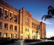
TREASURY HOTEL AND CASINO
GAMBARO HOTEL
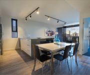
Arena Apartments
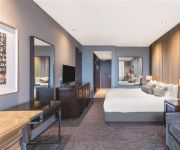
RYDGES SOUTH BANK BRISBANE
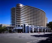
Mercure Brisbane
Evolution Apartment Hotel
PARK REGIS NORTH QUAY
Milton Motel Apartments
Milton Motel Apartments
MANTRA SOUTH BANK BRISBANE
Videos from this area
These are videos related to the place based on their proximity to this place.
West End, Brisbane
The urban village of West End hums to its own beat amid eclectic sights and sounds of a huge multicultural community. It's a pedestrian affair with all manner of grocers, urban cafes and retro...
Welcome to EF Brisbane
Learn more about EF Brisbane at http://www.ef.com/ef-brisbane Learn English with EF International Language Centres in the sunny Brisbane. The city has an average of 243 days of sun per year!...
Kirtan Meditation - A Natural Sanctuary for the Heart & Mind
Meditation is a journey of self-discovery. Simply by adding meditation to your life the journey will begin. Here in this series “Real People Really Meditating”, we hear some of the wonderful...
Sold by Alan Campbell 0414 777 338 RE/MAX Profile Bardon Real Estate a Smakk Media video
This property is SOLD 204/435 Coronation Drive Auchenflower Marketed by Alan Campbell 0414 777 338 Now You Can Holiday at Home All Year Round... Easy, breezy, and with access to absolutely.
5 years of photos at Somewhere to stay Backpackers
http://www.somewheretostay.com.au FREE bus to city every hour FREE Courtesy Pickup from Transit Centre Somewhere to Stay Backpackers offers a variety of rooms from Private Ensuite Rooms...
BTBR-Season01-Promo
A 31 Digital's original production about the stories of Qld Aboriginal and Torres Strait Islander communities. This series focuses on sustaining the First Nations Peoples language and introduces...
Gym Nation West End Brisbane January 2014
New video showcasing Gym Nation functional fitness training centre in West End Brisbane. Our members are committed to training hard, and results speak for themselves. Contact us today for...
5/5 Duncan Street West End (4101) QLD
West End is an inner city suburb of Brisbane, with a quirky vibe and fusion of cultures. Here it's certainly happening... with lively restaurants, pumping bars and the well-known weekend markets....
Unit 102 10 Pidgeon Close West End 4101 QLD by Tina Edwards
Property Video shoot of Unit 102 10 Pidgeon Close West End 4101 QLD by PlatinumHD http://www.platinumhd.tv for LJ Hooker Brisbane Central.
102 10 Pidgeon Close West End 4101 QLD by Anthony Dowley
Property Video shoot of 102 10 Pidgeon Close West End 4101 QLD by PlatinumHD http://www.platinumhd.tv for Ian Thompson Properties.
Videos provided by Youtube are under the copyright of their owners.
Attractions and noteworthy things
Distances are based on the centre of the city/town and sightseeing location. This list contains brief abstracts about monuments, holiday activities, national parcs, museums, organisations and more from the area as well as interesting facts about the region itself. Where available, you'll find the corresponding homepage. Otherwise the related wikipedia article.
Asia-Pacific Network Information Centre
APNIC Pty. Ltd. , doing business as the Asia Pacific Network Information Centre (APNIC), is the regional Internet registry for the Asia Pacific region. APNIC provides number resource allocation and registration services that support the global operation of the Internet. It is a not-for-profit, membership-based organization whose members include Internet Service Providers, National Internet Registries, and similar organizations.
William Jolly Bridge
The William Jolly Bridge is a vehicular and pedestrian bridge over the Brisbane River in Brisbane, Queensland, Australia. It is a steel frame arch bridge with an unusual concrete veneer and was opened to traffic on 30 March 1932 by Sir John Goodwin, the Governor of Queensland. When opened, during the worst year of the Great Depression, the bridge was known simply as the Grey Street Bridge.
Victoria Bridge, Brisbane
The Victoria Bridge is a vehicular and pedestrian bridge over the Brisbane River. The current bridge, opened in 1969, is the third permanent crossing erected at this location. It is shared by vehicular traffic, pedestrians and cyclists. Victoria Bridge connects the South Bank Parklands and Queensland Cultural Centre to the Brisbane central business district (CBD) at North Quay. Half of the road space on the bridge is now given over to the South-East Busway.
Merivale Bridge
The Merivale Bridge is a double track railway bridge crossing the Brisbane River. It crosses the Milton Reach of the river, slightly to the west of the William Jolly Bridge. Exclusively a railway crossing, it is located between the stations of South Brisbane and Roma Street, linking the northern and southern elements of the Citytrain system. The Merivale Bridge is the only inner-city rail crossing in Brisbane.
Milton, Queensland
Milton is an inner suburb of Brisbane, Australia approximately 2 kilometres west of Brisbane's central business district. The suburb is a mixture of light industry, warehouses, commercial offices, retail and single and multiple occupancy residences. The main roads are Milton Road, which runs beside the main western rail line and Coronation Drive (formerly River Road), which runs along the Brisbane River.
South Brisbane railway station
South Brisbane is a railway station in Brisbane, Queensland, Australia. It is part of the Queensland Rail City network and is located in Zone 1 of the TransLink integrated public transport system. It is the first station south of the Merivale Bridge and is also adjacent to the Cultural Centre busway station on the South East Busway.
Milton railway station, Brisbane
Milton Station is a railway station in Milton, Brisbane, Australia on the Ipswich and Rosewood and Springfield lines. The station includes a walkbridge to Suncorp Stadium and is also immediately adjacent the famous Castlemaine Perkins brewery in Milton.
West End, Queensland
West End is an inner-city suburb of southern Brisbane. At the 2011 Australian Census the suburb recorded a population of 8,061.
Brisbane Trades Hall
The Brisbane Trades Hall is the Trades Hall building in the Australian city of Brisbane. It is used by the Queensland trade union movement for meetings, offices, social and educational events, and is the location of the Trades and Labour Council, now known as the Queensland Council of Unions. The foundation stone of the original trades hall in Edward street, North Brisbane, was laid on 4 April 1891 by Sir Charles Lilley.
Brisbane Convention & Exhibition Centre
Brisbane Convention & Exhibition Centre (BCEC) is located in South Bank, Queensland.
The Skyneedle, Brisbane
The Skyneedle is a prominent feature of the Brisbane skyline which was constructed especially for World Expo 88. The 88 m landmark was earmarked for relocation to Tokyo Disneyland (following the completion of Expo '88). However, hairdresser Stefan Ackerie stepped in and purchased the Skyneedle, which was then relocated to the Stefan HQ at South Brisbane. After purchase, Stefan added his firm's signature rainbow rings logo to the top of the tower.
Queensland Cultural Centre
The Queensland Cultural Centre is a multi-venue centre located at South Bank, Brisbane, capital city of Queensland. It consists of the Queensland Performing Arts Centre (QPAC), the Queensland Museum, the State Library of Queensland (SLQ), the Queensland Art Gallery (QAG) and the Queensland Gallery of Modern Art (GOMA). The original part was designed by Brisbane architects Robin Gibson and Partners and opened in 1985.
Musgrave Park, Brisbane
Musgrave Park is a park in South Brisbane, a suburb of Brisbane, the capital city of the Australian state of Queensland. Musgrave Park is nestled between Edmonstone, Russell and Cordelia Streets and is approximately 3,000m. The park is next to Brisbane State High School and Musgrave Park Pool. The park is of cultural significance to indigenous Australians.
Brisbane State High School
Brisbane State High School (BSHS or often commonly State High) is a partially selective, co-educational, state secondary school, located in Brisbane, Queensland, Australia. It is a member of the Great Public Schools' Association of Queensland, and the Queensland Girls' Secondary Schools Sports Association. With an average year level cohort of slightly over 400 students, it is the largest secondary education institution in Queensland.
Cultural Centre busway station
The Cultural Centre Busway Station, at South Bank, is part of the South East Busway served by TransLink bus routes. The busway station is the first stop outside the city, and in Zone 1 of the TransLink integrated public transport system. The busway station is located directly south of Victoria Bridge which is close to the South Brisbane Railway Station, as well as the CityCat catamaran ferry wharf. The station takes its name from its location within the Queensland Cultural Centre precinct.
South Bank, Queensland
South Bank is a cultural, educational and recreational precinct in Brisbane, Queensland, Australia. The precinct is located in the suburb of South Brisbane, on the southern bank of the Brisbane River.
Highgate Hill, Queensland
Highgate Hill is a suburb of inner Brisbane, Australia 2 km south of the Brisbane CBD on the Brisbane River. The topography of the suburb is undulating hills no more than 70 metres above sea level. Highgate Hill is a high-density suburb with many apartment buildings, some more than 10 storeys. These apartment blocks are centered along the main road of Dornoch Terrace, a trend that was started in 1960 by the landmark Torbreck building.
Mephisto (tank)
Mephisto is the name of a German A7V tank captured by Australian troops during World War I. One of only 20 built, it is the last surviving example of the first German military tank, and is displayed at the Queensland Museum in Australia. Mephisto, chassis serial number 506, does not appear to be functional. Unlike modern tanks, the A7V has no turret.
West End ferry wharf
West End is a ferry wharf in the suburb of West End used by the CityCat on the Brisbane River. In January 2011 the wharf was destroyed during the devastating floods and the building works of the upgraded terminal were expected to be completed in July 2011. The new wharf was officially opened on July 24.
South Bank Grand Arbour
The South Bank Grand Arbour is a kilometre long arbour located in the South Bank Parklands in Brisbane, Australia. The structure functions as a pedestrian walkway which connects the Griffith Film School on the corner of Dock Street and Vulture Street to the Cultural Forecourt adjacent to QPAC, as well as the rest of the South Bank Parklands through which it runs. The arbour was designed by Melbourne-based architectural firm Denton Corker Marshall, and was officially opened in 2000.
Kurilpa Bridge
The Kurilpa Bridge (originally known as the Tank Street Bridge) is a (A$)$63 million pedestrian and bicycle bridge over the Brisbane River in Brisbane, Queensland, Australia. The bridge connects Kurilpa Point in South Brisbane to Tank Street in the Brisbane central business district. In 2011, the bridge was judged World Transport Building of the Year at the World Architecture Festival.
North Quay, Brisbane
North Quay is a location in the Brisbane central business district and the name of street in the same area, running along the Brisbane River from an intersection near Makerston Street to the top of the Queen Street.
Nepal Peace Pagoda
The Nepal Peace Pagoda in Brisbane, Australia, is located at the transformed Brisbane World Expo '88 site, South Bank Parklands. It is one of the most significant heritage items in Brisbane from the hosting of the Expo.
Commonwealth Law Courts
Harry Gibbs Commonwealth Law Courts on North Quay, Brisbane, Australia contains the Queensland registries of the High Court of Australia and the Federal Court of Australia; and the Brisbane registries of the Family Court of Australia, Federal Magistrates Court of Australia and the Administrative Appeals Tribunal. The building is thirteen storeys tall and construction was completed in August 1993.
Go Between Bridge
The Go Between Bridge, formerly known as the Hale Street Link, is a toll bridge for vehicles, pedestrians and cyclists over the Brisbane River in inner-city Brisbane, Queensland, Australia. The bridge connects Merivale and Cordelia Streets in West End to Hale Street and the Inner City Bypass at Milton. It is Brisbane's first inner-city traffic bridge in 40 years and is expected to carry around 12,000 vehicles per day. The bridge opened to traffic in the early hours on 5 July 2010.


