Discover New Farm
The district New Farm of in Brisbane (Queensland) is a subburb in Australia about 587 mi north-east of Canberra, the country's capital city.
If you need a hotel, we compiled a list of available hotels close to the map centre further down the page.
While being here, you might want to pay a visit to some of the following locations: Brisbane, Sunshine Coast, Carrolls Creek, and . To further explore this place, just scroll down and browse the available info.
Local weather forecast
Todays Local Weather Conditions & Forecast: 23°C / 73 °F
| Morning Temperature | 15°C / 59 °F |
| Evening Temperature | 20°C / 69 °F |
| Night Temperature | 18°C / 65 °F |
| Chance of rainfall | 0% |
| Air Humidity | 60% |
| Air Pressure | 1025 hPa |
| Wind Speed | Gentle Breeze with 8 km/h (5 mph) from North-West |
| Cloud Conditions | Broken clouds, covering 53% of sky |
| General Conditions | Light rain |
Monday, 29th of April 2024
24°C (75 °F)
18°C (64 °F)
Sky is clear, gentle breeze, clear sky.
Tuesday, 30th of April 2024
23°C (74 °F)
18°C (64 °F)
Light rain, gentle breeze, broken clouds.
Wednesday, 1st of May 2024
23°C (73 °F)
18°C (64 °F)
Light rain, gentle breeze, scattered clouds.
Hotels and Places to Stay
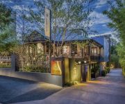
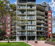
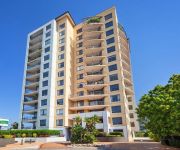
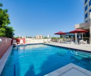
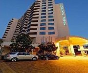
The Point Brisbane
Spicers Balfour Hotel
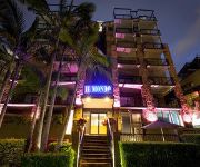
Il Mondo Boutique Hotel
Goldsborough Place Apartments
Alex Perry Hotel & Apartments
The Docks on Goodwin
BRIDGEWATER APARTMENTS
Central Dockside Apartment Hotel
Central Dockside
QUEST ON STORY BRIDGE SERVICED APTS
Videos from this area
These are videos related to the place based on their proximity to this place.
New Farm, Brisbane
New Farm is an inner city village steeped in historical charm and revived youthful energy. Shaded streets feature pop-up markets, cafes, lifestyle boutiques and artistic talent at the iconic...
BRIDGE PROJECT Walkthrough - City Map 1, 2, 3, 4 & 5 (Gameplay Lets Play Bridge Builder Game)
The Bridge Project game is a Bridge Builder Simulation Game. Construct a Huge Variety of Bridges. Bridge Project uses Accurate Physics using Pistons, Wood, Iron, Steel, Cables, Suspension Cables...
Tropico 4 Plantador - 1: Island Arrival (Best City Building Games PC 2014)
Tropico 4 Plantador DLC City Building Game! Best City Building Games 2014 & All Time! ElPresidente has washed up on a new island, one that lacks even basic infrastructure. We need to keep an...
BRIDGE PROJECT Walkthrough - City Map 8 & 9 (Challenge Builds: No Suspension, Most Flex)
The Bridge Project game is a Bridge Builder Simulation Game. Construct a Huge Variety of Bridges. Bridge Project uses Accurate Physics using Pistons, Wood, Iron, Steel, Cables, Suspension Cables...
Tropico 4 Megalopolis DLC - 1: Megalopolis City (Best City Building Games PC 2014)
Tropico 4 Megalopolis DLC City Building Game! Best City Building Games 2014 & All Time! ElPresidente has a new island, one that requires a great many buildings and people. We need to keep an...
Tropico 4 Junta Military DLC Gameplay 2 - EL Presidente Solo (City Building Games)
Tropico 4 Junta Military DLC Gameplay. Tropico 4 - a Military City Building Game. Tropico 4 is one of the Best City Building Games of All Time! City Building done Military! ElPresidente needs...
Tropico 4 Pirate Heaven DLC - 3: Rebel Attacks (Best City Building Games PC)
Tropico 4 Pirate Heaven DLC City Building Game ! Tropico 4 is one of the Best City Building Games of All Time! Build a Pirate City! Smuggle Goods, Steal Booty and Sail the Seven Seas! Manage...
Tropico 4 Plantador - 2: Building Tobacco Plantations (Best City Building Games PC 2014)
Tropico 4 Plantador DLC City Building Game! Best City Building Games 2014 & All Time! ElPresidente has washed up on a new island, one that lacks even basic infrastructure. We need to keep an...
Tropico 4 Plantador - 6: Mystery Island (Best City Building Games PC 2014)
Tropico 4 Plantador DLC City Building Game! Best City Building Games 2014 & All Time! ElPresidente has washed up on a new island, one that lacks even basic infrastructure. We need to keep an...
Tropico 4 Megalopolis DLC - 10: Victory (City Building Games)
Tropico 4 Megalopolis DLC City Building Game ! Tropico 4 is one of the Best City Building Games of All Time! ElPresidente has a new island, one that requires a great many buildings and people....
Videos provided by Youtube are under the copyright of their owners.
Attractions and noteworthy things
Distances are based on the centre of the city/town and sightseeing location. This list contains brief abstracts about monuments, holiday activities, national parcs, museums, organisations and more from the area as well as interesting facts about the region itself. Where available, you'll find the corresponding homepage. Otherwise the related wikipedia article.
Story Bridge
The Story Bridge is a steel cantilever bridge spanning the Brisbane River that carries vehicular, bicycle and pedestrian traffic between the northern and the southern suburbs of Brisbane, Queensland, Australia. It is the longest cantilever bridge in Australia. The bridge is part of Bradfield Highway (15) and connects Fortitude Valley to Kangaroo Point. It is named for John Douglas Story.
Anglican Church Grammar School
The Anglican Church Grammar School (ACGS), commonly referred to as Churchie, is an independent, Anglican, day and boarding school for boys, located in East Brisbane, an inner suburb of Brisbane, Queensland, Australia. Founded in 1912 by Canon William Perry French Morris, Churchie has a non-selective enrolment policy and currently caters for approximately 1,750 students from Reception to Year 12, including 150 boarders from Years 8 to 12.
New Farm, Queensland
New Farm is an inner suburb of Brisbane, Australia, 2 km east of the Brisbane CBD on a large bend of the Brisbane River. New Farm is partly surrounded by the Brisbane River, with land access from the north-west through Fortitude Valley and from the north through Newstead. It has the highest population density in Greater Brisbane with approximately 5,861.7 people per square kilometre.
New Farm Park
New Farm Park is a public park located in the suburb of New Farm, in Brisbane, Queensland, Australia. The park covers 15 hectares and is situated at the south-eastern end of the New Farm peninsula on a bend in the Brisbane River. The Powerhouse arts centre is located at the eastern end of the park.
Newstead, Queensland
Newstead is a riverside suburb of the city of Brisbane, Queensland, Australia. It is situated 3 km north of the Brisbane central business district. The north-west portion of the suburb, centred on Breakfast Creek Road, is predominantly commercial, with the remainder of the suburb now mainly residential. At the last census, over 67% of the households in Newstead consisted of couples without children and a further 20% were single person households.
Morningside Australian Football Club
Morningside Australian Football Club, also known as Morningside AFC or the Panthers, is an Australian Rules football club based at Jack Esplen Oval in the suburb of Hawthorne in Brisbane. The club consists of both Junior and Senior football sections. Its senior team competes in the AFL Queensland Australian rules football competition, while its junior sides compete in the AFL Brisbane Juniors (AFLBJ) competition.
Clem Jones Tunnel
The M7 Clem Jones Tunnel (CLEM7), known during its development as the North-South Bypass Tunnel (NSBT), is a A$3.2 billion motorway grade toll road built under the Brisbane River, which crosses between the suburbs of Woolloongabba and Bowen Hills in Brisbane, Queensland. The CLEM7 Community Open Day, a public open day which included a tunnel run and walk, was held on 28 February 2010.
Teneriffe ferry wharf
Teneriffe is a ferry wharf in the suburb of Teneriffe used by the CityFerry on the Brisbane River. In January 2011 the wharf sustained a minor damage during the devastating floods; it was repaired and reopened on 14 February 2011.
Hawthorne ferry wharf
Hawthorne is a ferry wharf in the suburb of Hawthorne used by the CityCat on the Brisbane River. In January 2011 the wharf sustained a minor damage during the devastating floods; it was repaired and reopened on 14 February 2011.
New Farm Park ferry wharf
New Farm Park is a ferry wharf in the suburb of New Farm used by the CityCat and the CityFerry on the Brisbane River. In January 2011 the wharf sustained a moderate damage during the devastating floods; it was repaired and reopened on 14 February 2011.
Mowbray Park ferry wharf
Mowbray Park is a ferry wharf in the suburb of East Brisbane used by the CityCat on the Brisbane River. Mowbray Park is named for Thomas Mowbray, a presbyterian minister who had been minister at Blackridge Parish Church, Scotland. In January 2011 the wharf sustained a moderate damage during the devastating floods; it was repaired and reopened on 14 February 2011.
Sydney Street ferry wharf
Sydney Street is a ferry wharf in the suburb of New Farm used by the CityCat and the CityFerry on the Brisbane River. In January 2011 the wharf was destroyed during the devastating floods, but was rebuilt shortly after, re-opening on the 18th of April 2011.
Dockside ferry wharf
Dockside is a ferry wharf in the suburb of Kangaroo Point used by the CityFerry on the Brisbane River. In January 2011 the wharf sustained a minor damage during the devastating floods; it was repaired and reopened on 14 February 2011.
Holman Street ferry wharf
Holman Street is a ferry wharf in the suburb of Kangaroo Point used by the CityFerry on the Brisbane River. On January 12, 2011, most of the wharf was destroyed and washed away during flooding of the Brisbane River and the rebuilding works are expected to take months.
Teneriffe, Queensland
Teneriffe is an inner city suburb in Brisbane, Australia. Situated next to Teneriffe are the suburbs of Newstead, Fortitude Valley, Bowen Hills and New Farm. Teneriffe, until Jan 2010 was not officially designated as a suburb and lay within the Brisbane suburb of Newstead, however the Brisbane City Council approved the designation of Teneriffe as a suburb in February 2010. There is a ferry servicing Teneriffe from the Teneriffe Ferry Wharf on the Brisbane River.
East Brisbane, Queensland
East Brisbane is an inner suburb of Brisbane, Australia located 3 km east of the Brisbane CBD. It is predominantly residential, with some original "Queenslander" style homes, but with an increasing number of apartment blocks. Major roads include Lytton Road, Wellington Road and Latrobe Street in the north and Vulture Street and Stanley Street in the south of the suburb.
Shafston College
Shafston International College is a private education institution for international students located in Brisbane, Australia. It offers certificate, diploma and English language programs. Shafston was established in 1996 and has grown rapidly with over 50,000 students having attended since its inception. Shafston has a diverse student population with over 36 different nationalities on campus at any given time.
Hawthorne, Queensland
Hawthorne is an inner suburb of Brisbane, Queensland, Australia located in the City of Brisbane. It is 4 kilometres east of the Brisbane central business district. Hawthorne started as a farming district in the 1860s, and was gradually subdivided as Brisbane grew. This was helped by the introduction of ferry and tram services. The suburb's name is from Hawthorne Bushes that were planted in on Galloways hill by the original settler William Baynes.
Norman Park ferry wharf
Norman Park is a ferry wharf in the suburb of Norman Park used by the CityFerry on the Brisbane River. The wharf and cross river service closed in 2000 due to poor patronage, but reopened on 15 January 2007.
Roman Catholic Archdiocese of Brisbane
The Roman Catholic Archdiocese of Brisbane' is a Latin rite metropolitan archdiocese of the Catholic Church in Australia located in Brisbane and covering the South East region of Queensland, Australia. Part of the Roman Catholic Ecclesiastical Province of Brisbane, the region covered was initially administered by the Archdiocese of Sydney. In 1859 the Diocese of Brisbane was erected; and elevated as an archdiocese in 1887.
Merthyr, Queensland
Merthyr is a named locality within the Brisbane, Queensland suburb of New Farm centred around Merthyr Road. It is the northside terminus of Tranlink Bus route 196, Fairfield Gardens to City to New Farm (Merthyr). It is also served by route 199, West End to City to New Farm. There is a small commercial precinct around the intersection of Merthyr Road and Brunswick Street, that includes Merthyr Village.
Norman Creek
Norman Creek is a small tributary of the Brisbane River. The headwaters of the creek are located on the northern slopes of Toohey Mountain and Mount Gravatt in southern Brisbane. Edmund Lockyer named the waterway Norman Creek in 1825. The creek drains the suburbs of Tarragindi and Holland Park West then flows northwards through Greenslopes, Norman Park and East Brisbane before entering the Brisbane River at Humbug Reach. The total catchment area is 29.8 km².
Howard Smith Wharves
Howard Smith Wharves is a wharf site on the Brisbane River in Brisbane, Queensland, Australia. The 3.5 ha site is culturally and historically significant and is one of the last undeveloped riverfront locations in Brisbane. Brisbane City Council had initially proposed an extensive commercial development of the site that includes hotel, sport and entertainment facilities in new or refurbished old buildings.
Coronet Flats
Coronet Flats (also known as Coronet Court) is a residential apartment building on the corner of Brunswick Street and Elystan Road, New Farm, Queensland, Australia. With its prominent siting, unusual form, and striking art deco style, Coronet Flats is considered one of the most beautiful and recognisable private buildings of the 1930s in Brisbane.
Heath Park (Brisbane)
Heath Park is a multi-sport venue located at East Brisbane, Queensland. It is home to Eastern Suburbs F.C.


