Touring Fairfield
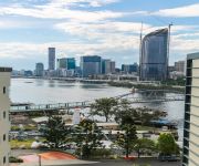
The district Fairfield of Brisbane in Brisbane (Queensland) is a subburb located in Australia about 584 mi north-east of Canberra, the country's capital place.
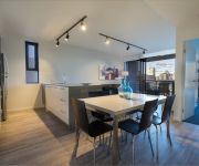
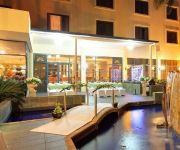
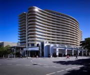
Need some hints on where to stay? We compiled a list of available hotels close to the map centre further down the page.
Being here already, you might want to pay a visit to some of the following locations: Sunshine Coast, Carrolls Creek, , and . To further explore this place, just scroll down and browse the available info.
Local weather forecast
Todays Local Weather Conditions & Forecast: 24°C / 75 °F
| Morning Temperature | 16°C / 61 °F |
| Evening Temperature | 22°C / 71 °F |
| Night Temperature | 18°C / 65 °F |
| Chance of rainfall | 0% |
| Air Humidity | 51% |
| Air Pressure | 1024 hPa |
| Wind Speed | Gentle Breeze with 7 km/h (4 mph) from West |
| Cloud Conditions | Few clouds, covering 14% of sky |
| General Conditions | Few clouds |
Tuesday, 30th of April 2024
24°C (75 °F)
18°C (64 °F)
Light rain, gentle breeze, few clouds.
Wednesday, 1st of May 2024
23°C (73 °F)
18°C (64 °F)
Light rain, gentle breeze, broken clouds.
Thursday, 2nd of May 2024
22°C (72 °F)
17°C (63 °F)
Light rain, gentle breeze, overcast clouds.
Hotels and Places to Stay
Arena Apartments
BEST WESTERN PLUS HOTEL DIANA
PARKVIEW APARTMENTS
Vine Serviced Apartments
RYDGES SOUTH BANK BRISBANE
MANTRA SOUTH BANK BRISBANE
Swiss-Belhotel Brisbane
Gabba Central Apartments
Sudima Suites
Hotel Chino
Videos from this area
These are videos related to the place based on their proximity to this place.
Condev Construction - Yeronga Village Crane Assembly
This is a Timelapse video of the assembly of the tower crane at Condev Construction's Yeronga Village Building Site.
SOLD: Country Quilt Doubletail Halfmoon Betta Pair
TO BUY - READ BELOW Gorgeous pair with great volume. Imported from select breeders in Thailand. Offered for sale $100AU/pr email to purchase. Details below. http://www.fishchick.com.au...
CRRAG Meeting 6 of 38
Luke Franzmann: Y'pilly "best balance" New station, shorter portal structure, TOD access, Tennyson loop access. New station, shooter travel time for tunnel connects, 5 mins between peak services....
CRRAG Meeting 5 of 38
Luke Franzmann: Deciding on the southern portal location Key considerations Inner city rail capacity study completed 2008 - pre-feasibility study - portal at Fairfield Feasibility study...
Rock n Roll Dance - move- BELAIRE.flv
This is but one of the many,many dance figures we teach in Rock n Roll Swing and Latin, This figure takes quite a lot of practice to perform smoothly. www.sunshinerockers.com Learn to Dance...
House for Rent in Annerley Annerley House 3BR/1BA by West End Property Management
Click http://www.metrocityrealty.com.au/ to visit Metrocity Realty for your "Brisbane Property Management" needs! You may also visit http://www.metrocityrealty.com.au/search/rentals for a list...
Unit for Rent in Annerley Annerley Unit 2BR/1BA by West End Property Management
Click http://www.metrocityrealty.com.au/ to visit Metrocity Realty for your "Brisbane Property Management" needs! You may also visit http://www.metrocityrealty.com.au/search/rentals for a list...
Unit for Rent in Highgate Hill Highgate Hill Unit 3BR/2BA by West End Property Management
Click http://www.metrocityrealty.com.au/ to visit Metrocity Realty for your "Brisbane Property Management" needs! You may also visit http://www.metrocityrealty.com.au/search/rentals for a list...
House for Rent in Highgate Hill Highgate Hill House 3BR/2BA by West End Property Management
Click http://www.metrocityrealty.com.au/ to visit Metrocity Realty for your "Brisbane Property Management" needs! You may also visit http://www.metrocityrealty.com.au/search/rentals for a list...
RC Drifting: Mad drifting at Cannon hill Drift night!!!
1080p HD WATCH IN HIGH DEFF! Went to check out the RC Drifting scene at Cannon Hill on Thursday night. www.driftcity.org is the club. So if you in the Brisbane area and you are hooked on drift,...
Videos provided by Youtube are under the copyright of their owners.
Attractions and noteworthy things
Distances are based on the centre of the city/town and sightseeing location. This list contains brief abstracts about monuments, holiday activities, national parcs, museums, organisations and more from the area as well as interesting facts about the region itself. Where available, you'll find the corresponding homepage. Otherwise the related wikipedia article.
University of Queensland
The University of Queensland (UQ) is a public university located in the state of Queensland, Australia. Founded in 1909, it is the oldest and largest university in Queensland and the fifth oldest in Australia. The main campus is located in the suburb of St Lucia, southwest of the Brisbane City Central Business District, with other major campuses in Gatton, Ipswich and Herston with a number of other satellite facilities.
Park Road railway station
Park Road is a railway station in Brisbane, Queensland, Australia. It is part of the Queensland Rail City network. It is in a transition precinct between Zone 1 and Zone 2 of the TransLink integrated public transport system. The station forms the branching point for the Beenleigh/Gold Coast and Cleveland railway lines. Platform 4 of this station was intended for use by Gold Coast trains but the curvature of the platform has proved to be unsafe for commuter train usage.
Boggo Road Gaol
Boggo Road Gaol (alt. and older spelling "Bogga") was a notorious Australian prison located on Annerley Road in Dutton Park, an inner southern suburb of Brisbane, Queensland, Australia. The site is the only surviving intact gaol in Queensland that reflects penological principles of the 19th century. For many years it was Queensland's main prison.
Princess Alexandra Hospital
The Princess Alexandra Hospital (PAH) is on Ipswich Road in Woolloongabba, Australia. It is one of the major hospitals in Brisbane and is a teaching hospital of the University of Queensland. It is a tertiary level teaching hospital with all major medical and surgical specialities onsite except for obstetrics, gynaecology and paediatrics. A new building was opened in 2000 to replace the ageing red-brick PA Hospital complex built in the 1950s.
Dutton Park railway station
Dutton Park is a railway station on the Beenleigh Line of Brisbane, Australia. It is part of the Queensland Rail City network. It is in Zone 2 of the TransLink integrated public transport system. Dutton Park was the junction of the Wooloongabba Branch from 1884 until 1989.
Fairfield railway station, Brisbane
Fairfield is a railway station on the Beenleigh Line of Brisbane, Australia. It is part of the Queensland Rail City network. It is in Zone 2 of the TransLink integrated public transport system. Fairfield station is located close to Fairfield Gardens Shopping Centre.
Yeronga railway station
Yeronga is a railway station on the Beenleigh Line of Brisbane, Australia. It is part of the Queensland Rail City network. It is in Zone 2 of the TransLink integrated public transport system.
South East Busway
The South East Busway is a grade separated bus-only corridor running south from the Brisbane CBD to Eight Mile Plains, in South East Queensland. Service providers using the Busway operate under the TransLink system. The Busway was completed to Woolloongabba in September 2000 and to Eight Mile Plains in April 2001.
Dutton Park, Queensland
Dutton Park is a suburb of Brisbane, Australia located about 4 km south of the Brisbane CBD. The suburb is predominantly residential, with some light industrial and commercial areas. The name Dutton comes from Charles Boydell Dutton, the Queensland Minister for Lands from 1883 to 1887, who created the recreation reserve in 1884.
Eastern Busway
The Eastern Busway is a bus-only corridor in Brisbane, Queensland. The busway runs from the University of Queensland St Lucia Campus via the Eleanor Schonell Bridge, connects with the South East Busway at Buranda busway station and then extends to Coorparoo following the Old Cleveland Road corridor.
Fairfield, Queensland
Fairfield is a suburb of Brisbane, Australia located 5 km south of the Brisbane CBD on the Brisbane River. The suburb is mainly residential with house and unit accommodation.
Eleanor Schonell Bridge
The Eleanor Schonell Bridge, better known as the Green Bridge, is a 390-metre (1,280 ft)-long cable-stayed bridge which crosses the Brisbane River between Dutton Park and the University of Queensland's St Lucia campus. Its deck is 185 metres long, 20 metres wide and about 18 metres above the river's surface.
Schonell Theatre
The Schonell Theatre is a Theatre and Cinema complex at the University of Queensland. It consists of Theatre One: a 420 seat, single auditorium theatre capable of hosting projected cinematic films, musical performances, plays and lectures; Theatre 2, a 175 seat cinema and the Cement Box Theatre. It is situated in the UQU complex at the University of Queensland's St Lucia campus. The theatre was constructed in 1970 and underwent refurbishment in 2005.
Yeronga, Queensland
Yeronga is a suburb of Brisbane, Queensland, Australia located on the Brisbane River 7 km south of the Brisbane CBD. Yeronga is a residential suburb. It is home to the Yeronga Devils.
University of Queensland ferry wharf
University of Queensland is a ferry wharf in the suburb of St Lucia used by the CityCat on the Brisbane River. A non-TransLink cross river ferry service formerly ran between UQ and Dutton Park, but was discontinued when the bus, cyclist and pedestrian only Eleanor Schonell Bridge adjacent to the route was completed. In January 2011 the wharf was destroyed during the devastating floods and the rebuilding works were expected to take months.
Yeronga Park
Yeronga Memorial Park was one of Brisbane's second earliest parks, originally reserved in 1888. The sprawling park caters for sports and recreational activities and is a significant World War I and World War II place of remembrance. Yeronga Park is situated on Ipswich Road in the suburb of Yeronga. A Brisbane City Council 50 m swimming pool complex is situated on the southern edge of the park. Also nearby, the Yeronga railway station is about 500 m to the west of the park.
UQ Lakes busway station
The UQ Lakes Bus Station, at UQ's St Lucia Campus, is serviced by TransLink bus routes. It is located west of College Road and is the new way of accessing UQ by public transport, via the new Eleanor Schonell Bridge. It is in Zone 2 of the TransLink integrated public transport system. UQ Lakes Station is the western terminus of the Eastern Busway. By 2012, about 1.5 million passengers were using the bus stop each year, making it one of the top-5 busiest stops in Brisbane.
InterVarsity Choral Festival (Australia)
The Australian InterVarsity Choral Festival (IVCF) is an annual event in which members of university choirs from all state capitals of Australia and the national capital Canberra meet for two weeks to rehearse, socialise and perform combined concerts. The Festival also serves as the annual conference of the member choirs of AICSA, the Australian Intervarsity Choral Societies Association.
Brisbane Catholic Education
Brisbane Catholic Education is the educational Vicariate of the Roman Catholic Archdiocese of Brisbane, Queensland.
Buranda, Queensland
Buranda is a locality in the southern Brisbane suburbs of Greenslopes and Woolloongabba in Brisbane, the capital of Queensland, Australia. The location is an important transport hub for southern Brisbane. Logan Road and Ipswich Road pass through the area as does the South East Busway with a station called Buranda busway station. The Pacific Motorway passes through the area. There is also the Buranda railway station on the Cleveland railway line.
TC Beirne School of Law
The TC Beirne School of Law at the University of Queensland, founded in 1936, is the oldest law school in the Australian state of Queensland, as well as the sixth oldest law school out of 32 in Australia. Its alumni include two Chief Justices of Australia. The school has approximately 2,000 students, the majority of whom are studying the Bachelor of Laws. Other programs offered by TC Beirne include the Master of Laws, Master of Applied Law and Doctor of Philosophy.
Princess Alexandra Hospital busway station
The Princes Alexandra Busway Station is serviced by TransLink bus routes travelling on the Eastern busway. It is located opposite O'Keefe Street. It is in Zone 2 of the TransLink integrated public transport system.
Boggo Road busway station
The Boggo Road Busway Station is serviced by TransLink bus routes travelling via the Eastern busway. It is located adjacent to the Park Road railway station. It is in Zone 2 of the TransLink integrated public transport system.
Shire of Stephens
The Shire of Stephens was a local government area in the inner southern suburbs of Brisbane, Queensland. The shire, administered from Annerley, covered an area of 9 square miles, and existed as a local government entity from 1886 until 1925, when it was amalgamated into the City of Brisbane under the City of Brisbane Act 1924.
Goodwin Park
Goodwin Park is a multi-sport venue located at Yeronga, Queensland. It is home to Brisbane Olympic.


