Explore Toowong
The district Toowong of in Brisbane (Queensland) is located in Australia about 585 mi north of Canberra, the country's capital.
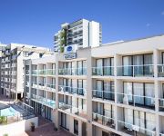
If you need a place to sleep, we compiled a list of available hotels close to the map centre further down the page.
Depending on your travel schedule, you might want to pay a visit to some of the following locations: Brisbane, Sunshine Coast, Carrolls Creek, and . To further explore this place, just scroll down and browse the available info.
Local weather forecast
Todays Local Weather Conditions & Forecast: 22°C / 72 °F
| Morning Temperature | 16°C / 62 °F |
| Evening Temperature | 20°C / 68 °F |
| Night Temperature | 18°C / 65 °F |
| Chance of rainfall | 0% |
| Air Humidity | 61% |
| Air Pressure | 1024 hPa |
| Wind Speed | Moderate breeze with 10 km/h (6 mph) from North-West |
| Cloud Conditions | Broken clouds, covering 62% of sky |
| General Conditions | Light rain |
Friday, 3rd of May 2024
21°C (69 °F)
17°C (62 °F)
Light rain, gentle breeze, broken clouds.
Saturday, 4th of May 2024
20°C (67 °F)
16°C (62 °F)
Light rain, gentle breeze, overcast clouds.
Sunday, 5th of May 2024
21°C (69 °F)
17°C (63 °F)
Light rain, gentle breeze, broken clouds.
Hotels and Places to Stay
GAMBARO HOTEL
Toowong Villas
JEPHSON HOTEL
PARK REGIS NORTH QUAY
Riverside Hotel South Bank
Vine Serviced Apartments
SOUTH CENTRAL APARTMENTS
PARKVIEW APARTMENTS
Arena Apartments
MANTRA SOUTH BANK BRISBANE
Videos from this area
These are videos related to the place based on their proximity to this place.
Framing Stephen Wiltshire Brisbane City Panorama
Watch how the conservation framing team at Art Land Indooroopilly tackled the massive job of framing the 4m Brisbane City drawing by Stephen Wiltshire. Get a glimpse into the conservation framing...
46 Swann Road Taringa 4068 QLD by Daniel Lee
Property Video shoot of 46 Swann Road Taringa 4068 QLD by PlatinumHD http://www.platinumhd.tv for LJ Hooker Toowong.
Babies Love Spinning Around at Snap Laundromat Taringa Brisbane
Babies Love Spinning Around and Around at Snap Laundromat Taringa Brisbane. Our Dexter Laundry washing machines keep them mesmerised and happy for ages! Our laundry is pram accessible, ...
22 Swann Road Taringa 4068 QLD by Daniel Lee
Property Video shoot of 22 Swann Road Taringa 4068 QLD by PlatinumHD http://www.platinumhd.tv for LJ Hooker Toowong.
Taringa Accountants: GST Advice, Systems, Compliance & BAS Return, FBT and CGT. Anthony Wetmore & Co
Taringa's Anthony Wetmore & Co (http://www.wetmore.com.au) has the proven expertise to provide any organisation with all of that organisations GST requirements. Due to the complexity and the...
Sold by Jonzun Lee 0418 885 708 Real estate agent - a Smakk Media video
Sold 12/53 Princess Street Taringa real estate for sale by Jonzun Lee. Call Jonzun today on 0418 885 708 Amongst the Tree Tops with City Glimpses Enjoy life in this top floor spacious apartment....
Sold by Juana Bernardo RE/MAX Profile 0418 775 373 Brisbane's #1 Broker:
SOLD: 5/101 Sherwood Rd Toowong has been sold Juana Bernardo from RE/MAX Profile on 0418 775 373 City Fringe Lifestyle Choice – Make it yours! What strikes you as you step into this apartment.
Sold by Alan Campbell 0414 777 338 RE/MAX Profile Bardon Real Estate a Smakk Media video
This property is SOLD 204/435 Coronation Drive Auchenflower Marketed by Alan Campbell 0414 777 338 Now You Can Holiday at Home All Year Round... Easy, breezy, and with access to absolutely.
Videos provided by Youtube are under the copyright of their owners.
Attractions and noteworthy things
Distances are based on the centre of the city/town and sightseeing location. This list contains brief abstracts about monuments, holiday activities, national parcs, museums, organisations and more from the area as well as interesting facts about the region itself. Where available, you'll find the corresponding homepage. Otherwise the related wikipedia article.
Toowong, Queensland
Toowong is an inner suburb of Brisbane, Australia, which is 5 kilometres west of the Brisbane CBD. At the centre of Toowong is a commercial precinct including Toowong Village and several office buildings. The remainder of the suburb is predominantly residential with a mix of medium density dwellings and detached houses.
Auchenflower railway station
Auchenflower Station is a railway station in Auchenflower, Brisbane, Australia, on the Ipswich and Rosewood and Springfield lines. Whereas Auchenflower station is in zone 1 of TransLink fare system, buses servicing Auchenflower are in zone 2 of the same system.
Toowong railway station
Toowong is a railway station in Toowong, a southwestern suburb of Brisbane, the state capital of Queensland, Australia, on the Ipswich and Rosewood and Springfield lines. The station falls in a transition precinct between Zone 1 and Zone 2 of the TransLink integrated public transport system. The station provides access to the café and shopping precinct, as well as the Regatta and Royal Exchange hotels nearby. It is the closest station to the St Lucia campus of the University of Queensland.
Taringa railway station
Taringa is a railway station in Taringa, Queensland, Australia, on the Ipswich and Rosewood and Springfield lines. It is located in Zone 2 of the TransLink integrated public transport system, and is part of the Queensland Rail city network.
Taringa, Queensland
Taringa is a suburb of Brisbane, Australia 5 km south-west of the Brisbane CBD. Taringa is mostly residential, except for a small number of commercial buildings mostly clustered along Moggill Road. It is a popular neighbourhood among the students of the University of Queensland and the Queensland University of Technology because of its proximity to the universities and to Brisbane city.
Brisbane College of Theology
Brisbane College of Theology, in Brisbane, Queensland, Australia, was an ecumenical theological education consortium, comprising St Francis' Theological College, St Paul's Theological College and Trinity Theological College. It was based at Raymont Lodge in Auchenflower and offered both under-graduate and post-graduate qualifications.
Regatta Hotel
The Regatta Hotel is an historic hotel located on the corner of Coronation Drive and Sylvan Road in Brisbane, Australia. It is located in the suburb of Toowong and faces the Brisbane River. The three-storey hotel contained accommodation on the upper two floors and a public bar and lounge area on the ground floor. It was named after the rowing regattas which were once held along the nearby river.
Indooroopilly, Queensland
Indooroopilly is a suburb of Brisbane, Australia 7 km west of the Brisbane central business district. The suburb covers 7.5 km² and has a population of more than 11,000 people.
Toowong Village
Toowong Village is a building situated at the centre of the Brisbane suburb of Toowong, Queensland, Australia, on the block of land bounded by Coronation Drive, High Street and Sherwood Road. The blue glass office tower is a prominent landmark visible from Toowong and surrounding suburbs. Opened in 1986, Toowong Village is an office tower and shopping centre. The complex was built on the site of the former Patterson's sawmill and over the existing Toowong Railway station.
Western Freeway, Brisbane
The M5 is a 5 km long freeway in western Brisbane that runs from Milton Road in Toowong to the western side of Indooroopilly where the freeway becomes the M5 Centenary Motorway. The freeway bears the symbol and forms part of Metroad 5. There is one interchange, at Indooroopilly onto Moggill Road. A bicycle path runs the length of the freeway, allowing commuting to Toowong and onto Brisbane by bicycle. Options are currently being investigated in to a possible Kenmore Bypass.
Metroad 5 (Brisbane)
Metroad 5 is one of Brisbane's metroads, running from Yamanto to Kedron. It is the main western bypass of Brisbane city.
Indooroopilly State High School
-- 03:06, 2 January 2013 (UTC) 40x40pxThis article appears to be written like an advertisement. Please help improve it by rewriting promotional content from a neutral point of view and removing any inappropriate external links. Indooroopilly State High School Indooroopilly State High School's Logo. Source: www. indoorooshs. qld. edu.
Brisbane Boys' College
Brisbane Boys' College (BBC), is an independent, Presbyterian and Uniting Church, day and boarding school for boys, located in Toowong, a suburb of Brisbane, Queensland, Australia. Established in 1902, the College has a non-selective enrolment policy and caters for approximately 1,550 students from Prep to 12, including 140 boarders from Years 5 to 12.
Regatta ferry wharf
Regatta is a ferry wharf in the suburb of Toowong used by the CityCat on the Brisbane River. With funding from the nearby Regatta Hotel and the Brisbane City Council the ferry wharf opened to the public on 7 April 2003 (2003-04-07).
Auchenflower, Queensland
Auchenflower is an inner suburb of Brisbane, Queensland, Australia 2.5 km west of the Brisbane CBD bordering the Brisbane River.
Queensland Academy for Science, Mathematics and Technology
The Queensland Academy for Science, Mathematics, and Technology (QASMT) is a selective entry high school in Queensland, Australia, developed in partnership with the University of Queensland. QASMT offers the International Baccalaureate Diploma Program to students in grades 11 and 12, and is also open to grade 10 students. The institution consistently performs above IB world-average, and is one of the highest performing schools in Queensland based on OP1-equivalents and tertiary acceptance rates.
Toowong Cemetery
The Brisbane General Cemetery also known as Toowong Cemetery at Toowong, Brisbane was established in 1866 and formally opened in 1875. It is Queensland's largest cemetery and is located on forty-four hectares of land at the corner of Frederick Street and Mount Coot-tha Road approximately four and a half kilometres west of Brisbane.
Brisbane Botanic Gardens, Mount Coot-tha
The Brisbane Botanic Gardens are located 7 km from the city of Brisbane in Toowong, Queensland, Australia, at the foot of Brisbane's tallest mountain, Mount Coot-tha.
Stuartholme School
Stuartholme School is a Catholic, day and boarding school for girls, located in Toowong, an inner suburb of Brisbane, Queensland, Australia. Established in 1920 by the Religious of the Sacred Heart, the school currently caters for approximately 750 students from Years 8 to 12, including 150 boarders.
Raymont Lodge
Raymont Lodge is a student residential college located in Auchenflower, Queensland, Australia. It shares its grounds with the Trinity Theological College, Brisbane College of Theology and the Queensland Synod of the Uniting Church of Australia. It is nationally listed heritage building, for its architectural significance and as one of the last grand mansions constructed in Brisbane.
Brigidine College, Indooroopilly
Brigidine College is an independent Roman Catholic day school for girls, located in the suburb of Indooroopilly in Brisbane, Australia. It was established in 1929 by the Congregation of the Sisters of Saint Brigid and continues to be an order-owned school. It is affiliated with the Association of Heads of Independent Schools of Australia (AHISA), the Alliance of Girls' Schools Australasia (AGSA) and the Brisbane Schoolgirls Sporting Association (BSGSA).
Wesley Hospital (Brisbane)
The Wesley Hospital is a hospital located in the suburb of Auchenflower in Brisbane, Queensland, Australia. The hospital currently has over 530 beds and offers a large range of clinical services. It is owned and operated by UnitingCare Health. The hospital recently underwent works and an extension. The hospital is well known for its 'Kim Walters Choices Program' which supports men, women and their families who have been diagnosed with breast or gynecological cancer. This program is free.
Jack Speare Park
Jack Speare Park, formerly known as the Indooroopilly Recreation Reserve ('The Rec'), was named for one of the founders of the Taringa Rovers Soccer Football Club (soccer) and Taringa Rovers Cricket Club. The ground is bounded by Fairley Street, Lambert and Carnarvon Roads at Indooroopilly, and features two football fields, junior fields, a turf cricket pitch, dressing rooms and licensed club house.
Crossway College
Crossway College (formerly known as the Bible College of Queensland and before that as the Queensland Bible Institute) is a Bible college in Toowong and Rothwell in Queensland. The Head of College is currently Johan Ferreira. Crossway College offers degrees through the Australian College of Theology. Crossway College is a multi-campus, independent, evangelical and interdenominational college. The College was established in 1943 and is preparing Christians for ministry and mission.
Temple of Peace (Toowong Cemetery)
The Temple of Peace is a memorial at Toowong Cemetery, Brisbane built by Richard Paul Carl Ramo in memory of his four sons, three of whom were killed in World War I.


