Discover Grovely
The district Grovely of in Brisbane (Queensland) is a subburb in Australia about 585 mi north of Canberra, the country's capital city.
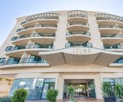
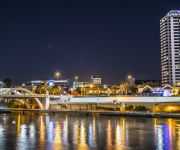
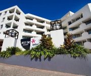
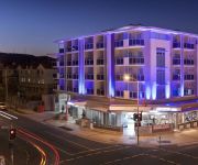
If you need a hotel, we compiled a list of available hotels close to the map centre further down the page.
While being here, you might want to pay a visit to some of the following locations: Brisbane, Sunshine Coast, Carrolls Creek, and . To further explore this place, just scroll down and browse the available info.
Local weather forecast
Todays Local Weather Conditions & Forecast: 22°C / 72 °F
| Morning Temperature | 14°C / 57 °F |
| Evening Temperature | 22°C / 71 °F |
| Night Temperature | 17°C / 63 °F |
| Chance of rainfall | 0% |
| Air Humidity | 49% |
| Air Pressure | 1023 hPa |
| Wind Speed | Light breeze with 5 km/h (3 mph) from North-West |
| Cloud Conditions | Few clouds, covering 11% of sky |
| General Conditions | Few clouds |
Wednesday, 15th of May 2024
21°C (71 °F)
18°C (64 °F)
Light rain, gentle breeze, overcast clouds.
Thursday, 16th of May 2024
19°C (66 °F)
16°C (61 °F)
Light rain, gentle breeze, overcast clouds.
Friday, 17th of May 2024
21°C (69 °F)
17°C (62 °F)
Light rain, light breeze, overcast clouds.
Hotels and Places to Stay
GAMBARO HOTEL
Central Cosmo
PARK REGIS NORTH QUAY
WEST END CENTRAL
JEPHSON HOTEL
Vine Serviced Apartments
THE OASIS APARTMENTS
Milton Motel Apartments
Milton Motel Apartments
PARKVIEW APARTMENTS
Videos from this area
These are videos related to the place based on their proximity to this place.
Taringa Accountants: GST Advice, Systems, Compliance & BAS Return, FBT and CGT. Anthony Wetmore & Co
Taringa's Anthony Wetmore & Co (http://www.wetmore.com.au) has the proven expertise to provide any organisation with all of that organisations GST requirements. Due to the complexity and the...
Sold by Juana Bernardo RE/MAX Profile 0418 775 373 Brisbane's #1 Broker:
SOLD: 5/101 Sherwood Rd Toowong has been sold Juana Bernardo from RE/MAX Profile on 0418 775 373 City Fringe Lifestyle Choice – Make it yours! What strikes you as you step into this apartment.
Juana Bernardo RE/MAX Profile real estate is selling 13/60 Sherwood Rd, Toowong Unit
13/60 Sherwood Rd, Toowong So Safe and Secure a Home or Investment! Make an Offer! One block from Toowong Village, the train and all amenities, your 2 bed 2 bath unit is a safe and secure ...
Sold under the hammer by Grant Penrose RE/MAX Profile Brisbane 0418 747 997 Smakk Media
Sold 62 Boundary Road Bardon has been sold by Grant Penrose real estate agent. Mobile 0418 747 997 Why You And The Kids Are Going To Be Saying, "We Want This One!" This one ticks off on...
Unit for Rent in West End Auchenflower Unit 2BR/1BA by West End Property Management
Click http://www.metrocityrealty.com.au/ to visit Metrocity Realty for your "West End Property Management" needs! You may also visit http://www.metrocityrealty.com.au/search/rentals for a list...
DJI Phantom 2 Over Brisbane
Afternoon flight over West End. Haze in the sky is from fires over at Stradbroke Island.
Toowong unit Sold by Juana Bernardo 0418 775 373 RE/MAX Profile; A Smakk Media video
Sold A touch of New York in the heart of Toowong at 2/79 Jephson St, Toowong property for sale by RE/MAX Profile's Juana Bernardo. Call her today on 0418 775 373. Renovated with a palette...
Videos provided by Youtube are under the copyright of their owners.
Attractions and noteworthy things
Distances are based on the centre of the city/town and sightseeing location. This list contains brief abstracts about monuments, holiday activities, national parcs, museums, organisations and more from the area as well as interesting facts about the region itself. Where available, you'll find the corresponding homepage. Otherwise the related wikipedia article.
B105 FM
B105 is a commercial FM radio station broadcasting on 105.3 MHz in Brisbane, Australia. It is part of the Austereo Radio Network. B105's primary audience is 10 to 24 age group.
4ZZZ
4ZZZ (pronounced "Four Triple Zed" or simply "Triple Zed") is an independent community radio station operating in Brisbane, Queensland, Australia, at the frequency 102.1 FM. As a community radio station, 4ZZZ is a member of the Community Broadcasting Association of Australia. The station broadcasts to much of South-East Queensland, parts of Northern NSW and web streams from its website.
Purtell Park
Purtell Park is a rugby league ground in Bardon, a suburb in Brisbane's west. It was the home ground for the Western Suburbs Panthers, who played in the Queensland Rugby League South East Queensland Division's Mixwell Cup and Mixwell Colts Challenge, and who played in the Queensland Cup until the end of 2003. It is regarded as one of the poorer quality major rugby league venues in Brisbane, with the field actually being on a slope, although this is not noticeable on television.
Mount Coot-tha, Queensland
Mount Coot-tha, which is 287 metres above sea level, has the highest peak in Brisbane, Queensland, Australia. Mount Coot-tha forms the eastern extent of the Taylor Range and is a prominent landmark approximately 6 km to the west of the Brisbane central business district.
BTQ
For other acronyms using BTQ, such as the stimulant drug Butyltolylquinuclidine, see the BTQ (disambiguation) page. BTQ is the Brisbane station of the Australian Seven Network. BTQ was the second television station to launch in Brisbane, going to air on 1 November 1959, after QTQ (station of the Nine Network) launched three months earlier. Along with other Australian television channels, BTQ began broadcasting on digital television on 1 January 2001.
TVQ
For the method of measuring the appeal of television programs, please see Q Score.
Taylor Range
The Taylor Range or Herbert Taylor Range is a mountain range on the western edge of Brisbane, Queensland, Australia. It was first named The Glenmorrison Range by John Oxley during his exploration of the area in January 1824. The range is an eastern spur at the southern end of the D'Aguilar Range. Most of the range is covered by two protected areas, Mount Coot-tha Reserve and the most southern section of Brisbane Forest Park. Sir Samuel Griffith Drive is the only road over the range.
Nova 106.9
Nova 106.9 is a commercial radio station operating in Brisbane, Australia, owned by the DMG Radio Network. DMG Radio purchased the Brisbane FM licence for $80 million in April 2004 to complete their national network of Nova stations. Nova 106.9's studios are located at 130 Commercial Road in Teneriffe.
Bardon, Queensland
Bardon is an inner suburb of Brisbane, Australia approximately 5 km west of the Brisbane CBD. Bardon is a leafy residential suburb, much of which nestles into the foothills of Mount Coot-tha.
4MMM
4MMM (identified on air and in print as Triple M) is one of Brisbane, Australia's commercial FM Rock radio stations, primarily targeted at those in the 25-50 age group. It is part of the Southern Cross Austereo Triple M network and broadcasts on 104.5 MHz.
Western Freeway, Brisbane
The M5 is a 5 km long freeway in western Brisbane that runs from Milton Road in Toowong to the western side of Indooroopilly where the freeway becomes the M5 Centenary Motorway. The freeway bears the symbol and forms part of Metroad 5. There is one interchange, at Indooroopilly onto Moggill Road. A bicycle path runs the length of the freeway, allowing commuting to Toowong and onto Brisbane by bicycle. Options are currently being investigated in to a possible Kenmore Bypass.
Metroad 5 (Brisbane)
Metroad 5 is one of Brisbane's metroads, running from Yamanto to Kedron. It is the main western bypass of Brisbane city.
Simpson Falls
Simpson Falls are located within the Mount Coot-tha Forest, in Brisbane, Queensland, Australia. The waterway formed by Simpson Falls is the western branch of the headwaters of Ithaca Creek. Mt Coot-tha Forest is around 1,500 hectares of open eucalypt forest forming the south-eastern part of D'Aguilar National Park. These two areas make up a 30,000 hectare forest that extends well into suburban Brisbane. It is home to powerful owls, goshawks, eagles, wrens and robins as well as possums and bats.
Toowong Cemetery
The Brisbane General Cemetery also known as Toowong Cemetery at Toowong, Brisbane was established in 1866 and formally opened in 1875. It is Queensland's largest cemetery and is located on forty-four hectares of land at the corner of Frederick Street and Mount Coot-tha Road approximately four and a half kilometres west of Brisbane.
Brisbane Botanic Gardens, Mount Coot-tha
The Brisbane Botanic Gardens are located 7 km from the city of Brisbane in Toowong, Queensland, Australia, at the foot of Brisbane's tallest mountain, Mount Coot-tha.
97.3 FM (Brisbane)
97.3 FM is a commercial radio station in Brisbane, Australia. It is a 50/50 joint venture between DMG and ARN, who jointly purchased the license at auction for $67M. 97.3 FM plays current hits and a variety of 70s, 80s and 90s music, primarily targeted at the 25-54 age group, the group most valued by advertisers. Brisbane's 97.3 FM is part of the Mix Network with sister stations in other major Australian cities - Mix 106.5 Sydney, Mix 101.1 Melbourne, Mix 102.3 Adelaide and Mix 106.3 Canberra.
ABQ
ABQ is the Australian Broadcasting Corporation's television station in Brisbane, Queensland. It began broadcasting on 2 November 1959 and is based at purpose built headquarters on Brisbane's South Bank. The station is received throughout the state through a number of relay transmitters, and satellite transmission on the Optus Aurora free-to-view platform.
4MBS
4MBS Classic FM is a Brisbane community radio station that broadcasts classical music, jazz and nostalgia throughout South East Queensland. It is broadcast at a frequency of 103.7 MHz. Its operations are conducted by volunteers and a small number of paid staff. Operational funding is principally derived from commercial sponsorship, listener subscriptions, a ticketing service, occasional sales of second-hand LPs, and an annual classical music festival.
Stuartholme School
Stuartholme School is a Catholic, day and boarding school for girls, located in Toowong, an inner suburb of Brisbane, Queensland, Australia. Established in 1920 by the Religious of the Sacred Heart, the school currently caters for approximately 750 students from Years 8 to 12, including 150 boarders.
St Johns Wood, Queensland
St Johns Wood is a locality within the suburb of Ashgrove in Brisbane, Australia. A small residential pocket at the base of Taylor Range, it is embraced by a loop of Enoggera Creek and by the Ashgrove Golf Club, Brisbane City Council Reserve and the Enoggera Barracks. The locality was originally inhabited by the Indigenous Turrbal people before it opened up to European Settlement during the second land-sales of the District in 1858, with the homestead called The Granite House founded in 1864.
96five Family FM
96five is a community broadcast radio station operated by Family Radio Ltd in Brisbane, Australia. The radio stations continued operation is supported by sponsorship, fundraising and pledges.
4EB
4EB FM is an ethnic community radio station broadcasting to the Brisbane, Queensland area. Its output is multicultural, facilitating over 55 language groups from around the world.
98.9 FM (Brisbane)
98.9 FM (callsign 4AAA) is a community radio station that caters to the Aboriginal and Torres Strait Islander communities in metropolitan Brisbane, Queensland.
Crossway College
Crossway College (formerly known as the Bible College of Queensland and before that as the Queensland Bible Institute) is a Bible college in Toowong and Rothwell in Queensland. The Head of College is currently Johan Ferreira. Crossway College offers degrees through the Australian College of Theology. Crossway College is a multi-campus, independent, evangelical and interdenominational college. The College was established in 1943 and is preparing Christians for ministry and mission.
Temple of Peace (Toowong Cemetery)
The Temple of Peace is a memorial at Toowong Cemetery, Brisbane built by Richard Paul Carl Ramo in memory of his four sons, three of whom were killed in World War I.





!['City View Timelapse - Brisbane [HD]' preview picture of video 'City View Timelapse - Brisbane [HD]'](https://img.youtube.com/vi/v5c3pB-02LA/mqdefault.jpg)


