Discover Nudgee
The district Nudgee of in Brisbane (Queensland) is a subburb in Australia about 594 mi north-east of Canberra, the country's capital city.
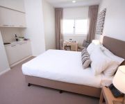
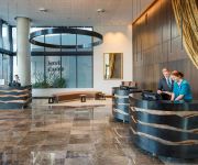
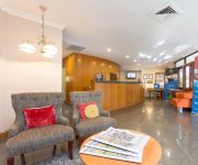
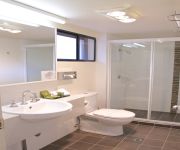
If you need a hotel, we compiled a list of available hotels close to the map centre further down the page.
While being here, you might want to pay a visit to some of the following locations: Brisbane, Sunshine Coast, Carrolls Creek, and . To further explore this place, just scroll down and browse the available info.
Local weather forecast
Todays Local Weather Conditions & Forecast: 23°C / 73 °F
| Morning Temperature | 15°C / 59 °F |
| Evening Temperature | 21°C / 70 °F |
| Night Temperature | 18°C / 65 °F |
| Chance of rainfall | 0% |
| Air Humidity | 50% |
| Air Pressure | 1023 hPa |
| Wind Speed | Gentle Breeze with 7 km/h (5 mph) from North-West |
| Cloud Conditions | Clear sky, covering 9% of sky |
| General Conditions | Sky is clear |
Wednesday, 15th of May 2024
23°C (74 °F)
19°C (65 °F)
Light rain, gentle breeze, broken clouds.
Thursday, 16th of May 2024
20°C (67 °F)
18°C (64 °F)
Light rain, moderate breeze, overcast clouds.
Friday, 17th of May 2024
19°C (67 °F)
17°C (63 °F)
Light rain, light breeze, overcast clouds.
Hotels and Places to Stay
DOMAIN SERVICED APARTMENTS
Pullman Brisbane Airport
Brisbane International Virginia
Comfort Inn & Suites Northgate Airport
Domain Serviced Apartments
Pegasus Motor Inn and Serviced Apartments
QUEST ASCOT SERVICED APTS
Essence Serviced Apartments
BEST WESTERN AIRPORT 85 MOTEL
KINGSFORD SMITH MOTEL
Videos from this area
These are videos related to the place based on their proximity to this place.
Izzy Lane's Kingston Caravan Review| Comfort Caravans Kingston 19'
Izzy Lane's Kingston Caravan Review http://australiancaravans.com/ https://www.facebook.com/AustralianCaravans101 "From the moment we saw the Kingston caravan we knew it was the van for us....
HAARP- IONESPHERIC HEATER OVER AUSTRALIA.
Some heavy duty clouds were slowly moving over Brisbane, Australia Supposedly, these are Cirrocumulus (?) clouds, but is there more to these clouds than meets the eye? These clouds look like...
burnout Our Wedding Car
Burnout at My wedding. Note rough time of day by amount of cars on Sandgate Road!!!
Nudgee College Fodder Drive & Baked Relief 2014 - Thankyou
Thankyou to all the families and the Nudgee College Community #lovetothewest.
2014 Nudgee College Senior Investiture
A new year with new students from Years 5 - 12 and new group of College Leaders.
Highway smash, Brisbane. Check your mirrors!
Gateway motorway, 25/02/2014. Once again a brain dead idiot with an obvious low IQ being very impatient, actually thinks by switching lanes every 9 seconds to the lane that is moving faster...
7 First Street - Virginia (4014) Queensland by Clint Deverea...
Property Video shoot of 7 First Street - Virginia (4014) Queensland by PlatinumHD http://www.platinumhd.tv for Northside First National.
20 Raleigh Street, Virginia Queensland By Clint Devereaux
Property Video shoot of 20 Raleigh Street, Virginia Queensland by PlatinumHD http://www.platinumhd.tv for Northside First National.
7a First Street - Virginia (4014) Queensland by Clint Devereaux
Listed price: $555000 Sold price: $550000 Days on market: 6 Amount of offers: 2 Number of enquiries: 23 Number of inspections: 3.
Videos provided by Youtube are under the copyright of their owners.
Attractions and noteworthy things
Distances are based on the centre of the city/town and sightseeing location. This list contains brief abstracts about monuments, holiday activities, national parcs, museums, organisations and more from the area as well as interesting facts about the region itself. Where available, you'll find the corresponding homepage. Otherwise the related wikipedia article.
Australian Catholic University
Australian Catholic University (ACU) is a national public university. It has six campuses and offers programs in six faculties throughout Australia.
Domestic Terminal railway station, Brisbane
Domestic Terminal railway station is a privately owned railway station on, and terminus of, the Airtrain Airport line at the Brisbane Airport domestic terminal, northeast of Brisbane, the state capital of Queensland, Australia. Owned and operated by Airtrain Citylink Limited, Domestic Terminal railway station is a private station that connects seamlessly with the Queensland Rail City network, and services use Queensland Rail rolling stock under a commercial agreement.
Northgate railway station
Northgate is a railway station at Northgate, Brisbane, the state capital of Queensland, Australia. It is part of the Queensland Rail City network, in a transition precinct between Zone 2 and Zone 3 of the TransLink integrated public transport system. The station forms the branching point between the Caboolture and Shorncliffe lines.
Bindha railway station
Bindha is a railway station on the Shorncliffe Line in Banyo, a northern suburb of Brisbane, the state capital of Queensland, Australia. It is part of the Queensland Rail City network, within Zone 3 of the TransLink integrated public transport system. The station is built directly behind the Golden Circle cannery, and the station was originally built to provide a stop for the many factory workers.
Nudgee railway station
Nudgee is a railway station on the Shorncliffe line in Nudgee, a northern suburb of Brisbane, the state capital of Queensland, Australia. It is part of the Queensland Rail City network, in Zone 3 of the TransLink integrated public transport system.
Banyo railway station
Banyo is a railway station on the Shorncliffe Line of Brisbane, Australia. It is part of the Queensland Rail City network, falling within Zone 3 of the TransLink integrated public transport system.
Boondall railway station
Boondall (formerly Cabbage Tree Creek and Nudgee College) is a railway station on the Shorncliffe line in Boondall, a northern suburb of Brisbane, the state capital of Queensland, Australia. It is part of the Queensland Rail City network, in a transition precinct between Zone 3 and Zone 4 of the TransLink integrated public transport system. It is within easy walking distance of the Brisbane Entertainment Centre.
Virginia railway station
Virginia Station is a railway station at Virginia on the Caboolture Line of Brisbane, Australia. It is part of the QR Citytrain network. The station is in Zone 3 of the TransLink integrated public transport system.
Geebung railway station
Geebung station is a railway station on the Caboolture line as a part of the Queensland Rail train network in Brisbane, Australia. The station is located in zone 3 of the TransLink integrated public transport system.
Sunshine railway station, Brisbane
Sunshine Station is a railway station on the Caboolture Line of Brisbane, Australia. It is part of the QR Citytrain network. The station is in Zone 3 of the TransLink integrated public transport system.
Geebung, Queensland
Geebung is a suburb of northern Brisbane, Australia. It is centred around its railway station on the Caboolture railway line. The suburb is named after the Geebung tree of the genus Persoonia which was previously known as the Geebong. The name change came about due to handwritten addresses on letters being incorrectly sent to Geelong.
Division of Lilley
The Division of Lilley is an Australian Electoral Division in Queensland. The division was first proclaimed in 1913. The division is named after Sir Charles Lilley, a former Premier of Queensland and a former Chief Justice in the Supreme Court of Queensland. The Division of Lilley includes sparsely populated areas of Brisbane Airport, tidal wetlands around Boondall and industrial areas around Pinkenba.
Brisbane Entertainment Centre
The Brisbane Entertainment Centre (BEC) is a centre, located in Boondall, a Brisbane City suburb, in Queensland, Australia. It is managed by AEG Ogden. The arena has an array of seating plans which facilitate the comfort of its users, subject to performance. Specific seating plans are usually allocated, depending on the performance and the size of its audience. The general seating arrangements are end stage mode, "in the round" and intimate mode, which only uses half of the arena.
Boondall
Boondall is a northern suburb of Brisbane, Queensland, Australia, formerly known as Cabbage Tree Creek (after the creek that flows through the area). Situated approximately 20 km north of Brisbane near Moreton Bay, almost half way between Brisbane and the coastal city of Redcliffe. Bounded on the north by Deagon, Sandgate and Shorncliffe, on the east by Nudgee and Nudgee Beach, on the south by Banyo, Geebung and Virginia and on the west by Taigum and Zillmere.
Banyo, Queensland
Banyo is a northern suburb of Brisbane, Queensland. It is a community split between residential and industrial land usage, the latter being attracted by the accessibility of local transport, including the Gateway Motorway.
Zillmere, Queensland
Zillmere is a suburb 14 km north of the Brisbane central business district in Queensland, Australia.
Northgate, Queensland
Northgate is a suburb of Brisbane, Australia located 9 km north of the Brisbane CBD. The land area comprises industrial and residential areas. Inter war homes can be found on Northgate Hill—elevated land that rises west of the railway station; and post World War II real estate on "the flat" -- the large arc of flat land that extends to Moreton Bay at Nudgee Beach with most of the housing stock being post WWII.
Virginia, Queensland
Virginia is a suburb in Brisbane, Queensland, Australia. It is located 10 km north of the Brisbane central business district. It is primarily a residential suburb with many timber and tin Queenslander style housing. The suburb was named after the Virginia Brick Company, founded in 1897, near the Virginia Railway Station, which the station opened in 1888. One of Brisbane Transport's bus depots is based in Virginia.
4BC
4BC is a radio station in Brisbane, Queensland on 1116kHz AM. 4BC is Brisbane's only commercial talkback station, using the promotional phrase "News Talk 1116". Like most talk radio stations, it caters to a predominantly conservative audience. The station's broadcasting facility is at Cannon Hill, and its tower is alongside the Gateway Motorway in Nudgee.
Nudgee, Queensland
Nudgee is a suburb of Brisbane, Australia. It is 13 kilometres north of the CBD. Nudgee was part of the Toombul Shire Council until 1925 when it was absorbed by the Brisbane City Council. Nudgee can be accessed by train, with its train station providing Shorncliffe services and train services to the city. The name Nudgee is believed to be derived from the Indigenous (Oondumbi/Undumbi clan) words N'mugi or Na'dah, meaning the 'home of wild ducks'.
Nudgee Beach, Queensland
Nudgee Beach is an outer suburb of Brisbane, Australia and also the name of the beach located in the suburb. It is 18 kilometres north of the Brisbane central business district where Schulz Canal enters Moreton Bay. Directly to the south is Brisbane Airport. Nudgee Beach is named after the neighbouring suburb Nudgee. At the 2011 Australian census 261 residents were recorded to live in the suburb.
Earnshaw State College
Earnshaw State College is the only P-12 college in the Brisbane North Education District. Established in 2003 and located in Queensland, Australia in the suburb of Banyo in northeast Brisbane. Earnshaw has a short history as a College but a long history in Nudgee State School and Banyo State High School. Earnshaw specialises in Business. Teams of Earnshaw students from grades 10, 11 and 12 won the 2010, 2011, and 2012 Global Enterprise Challenge.
Schulz Canal
Schulz Canal is an artificial waterway in Nundah, Queensland that enters Moreton Bay. There are tributaries that enter the short canal, draining the suburbs of Hendra and Wooloowin in Brisbane's north east. It was originally constructed in the early 20th century, and was named after William Schulz, an alderman on the Toombul shire council at the time. Today the canal begins in Kedron at the end of the Kedron Brook.
Boondall Wetlands
The Boondall Wetlands lie on the edge of Moreton Bay in the Brisbane suburb of Boondall between Nudgee Beach and Shorncliffe, in south-east Queensland, Australia. The wetlands are preserved within the Boondall Wetlands Reserve which was preserved in 1990 and covers more than 1100 hectares of internationally significant wetlands.
Boondall State School
Boondall State School is a public primary school located in Brisbane, Queensland, in the suburb of Boondall. The school is run by the Queensland State Government.


