Explore Boondall
The district Boondall of in Brisbane (Queensland) is located in Australia about 595 mi north of Canberra, the country's capital.
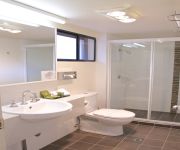
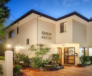
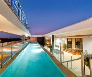
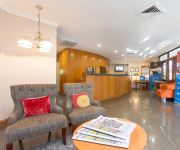
If you need a place to sleep, we compiled a list of available hotels close to the map centre further down the page.
Depending on your travel schedule, you might want to pay a visit to some of the following locations: Brisbane, Sunshine Coast, Carrolls Creek, and . To further explore this place, just scroll down and browse the available info.
Local weather forecast
Todays Local Weather Conditions & Forecast: 20°C / 69 °F
| Morning Temperature | 17°C / 62 °F |
| Evening Temperature | 20°C / 69 °F |
| Night Temperature | 17°C / 63 °F |
| Chance of rainfall | 2% |
| Air Humidity | 74% |
| Air Pressure | 1025 hPa |
| Wind Speed | Moderate breeze with 10 km/h (6 mph) from North-West |
| Cloud Conditions | Overcast clouds, covering 97% of sky |
| General Conditions | Light rain |
Thursday, 9th of May 2024
21°C (71 °F)
18°C (64 °F)
Light rain, moderate breeze, broken clouds.
Friday, 10th of May 2024
20°C (68 °F)
17°C (62 °F)
Light rain, gentle breeze, overcast clouds.
Saturday, 11th of May 2024
19°C (66 °F)
19°C (65 °F)
Light rain, gentle breeze, scattered clouds.
Hotels and Places to Stay
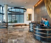
Pullman Brisbane Airport
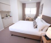
DOMAIN SERVICED APARTMENTS
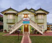
Murphys Bed and Breakfast
KINGSFORD SMITH MOTEL
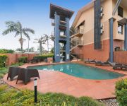
Pegasus Motor Inn and Serviced Apartments
Domain Serviced Apartments
QUEST ASCOT SERVICED APTS
BEST WESTERN AIRPORT 85 MOTEL
Novotel Brisbane Airport
Brisbane International Virginia
Videos from this area
These are videos related to the place based on their proximity to this place.
Pacific Monster Truck World Finals - Media Release
Aussie Monster Trucks and Australia's Only Female Driver Warm Up in Brisbane for the Sony Playstation World Monster Truck Finals Two giant Monster Trucks and the country's only female driver...
Izzy Lane's Kingston Caravan Review| Comfort Caravans Kingston 19'
Izzy Lane's Kingston Caravan Review http://australiancaravans.com/ https://www.facebook.com/AustralianCaravans101 "From the moment we saw the Kingston caravan we knew it was the van for us....
HAARP- IONESPHERIC HEATER OVER AUSTRALIA.
Some heavy duty clouds were slowly moving over Brisbane, Australia Supposedly, these are Cirrocumulus (?) clouds, but is there more to these clouds than meets the eye? These clouds look like...
2000 Honda CR-V Sport Red 5 SPEED Manual Wagon
http://www.stevesmotorworld.com.au/view.php/used_cars/2000_Honda_CR-V_Sport_Red_5_SPEED_Manual_Wagon/7522458/
burnout Our Wedding Car
Burnout at My wedding. Note rough time of day by amount of cars on Sandgate Road!!!
Nudgee College Fodder Drive & Baked Relief 2014 - Thankyou
Thankyou to all the families and the Nudgee College Community #lovetothewest.
Videos provided by Youtube are under the copyright of their owners.
Attractions and noteworthy things
Distances are based on the centre of the city/town and sightseeing location. This list contains brief abstracts about monuments, holiday activities, national parcs, museums, organisations and more from the area as well as interesting facts about the region itself. Where available, you'll find the corresponding homepage. Otherwise the related wikipedia article.
Bindha railway station
Bindha is a railway station on the Shorncliffe Line in Banyo, a northern suburb of Brisbane, the state capital of Queensland, Australia. It is part of the Queensland Rail City network, within Zone 3 of the TransLink integrated public transport system. The station is built directly behind the Golden Circle cannery, and the station was originally built to provide a stop for the many factory workers.
Nudgee railway station
Nudgee is a railway station on the Shorncliffe line in Nudgee, a northern suburb of Brisbane, the state capital of Queensland, Australia. It is part of the Queensland Rail City network, in Zone 3 of the TransLink integrated public transport system.
North Boondall railway station
North Boondall is a railway station on the Shorncliffe line in Boondall, a northern suburb of Brisbane, the state capital of Queensland, Australia. It is part of the Queensland Rail City network, falling within Zone 4 of the TransLink integrated public transport system. It was originally known as Boondall, which was moved to its current location upon the opening of the Brisbane Entertainment Centre.
Banyo railway station
Banyo is a railway station on the Shorncliffe Line of Brisbane, Australia. It is part of the Queensland Rail City network, falling within Zone 3 of the TransLink integrated public transport system.
Deagon railway station
Deagon is a railway station on the Shorncliffe line in Deagon, a northern suburb of Brisbane, the state capital of Queensland, Australia. It is part of the Queensland Rail City network, falling in Zone 4 of the TransLink integrated public transport system.
Boondall railway station
Boondall (formerly Cabbage Tree Creek and Nudgee College) is a railway station on the Shorncliffe line in Boondall, a northern suburb of Brisbane, the state capital of Queensland, Australia. It is part of the Queensland Rail City network, in a transition precinct between Zone 3 and Zone 4 of the TransLink integrated public transport system. It is within easy walking distance of the Brisbane Entertainment Centre.
Virginia railway station
Virginia Station is a railway station at Virginia on the Caboolture Line of Brisbane, Australia. It is part of the QR Citytrain network. The station is in Zone 3 of the TransLink integrated public transport system.
Geebung railway station
Geebung station is a railway station on the Caboolture line as a part of the Queensland Rail train network in Brisbane, Australia. The station is located in zone 3 of the TransLink integrated public transport system.
Sunshine railway station, Brisbane
Sunshine Station is a railway station on the Caboolture Line of Brisbane, Australia. It is part of the QR Citytrain network. The station is in Zone 3 of the TransLink integrated public transport system.
Zillmere railway station
Zillmere Station is a railway station on the Caboolture Line of Brisbane, Australia. It is part of the QR Citytrain network. The station is in a transition precinct between Zone 3 and Zone 4 of the TransLink integrated public transport system.
Geebung, Queensland
Geebung is a suburb of northern Brisbane, Australia. It is centred around its railway station on the Caboolture railway line. The suburb is named after the Geebung tree of the genus Persoonia which was previously known as the Geebong. The name change came about due to handwritten addresses on letters being incorrectly sent to Geelong.
Division of Lilley
The Division of Lilley is an Australian Electoral Division in Queensland. The division was first proclaimed in 1913. The division is named after Sir Charles Lilley, a former Premier of Queensland and a former Chief Justice in the Supreme Court of Queensland. The Division of Lilley includes sparsely populated areas of Brisbane Airport, tidal wetlands around Boondall and industrial areas around Pinkenba.
Brisbane Entertainment Centre
The Brisbane Entertainment Centre (BEC) is a centre, located in Boondall, a Brisbane City suburb, in Queensland, Australia. It is managed by AEG Ogden. The arena has an array of seating plans which facilitate the comfort of its users, subject to performance. Specific seating plans are usually allocated, depending on the performance and the size of its audience. The general seating arrangements are end stage mode, "in the round" and intimate mode, which only uses half of the arena.
Boondall
Boondall is a northern suburb of Brisbane, Queensland, Australia, formerly known as Cabbage Tree Creek (after the creek that flows through the area). Situated approximately 20 km north of Brisbane near Moreton Bay, almost half way between Brisbane and the coastal city of Redcliffe. Bounded on the north by Deagon, Sandgate and Shorncliffe, on the east by Nudgee and Nudgee Beach, on the south by Banyo, Geebung and Virginia and on the west by Taigum and Zillmere.
Fitzgibbon, Queensland
Fitzgibbon is a suburb north of the Brisbane central business district in Queensland, Australia. The suburb is one of the smallest suburbs in Brisbane and was named after Abram Fitzgibbon, who was chief engineer of railways in Queensland in the 1860s. The suburb is roughly triangular in shape, and is bounded by the North Coast railway, Cabbage Tree Creek, and Telegraph Road. It is a rather new residential area, having been mostly subdivided in the 1980s and 1990s.
Banyo, Queensland
Banyo is a northern suburb of Brisbane, Queensland. It is a community split between residential and industrial land usage, the latter being attracted by the accessibility of local transport, including the Gateway Motorway.
Zillmere, Queensland
Zillmere is a suburb 14 km north of the Brisbane central business district in Queensland, Australia.
Taigum, Queensland
Taigum is a northern suburb of Brisbane in Queensland in Australia. It is about 13 kilometres north of the Brisbane central business district|CBD. It is predominantly a residential area. The suburb contains a Centro shopping centre, which is similar to another shopping centre in Victoria Point, both of which opened in late 2003. The Taigum area was first developed around 1891, as part of a subdivision of the Nundah Divisional board.
Virginia, Queensland
Virginia is a suburb in Brisbane, Queensland, Australia. It is located 10 km north of the Brisbane central business district. It is primarily a residential suburb with many timber and tin Queenslander style housing. The suburb was named after the Virginia Brick Company, founded in 1897, near the Virginia Railway Station, which the station opened in 1888. One of Brisbane Transport's bus depots is based in Virginia.
4BC
4BC is a radio station in Brisbane, Queensland on 1116kHz AM. 4BC is Brisbane's only commercial talkback station, using the promotional phrase "News Talk 1116". Like most talk radio stations, it caters to a predominantly conservative audience. The station's broadcasting facility is at Cannon Hill, and its tower is alongside the Gateway Motorway in Nudgee.
Deagon, Queensland
Deagon is an outer suburb of Brisbane, Australia. It is 16 km north of the CBD. Deagon was named after William Deagon who was Mayor of Sandgate in 1882, 1883 and 1884. William Deagon was an old identity of the area, and his name was used for the locality when the railway line went through in 1887. He owned the Sandgate Hotel, a stopping place for the Cobb & Co. coaches. Deagon Street, the racecourse, the railway station and the Deagon Wetlands now bear his name.
Sandgate District State High School
Sandgate District State High School (SDSHS) is an Australian secondary school located in Deagon, Queensland. Its motto is "Industria Floremus", which translates to "hard work brings success", or more literally "through industry we flourish". It educates grade levels eight to twelve.
Centro Taigum
Centro Taigum is a sub-regional shopping centre located in Taigum, a suburb of Brisbane in the state of Queensland, Australia. Owned by Centro Properties Group, the centre is located on Beams Road, providing access via Gympie and Sandgate Roads. It is anchored by Woolworths, Big W, Homeart and Best & Less, and incorporates 65 stores on the premises.
Boondall Wetlands
The Boondall Wetlands lie on the edge of Moreton Bay in the Brisbane suburb of Boondall between Nudgee Beach and Shorncliffe, in south-east Queensland, Australia. The wetlands are preserved within the Boondall Wetlands Reserve which was preserved in 1990 and covers more than 1100 hectares of internationally significant wetlands.
Boondall State School
Boondall State School is a public primary school located in Brisbane, Queensland, in the suburb of Boondall. The school is run by the Queensland State Government.


