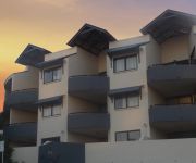
Touring Chapel Hill
The district Chapel Hill of in Brisbane (Queensland) is a subburb located in Australia about 583 mi north of Canberra, the country's capital place.
Need some hints on where to stay? We compiled a list of available hotels close to the map centre further down the page.
Being here already, you might want to pay a visit to some of the following locations: Brisbane, Sunshine Coast, Carrolls Creek, and . To further explore this place, just scroll down and browse the available info.
Local weather forecast
Todays Local Weather Conditions & Forecast: 22°C / 72 °F
| Morning Temperature | 14°C / 57 °F |
| Evening Temperature | 22°C / 71 °F |
| Night Temperature | 17°C / 63 °F |
| Chance of rainfall | 0% |
| Air Humidity | 49% |
| Air Pressure | 1023 hPa |
| Wind Speed | Light breeze with 5 km/h (3 mph) from North-West |
| Cloud Conditions | Few clouds, covering 11% of sky |
| General Conditions | Few clouds |
Wednesday, 15th of May 2024
21°C (71 °F)
18°C (64 °F)
Light rain, gentle breeze, overcast clouds.
Thursday, 16th of May 2024
19°C (66 °F)
16°C (61 °F)
Light rain, gentle breeze, overcast clouds.
Friday, 17th of May 2024
21°C (69 °F)
17°C (62 °F)
Light rain, light breeze, overcast clouds.
Hotels and Places to Stay
Milton Motel Apartments
Toowong Villas
MT OMMANEY HOTEL APARTMENTS
SOUTH CENTRAL APARTMENTS
Central Cosmo
Vine Serviced Apartments
THE OASIS APARTMENTS
PARKVIEW APARTMENTS
Arena Apartments
Milton Motel Apartments
Videos from this area
These are videos related to the place based on their proximity to this place.
Yogi & Boo Boo - Their Journey
Update 20/10/2012 - Yogi and Boo Boo have now been adopted. This has given us great joy and excitement. We are very greatful for so much support.- Yogi and Boo Boo are two community kittens...
go via network
The go via network is an integrated toll network of roads, bridges and tunnels that provides greater connectivity, efficiency and travel time reliability across the greater Brisbane area. ...
SOLD by Liza McKilliam RE/MAX Profile Bardon real estate agent - a Smakk Video production
SOLD 35 Edson Street Kenmore property SOLD by Liza McKIlliam real estate agent. Call Liza now on 0418 158 501 Situated in a brilliant location in central Kenmore and just a short stroll...
For Rent - 53 Cedarleigh Road Kenmore - Property Management Kenmore
http://rentalexpresspropertymanagement.com.au/rental-properties/rental-display/4-bedroom-house-for-rent-kenmore,5861 You'll love every element of this gorgeous family residence from the moment...
Cubberla Creek Chapel Hill - during the flood - Part 1
Cubberla Creek Chapel Hill - during the flood - Part 1.
Rostrum Brisbane West Public Speaking Club
Anyone can learn to speak with confidence and Rostrum provides a friendly supportive environment where members can practise and receive constructive feedback on their speeches. As one of...
Jack, Cod, Carp, Bass, Sharks. Kayak Fishing Brisbane Random Captures On Dragon Kayaks
A bunch of random clips from the last couple of months including some highlighs like. Mangrove Jack in a cast net, Estuary Cod and tilapa on my lucky diver and a surface bass for Jai. Plus...
Your new Family home at 6 Chantilly St, Chapel Hill? Jocelyn Frost 0414 490 270 RE/MAX Profile
6 Chantilly St Chapel Hill 0414 490 270 In a quiet street in the leafy suburb of Chapel Hill 'No6' has been home to the same family for 32 years. They have loved living here and raising...
For Rent - 57A Fig Tree Pocket Road Chapel Hill - Property Management Chapel Hill
http://rentalexpresspropertymanagement.com.au/rental-properties/rental-display/2-bedroom-unit-for-rent-chapel-hill,6010 Welcome to a perfectly located and impressive air-conditioned 2 bedroom,...
For Rent - 671 Moggill Road Chapel Hill - Property Management Chapel Hill
http://rentalexpresspropertymanagement.com.au/rental-properties/rental-display/6-bedroom-house-for-rent-chapel-hill,6029 Simply Perfect. This renovated Queenslander has been lovingly and tastefull ...
Videos provided by Youtube are under the copyright of their owners.
Attractions and noteworthy things
Distances are based on the centre of the city/town and sightseeing location. This list contains brief abstracts about monuments, holiday activities, national parcs, museums, organisations and more from the area as well as interesting facts about the region itself. Where available, you'll find the corresponding homepage. Otherwise the related wikipedia article.
Walter Taylor Bridge
The Walter Taylor Bridge is a suspension bridge crossing the Brisbane River between Indooroopilly and Chelmer in Brisbane, Queensland, Australia. It is shared by motor traffic and pedestrians and is the only habitable bridge in the Southern Hemisphere.
Centenary Bridge
The Centenary Bridge is a motorway crossing of the Brisbane River. As it forms part of Brisbane's Centenary Motorway it is used primarily by vehicular traffic, although it includes footpaths for pedestrian traffic. Built to service the new "Centenary" suburbs of Jindalee, Mount Ommaney and Westlake, the original two lane bridge opened in 1964. It was subsequently duplicated in the 1980s. During the 1974 floods, the bridge was badly damaged when a barge rammed into its upstream side.
Albert Bridge, Brisbane
The Albert Bridge is a railway bridge of steel truss design crossing the Brisbane River, Queensland, Australia. The Albert Bridge links Indooroopilly and Chelmer stations, and has two long spans with one central pier. The structure consists of two steel spans supported by masonry abutments and a central concrete pier that is encased in an iron caisson. A footway was positioned on the upstream side.
Jack Pesch Bridge
The Jack Pesch Bridge is a bridge for pedestrians and cyclists which crosses the Brisbane River. The bridge is named in honour of Jack Pesch, a cycling champion during the 1930s. He subsequently ran a bicycle shop in Petrie Terrace Brisbane until the mid-1990s, selling and servicing his own 'Rocket' cycles and cycle parts. The bridge crosses the Indooroopilly Reach of the River, linking Chelmer and Indooroopilly. It is immediately adjacent to the Albert and Walter Taylor Bridges.
QTQ
QTQ is an Australian television station, licensed to, and serving Brisbane, Queensland. It is owned by the Nine Entertainment Co. , and is part of the Nine Network. It broadcasts on VHF channel 9 and VHF channel 8. QTQ began broadcasting on 16 August 1959, the first of the Brisbane stations to launch. 2009 marked the 50 year anniversary for the station.
Taringa railway station
Taringa is a railway station in Taringa, Queensland, Australia, on the Ipswich and Rosewood and Springfield lines. It is located in Zone 2 of the TransLink integrated public transport system, and is part of the Queensland Rail city network.
Indooroopilly railway station
Indooroopilly is a railway station in Indooroopilly, Queensland, Australia, on the Ipswich and Rosewood and Springfield lines. It is located in Zone 2 of the TransLink integrated public transport system, and is part of the Queensland Rail city network. Immediately south of the station, the line crosses the Brisbane River on the Albert Bridge, next to the Walter Taylor Bridge.
Chelmer railway station
Chelmer is a railway station in Chelmer, a suburb of Brisbane, Australia, on the Ipswich and Rosewood and Springfield lines. It is located in Zone 2 of the TransLink integrated public transport system, and is part of the Queensland Rail city network.
Graceville railway station
Graceville is a railway station in Graceville, a suburb of Brisbane, Australia, on the Ipswich and Rosewood and Springfield lines. It is in a transition precinct between Zone 2 and Zone 3 of the TransLink integrated public transport system.
Taringa, Queensland
Taringa is a suburb of Brisbane, Australia 5 km south-west of the Brisbane CBD. Taringa is mostly residential, except for a small number of commercial buildings mostly clustered along Moggill Road. It is a popular neighbourhood among the students of the University of Queensland and the Queensland University of Technology because of its proximity to the universities and to Brisbane city.
Mount Coot-tha, Queensland
Mount Coot-tha, which is 287 metres above sea level, has the highest peak in Brisbane, Queensland, Australia. Mount Coot-tha forms the eastern extent of the Taylor Range and is a prominent landmark approximately 6 km to the west of the Brisbane central business district.
Taylor Range
The Taylor Range or Herbert Taylor Range is a mountain range on the western edge of Brisbane, Queensland, Australia. It was first named The Glenmorrison Range by John Oxley during his exploration of the area in January 1824. The range is an eastern spur at the southern end of the D'Aguilar Range. Most of the range is covered by two protected areas, Mount Coot-tha Reserve and the most southern section of Brisbane Forest Park. Sir Samuel Griffith Drive is the only road over the range.
Indooroopilly, Queensland
Indooroopilly is a suburb of Brisbane, Australia 7 km west of the Brisbane central business district. The suburb covers 7.5 km² and has a population of more than 11,000 people.
Western Freeway, Brisbane
The M5 is a 5 km long freeway in western Brisbane that runs from Milton Road in Toowong to the western side of Indooroopilly where the freeway becomes the M5 Centenary Motorway. The freeway bears the symbol and forms part of Metroad 5. There is one interchange, at Indooroopilly onto Moggill Road. A bicycle path runs the length of the freeway, allowing commuting to Toowong and onto Brisbane by bicycle. Options are currently being investigated in to a possible Kenmore Bypass.
Metroad 5 (Brisbane)
Metroad 5 is one of Brisbane's metroads, running from Yamanto to Kedron. It is the main western bypass of Brisbane city.
Chelmer, Queensland
Chelmer is an inner suburb of Brisbane, Australia 7 km west of the Brisbane CBD on the Brisbane River. Chelmer is zoned as a residential area, and consists of low-density housing. It has many fine Queenslanders, characterised by wooden verandahs, wide stairways and roofing of galvanized iron, but in recent years solid brick homes have been built also. It suffered badly from the 2011 Queensland floods, with many homes submerged by the rising river.
Kenmore State High School
Kenmore State High School, is a secondary education institution in Brisbane, Queensland, Australia, with almost 1700 students from grades 8 through to 12, approaching the school's maximum student capacity. The school was opened in 1972 and has been expanding since. Kenmore State High School has been accredited by the Council of International Schools (Australia).
Kenmore, Queensland
Kenmore is a suburb of Brisbane, Australia located on the Brisbane River, 10 km south-west of the Brisbane CBD. Kenmore is a leafy suburb with a high number of professional residents and families. It is dominated by detached housing - units and townhouses are rare. Kenmore has benefited greatly from the Centenary Highway which gives it direct access to the city via Milton Road or Coronation Drive.
Indooroopilly Shopping Centre
Indooroopilly Shopping Centre is a major regional shopping centre in the western suburb of Indooroopilly, which is located in the city of Brisbane, Queensland, Australia. It is the largest shopping centre in the western suburbs of Brisbane, by gross lettable area, and contains the only Myer store in that region.
Kenmore Hills, Queensland
Kenmore Hills is a suburb of Brisbane, Australia approximately 10 km south-west of the CBD. At the 2011 Australian Census the suburb recorded a population of 2,577. Kenmore Hills originally formed part of Brookfield, but in 1975 the name was changed to Kenmore Hills, based on the nearby suburb of Kenmore.
Jindalee State School
Jindalee State School (JSS) is a co-educational primary school in the western Brisbane suburb of Jindalee. It caters for students from Prep to Grade 7, and is a feeder school to Centenary State High School. The current enrolment number of children is around 800, down from a peak of 981 in 1981.
Nudgee Junior College
Nudgee Junior College (in full, St Joseph's Nudgee Junior College) is an independent Catholic boy's primary (years 4 to 7) school in Indooroopilly, Queensland, Australia. It is administered by Edmund Rice Education Australia, an organization established by the Congregation of Christian Brothers.
Brigidine College, Indooroopilly
Brigidine College is an independent Roman Catholic day school for girls, located in the suburb of Indooroopilly in Brisbane, Australia. It was established in 1929 by the Congregation of the Sisters of Saint Brigid and continues to be an order-owned school. It is affiliated with the Association of Heads of Independent Schools of Australia (AHISA), the Alliance of Girls' Schools Australasia (AGSA) and the Brisbane Schoolgirls Sporting Association (BSGSA).
Indooroopilly Railway Bridge
The Indooroopilly Railway Bridge is a railway bridge of steel truss design which crosses the Brisbane River, Queensland, Australia. The Indooroopilly Railway Bridge links Indooroopilly and Chelmer stations, and has two long spans with one central pier. It was built just upstream and parallel to the Albert Bridge as part of the quadruplication of the Ipswich Line between 1955–1957.
Jack Speare Park
Jack Speare Park, formerly known as the Indooroopilly Recreation Reserve ('The Rec'), was named for one of the founders of the Taringa Rovers Soccer Football Club (soccer) and Taringa Rovers Cricket Club. The ground is bounded by Fairley Street, Lambert and Carnarvon Roads at Indooroopilly, and features two football fields, junior fields, a turf cricket pitch, dressing rooms and licensed club house.


