Discover Abermain
Abermain in Ipswich (Queensland) is a city in Australia about 575 mi (or 925 km) north of Canberra, the country's capital city.
Local time in Abermain is now 10:15 PM (Thursday). The local timezone is named Australia / Brisbane with an UTC offset of 10 hours. We know of 8 airports in the vicinity of Abermain, of which one is a larger airport. The closest airport in Australia is Brisbane Archerfield Airport in a distance of 14 mi (or 22 km), East. Besides the airports, there are other travel options available (check left side).
Also, if you like golfing, there are a few options in driving distance. Looking for a place to stay? we compiled a list of available hotels close to the map centre further down the page.
When in this area, you might want to pay a visit to some of the following locations: Brisbane, Sunshine Coast, Carrolls Creek, and . To further explore this place, just scroll down and browse the available info.
Local weather forecast
Todays Local Weather Conditions & Forecast: 22°C / 72 °F
| Morning Temperature | 14°C / 57 °F |
| Evening Temperature | 19°C / 66 °F |
| Night Temperature | 15°C / 60 °F |
| Chance of rainfall | 0% |
| Air Humidity | 60% |
| Air Pressure | 1024 hPa |
| Wind Speed | Gentle Breeze with 8 km/h (5 mph) from North-West |
| Cloud Conditions | Broken clouds, covering 61% of sky |
| General Conditions | Light rain |
Friday, 3rd of May 2024
21°C (71 °F)
16°C (60 °F)
Light rain, gentle breeze, broken clouds.
Saturday, 4th of May 2024
17°C (62 °F)
15°C (58 °F)
Light rain, light breeze, overcast clouds.
Sunday, 5th of May 2024
21°C (69 °F)
15°C (60 °F)
Light rain, light breeze, overcast clouds.
Hotels and Places to Stay
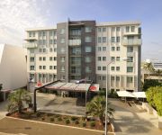
Metro Hotel Ipswich Int
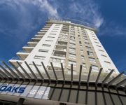
OAKS ASPIRE
BEST WESTERN IPSWICH
QUEST IPSWICH SERVICED APTS
COUNTRY COMFORT MOTOR INN IPSWICH
Cumquat House
Videos from this area
These are videos related to the place based on their proximity to this place.
Tutorial Adjusting K1 Bypass Valve
A quick tutorial on how to adjust a K1 Bypass Valve. http://www.thoroughclean.com.au ThoroughClean is a Brisbane based manufacturer of Heavy Duty, High Pressure Cleaners.
How to Make a Pottery House with Clay
A step by step guide showing you how to make a Pottery House with Clay,(1).
108 Jacaranda Street North Booval 4304 QLD by Trent Quinn
This one ticks all the boxes:• A fully renovated colonial• Quarter acre block• Large swimming pool• ...
Award winning tourist attraction in Ipswich
You thought The Workshops Rail Museum was just for kids? Think again! BIG LOUD FUN and wholly interactive, The Workshops Rail Museum is an award winning heritage and cultural tourism ...
Winter holiday fun at The Workshops Rail Museum
Warm up with the wonderful Wizards Express these holidays at The Workshops Rail Museum www.theworkshops.qm.qld.gov.au.
BB18 ¼ 1079 and AC16 221A Mayne Transfer - 4.12.2008
On a hot Thursday Morning, steam locomotives BB18 ¼ 1079 and AC16 221A were transferred to Mayne Railway Yard in Brisbane in preparation for a weekend on steam train excursions around ...
Model Railway at the Workshops Railway Museum, Ipswich, Queensland.
Model Railway at the Workshops Railway Museum, Ipswich, Queensland. HOn3.5 gauge.
C17 974 - The Toylands Express - 8.04.2008
Steam locomotive C17 974 brings up a train into the Workshops Rail Museum on a "Toylands Express" charter.
Videos provided by Youtube are under the copyright of their owners.
Attractions and noteworthy things
Distances are based on the centre of the city/town and sightseeing location. This list contains brief abstracts about monuments, holiday activities, national parcs, museums, organisations and more from the area as well as interesting facts about the region itself. Where available, you'll find the corresponding homepage. Otherwise the related wikipedia article.
Bremer River (Queensland)
The Bremer River is a sub-catchment of the Brisbane River. The Bremer river drains several Scenic Rim valleys in south-east Queensland, including the Fassifern Valley. The river was discovered in 1824 by John Oxley and Allan Cunningham. This river and its tributaries cover an area of approximately 2032 km². Most valleys within the catchment have extensive river terraces. The Bremer River system is extremely degraded.
M2, Brisbane
The M2 in Brisbane, Queensland, Australia, is a major motorway route and southern bypass of Brisbane. It connects the Warrego Highway A2 at Brassall to the M1 at Eight Mile Plains via the following corridors: Northern Ipswich Bypass from Brassall to Dinmore Ipswich Motorway from Dinmore to Gailes Logan Motorway from Gailes to Drewvale Gateway Motorway from Drewvale to Eight Mile Plains
Chuwar, Queensland
Chuwar is a suburb of both Ipswich, Australia and Brisbane in South East Queensland, Australia. It is 6 kilometres north of the Ipswich central business district, 32 kilometres west of Brisbane by road. Chuwar, home of the Karana Gardens Estate, has a number of amenities including service station, a produce store, two churches, a motorcycle track, a vet and a local shopping centre with a major supermarket in the neighbouring suburb of Karalee.
Mount Crosby Pumping Station
The Mount Crosby Pumping Station is located on the Brisbane River at Chuwar in the City of Ipswich. The facility supplies water to Brisbane and nearby cities and towns within the SEQ Water Grid. The pumping station is close to the Mount Crosby Weir and now occupies book banks of the river. Most of the water treated is sourced Lake Wivenhoe, though some is also from Lake Manchester. There are two intakes pipes, one on each bank.
Tivoli, Queensland
Tivoli is a suburb of Ipswich, Queensland, Australia. Tivoli State School is located within the suburb. In 1932 two of the Tivoli rugby league club's players, Hector Gee and Les Heidke were selected to play for the Australian national team.
North Tivoli, Queensland
North Tivoli is a suburb of Ipswich, Queensland, Australia.
Mount Crosby Weir
The Mount Crosby Weir is weir on the Brisbane River at Mount Crosby in South East Queensland, Australia. The project was instigated by John Petrie at the end of the 19th century. The town of Brisbane was expanding and seeking more reliable sources of drinking water than Enoggera Dam and Gold Creek Dam could provide. The location was selected because it was just above the upstream tidal flow of seawater at Colleges Crossing. The concrete structure was completed in April 1892.
Colleges Crossing
College's Crossing (also known as Colleges Crossing) is a low level bridge that crosses Brisbane River at Chuwar, a suburb of Ipswich in South East Queensland, Australia. The location is the point where the tidal influences no longer affect the waters of the river. The road across the bridge is Mount Crosby Road. During major floods or water releases from the Wivenhoe Dam the road becomes impassable.


