Explore Bundamba
The district Bundamba of in Ipswich (Queensland) with it's 5,159 inhabitants Bundamba is located in Australia about 573 mi north of Canberra, the country's capital.
If you need a place to sleep, we compiled a list of available hotels close to the map centre further down the page.
Depending on your travel schedule, you might want to pay a visit to some of the following locations: Brisbane, Sunshine Coast, Carrolls Creek, and . To further explore this place, just scroll down and browse the available info.
Local weather forecast
Todays Local Weather Conditions & Forecast: 19°C / 66 °F
| Morning Temperature | 16°C / 61 °F |
| Evening Temperature | 17°C / 63 °F |
| Night Temperature | 16°C / 60 °F |
| Chance of rainfall | 6% |
| Air Humidity | 88% |
| Air Pressure | 1026 hPa |
| Wind Speed | Gentle Breeze with 6 km/h (3 mph) from North-West |
| Cloud Conditions | Overcast clouds, covering 100% of sky |
| General Conditions | Moderate rain |
Friday, 17th of May 2024
19°C (67 °F)
14°C (57 °F)
Light rain, light breeze, overcast clouds.
Saturday, 18th of May 2024
22°C (71 °F)
13°C (55 °F)
Moderate rain, gentle breeze, clear sky.
Sunday, 19th of May 2024
18°C (64 °F)
12°C (53 °F)
Sky is clear, gentle breeze, clear sky.
Hotels and Places to Stay
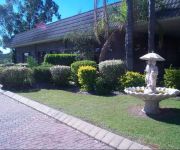
COUNTRY COMFORT MOTOR INN IPSWICH
Metro Hotel Ipswich Int
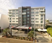
BEST WESTERN IPSWICH
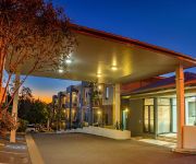
QUEST IPSWICH SERVICED APTS
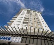
OAKS ASPIRE
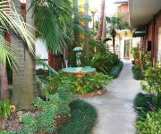
Cumquat House
Videos from this area
These are videos related to the place based on their proximity to this place.
Lowboy quad circuit breaker
A quick unedited clip showing the breaker I fitted this morning. The breaker was $10 with free shipping and looks pretty good to me. It is the cheapest lightest switch I found. I don't expect...
Weekly checks on your car
things to check every week, quick and easy, takes about 3 or 4 minutes. i find the best time is to do it while i fill up at the servo, that-way if you need something you can get it at the same...
daily check before driving anywhere
just a quick video of what visual checks you should make everyday before driving off for the day, it takes about 30 seconds to do and might save you money or maybe even your life.
MINECRAFT part 1 Play along from the start
(the video went strange) Welcome to my first attempt at minecraft, I played for a few minutes first to cover the basics, the rest we will learn togeather.
Ripley Run 26-4-2011. Recovery and fun G60 Nissan Patrol, Toyota Landcruiser, Holden Jackaroo
Shoestring 4WD Group Ripley Run 26-4-2011. Recovery and fun G60 Nissan Patrol, Toyota Landcruiser, Holden Jackaroo. our first time at Ripley. Had a great day.
17 Byrne Street, Bundamba QLD By Luke Buckel
Property Video shoot of 17 Byrne Street, Bundamba QLD by platinumhd http://www.platinumhd.tv for Ray White Bundamba.
basic car service older cars g60 patrol nissan datsun diy how-to oil filter plugs
the basics on how to service your vehicle, oil-filter-plugs plus some basic oil leak stoping.
idiot lights and ford ignition problem
what are idiot lights and which ones do you need to take notice of, also if you have a ford that wont start, try this...
tim's aerochute presolo touches and goes
Unedited clip of TimNQ pre-solo training with Mal. Thursday, 6 June 2013, 11:54:08 AM.
Videos provided by Youtube are under the copyright of their owners.
Attractions and noteworthy things
Distances are based on the centre of the city/town and sightseeing location. This list contains brief abstracts about monuments, holiday activities, national parcs, museums, organisations and more from the area as well as interesting facts about the region itself. Where available, you'll find the corresponding homepage. Otherwise the related wikipedia article.
Bremer River (Queensland)
The Bremer River is a sub-catchment of the Brisbane River. The Bremer river drains several Scenic Rim valleys in south-east Queensland, including the Fassifern Valley. The river was discovered in 1824 by John Oxley and Allan Cunningham. This river and its tributaries cover an area of approximately 2032 km². Most valleys within the catchment have extensive river terraces. The Bremer River system is extremely degraded.
Bundamba State Secondary College
Bundamba State Secondary College (previously Bundamba State High School) is a Queensland public secondary school in the Ipswich suburb of Bundamba. Bundamba State Secondary College is known for its multiculturalism with many of the students coming from cultural backgrounds as diverse as Indigenous Australian, Polynesian, Torres Strait Islanders, Chinese, German, Indian, African and Russian.
Dinmore railway station
Dinmore Station is a railway station on the Ipswich Line of Brisbane, Australia. It is part of the Queensland Rail City network. It is in Zone 6 of the TransLink integrated public transport system.
Ebbw Vale railway station, Brisbane
Ebbw Vale Station is a railway station on the Ipswich Line of Brisbane, Australia. It is part of the Queensland Rail City network. It is in Zone 6 of the TransLink integrated public transport system.
Bundamba railway station
Bundamba Station is a railway station on the Ipswich Line of Brisbane, Australia. It is part of the Queensland Rail City network. It is in a transition precinct between Zone 6 and Zone 7 of the TransLink integrated public transport system.
East Ipswich railway station
East Ipswich Station is a railway station on the Ipswich Line of Brisbane, Australia. It is part of the Queensland Rail City network. It is in Zone 7 of the TransLink integrated public transport system.
Booval railway station
Booval Station is a railway station on the Ipswich Line of Brisbane, Australia. It is part of the Queensland Rail City network. It is in Zone 7 of the TransLink integrated public transport system.
Basin Pocket, Queensland
Basin Pocket is a small residential suburb of Ipswich, Queensland, Australia. The suburb is bordered to the north and west by the Bremer River, and the remainder by East Ipswich. It contains a small set of shops on the corner of Chermside Rd and Jacaranda Street providing basic services. The origin of the suburb name is derived from "The Basin", an enlarged natural widening used by river steamers to turn before or after berthing at Ipswich, which the suburb is adjacent to.
Moores Pocket, Queensland
Moores Pocket is a suburb of Ipswich, Queensland, Australia. The origin of the suburb name is from Thomas Moore, an early blacksmith in the area.
North Tivoli, Queensland
North Tivoli is a suburb of Ipswich, Queensland, Australia.
Bundamba, Queensland
Bundamba is a large suburb of Ipswich, Queensland, Australia. Bundamba stretches from the Bremer River to the north, across Brisbane Rd, the main arterial link to the Ipswich Motorway, to the Cunningham Highway in the south. The suburb consists of residential and industrial areas, with a variety of shops lining Brisbane Rd. The origin of the suburb name is from the Yugarabul Aboriginal language meaning place of the stone axe.
North Booval, Queensland
North Booval is a suburb of Ipswich, Queensland, Australia. North Booval is largely defined by the courses of the Bremer River and Bundamba Creek between which it lies; and the rail Rosewood-Brisbane rail line to the south.
East Ipswich, Queensland
East Ipswich is a residential inner-city suburb of Ipswich, Queensland, Australia. One of the older suburbs, East Ipswich is predominantly made up of weatherboard and fibro houses punctuated with larger heritage houses, and newer townhouses and flats. The suburb is bordered on the north and west by two sections of the Bremer River (split by the small suburb of Basin Pocket); and to the south by Brisbane Road, the city's main arterial link to the Ipswich Motorway.
Newtown, Queensland (Ipswich)
Newtown is a small residential suburb of Ipswich, Queensland, Australia. It is bordered by Queens Park to the west, to the north by Brisbane Road, the city's main arterial link to the Ipswich Motorway. A small set of shops lies on the five-ways intersection where Brisbane Road, Queen Victoria Parade, Glebe Road and Chermside Road meet.
Eastern Heights, Queensland
Eastern Heights is a residential suburb of Ipswich, Queensland, Australia. It is bordered to the west by Queens and Limestone Park The origin of the suburb name is from a high ridge on the eastern side of the Ipswich CBD.
Raceview, Queensland
Raceview is a suburb of Ipswich, Queensland, Australia. The origin of the suburb name is from an early racecourse in the area which was located at the end of Grange Road.
Booval, Queensland
Booval is a suburb of Ipswich, Queensland, Australia, containing both residential and commercial areas. Booval straddles Brisbane Rd, the main arterial link to the Ipswich Motorway. The Booval Fair shopping centre, located on Brisbane Rd, contains a number of major chain stores, including Woolworths and Big W, while a number of smaller businesses line South Station Rd and Brisbane Rd. The largest privately owned business in Booval is Llewellyn Motors.
Silkstone, Queensland
Silkstone is a suburb of Ipswich, Queensland, Australia.
Blackstone, Queensland
Blackstone is a suburb of Ipswich, Queensland, Australia. The origin of the suburb name is from a place in Ireland called Blackstone.
Dinmore, Queensland
Dinmore is a suburb of Ipswich, Queensland, Australia. The origin of the suburb name is from a village called Hope under Dinmore in Herefordshire, England. Dinmore is situated in the crossroads area of, and is basically bordered by, the Ipswich Motorway, The Cunningham Highway, and The Warrego Highway. Brisbane Road, the main street leading to the nearby Historical City of Ipswich, runs through the middle of Dinmore.
Ebbw Vale, Queensland
Ebbw Vale is a suburb of Ipswich, Queensland, Australia. The name Ebbw Vale is of old Welsh origin. Ebbw Vale is Welsh for Head of the Valley which refers to the location of Ebbw Vale in Wales. Its name in Welsh is Glyn Ebwy. Ebbw Vale is named after a coal mine which formerly operated in the area. The coal mine was named after the Welsh town of Ebbw Vale, Wales.
Collingwood Park, Queensland
For Collingwood Park in Albany, Western Australia, see Collingwood Park, Western Australia. Collingwood Park is a suburb of Ipswich, Queensland, Australia.
New Chum, Queensland
New Chum is a suburb of Ipswich, Queensland, Australia.
Elizabeth Grove, South Australia
Elizabeth Grove is a suburb in the northern extent of Adelaide, South Australia. It was established in 1955.
Denmark Hill Insect Bed
The Denmark Hill Insect Bed is a Triassic fossil locality in the Denmark Hill Conservation Park of Ipswich, Queensland, Australia. It belongs to the Blackstone Formation (Ipswich Coal Measures Group) dated to the Carnian age (228.0 - 216.5 million years ago). Its coordinates are {{#invoke:Coordinates|coord}}{{#coordinates:27.6|S|152.8|E||||| |primary |name= }}. Its paleogeographic coordinates are {{#invoke:Coordinates|coord}}{{#coordinates:59.0|S|105.8|E||||| | |name= }}.


