Discover Pinkenba
The district Pinkenba of in Brisbane (Queensland) is a district in Australia about 591 mi north-east of Canberra, the country's capital city.
Looking for a place to stay? we compiled a list of available hotels close to the map centre further down the page.
When in this area, you might want to pay a visit to some of the following locations: Brisbane, Sunshine Coast, Carrolls Creek, and . To further explore this place, just scroll down and browse the available info.
Local weather forecast
Todays Local Weather Conditions & Forecast: 23°C / 73 °F
| Morning Temperature | 17°C / 63 °F |
| Evening Temperature | 21°C / 69 °F |
| Night Temperature | 17°C / 63 °F |
| Chance of rainfall | 0% |
| Air Humidity | 54% |
| Air Pressure | 1026 hPa |
| Wind Speed | Gentle Breeze with 9 km/h (5 mph) from North-West |
| Cloud Conditions | Broken clouds, covering 51% of sky |
| General Conditions | Light rain |
Saturday, 11th of May 2024
21°C (70 °F)
18°C (65 °F)
Overcast clouds, light breeze.
Sunday, 12th of May 2024
21°C (69 °F)
17°C (63 °F)
Light rain, light breeze, overcast clouds.
Monday, 13th of May 2024
21°C (69 °F)
18°C (64 °F)
Sky is clear, light breeze, clear sky.
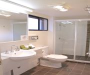
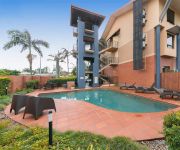
Hotels and Places to Stay
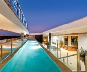
Pullman Brisbane Airport
DOMAIN SERVICED APARTMENTS
Novotel Brisbane Airport
Quality Hotel Airport International
BEST WESTERN AIRPORT 85 MOTEL
Comfort Inn & Suites Northgate Airport
Pegasus Motor Inn and Serviced Apartments
KINGSFORD SMITH MOTEL
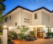
QUEST ASCOT SERVICED APTS
Link Portside Apart'Hotel
Videos from this area
These are videos related to the place based on their proximity to this place.
35 Rodney Street - Wynnum West (4178) Queensland by Benjamin Williams
Property Video shoot of 35 Rodney Street - Wynnum West (4178) Queensland by platinumhd http://www.platinumhd.tv for.
KINGSFORD SMITH DRIVE, EAGLE FARM.
In the early hours of the morning, i came across this smash. Not sure who was in the right or wrong but what ever, you just never know what is around the corner. From what i can see, its looking...
310 Fison Avenue, Eagle Farm QLD By Daniel Wilson
Property Video shoot of 310 Fison Avenue, Eagle Farm QLD by PlatinumHD http://www.platinumhd.tv for Ray White Industrial.
Brisbane Kermesse powered by Tineli; course preview.
Kangaroo Point Cycling Club is proud to introduce Queensland's newest open road race; the Brisbane Kermesse powered by Tineli. This never before raced spectator friendly 3.5km circuit just...
Hectic Go Kart Drift Battle
This is a battle between myself and my good friend Callum Whatmore (in the yellow shirt). A slippery track, unpredictable traffic, and a pride fuelled rivalry make for an enjoyable video. The...
ADS Slat Wall Brisbane
http://www.advdis.com.au/shopfittings-and-displays/slat-wall Advanced Display System, a shop fittings supplier in Brisbane offers a wide selection of slat wall and slat wall accessories. Watch...
36 Newrybar Street, Hemmant, Brisbane, Queensland, Australia
Two -- Yes that's Two, Homes on Acreage -- Dual Living in Rural Setting Proudly presented to the marketplace is this unique acreage opportunity in bay-side Brisbane. Large land parcel of 5079...
Gateway Bream Fishing on Dragon Kayaks
A trip to the Gateway bridge on the Brisbane River a while back gave Jai the chance to show off some of his skillz using the Zman CrusteaZ... Was hard fishing in the murky water due to recent...
Brisbane Transport Bus going over the Brisbane Gateway Bridge doing a bus run 598
This is a great bus run to go on if you come to Brisbane. This bus run is the 598 going anticlockwise around the city. The bus that goes clockwise around the city is 599 bus. These buses stop...
Videos provided by Youtube are under the copyright of their owners.
Attractions and noteworthy things
Distances are based on the centre of the city/town and sightseeing location. This list contains brief abstracts about monuments, holiday activities, national parcs, museums, organisations and more from the area as well as interesting facts about the region itself. Where available, you'll find the corresponding homepage. Otherwise the related wikipedia article.
Fort Lytton National Park
Fort Lytton is a national park in Queensland, Australia, 13 km northeast of Brisbane. It is located near the mouth of the Brisbane River on the southern bank. Fort Lytton is an important historical site. It is a pentagonal fortress hidden behind a moat and grassy embankments. It is the only fort in Australia with a moat.
Sir Leo Hielscher Bridges
The Sir Leo Hielscher Bridges are a pair of road bridges on the Gateway Motorway (M1), which skirts the eastern suburbs of Brisbane, Queensland, Australia. They are the most eastern crossing of the Brisbane River, the closest to Moreton Bay, crossing at the Quarries Reach, between Eagle Farm and Murarrie. The original bridge (formerly named the Gateway Bridge) was opened on 11 January 1986 and cost A$140 million to build. The duplicate bridge was opened in May 2010.
International Terminal railway station, Brisbane
International Terminal railway station is a privately owned railway station on the Airtrain airport line at the Brisbane Airport International terminal, northeast Brisbane, the state capital of Queensland, Australia. Owned and operated by Airtrain Citylink Limited, the International Terminal is a private station that connects seamlessly with the Queensland Rail City network, and services use Queensland Rail rolling stock under a commercial agreement.
Doomben railway station
Doomben is a railway station and the terminus of the Doomben line in Ascot, a northeast suburb of Brisbane, the capital of Queensland, Australia. It is part of the Queensland Rail City network and terminus for passenger services on the Pinkenba line. It is in Zone 2 of the TransLink integrated public transport system. The station is nearby to the Doomben Racecourse, after which it is named.
Murarrie railway station
Murrarie Station is a railway station on the Cleveland Line of Brisbane, Australia. It is part of the Queensland Rail City network. It is in Zone 3 of the TransLink integrated public transport system.
Hemmant railway station
Hemmant Station is a railway station on the Cleveland Line of Brisbane, Australia. It is part of the Queensland Rail City network. It is in Zone 3 of the TransLink integrated public transport system.
Wynnum North railway station
Wynnum North Station is a railway station on the Cleveland Line of Brisbane, Australia. It is part of the Queensland Rail City network. It is in a transition precinct between Zone 3 and Zone 4 of the TransLink integrated public transport system. It is by far one of the most popular stations in the area, with the early morning schedule regularly seeing the platform very congested.
Lindum railway station
Lindum Station is a railway station on the Cleveland Line of Brisbane, Australia. It is part of the Queensland Rail City network. Lindum is the last station before the parallel freight line to the Port of Brisbane diverges from the Cleveland line. It is in Zone 3 of the TransLink integrated public transport system.
Bulimba Creek
The Bulimba Creek catchment has it sources in the marshy parts of the suburbs of Runcorn and Kuraby in the south of Brisbane. It then flows in a northerly direction through the suburbs of Mansfield, Mackenzie, Carindale, Murarrie and Lytton, before meeting the Brisbane River along the Lytton Reach. The creek was originally known as Doboy Creek.
Tingalpa, Queensland
Tingalpa is located near Manly West and Belmont, Queensland in the Eastern suburbs of Brisbane, Australia. It is located 10 kilometres east of the Brisbane CBD. The suburb has some older style homes built in the post war period – weatherboard and chamferboard post war cottages in particular. Most of the new estates are made up of typically low set and high set brick and tile homes.
Pinkenba, Queensland
Pinkenba is the name of a suburb in eastern Brisbane on the northern side of the Brisbane River, 10 kilometres from the Brisbane central business district. The area is spatially isolated from other residential suburbs and is surrounded by the Brisbane Airport to the north and west, and industrial land and the bank of the Brisbane River to the south. Pinkenba recorded a population of 350 people at the 2011 Australian Census.
Eagle Farm, Queensland
Eagle Farm is a largely industrial suburb of Brisbane in Queensland, Australia, situated around six kilometres from the Brisbane central business district. It is the former site of Eagle Farm Airport, Brisbane's main airport until the opening of the Brisbane Airport. Eagle Farm was also the site of the disused Eagle Farm railway station. The locality of Whinstanes is located in Eagle Farm.
Murarrie, Queensland
Murarrie is a suburb of Brisbane, Australia. It is located in the eastern suburbs on the southern bank of the Brisbane River adjacent to the Gateway Bridge. Murarrie has both residential and industrial sections. Brisbane's two newspapers, The Courier-Mail and The Sunday Mail, are published at News Corporation's printing facility in Murarrie. Murarrie's postcode is 4172.
Iona College (Queensland)
Iona College, is a private, Roman Catholic, day school for boys, located in Wynnum, a suburb of Brisbane, Queensland, Australia. Founded in 1958, the college currently caters for approximately 1,500 students from years 5 to 12, on a 27–hectare campus 16 km east of the Brisbane central business district. Iona is operated by the Oblates of Mary Immaculate, a religious order that was founded in 1816 by Saint Eugene de Mazenod.
M1 (Queensland)
The M1 in Brisbane, Queensland, Australia, is a major urban road corridor.
Metroad 1 (Brisbane)
Metroad 1 in Brisbane, Queensland, Australia, is the former designation of the major urban road corridor. It connects Bald Hills to the southern suburb of Beenleigh via the following corridors. Gateway Motorway between Bald Hills and Eight Mile Plains Pacific Motorway between Eight Mile Plains and Beenleigh Due to the recent resigning of Metroad 1 as the M1 of the new alphanumeric road system, this corridor is still undergoing new signage.
4RPH
Radio 4RPH 1296 kHz is a volunteer manned community radio station in Brisbane, Queensland, Australia. Radio 4RPH is a member of the Radio Print Handicapped Network. Its catch-phrases are, Your information station and Turning print into sound, and it is intended to serve all those who are, for any reason, handicapped from reading printed material. Newspapers, magazines, books, and other printed material are read to air.
Wynnum West, Queensland
Wynnum West is an outer suburb of Brisbane, Australia located 13 km east of the CBD. Originally part of surrounding suburbs, Wynnum West was gazetted in 1975 as a separate suburb. People started to settle the from the 1860. Farming and viticulture was the main use of the land. During the 1880s and 1890s population was minimal, it wasn't until the post-war years that significant development happened.
Hemmant, Queensland
Hemmant is a suburb of Brisbane, Australia. It is 11 km east of the CBD located on the Brisbane River.
Brisbane Airport (suburb)
Brisbane Airport is a suburb of Brisbane, Queensland, Australia. Brisbane Airport is located approximately 14 kilometres north-east from the Brisbane central business district. The majority of the land is occupied by the Brisbane Airport. The Airport Drive currently links the Airport with the Gateway Motorway.
Myrtletown, Queensland
Myrtletown is an unbounded locality within the suburb of Pinkenba, Brisbane, Queensland, Australia. In the east of Pinkenba, it is situated near the northern bank of the mouth of the Brisbane River. Formerly a semi-rural residential area, the construction of the Brisbane Airport at nearby Cribb Island caused most residents to leave. The area's school closed in 1971, and the area has become increasingly industrial ever since.
Bulwer Island
Bulwer Island is a 120 hectares reclaimed tidal mangrove island at the mouth of the Brisbane River in the suburb of Pinkenba, Brisbane, Queensland, Australia. It is named for Sir Edward Bulwer-Lytton, the British Colonial Secretary who separated Queensland from New South Wales in 1859 and made Sir George Bowen its first Governor.
City of Brisbane
The City of Brisbane is the local government area that has jurisdiction over the inner portion of the metropolitan area of Brisbane, Queensland, Australia. Unlike LGAs in the other mainland state capitals, which are generally responsible only for the central business districts and inner neighbourhoods of those cities, the City of Brisbane administers a significant portion of the Brisbane metropolitan area. As such, it has a larger population than any other local government area in Australia.
Charlie Earp Bridge
The Charlie Earp Bridge is a road bridge over the Airport Drive in Brisbane, Queensland, Australia. The bridge constructed over the main access road to the Brisbane Airport is less than 1 kilometre from the Gateway Motorway and the Airport Flyover. It provides access to the Airport Village and the shopping centre with its anchor tenant Direct Factory Outlets.
Carmichael Park, Tingalpa
Carmichael Park is a multi-sport venue located at Tingalpa, Queensland. It is home to Brisbane Wolves.


