Safety Score: 2,7 of 5.0 based on data from 9 authorites. Meaning we advice caution when travelling to United States.
Travel warnings are updated daily. Source: Travel Warning United States. Last Update: 2024-04-27 08:23:39
Explore New Germany
New Germany in Greene County (Ohio) is located in United States about 381 mi (or 613 km) west of Washington DC, the country's capital.
Local time in New Germany is now 08:51 AM (Saturday). The local timezone is named America / New York with an UTC offset of -4 hours. We know of 8 airports in the wider vicinity of New Germany, of which 5 are larger airports. The closest airport in United States is James M Cox Dayton International Airport in a distance of 12 mi (or 19 km), North-West. Besides the airports, there are other travel options available (check left side).
Also, if you like golfing, there are multiple options in driving distance. If you need a place to sleep, we compiled a list of available hotels close to the map centre further down the page.
Depending on your travel schedule, you might want to pay a visit to some of the following locations: Dayton, Xenia, Troy, Springfield and Lebanon. To further explore this place, just scroll down and browse the available info.
Local weather forecast
Todays Local Weather Conditions & Forecast: 17°C / 63 °F
| Morning Temperature | 15°C / 58 °F |
| Evening Temperature | 21°C / 70 °F |
| Night Temperature | 19°C / 66 °F |
| Chance of rainfall | 2% |
| Air Humidity | 86% |
| Air Pressure | 1020 hPa |
| Wind Speed | Fresh Breeze with 14 km/h (8 mph) from North-East |
| Cloud Conditions | Overcast clouds, covering 100% of sky |
| General Conditions | Light rain |
Saturday, 27th of April 2024
24°C (75 °F)
18°C (65 °F)
Overcast clouds, moderate breeze.
Sunday, 28th of April 2024
24°C (75 °F)
18°C (64 °F)
Light rain, moderate breeze, overcast clouds.
Monday, 29th of April 2024
22°C (72 °F)
19°C (65 °F)
Light rain, gentle breeze, overcast clouds.
Hotels and Places to Stay
Courtyard Dayton Beavercreek
SpringHill Suites Dayton Beavercreek
Best Western Wright Patterson
La Quinta Inn and Suites Fairborn Wright-Patterson
The Hope Hotel and Richard C. Holbrooke Conference Center
Hilton Garden Inn Dayton Beavercreek
Residence Inn Dayton Beavercreek
Holiday Inn DAYTON/FAIRBORN I-675
Homewood Suites Dayton-Fairborn
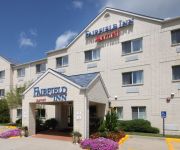
Fairfield Inn Dayton Fairborn
Videos from this area
These are videos related to the place based on their proximity to this place.
Beavercreek Real Estate - Home with Riverside property taxes SOLD by Don & Cyndi Shurts of RE/MAX
The brick ranch home for sale in Beavercreek's school district sits on 7/10ths of an acre in Riverside, a suburb of Dayton Ohio. Riverside has lower property tax than Beavercreek. This property...
Flames roll into the sky over Riverside shopping center
Flames roll into the sky over Riverside shopping center.
2006 Chrysler Town & Country Used Cars Dayton OH
http://www.maranathaauto.com This 2006 Chrysler Town & Country is available from Maranatha Auto Inc. For details, call us at 937-781-9960.
Schindler Hydraulic Elevator at Macy's (The Mall at Fairfield Commons) in Beavercreek
This mall is about 10 miles west of Dayton, OH. Location: The Mall Fairfield Commons, JCPenney City: Beavercreek, OH Recorded: April 14, 2012.
Housing Tour: Arlington Village Townhomes & Flats
The UCIE takes you on a tour of your off-campus housing option at the Arlington Village Townhomes & Flats.
In the City: Soin Baby Fair
The Soin Baby Fair was a chance for parents to get some great resources for their newborns!
Wright State President On A Virtual Tour
Visit http://www.wrightstatealumni.com to learn more about the Wright State Alumni Association. Hundreds of Wright State alumni from across the country listened to and interacted with university...
Neoliberalism Part 1 - Emergence and Scope
Seminar on Neoliberalism: Ideology, Economics, and Movements April 5, 2013, Wright State University, Dayton, OH Part1 Speakers: John F. Henry, University of Missouri ‐ Kansas City Neoliberalism:...
Seasons Greetings 2013
Holiday Greetings from the College of Science and Mathematics at Wright State University.
Schindler Hydraulic Elevator at Sears (The Mall at Fairfield Commons) in Beavercreek
This is just another typical Sears. This mall is located about 10 miles west of Dayton. Location: The Mall at Fairfield Commons, Sears City: Beavercreek, OH Recorded: April 14, 2012.
Videos provided by Youtube are under the copyright of their owners.
Attractions and noteworthy things
Distances are based on the centre of the city/town and sightseeing location. This list contains brief abstracts about monuments, holiday activities, national parcs, museums, organisations and more from the area as well as interesting facts about the region itself. Where available, you'll find the corresponding homepage. Otherwise the related wikipedia article.
Wright Field
Wright Field was an airfield of the United States Army Air Corps and Air Forces near Riverside, Ohio. It was one of thirty-two Air Service training camps established after the United States entry into World War I in April 1917. From 1927 to 1947 it was the research and development center for the Air Corps, and during World War II a flight test center.
Wright State University
50x40pxThis article needs additional citations for verification. Please help improve this article by adding citations to reliable sources. Unsourced material may be challenged and removed. Wright State University Wright State University Primary Corporate Mark {{#invoke:InfoboxImage|InfoboxImage|image=|size=|sizedefault=frameless|alt=}}Established 1967Type PublicEndowment $76.97 million (As of June 30, 2012)President David R. Hopkins, P.E.D.
Convair XC-99
The Convair XC-99, 43-52436, was a prototype heavy cargo aircraft built by Convair for the United States Air Force. It was the largest piston-engined land-based transport aircraft ever built, and was developed from the B-36 bomber, sharing the wings and some other structures with it. The first flight was on 23 November 1947 in San Diego, California, and after testing it was delivered to the Air Force on 23 November 1949.
The Mall at Fairfield Commons
The Mall at Fairfield Commons is a shopping center in Beavercreek, Ohio. The mall was opened in 1993 and has two floors featuring six anchor stores and a food court. Located adjacent to Interstate 675, it's near a golf course, Wright Patterson Air Force Base, Wright State University and Nutter Center entertainment complex. The mall is located just south of the interstate on North Fairfield Road (Veterans Memorial Highway), a main thoroughfare through Beavercreek.
Air Force Institute of Technology
The Air Force Institute of Technology (AFIT) is a graduate school and provider of professional and continuing education that for the United States Armed Forces and is part of the United States Air Force. It is located on Wright-Patterson AFB, Ohio.
WWSU
WWSU is a radio station broadcasting a Variety format. Licensed to Fairborn, Ohio, USA, the station serves the Ohio college area. The station is currently owned by Wright State University. Along with music, WWSU broadcasts select Wright State Raiders sporting events. WWSU broadcasts in an open format. This means that the DJ has nearly complete control over what gets played on the air. Shows typically average two hours, with an automation system playing when no DJs are on the air.
Boonshoft School of Medicine
Boonshoft School of Medicine (formerly known as The Wright State University School of Medicine) is the medical school at Wright State University. Wright State University Boonshoft School of Medicine is located in Dayton, Ohio, and serves the Miami Valley region of southwestern Ohio.
Indu and Raj Soin Medical Center
Indu and Raj Soin Medical Center (Soin Medical Center) is a full-service hospital located in Beavercreek, Ohio next to the Mall at Fairfield Commons. It is part of Kettering Health Network in Southwest Ohio. The medical center is accredited by the American Osteopathic Association's Healthcare Facilities Accreditation Program.


