Safety Score: 2,7 of 5.0 based on data from 9 authorites. Meaning we advice caution when travelling to United States.
Travel warnings are updated daily. Source: Travel Warning United States. Last Update: 2024-05-03 08:06:06
Delve into Clearwater Forest
The district Clearwater Forest of Sanford in Lee County (North Carolina) is a district located in United States about 263 mi south-west of Washington DC, the country's capital town.
In need of a room? We compiled a list of available hotels close to the map centre further down the page.
Since you are here already, you might want to pay a visit to some of the following locations: Pittsboro, Carthage, Lillington, Fayetteville and Raeford. To further explore this place, just scroll down and browse the available info.
Local weather forecast
Todays Local Weather Conditions & Forecast: 29°C / 84 °F
| Morning Temperature | 18°C / 65 °F |
| Evening Temperature | 26°C / 79 °F |
| Night Temperature | 21°C / 69 °F |
| Chance of rainfall | 0% |
| Air Humidity | 45% |
| Air Pressure | 1016 hPa |
| Wind Speed | Gentle Breeze with 7 km/h (4 mph) from North |
| Cloud Conditions | Overcast clouds, covering 100% of sky |
| General Conditions | Overcast clouds |
Saturday, 4th of May 2024
23°C (73 °F)
18°C (65 °F)
Light rain, gentle breeze, overcast clouds.
Sunday, 5th of May 2024
25°C (76 °F)
19°C (67 °F)
Light rain, gentle breeze, overcast clouds.
Monday, 6th of May 2024
25°C (77 °F)
20°C (69 °F)
Moderate rain, moderate breeze, overcast clouds.
Hotels and Places to Stay
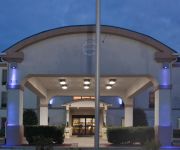
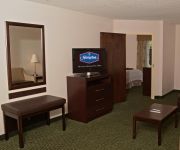
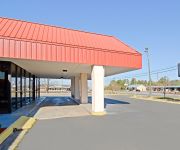
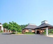
Holiday Inn Express & Suites SANFORD
Hampton Inn Sanford
Americas Best Value Inn
Econo Lodge Sanford
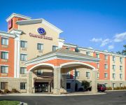
Comfort Suites Sanford
BAYMONT INN & SUITES SANFORD
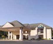
DAYS INN OF SANFORD
Videos from this area
These are videos related to the place based on their proximity to this place.
2003 Chevrolet Silverado 1500 SS Used Cars Sanford NC
http://www.cheathamandcheatham.com This 2003 Chevrolet Silverado 1500 SS is available from Cheatham & Cheatham Associates. For details, call us at 919-353-5157.
2013 Brick Capital GRAND CHAMPION performance
Union Pines Marching Vikings performing "Reflections" Lee County's 34th Annual Brick Capital Classic November 2, 2013 5A Band Rating - SUPERIOR Percussion Score - 97 (top Percussion of the...
San Lee Park - Shock and Awe
New for 2014 Shock and Awe takes San Lee parks mountain bike trail system to the next level. We looked at Mega Jump and said how do we top that and that was how the concept for Shock and Awe...
Bouldergeist @ San Lee Park - Cat 2 men 2013
Cat two men raced 20 miles - two laps minus Free Fall. Fastest Cat 2 racer - Hayden Miller 1:54:58. Fastest Singlespeed racer - Cat 1 - Bart Wellisley 1:54:57. Thanks to Storm Racing & MAXXIS...
San Lee Park 2013 MEGA JUMP and other new stuff
My first video of new the new trail features I built over the winter. This video showcases MEGA JUMP / Drop Zone / Six Pack / Lizard Lick & Dragons Tail - 15 days on Kubota U17 mini excavator...
Maxxis Southern Classic Series cat 3 men 2014 @ San Lee Park
Bouldergeist Race at San Lee Park in Sanford NC. This video shows the Cat 3 beginner men's classes take on the newly renovated trail system here at San Lee Park. Trail designer has added...
MAXXIS Southern Classic Series cat 1 men @ San Lee Park 2014
MAXXIS Southern Classic Series 2014 Cat 1 Men - (Expert Class) at San Lee Park Sanford NC. Light rain made for super slick conditions. Race highlighted many of our new trail features for...
Tobacco Road Classic @ San Lee Park
Race video clips was shot at one of San Lee Parks signature bike trail features - Bouldergiest - a 40' rocky surprise for the college racers. Race was put on by NCSU Cycling club. Location...
Videos provided by Youtube are under the copyright of their owners.
Attractions and noteworthy things
Distances are based on the centre of the city/town and sightseeing location. This list contains brief abstracts about monuments, holiday activities, national parcs, museums, organisations and more from the area as well as interesting facts about the region itself. Where available, you'll find the corresponding homepage. Otherwise the related wikipedia article.
Lee County, North Carolina
Lee County is a county located in the U.S. state of North Carolina. As of 2000, the population was 49,040. Its county seat is Sanford.
Sanford, North Carolina
Sanford is a city in Lee County, North Carolina, United States. The population was 23,220 at the 2000 census. It is the county seat of Lee County.
Broadway, North Carolina
Broadway is a town in Lee County, North Carolina, United States.
Haywood, North Carolina
Haywood is an unincorporated community in southeastern Chatham County, North Carolina, United States. Haywood was one of the sites considered in 1792 as a possible location for North Carolina's new capital, although Raleigh was ultimately chosen.
WUVC-DT
WUVC-DT is the Univision owned and operated station based and licensed in Fayetteville, North Carolina and serving the Triangle television market. It broadcasts in digital on UHF channel 38. WUVC is shown on cable channel 8 in Raleigh, Fayetteville, Carrboro, and most suburbs, channel 2 in Cary, Garner, Clayton, and Smithfield, and on channel 11 in Durham and Chapel Hill.
Capitol Broadcasting Tower Columbia
Capitol Broadcasting Tower Broadway is a 533.1 metre high guyed tower for TV transmission near Broadway, North Carolina, USA at {{#invoke:Coordinates|coord}}{{#coordinates:35|30|44|N|78|58|41.0|W|type:landmark | |name= }}. Capitol Broadcasting Tower was built in 2002-2003 and replaced the Capitol Broadcasting Tower Broadway damaged in a plane crash. The tower which it replaced was also 533.1 metre high guyed tower for TV transmission built in 1985.
Lockville, North Carolina
Lockville (also Ramsey's Mill) is an unincorporated community southeastern Chatham County, North Carolina, United States, near the community of Moncure.
Corinth, Chatham County, North Carolina
Corinth is an unincorporated community in Chatham County, North Carolina, United States. The community is located in the "boot" of Chatham County southeast of Moncure.
WDCC
WDCC is a college radio station broadcasting a Rhythmic Contemporary Hit Radio format. Licensed to Sanford, North Carolina, USA, the station serves the North Carolina college area. The station is currently owned by Central Carolina Community College.
Gulf, North Carolina
Gulf is an unincorporated community in southwestern Chatham County, North Carolina, United States, south of the town of Goldston. It is located on the Deep River. The community is home to a general store and several historical homes. It received its name from its location, at a wide bend in the Deep River. Gulf is the geographical center of North Carolina.
Moncure, North Carolina
Moncure, founded in 1881 is a small unincorporated rural community in southeastern Chatham County, North Carolina. The community is located near the confluence of the Deep and Haw Rivers, which forms the Cape Fear River. Moncure once served as the western-most inland port in the state, linked all the way to the coast by steamships. The B.
Brickhaven, North Carolina
Brickhaven is an unincorporated community in southeastern Chatham County, North Carolina, United States, near the Harnett County line. It is located in the "boot" of Chatham County southeast of Moncure and is near the community of Corinth. Its name derives from the numerous brick plants and clay pits located in the community.
Lee County High School (Sanford, North Carolina)
Lee County High School is one of two high schools in Sanford, North Carolina. The high school is located on 1708 Nash Street in Sanford and serves grades 9–12. The school mascot is the yellow jacket and the school's colors are navy and gold.
Coal Glen mine disaster
The Coal Glen Mine Disaster was a coal mine explosion that occurred on May 27, 1925, in Coal Glen, Oakland Township, Chatham County, North Carolina, USA. It is located just north of the city of Sanford, North Carolina. Fifty-three miners died. Attempts at re-opening the mine were made sporadically until the 1950s, but were never financially viable. The mine was permanently closed in 1951.
The Sanford Herald
The Sanford Herald is a newspaper published Tuesdays through Sundays in Sanford, North Carolina. The Sanford Herald has a daily circulation of just over 9,000 and is published every day except Mondays, and has published continuously since 1930. The Herald is a member of the Audit Bureau of Circulations and of the North Carolina Press Association. It is published by the Paxton Media Group of Paducah, Kentucky.
Barbecue Township, Harnett County, North Carolina
Barbecue Township is one of thirteen townships in Harnett County, North Carolina, USA. The township had a population of 9,174 according to the 2000 census. It is a part of the Dunn Micropolitan Area, which is also a part of the greater Raleigh–Durham–Cary Combined Statistical Area (CSA) as defined by the United States Census Bureau. Geographically, Barbecue Township occupies 59.66 square miles in southwestern Harnett County.
Olivia, North Carolina
Olivia is an unincorporated community centered in the Barbecue Township of Harnett County, North Carolina but also covering parts of Anderson Creek Township near the Lee County line. It is a part of the Dunn Micropolitan Area, which is also a part of the greater Raleigh–Durham–Cary Combined Statistical Area (CSA) as defined by the United States Census Bureau.
Ryes, North Carolina
Ryes is an unincorporated community located along old U.S. Highway 421 in the Upper Little River Township of Harnett County, North Carolina between the communities of Seminole and Mamers {{#invoke:Footnotes | harvard_citation }}. It is a part of the Dunn Micropolitan Area, which is also a part of the greater Raleigh–Durham–Cary Combined Statistical Area (CSA) as defined by the United States Census Bureau.
Seminole, North Carolina
Seminole is an unincorporated community located along U.S. Highway 421 in the Upper Little River Township of Harnett County, North Carolina near the county line with Lee County just outside the town of Broadway {{#invoke:Footnotes | harvard_citation }}. It is a part of the Dunn Micropolitan Area, which is also a part of the greater Raleigh–Durham–Cary Combined Statistical Area (CSA) as defined by the United States Census Bureau.
WWGP
WWGP is a radio station broadcasting a Country music format. Licensed to Sanford, North Carolina, USA, its primary market covers Lee County, Chatham County, Moore County, and Harnett County. The station is currently owned by WWGP Broadcasting and is the AM sister station of WFJA. HISTORY OF W W G P- A M WWGP-AM signed on the air in 1946. It was co-owned by close friends Waldo W. Primm, manager/engineer, and Walter W. Gregory, Rocky Mount, NC, financier, for whom the call letters stand. W. W.
WXKL
WXKL is a radio station broadcasting a Gospel format. Licensed to Sanford, North Carolina, USA. The station is currently owned by Thomas Broadcasting.
Cumnock, North Carolina
Cumnock is an unincorporated community in northwestern Lee County, North Carolina, United States. It lies on Cumnock Road, about a mile north of U.S. Route 421, and at an elevation of 292 feet (89 m). Endor Iron Furnace is located near the community.
Lemon Springs, North Carolina
Lemon Springs is an unincorporated community in southern Lee County, North Carolina, United States. It lies south of Sanford, and southeast of Tramway. The community is centered around The Fastop Convenience store, the business shares a building with the Fastop Grill. The Greenwood Elementary School is the only one in the Lemon Springs community, before there were closer Middle and High schools, Greenwood was for grades K-12.
Tramway, North Carolina
Tramway, North Carolina, is an area of Lee County, North Carolina which politically forms part of Sanford. It is located on U.S. 1/15/501, north of the road's intersection with North Carolina Highway 78. Its elevation is 499 feet or 152 meters.
Southern Lee High School
Southern Lee High School is one of two high schools in Sanford, North Carolina. The high school is located on 2301 Tramway Road, in Sanford and serves grades 9-12. The school mascot is the cavalier and the school's colors are blue & orange.


