Safety Score: 2,7 of 5.0 based on data from 9 authorites. Meaning we advice caution when travelling to United States.
Travel warnings are updated daily. Source: Travel Warning United States. Last Update: 2024-05-18 08:26:29
Discover Bonham Heights
The district Bonham Heights of Mansfield in Carteret County (North Carolina) is a subburb in United States about 288 mi south of Washington DC, the country's capital city.
If you need a hotel, we compiled a list of available hotels close to the map centre further down the page.
While being here, you might want to pay a visit to some of the following locations: Beaufort, Bayboro, New Bern, Jacksonville and Trenton. To further explore this place, just scroll down and browse the available info.
Local weather forecast
Todays Local Weather Conditions & Forecast: 23°C / 73 °F
| Morning Temperature | 22°C / 71 °F |
| Evening Temperature | 23°C / 73 °F |
| Night Temperature | 22°C / 71 °F |
| Chance of rainfall | 7% |
| Air Humidity | 87% |
| Air Pressure | 1012 hPa |
| Wind Speed | Moderate breeze with 11 km/h (7 mph) from North-East |
| Cloud Conditions | Overcast clouds, covering 100% of sky |
| General Conditions | Moderate rain |
Sunday, 19th of May 2024
19°C (66 °F)
17°C (62 °F)
Moderate rain, moderate breeze, overcast clouds.
Monday, 20th of May 2024
20°C (68 °F)
17°C (63 °F)
Overcast clouds, moderate breeze.
Tuesday, 21st of May 2024
23°C (74 °F)
19°C (66 °F)
Broken clouds, moderate breeze.
Hotels and Places to Stay
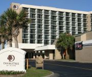
DoubleTree by Hilton Atlantic Beach Oceanfront
Hampton Inn Morehead City
Holiday Inn Express & Suites MOREHEAD CITY
Hampton Inn - Suites Atlantic Beach
Econo Lodge Crystal Coast
Sand Dollar Motel
Quality Hotel Morehead City
PEPPERTREE ATLANTIC BEACH
an Ascend Hotel Collection Member Bask Hotel at Big Rock Landing
Videos from this area
These are videos related to the place based on their proximity to this place.
Penguin Plunge 2014 - Atlantic Beach, NC
BeaufortShops.com Brave souls venturing in to the Atlantic Ocean in Atlantic Beach, North Carolina during the Penguin Plunge 2014.
CopTraX - Atlantic Beach PD NC 2010
IncaX - CopTrax footage from Atlantic Beach PD 2010 - AT&T Android Cell Phones and Windows Laptops Geocasting.
Jack and Ben in the pool at Atlantic Beach
This was just 40 seconds of hours of potential footage. Jack seemingly did this exact circuit hundreds of times... Ben became a fish this weekend. We're now ...
108 Talford
For more details click here: http://www.visualtour.com/showvt.asp?t=3285180 108 Talford Dr Atlantic Beach, NC 28512-7227 $479000, 4 bed, 3.0 bath, 1727 SF,...
Beach Sand and Shells
Beach Sand and Shells near Morehead City, NC, with a surprise appearance of my 4 year old daughter.
Morehead City Hotel - Hampton Inn Morehead City
A virtual tour of the our Morehead City hotel and area attractions.
Morehead City, NC Dentist, Dr. Jack Winchester - Comprehensive Dental Center
Morehead City & Newport, NC Dentist, Dr. Jack Winchester at Comprehensive Dental Center provides dental services with the latest technology. Call Comprehensive Dental Center today at ...
Pairing Physical Therapy with Home Care
Jeff Hajduk, a physical therapist with Liberty HomeCare and Hospice Services in Morehead City, NC discusses the process and benefits of pairing home care with physical therapy. A patient who...
Videos provided by Youtube are under the copyright of their owners.
Attractions and noteworthy things
Distances are based on the centre of the city/town and sightseeing location. This list contains brief abstracts about monuments, holiday activities, national parcs, museums, organisations and more from the area as well as interesting facts about the region itself. Where available, you'll find the corresponding homepage. Otherwise the related wikipedia article.
Beaufort, North Carolina
Beaufort is a town in and the county seat of Carteret County, North Carolina, United States. Established in 1709, Beaufort is the third-oldest town in North Carolina. On February 1, 2012, Beaufort was ranked as "America's Coolest Small Town" by readers of Budget Travel Magazine. The population was 4,189 at the 2008 census. It is sometimes confused with a city of the same name in South Carolina; the two are distinguished by different pronunciations.
Atlantic Beach, North Carolina
Atlantic Beach is a town in Carteret County, North Carolina, United States. It is one of the five communities located on Bogue Banks. The population was 1,815 at the 2008 census.
Morehead City, North Carolina
Morehead City is a port city in Carteret County, North Carolina, United States. The population was 8,661 at the 2010 census. Morehead City celebrated the 150th anniversary of its founding on May 5, 2007. It forms part of the Crystal Coast.
Newport, North Carolina
Newport is a town in Carteret County, North Carolina, United States. The population was 4,510 at the 2010 census.
Indian Beach, North Carolina
You may be looking for Indian Beach, Florida -- which is now part of Sarasota, Florida Indian Beach, North Carolina — Town — Official seal of Indian Beach, North Carolina Location of Indian Beach, North Carolina Coordinates: {{#invoke:Coordinates|coord}}{{#coordinates:34|41|16|N|76|53|29|W|region:US_type:city |primary |name= }} Country United States State North Carolina County Carteret Area • Total 1.5 sq mi (3.9 km) • Land 0.6 sq mi (1.5 km) • Water 0.9 sq mi (2.3 km) Elevation 7 ft (2 m) Population (2009) • Total 93 • Density 159.9/sq mi (61.7/km) Time zone Eastern (EST) • Summer EDT ZIP code 28512 Area code(s) 252 FIPS code 37-33460 GNIS feature ID 1017958 Website http://www.
Pine Knoll Shores, North Carolina
Pine Knoll Shores is a town in Carteret County, North Carolina, United States. The population was 1,547 at the 2008 census. One of North Carolina's state aquariums is located here.
Salter Path, North Carolina
Salter Path is an unincorporated community in Carteret County, North Carolina, United States. A Crystal Coast community, it lies on Bogue Banks as an enclave within Indian Beach.
Siege of Fort Macon
The Siege of Fort Macon took place from March 23 to April 26, 1862, on the Outer Banks of Carteret County, North Carolina. It was part of Union Army General Ambrose E. Burnside's North Carolina Expedition during the American Civil War. In late March, Major General Burnside’s army advanced on Fort Macon, a casemated masonry fort that commanded the channel to Beaufort, 35 miles (56 km) southeast of New Bern.
Bogue Banks
Bogue Banks form a 21-mile barrier island off the mainland of North Carolina in Carteret County. The island, separated from the mainland by Bogue Sound, runs east to west, with the ocean beaches facing due south.
West Carteret High School
West Carteret High School is a public secondary school located in Morehead City, North Carolina on Country Club Road, and is part of the Carteret County Public Schools system. The school serves the student populations of Morehead City, Newport, Atlantic Beach, and surrounding areas. It opened in 1964, and has since grown to be the largest high school in Carteret County. Its school mascot is Pete the Patriot.
WRHT
WRHT (also known as "Thunder Country") is a radio station, broadcasting with 100,000 watts that cover the Greenville/New Bern/Jacksonville area with a country music format. WRHT is licensed to Morehead City. WRHT is owned and operated by Inner Banks Media, owned by Henry Hinton.
Gales Creek, North Carolina
The Gales Creek area of Carteret County, North Carolina is part of the greater Newport, North Carolina area. Gales Creek empties into Bogue Sound, which is separated from the Atlantic Ocean by Bogue Banks, part of North Carolina's barrier islands known as the Southern Outer Banks. A Presbyterian Church Camp, Camp Albemarle, is located near the mouth of Gales Creek at the former home of Henry Wilkins Hibbs, 1862-1942, the second mayor of St.
Michael J. Smith Field
Michael J. Smith Field is a public airport located one mile (2 km) north of the central business district of Beaufort and northeast of Morehead City, in Carteret County, North Carolina, United States. It is owned by the Beaufort-Morehead City Airport Authority. The airport is named in memory of astronaut Michael J. Smith, a native of Beaufort who died in the Space Shuttle Challenger disaster. It was formerly known as Beaufort-Morehead City Airport. Although most U.S.
Wildwood, North Carolina
Wildwood, North Carolina is a small unincorporated community centered on the Wildwood Road, just west of the Morehead City, North Carolina town limits along US Highway 70, in Carteret County, NC. Newport, North Carolina is the next closest town.
Newport River
The Newport River is a small river in North Carolina that runs approximately twenty kilometers southeast through the town of Newport with its mouth opening into Bogue Sound, between Morehead City and Beaufort. It is popular for flatwater paddling and canoeing.
Broad Creek, North Carolina
The Broad Creek area of Carteret County, North Carolina is part of the greater Newport, North Carolina area. It currently shares the Newport zip code of 28570.
Gales Creek (North Carolina)
Gales Creek is a creek bordering the communities of Broad Creek and Gales Creek in the U.S. state of North Carolina. Gales Creek empties into Bogue Sound, which is separated from the Atlantic Ocean by Bogue Banks, part of North Carolina's barrier islands known as the Southern Outer Banks. The Creek also runs through the Croatan National Forest. Upstream along Gales Creek and further into the Pocosin, is a camp for youth operated by the Eckerd Youth Alternatives program, Camp E-Ma-Henwu.
WXBE
WXBE is a radio station broadcasting a Religious format. Licensed to Beaufort, NC, USA, it serves the Fayetteville, NC area. The station is currently owned by American Family Association.
WOTJ
WOTJ is a radio station broadcasting family christian programming. Licensed to Morehead City, North Carolina, USA, it serves the Greenville-New Bern, North Carolina, area. The station is currently owned by Grace Christian School, a ministry of Grace Baptist Church of Newport, North Carolina, and is the flagship station of the Fundamental Broadcasting Network.
WLGP
WLGP is a radio station broadcasting a Christian Radio format as an affiliate of Good News Network. Licensed to Harkers Island, North Carolina, USA, it serves the Greenville-New Bern area. The station is currently owned by Augusta Radio Fellowship Institute, Inc. Programs heard on WLGP include; Grace to You with John MacArthur, In Touch with Charles Stanley, Thru the Bible with J.
Carteret Community College
Carteret Community College is a community college in Morehead City, North Carolina, USA. It serves Carteret County, North Carolina. Founded in 1963, Carteret Community College is one of 59 institutions comprising the N.C. Community College System. Located in Morehead City, N.C. , the college lies on the shores of the beautiful Bogue Sound -- part of the Atlantic Intracoastal Waterway.
O'Neal Field at Big Rock Stadium
O'Neal Field at Big Rock Stadium is a baseball venue in Morehead City, North Carolina, USA. Also known as simply Big Rock Stadium, the venue is home to the Morehead City Marlins of the Coastal Plain League, a collegiate summer baseball league. The Marlins began play at the field for the 2010 season, after their arrival was announced in the fall of 2009.
WLVG
WLVG is a radio station broadcasting the K-Love Contemporary Christian format. Licensed to Havelock, North Carolina, USA, the station served the Havelock, NC area. The station was recently sold by NM Licensing LLC.
Neusiok Trail
The Neusiok Trail is a 20.4-mile hiking trail located in the Croatan National Forest in Carteret County, North Carolina. The trail traverses the forest from a sandy beach on the Neuse River to a salt marsh on the Newport River, and along the way, it crosses cypress swamps, hardwood ridges, longleaf-pine savannah and pocosin—shrubby bogs The entire Neusiok is part of the Mountains-to-Sea Trail (MST) which spans North Carolina, and the MST in the Croatan is a designated National Recreation Trail.
Carteret General Hospital
Carteret General Hospital is a 135 bed, non-profit hospital in Morehead City, North Carolina. Carteret General was founded in 1967.


