Safety Score: 2,7 of 5.0 based on data from 9 authorites. Meaning we advice caution when travelling to United States.
Travel warnings are updated daily. Source: Travel Warning United States. Last Update: 2024-05-05 08:24:42
Delve into Cooks Crossing
Cooks Crossing in Carroll County (New Hampshire) is located in United States about 469 mi (or 754 km) north-east of Washington DC, the country's capital town.
Current time in Cooks Crossing is now 03:14 PM (Sunday). The local timezone is named America / New York with an UTC offset of -4 hours. We know of 11 airports close to Cooks Crossing, of which 5 are larger airports. The closest airport in United States is Portland International Jetport Airport in a distance of 54 mi (or 87 km), South-East. Besides the airports, there are other travel options available (check left side).
Also, if you like playing golf, there are some options within driving distance. If you need a hotel, we compiled a list of available hotels close to the map centre further down the page.
While being here, you might want to pay a visit to some of the following locations: Ossipee, Lancaster, Guildhall, Laconia and Paris. To further explore this place, just scroll down and browse the available info.
Local weather forecast
Todays Local Weather Conditions & Forecast: 13°C / 55 °F
| Morning Temperature | 7°C / 45 °F |
| Evening Temperature | 7°C / 45 °F |
| Night Temperature | 8°C / 46 °F |
| Chance of rainfall | 6% |
| Air Humidity | 62% |
| Air Pressure | 1025 hPa |
| Wind Speed | Gentle Breeze with 6 km/h (4 mph) from North |
| Cloud Conditions | Overcast clouds, covering 100% of sky |
| General Conditions | Moderate rain |
Sunday, 5th of May 2024
22°C (71 °F)
10°C (49 °F)
Light rain, light breeze, broken clouds.
Monday, 6th of May 2024
21°C (71 °F)
10°C (51 °F)
Sky is clear, gentle breeze, clear sky.
Tuesday, 7th of May 2024
8°C (46 °F)
7°C (44 °F)
Moderate rain, light breeze, overcast clouds.
Hotels and Places to Stay
The Inn at Thorn Hill & Spa
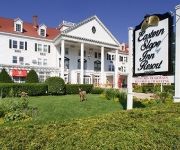
EASTERN SLOPE INN RESORT
WHITE MOUNTAIN HOTEL AND RESORT
FOX RIDGE RESORT
EAGLE MOUNTAIN HOUSE AND GOLF CLUB
Christmas Farm Inn and Spa
THE WENTWORTH HOTEL
The Snowflake Inn
RiverWood Inn
Old Field House
Videos from this area
These are videos related to the place based on their proximity to this place.
A4 River Run Road, Bartlett, NH Presented by Steven Steiner.
Click to see more: http://www.searchallproperties.com/listings/2019918/A4-River-Run-Road-Bartlett-NH/auto?reqpage=video A4 River Run Road Bartlett, NH 03812 Contact Steven Steiner for more...
AbilityPLUS 2013 - Olivier - Mono-Ski Training at Attitash Mountain - Adaptive Skiing
I am a volunteer Adaptive Ski Instructor with AbilityPLUS at Attitash Mountain in Bartlett New Hampshire. Olivier is training to be an independent skier in the Mono-Ski. It has been quite a journey.
Attitash Run March 30
My nephew skiing at Attitash in Bartlett, NH on March, 30, 2015. Shot with my old GoPro, the Hero 2, which is still going strong!
AlpineSlide
A ride down the Apline Slide at Attitash Mountain in Bartlett NH. Recorded in HD on my Droid X.
17 Bearfoot Creek on Attitash Bear Peak
Check out this video of one of the newest luxury ski neighborhoods in New England. A true post and beam home with 4BR and 4.5BA located on the trails of Attitash Bear Peak and just two turns...
Attitash Oktoberfest 2013 Slackline Competition
The attempts and final win of the Attitash Oktoberfest 2013 Slackline Competition in 2013. #attitash #slacklining.
Steam in the Snow: CN 7470 at Roger's Crossing
0-6-0 7470 on a photo runby at Roger's Crossing during the MBRRE's Steam in the Snow event.
Alpine Slide at Attitash Mountain
The Alpine Slide at Attitash is the longest in North America at over 1 mile long. I hadn't ridden this for at least 20 years!
Videos provided by Youtube are under the copyright of their owners.
Attractions and noteworthy things
Distances are based on the centre of the city/town and sightseeing location. This list contains brief abstracts about monuments, holiday activities, national parcs, museums, organisations and more from the area as well as interesting facts about the region itself. Where available, you'll find the corresponding homepage. Otherwise the related wikipedia article.
Story Land
Story Land is a theme park located in Glen, New Hampshire. In the few years prior to opening, the founders, Bob and Ruth Morrell, had purchased a large number of dolls from Germany based on storybook characters. This was the basis for the park. When it opened, it had just one ride: a ride on an old fire truck. By the end of the 20th century, the park spanned some 35 acres and had over 20 rides. Story Land was operated by the family-owned Morrell Corporation from 1954 to 2007.
Rocky Branch (New Hampshire)
The Rocky Branch is a 13.1 mile long river in the White Mountains of New Hampshire in the United States. It is a tributary of the Saco River, which flows to the Atlantic Ocean in Maine. The Rocky Branch rises in the Presidential Range Dry River Wilderness Area of the White Mountain National Forest on the southernmost slopes of Mount Washington.
Ellis River (New Hampshire)
The Ellis River is a 16.7 mile long (26.9 km) river in the White Mountains of New Hampshire in the United States. It is a tributary of the Saco River, which flows to the Atlantic Ocean in Maine. The Ellis River rises on the eastern slopes of Mount Washington, the highest peak in the northeastern United States. Flowing south, it is quickly joined by the Cutler River flowing out of Tuckerman and Huntington ravines, passes over Crystal Cascade, and reaches the floor of Pinkham Notch.
East Branch Saco River
The East Branch of the Saco River is a 13.2 mile long (21.3 km) river in the White Mountains of New Hampshire in the United States. It is a tributary of the Saco River, which flows to the Atlantic Ocean in Maine. The East Branch rises near the northern boundary of Jackson, New Hampshire in an area just south of the Wild River, east of Black Mountain, and southwest of the Baldface mountains.
Glen, New Hampshire
Glen is an unincorporated village in the town of Bartlett in the White Mountains of New Hampshire. The village is the home of Story Land, a popular amusement park in the Mount Washington Valley region, a resort area that also includes the communities of North Conway and Jackson. Glen is found at the intersection of U.S. Route 302 and New Hampshire Route 16, 5 miles north of the center of North Conway and 6 miles east of the center of Bartlett.
WJSK-LP
WJSK-LP is a radio station licensed to Bartlett, New Hampshire, USA. The station is currently owned by The Bartlett-Jackson Community Broadcasters Association.
Diana's Baths
Diana's Baths is a series of small waterfalls located in the southeastern corner of the town of Bartlett, New Hampshire, near the village of North Conway in the White Mountains of New Hampshire, United States. This historic site is within the White Mountain National Forest. The stream that flows into this waterfall is called Lucy Brook. The waterfalls were once the location of an old sawmill operation in the 1800s.


