Safety Score: 2,7 of 5.0 based on data from 9 authorites. Meaning we advice caution when travelling to United States.
Travel warnings are updated daily. Source: Travel Warning United States. Last Update: 2024-05-01 08:01:32
Delve into Summit
Summit in Worcester County (Massachusetts) is a town located in United States about 363 mi (or 585 km) north-east of Washington DC, the country's capital town.
Time in Summit is now 06:14 PM (Wednesday). The local timezone is named America / New York with an UTC offset of -4 hours. We know of 9 airports closer to Summit, of which 3 are larger airports. The closest airport in United States is Worcester Regional Airport in a distance of 6 mi (or 10 km), South-West. Besides the airports, there are other travel options available (check left side).
Also, if you like the game of golf, there are some options within driving distance. We saw 1 points of interest near this location. In need of a room? We compiled a list of available hotels close to the map centre further down the page.
Since you are here already, you might want to pay a visit to some of the following locations: Worcester, North Providence, Johnston, Dedham and Providence. To further explore this place, just scroll down and browse the available info.
Local weather forecast
Todays Local Weather Conditions & Forecast: 13°C / 56 °F
| Morning Temperature | 8°C / 46 °F |
| Evening Temperature | 15°C / 58 °F |
| Night Temperature | 9°C / 49 °F |
| Chance of rainfall | 0% |
| Air Humidity | 78% |
| Air Pressure | 1014 hPa |
| Wind Speed | Light breeze with 5 km/h (3 mph) from North-West |
| Cloud Conditions | Overcast clouds, covering 95% of sky |
| General Conditions | Light rain |
Wednesday, 1st of May 2024
19°C (66 °F)
10°C (49 °F)
Overcast clouds, gentle breeze.
Thursday, 2nd of May 2024
13°C (55 °F)
5°C (41 °F)
Overcast clouds, gentle breeze.
Friday, 3rd of May 2024
13°C (56 °F)
6°C (42 °F)
Overcast clouds, light breeze.
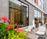
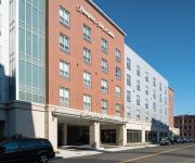
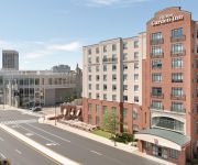
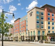
Hotels and Places to Stay
AC Hotel Worcester
Residence Inn Worcester
MA Hampton Inn & Suites-Worcester
Courtyard Worcester
The Beechwood Hotel-Worldhotel
Hilton Garden Inn Worcester
Holiday Inn Express WORCESTER DOWNTOWN
Homewood Suites By Hilton Worcester
Suburban Extended Stay Hotel Worcester
Quality Inn & Suites Worcester
Videos from this area
These are videos related to the place based on their proximity to this place.
Worcester: TG-850 Take of the Montgomery Hydraulic Mall Elevator @ Greendale Mall
This is the Stylus TG-850 take on the Montgomery Hydraulic Mall Elevator, serving the food court and lower parking at Greendale Mall, Worcester, Massachusetts. We take several rides because...
Worcester: Montgomery Escalators @ Greendale Mall, With Bonus Ending
We ride the not-so tall, nor scenic "Twinkie M" Montgomery escaators at the Greendale Mall, Worcester, Massachusetts. They make a lot of noise, bump very slightly, but actually run quite...
Holden - DJI Phantom 2 Aerial video
WATCH IN FULL SCREEN & HD! - This is the DJI Phantom 2, H3-3D, GoPro Hero 3+ Black Edition, Flysight FPV system, DJI iOSD Mini, DJI Ground Station.
67 Cranbrook Dr, Holden, MA 01520
http://67cranbrookdr.epropertysites.com?rs=youtube Renovated in 2006! Immaculate multi-level home with open concept living. Hardwood floors throughout the main living area, including the...
Boylston Massachusetts (MA) Real Estate Tour
http://www.boylstonmarealestate.com -- Tour Boylston, MA neighborhoods, condominium developments, subdivisions, schools, landmarks, recreational areas, and town offices. Boylston, Massachusetts.
2010 Memorial Day Parade - Pack 103 Float
Take a ride on the the Cub Scouts from Pack 103 float for the Memorial Day Parade in Boylston, MA. About the Photographer: Jay Groccia is a Massachusetts based photographer who provides...
Jess Weagle owner of Deep Relief Massage Therapy in West Boylston, MA
http://www.deepreliefmassagetherapy.com/jess-weagle.html Jess Weagle is the owner of Deep Relief Massage Therapy in West Boylston, MA. She is also an independent product consultant for ...
6 Kings Mountain St., West Boylston, MA Presented by Jane Becker.
Click to see more: http://www.searchallproperties.com/listings/2008315/6-Kings-Mountain-St.-West-Boylston-MA/auto?reqpage=video 6 Kings Mountain St. West Boylston, MA 01583 Contact Jane ...
Dr. Pelto's Spanish Talk About Diabetic Foot Problems
Talk in Spanish to the Adult Day Care & Health Center in West Boylston, MA. Covering topics about diabetes including wound and general foot problems.
Videos provided by Youtube are under the copyright of their owners.
Attractions and noteworthy things
Distances are based on the centre of the city/town and sightseeing location. This list contains brief abstracts about monuments, holiday activities, national parcs, museums, organisations and more from the area as well as interesting facts about the region itself. Where available, you'll find the corresponding homepage. Otherwise the related wikipedia article.
Quinsigamond Community College
Quinsigamond Community College is a public, two-year academic institution in Worcester, Massachusetts. A commuter school, the college has an enrollment of over 8,000 students in its Associate's degree and certification programs. A number of students are enrolled in transfer programs with the intent of continuing on to a four-year college or university, often the University of Massachusetts Amherst or Worcester State University through guaranteed-acceptance programs.
WTAG
WTAG is an AM radio station broadcasting on 580 kHz from transmitters in Holden, Massachusetts. WTAG's studios are in Paxton, Massachusetts. WTAG is licensed to Worcester, Massachusetts. WTAG programming is also simulcast on FM translator W235AV at 94.9 MHz, licensed to Tatnuck, Massachusetts. http://www. wtag. com/pages/history. html WTAG is operated by Clear Channel Communications.
Abby Kelley Foster Charter Public School
Abby Kelley Foster Charter Public School is a small K-12 school located at 10 New Bond St. , Worcester, Massachusetts in former Heald Machine Company buildings. The school was founded in 1998.
Worcester Country Club
Worcester Country Club is a golf course in Worcester, Massachusetts. The course hosted the first Ryder Cup in 1927, and was the site of the 1925 U.S. Open, which was won by Willie Macfarlane. It is the only golf course in the United States to host all three events: the men's and women's U.S. Open Championships and the Ryder Cup.
1925 U.S. Open (golf)
The 1925 U.S. Open was the 29th U.S. Open. The golf tournament was held June 3–5, 1925, at Worcester Country Club in Worcester, Massachusetts. Scottish pro Willie Macfarlane won the 36-hole playoff by one stroke on the final hole to secure his first major championship and deny Bobby Jones his second Open. Francis Ouimet, the 1913 U.S. Open champion, held the lead after the first round.
Salter College
Salter College is a for-profit junior college located in West Boylston, Massachusetts.
Osgood Bradley Car Company
The Osgood Bradley Car Company manufactured railway passenger cars and streetcars in Worcester, Massachusetts.
Worcester County Hospital
Worcester County Hospital was a hospital operated by Worcester County which was operational from 1931 until 1993 in Boylston, Massachusetts. Originally opened as a tuberculosis hospital, the hospital eventually became the county hospital for Worcester until its closure in 1993.


