Safety Score: 4,0 of 5.0 based on data from 9 authorites. Meaning please reconsider your need to travel to Switzerland.
Travel warnings are updated daily. Source: Travel Warning Switzerland. Last Update: 2024-05-02 08:23:34
Discover Thayngen, Barzheim
The district Thayngen, Barzheim of Thayngen in Bezirk Reiat (Canton of Schaffhausen) is a district in Switzerland about 82 mi north-east of Bern, the country's capital city.
Looking for a place to stay? we compiled a list of available hotels close to the map centre further down the page.
When in this area, you might want to pay a visit to some of the following locations: Gottmadingen, Hilzingen, Diessenhofen, Muhlhausen-Ehingen and Schaffhausen. To further explore this place, just scroll down and browse the available info.
Local weather forecast
Todays Local Weather Conditions & Forecast: 16°C / 61 °F
| Morning Temperature | 11°C / 51 °F |
| Evening Temperature | 10°C / 50 °F |
| Night Temperature | 8°C / 46 °F |
| Chance of rainfall | 1% |
| Air Humidity | 68% |
| Air Pressure | 1000 hPa |
| Wind Speed | Fresh Breeze with 14 km/h (8 mph) from North-East |
| Cloud Conditions | Broken clouds, covering 72% of sky |
| General Conditions | Light rain |
Friday, 3rd of May 2024
9°C (49 °F)
7°C (44 °F)
Light rain, moderate breeze, overcast clouds.
Saturday, 4th of May 2024
15°C (59 °F)
9°C (49 °F)
Light rain, light breeze, overcast clouds.
Sunday, 5th of May 2024
16°C (62 °F)
12°C (54 °F)
Moderate rain, light breeze, overcast clouds.
Hotels and Places to Stay
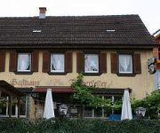
Fischerkeller Pension
Am Kellhof
Bibermühle
Rheingold
Alte Rheinmühle
Waldhotel Hohberg Business- Seminar
Kronenhof
Schützen Landgasthof
Alte Schreinerei Harlekin
Hirschen
Videos from this area
These are videos related to the place based on their proximity to this place.
Freude am Leben
Kantonale Sängertage SH 31. Juni - 1. Juni 2012 in Büsingen Wirtechor Schaffhausen unter Leitung von Giuseppa Graf Bergkirche Büsingen.
Parrot AR.Drone 2.0 mit Fischreiher bei Dörflingen
Vorbeiflug eines Fischreihers während dem Flug. Bei 01:53 erscheint er...wobei er beim "Angriff" nicht vor die Kamera kam..
Fasnetsumzug: Hilzingen am Bodensee, 10.02.2013
Fasnetsumzug: Hilzingen am Bodensee, 10.02.2013 Bilder: http://www.seechat.de/photopost/g1622-10-02-2013-hilzingen.html Fotos und Video: seechat.de | Die Bodensee Community ...
Gewerbeschau Hilzingen am Bodensee, 22.04.2012
Gewerbeschau Hilzingen am Bodensee, 22.04.2012 Fotos und Videos by seechat.de | Die Bodensee Community http://www.seechat.de http://www.seechat.tv.
Guggenmusik an Hochzeit - Gülläpumpä-Bänd
Die Lieder Angels, I kissed a girl und U & Ur Hand vom Hochzeitsständchen am 25.07.2009 für Kathrin und Holger. Weitere Infos zur Guggenmusik Gülläpumpä-Bänd unter: www.gpb-hilzingen.de.
Ebringen-Gottmadingen (Heilsberg) (MTB/DH)
Fahrrad: Merida One-Forty XT-Edition Trail: Von Ebringer Berg (Heilsberg) im Hegau (BW) nach Gottmadingen. Kamera: GoPro Hero 2.
REC Konstanz vs RRV Gottmadingen
Ein Zusammenschnitt des Spiels REC Konstanz gegen den RRV Gottmadingen im Rahmen der Süddeutschen Meisterschaft. Leider hat es den ganzen Tag geregnet wodurch der Spielverlauf ...
Videos provided by Youtube are under the copyright of their owners.
Attractions and noteworthy things
Distances are based on the centre of the city/town and sightseeing location. This list contains brief abstracts about monuments, holiday activities, national parcs, museums, organisations and more from the area as well as interesting facts about the region itself. Where available, you'll find the corresponding homepage. Otherwise the related wikipedia article.
Rhine Falls
The Rhine Falls is the largest plain waterfall in Europe. The falls are located on the Upper Rhine between the municipalities of Neuhausen am Rheinfall and Laufen-Uhwiesen, near the town of Schaffhausen in northern Switzerland, between the cantons of Schaffhausen and Zürich. They are 150 m (450 ft) wide and 23 m (75 ft) high. In the winter months, the average water flow is 250 m³/s, while in the summer, the average water flow is 700 m³/s.
Cholfirst Tunnel
The Cholfirst Tunnel is a tunnel in Switzerland, and forms part of the Autostrasse A4. The tunnel is 1.26 km long and has three lanes (two heading for Zurich, and one heading for Schaffhausen). There is no central reservation. It lies in the northern canton of Zuerich. Construction of the tunnel was completed in 1996.
Munot
The Munot is a circular 16th century fortification in the center of the Swiss city of Schaffhausen. It is surrounded by vineyards and serves as the city's symbol. The ring-shaped fortress was built in the 16th century. Today, it is a tourist attraction and hosts various events. The ring-shaped fortress was built in the 16th century.
Stadion Breite
Stadion Breite is a multi-purpose stadium in Schaffhausen, Switzerland. It is currently used mostly for football matches and is the home ground of FC Schaffhausen. The current capacity of the stadium is 7,300. The stadium has 1,028 covered seats, 262 uncovered seats and 6,010 standing places.
High Rhine
The High Rhine is the name used in Germany for the part of the Rhine River that flows westbound from Lake Constance to Basel. The High Rhine begins at the outflow of the Rhine from the Untersee in Stein am Rhein and turns into the Upper Rhine in Basel. In contrast to the Alpine Rhine and Upper Rhine, the High Rhine flows mostly to the west. The section is marked by Rhine-kilometers 0 to 165, measurements beginning at the outflow of the Obersee at the Old Rhine Bridge in Constance.
Diessenhofen District
Diessenhofen District is a former district of the canton of Thurgau in Switzerland. It had a population of 6,621 (as of 2009). Its capital was the town of Diessenhofen. The former district contained the following municipalities:
Hegau
The Hegau is a formerly volcanic landscape in southern Germany extending around the industrial city of Singen (Hohentwiel), between Lake Constance in the east, the Rhine River in the south, the Danube River in the north and the Randen—as the southwestern mountains of the Swabian Jura are called—in the west. The most famous sight of the Hegau is the Hohentwiel, a volcanic stub. On top of the mountain lies Hohentwiel fortress.
Cholfirst Radio Tower
Cholfirst Radio Tower is a 96 metres tall lattice tower on Cholfirst Mountain at Flurlingen, Canton of Zurich, Switzerland. The tower was built in 1973 by PTT on Cholfirst Mountain, a 570 metres high mountain near Flurlingen after 3 years of successful operation of an experimental TV transmitter on channel 47 on a 40 metres high tower nearby. The construction of Cholfirst Radio Tower cost 7 millions Swiss Francs.
Verenahof
Verenahof (aka. Büttenharter Hof or Verenahöfe) was a German exclave in Switzerland, administratively part of the German town of Wiechs am Randen (which is now part of the town of Tengen). Geographically, it was separated from Wiechs am Randen by a 200-300 metre broad strip of Swiss territory.
Basadingen
Basadingen is a village and former municipality in the canton of Thurgau, Switzerland. In 1999 the municipality was merged with the neighboring municipality Schlattingen to form a new and larger municipality Basadingen-Schlattingen.
Schlattingen
Schlattingen is a village and former municipality in the canton of Thurgau, Switzerland. In 1999 the municipality was merged with the neighboring municipality Basadingen to form a new and larger municipality Basadingen-Schlattingen.
Hallen für Neue Kunst
The Hallen für Neue Kunst is a museum for contemporary art, especially New Art (since 1965). It is located in the Swiss city of Schaffhausen, right on the banks of the river Rhine. The Hallen was founded and established in 1982/83 by the artist Urs Raussmüller. Being convinced that New Art needed time and space to unfold its impact, he created a permanent situation for major, predominantly large-scale works by American and European artists that have been shown (1984).
Morgetshofsee
Morgetshofsee is a kettle lake at Thayngen in the canton of Schaffhausen, Switzerland. The lake and its surroundings are listed in the Federal Inventory of Amphibian Spawning Areas as a site of national importance.
Hohenhewen
Hohenhewen is a mountain of Baden-Württemberg, Germany.
Hohenkrähen
Hohenkrähen is a mountain of Baden-Württemberg, Germany.
Hohenstoffeln
Hohenstoffeln is a mountain of Baden-Württemberg, Germany.
Mägdeberg
Mägdeberg is a mountain of Baden-Württemberg, Germany.
Neuhewen
Neuhewen is a mountain of Baden-Württemberg, Germany.
Rosenegg (mountain)
Rosenegg is a mountain of Baden-Württemberg, Germany.
Biber (Rhine)
The Biber is a small river on the border between Germany and Switzerland. The source is located at Watterdingen in the municipality Tengen, district of Constance in Baden-Wuerttemberg. After about 24 km the Biber river flows into the Rhine at the Biber Mill west of Hemishofen in the Canton of Schaffhausen. The Biber is the largest tributary of the High Rhine on the stretch between Stein am Rhein and Schaffhausen.
Unterhof Castle
Unterhof Castle is a castle in the municipality of Diessenhofen of the Canton of Thurgau in Switzerland. It is a Swiss heritage site of national significance.
Herblingen Castle
Herblingen Castle is a castle in the municipality of Stetten of the Canton of Schaffhausen in Switzerland. It is a Swiss heritage site of national significance.
Schloss Laufen am Rheinfall railway station
Schloss Laufen am Rheinfall is a railway station in the Swiss canton of Zurich and municipality of Laufen-Uhwiesen. The station is overlooked by Schloss Laufen ("Laufen Castle") and in turn overlooks the famous Rhine Falls, from which it derives its name. It is located on the Swiss Federal Railway's Rheinfall line and is served by Zurich S-Bahn line S33. The station is situated to the west of Schloss Laufen and its single platform overlooks the Rhine immediately below the falls.
Schaffhausen railway station
Schaffhausen is a railway station in the Swiss canton of Schaffhausen and city of Schaffhausen. The station is jointly owned by the Swiss Federal Railways (SBB) and Deutsche Bahn (DB), and is served by trains of both national operators, as well as trains of the Swiss regional operator Thurbo. The station is a major intermediate station on the DB's Upper Rhine Railway that briefly transits Swiss territory on its route along the northern bank of the Rhine between Basel and Singen.
Neuhausen railway station
Neuhausen is a railway station in the Swiss canton of Schaffhausen and municipality of Neuhausen am Rheinfall.


