Safety Score: 4,0 of 5.0 based on data from 9 authorites. Meaning please reconsider your need to travel to Switzerland.
Travel warnings are updated daily. Source: Travel Warning Switzerland. Last Update: 2024-05-15 08:00:47
Delve into Räterichsboden
Räterichsboden in Interlaken-Oberhasli District (Canton of Bern) is located in Switzerland about 49 mi (or 79 km) south-east of Bern, the country's capital town.
Current time in Räterichsboden is now 12:06 PM (Wednesday). The local timezone is named Europe / Zurich with an UTC offset of 2 hours. We know of 9 airports close to Räterichsboden, of which 3 are larger airports. The closest airport in Switzerland is Buochs Airport in a distance of 27 mi (or 44 km), North. Besides the airports, there are other travel options available (check left side).
There are several Unesco world heritage sites nearby. The closest heritage site in Switzerland is Swiss Alps Jungfrau-Aletsch in a distance of 15 mi (or 25 km), West. We encountered 4 points of interest near this location. If you need a hotel, we compiled a list of available hotels close to the map centre further down the page.
While being here, you might want to pay a visit to some of the following locations: Formazza, Premia, Baceno, Sarnen and Crodo. To further explore this place, just scroll down and browse the available info.
Local weather forecast
Todays Local Weather Conditions & Forecast: 12°C / 54 °F
| Morning Temperature | 10°C / 50 °F |
| Evening Temperature | 12°C / 53 °F |
| Night Temperature | 8°C / 47 °F |
| Chance of rainfall | 3% |
| Air Humidity | 89% |
| Air Pressure | 1006 hPa |
| Wind Speed | Light breeze with 5 km/h (3 mph) from North-West |
| Cloud Conditions | Overcast clouds, covering 100% of sky |
| General Conditions | Light rain |
Thursday, 16th of May 2024
11°C (52 °F)
9°C (47 °F)
Moderate rain, gentle breeze, overcast clouds.
Friday, 17th of May 2024
11°C (53 °F)
8°C (47 °F)
Light rain, light breeze, overcast clouds.
Saturday, 18th of May 2024
12°C (53 °F)
10°C (50 °F)
Light rain, light breeze, broken clouds.
Hotels and Places to Stay
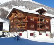
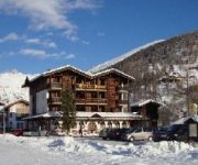
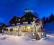
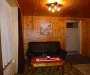
Blatter Posthaus (Wohnung Weisshorn) - Ulrichen
Hotel Walser
Alpenhof
Furka - Oberwald
Alpenluft Studio
Videos from this area
These are videos related to the place based on their proximity to this place.
Sidelhorn (2764m, Berner Alpen) - Kanton Bern, Kanton Wallis, Schweiz
Das Panorama auf dem Sidelhorn Tourbeschreibung und Bilder unter: http://www.christianengl.de/sidelhorn.shtml.
Travel memories... Switzerland, Gletscher ice tunnel and cave (Wallis - Valais)
Switzerland, "Gletscher ice tunnel and grotto" (Wallis - Valais) "Vallée des Conches" "glacier du Rhône" "col de la Furka" "Ubergoms Wallis"
Wiederholung der Eröffnungsfahrt mit Dampfzug Brig-Oberwald-Gletsch vom 30. Juni 1914
Wiederholung der Eröffnungsfahrt mit Dampfzug Brig-Oberwald-Gletsch vom 30. Juni 1914 Aufgenommen am 30. Juni 2014.
DFB 06 - On section Gletsch - Oberwald
Dampfbahn Furka Bergstrecke (DFB) on the section Gletsch - Oberwald 2010/08/22.
Motoweek 2014 - Grimsel Pass, Gletsch, Oberwald
Day one of a week long motorcycle tour around Switzerland, and bordering regions.
Grimselpass to Gletsch
A trip at 6 kilometers 2165 meter down to 1759 meter GPS 46.56138 8.33644 - 46.56235 8.36129.
100 Jahre Brig-Gletsch - Öffentliche Dampfzugfahrten
100 Jahre Brig - Gletsch MGB Regionalzüge Glacier Express Dampf-Extrazug mit BFD 9 von Brig nach Oberwald Passquerender Dampfzug der Dampfbahn Furka Bergstrecke mit F.O. 4 anstatt DFB 1.
Videos provided by Youtube are under the copyright of their owners.
Attractions and noteworthy things
Distances are based on the centre of the city/town and sightseeing location. This list contains brief abstracts about monuments, holiday activities, national parcs, museums, organisations and more from the area as well as interesting facts about the region itself. Where available, you'll find the corresponding homepage. Otherwise the related wikipedia article.
Rhone Glacier
The Rhone Glacier, or sometimes Rhône Glacier is a glacier in the Swiss Alps and the source of the Rhone River and one of the primary contributors to Lake Geneva in the far eastern end of the Swiss canton of Valais. Because the Glacier is located close to the Furka Pass road it is easily accessible.
Grimselsee
Grimselsee or Lake Grimsel is an artificial lake near Grimsel pass in the Canton of Berne, Switzerland. With a volume of 95 mio m³, it is larger than other hydroelectric reservoirs in the region: Oberaarsee, Räterichsbodensee and Gelmersee. The dam was completed in 1932 and is operated by Kraftwerke Oberhasli AG (KWO). It is located in the municipality of Guttannen.
Totensee
Totensee (or Totesee) is a small natural lake at the Grimsel Pass in the canton of Valais, Switzerland. It is used as a reservoir and drained into Grimselsee. In November 2006, the lake's entire trout population died, possibly due to algae. The name Totensee is said to be derived from soldiers of Duke Berchtold V of Zähringen driven into the lake by the people of Valais.
Gelmersee
Gelmersee (or Lake Gelmer) is a lake in Bernese Oberland, Switzerland. The hydroelectric reservoir was built at the same time as Grimselsee. The reservoir's volume is 13 million m³ and its surface area 0.645 km². The lake may be reached by the Gelmerbahn from Handegg, Guttannen at 1,412 m. The funicular's track with a length of 1,028 m has a maximum inclination of 106%.
Räterichsbodensee
Räterichsbodensee is a lake in Guttannen, Oberhasli, Switzerland. The reservoir has a volume of 25 mio m³ and a surface area is 0.67 km².
Gelmerbahn
The Gelmerbahn is a funicular railway in the canton of Bern, Switzerland. It links a lower terminus at Handegg, in the Haslital (the valley of the upper Aar River), with an upper terminus at the Gelmer Lake. It is the steepest funicular in Switzerland. The Gelmer Lake is in fact a reservoir, constructed in 1926 in order to exploit the hydroelectric ressources of the area.
Gletsch railway station
Gletsch railway station is a metre gauge railway station serving the village of Gletsch, in the Canton of Valais, Switzerland.
Furka Cogwheel Steam Railway
The Furka Cogwheel Steam Railway (Dampfbahn Furka-Bergstrecke, DFB in German) is a largely volunteer operated heritage railway which operates a partially rack and pinion-operated line between Realp and Oberwald in Switzerland. It is an old mountainous section of the Furka-Oberalp-Bahn (FOB) that was abandoned after the construction of the Furka Tunnel.


