Safety Score: 3,0 of 5.0 based on data from 9 authorites. Meaning we advice caution when travelling to Slovenia.
Travel warnings are updated daily. Source: Travel Warning Slovenia. Last Update: 2024-05-01 08:01:32
Delve into Dol
Dol in Kamnik is located in Slovenia about 20 mi (or 31 km) north of Ljubljana, the country's capital town.
Current time in Dol is now 06:30 AM (Thursday). The local timezone is named Europe / Ljubljana with an UTC offset of 2 hours. We know of 11 airports close to Dol, of which 5 are larger airports. The closest airport in Slovenia is Ljubljana Jože Pučnik Airport in a distance of 11 mi (or 17 km), South-West. Besides the airports, there are other travel options available (check left side).
There are several Unesco world heritage sites nearby. The closest heritage site in Slovenia is Škocjan Caves in a distance of 54 mi (or 88 km), South-West. We encountered 1 points of interest near this location. If you need a hotel, we compiled a list of available hotels close to the map centre further down the page.
While being here, you might want to pay a visit to some of the following locations: Kamnik, Solcava, Luce, Zgornje Jezersko and Komenda. To further explore this place, just scroll down and browse the available info.
Local weather forecast
Todays Local Weather Conditions & Forecast: 13°C / 55 °F
| Morning Temperature | 11°C / 51 °F |
| Evening Temperature | 15°C / 59 °F |
| Night Temperature | 10°C / 51 °F |
| Chance of rainfall | 10% |
| Air Humidity | 94% |
| Air Pressure | 1008 hPa |
| Wind Speed | Gentle Breeze with 6 km/h (4 mph) from North-East |
| Cloud Conditions | Overcast clouds, covering 95% of sky |
| General Conditions | Moderate rain |
Friday, 3rd of May 2024
10°C (51 °F)
10°C (50 °F)
Moderate rain, calm, overcast clouds.
Saturday, 4th of May 2024
15°C (58 °F)
10°C (51 °F)
Light rain, calm, overcast clouds.
Sunday, 5th of May 2024
15°C (59 °F)
10°C (50 °F)
Light rain, light breeze, overcast clouds.
Hotels and Places to Stay
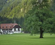
Hotel Plesnik
Videos from this area
These are videos related to the place based on their proximity to this place.
inspired by rodney (primo)
check my "smoking s bad for skateboarding" video for some new primo footage :) ... ... for this first ones it took me like a 1000 trys to finaly make them ...
SA:MP AutoFix/Flip/InfinityNos - Filterscript [New Video]
This video is about a samp filterscript that i made. If you want to get more information about it or you want to download the filterscript go here: http://forum.sa-mp.com/showthread.php?t=373147.
Bad Eisenkappel Südkärnten Bergtour auf Ledin, Ceska Koca http://www.bad-eisenkappel.info
Bergtour Ledin, Ceska Koca Südkärnten geführte Bergtour aus Bad Eisenkappel Südkärnten http://www.bad-eisenkappel.info.
MALA PLANINA - family hikings in Slovenia
Drove up to the starting point, where you can park. You can eat in the mountain hut. During the summer you can see a lot of cows on the mountain and you can buy from shepards milk and some...
Trnič velikoplaninski trdi sir
Trniči so vrsta posušenih sirov značilne hruškaste oblike, ki jih pripravljajo na območju Velike, Male in Gojške planine v Kamniško-Savinjskih Alpah. Izdelani so iz skute, smetane in...
Kamniška Bistrica-Veliki in Mali Predaselj
Veliki in Mali Predaselj predstavljata najožji del struge Kamniške Bistrice.To je več kot 100 metrov dolga soteska,v kateri dere Kamniška Bistrica med navpičnimi stenami trdnega temno...
Videos provided by Youtube are under the copyright of their owners.
Attractions and noteworthy things
Distances are based on the centre of the city/town and sightseeing location. This list contains brief abstracts about monuments, holiday activities, national parcs, museums, organisations and more from the area as well as interesting facts about the region itself. Where available, you'll find the corresponding homepage. Otherwise the related wikipedia article.
Velika Planina (plateau)
Velika Planina is a karstified mountain plateau in the Kamnik–Savinja Alps northeast of Kamnik. It measures 5.8 square kilometres and has the average elevation of 1,500 metres above sea level. Its highest point is Mount Gradišče, at 1,666 metres . There are numerous herders' dwellings that comprise several settlement areas: Velika Planina (Big Pasture), Mala Planina (Little Pasture), Gojška Planina (Gozd Pasture, named for the village of Gozd), Tiha Dolina (Quiet Valley), and others.


!['SA:MP AutoFix/Flip/InfinityNos - Filterscript [New Video]' preview picture of video 'SA:MP AutoFix/Flip/InfinityNos - Filterscript [New Video]'](https://img.youtube.com/vi/wVbEtdYKzP4/mqdefault.jpg)


