Safety Score: 2,8 of 5.0 based on data from 9 authorites. Meaning we advice caution when travelling to Poland.
Travel warnings are updated daily. Source: Travel Warning Poland. Last Update: 2024-04-29 08:03:39
Discover Stama
Stama in Powiat mrągowski (Województwo Warmińsko-Mazurskie) is a place in Poland about 114 mi (or 184 km) north of Warsaw, the country's capital city.
Current time in Stama is now 10:48 AM (Monday). The local timezone is named Europe / Warsaw with an UTC offset of 2 hours. We know of 8 airports near Stama, of which one is a larger airport. The closest is airport we know is Khrabrovo Airport in Russia in a distance of 74 mi (or 119 km). The closest airport in Poland is Białystok-Krywlany Airport in a distance of 97 mi (or 119 km), North. Besides the airports, there are other travel options available (check left side).
There are two Unesco world heritage sites nearby. The closest heritage site is Curonian Spit in Lithuania at a distance of 97 mi (or 156 km). The closest in Poland is Historic Centre of Warsaw in a distance of 112 mi (or 156 km), North. We encountered 1 points of interest in the vicinity of this place. If you need a hotel, we compiled a list of available hotels close to the map centre further down the page.
While being here, you might want to pay a visit to some of the following locations: Mragowo, Biskupiec, Bisztynek, Ryn and Szczytno. To further explore this place, just scroll down and browse the available info.
Local weather forecast
Todays Local Weather Conditions & Forecast: 20°C / 68 °F
| Morning Temperature | 11°C / 52 °F |
| Evening Temperature | 20°C / 68 °F |
| Night Temperature | 15°C / 59 °F |
| Chance of rainfall | 0% |
| Air Humidity | 55% |
| Air Pressure | 1025 hPa |
| Wind Speed | Moderate breeze with 11 km/h (7 mph) from North |
| Cloud Conditions | Overcast clouds, covering 100% of sky |
| General Conditions | Overcast clouds |
Tuesday, 30th of April 2024
19°C (67 °F)
12°C (53 °F)
Overcast clouds, moderate breeze.
Wednesday, 1st of May 2024
21°C (69 °F)
12°C (54 °F)
Scattered clouds, gentle breeze.
Thursday, 2nd of May 2024
21°C (69 °F)
13°C (55 °F)
Few clouds, light breeze.
Hotels and Places to Stay
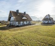
Apartamenty Szelągówka
Im Park
Videos from this area
These are videos related to the place based on their proximity to this place.
Riders' Night - Parada Country - Mrągowo 27.07.2013 cz. II
Po raz Pierwszy w historii 32 festiwalu PIKNIK COUNTRY & FOLK będzie miał miejsce specjalny niedzielny projekt „Riders' Night ". Decyzja o mocniejszym akcencie związana jest z wieloletnią...
Riders' Night - Parada Country - Mrągowo 27.07.2013
Po raz Pierwszy w historii 32 festiwalu PIKNIK COUNTRY & FOLK będzie miał miejsce specjalny niedzielny projekt „Riders' Night ". Decyzja o mocniejszym akcencie związana jest z wieloletnią...
10 lat Mrągowa w Unii Europejskiej
W tym roku świętujemy 10-lecie wstąpienia Polski do Unii Europejskiej. Z tej okazji zachęcamy do obejrzenia wyjątkowego filmu, który ukazuje jak Mrągowo zmieniło się w ostatniej dekadzie...
Pokaz niszczenia auta [Wrak Race Mrągowo - 02-02-2014r.]
Zobacz zdjęcia na: http://imedia4you.pl/?p=galeria&a=przerwa_w_pracy&b=2014_02_02_Wrak_Race_=_Mr%C4%85gowo.
Videos provided by Youtube are under the copyright of their owners.
Attractions and noteworthy things
Distances are based on the centre of the city/town and sightseeing location. This list contains brief abstracts about monuments, holiday activities, national parcs, museums, organisations and more from the area as well as interesting facts about the region itself. Where available, you'll find the corresponding homepage. Otherwise the related wikipedia article.
Joachimowo
Joachimowo is a settlement in the administrative district of Gmina Mrągowo, within Mrągowo County, Warmian-Masurian Voivodeship, in northern Poland. Before 1945 the area was part of Germany.
Bałowo, Mrągowo County
Bałowo is a village in the administrative district of Gmina Sorkwity, within Mrągowo County, Warmian-Masurian Voivodeship, in northern Poland. Before 1945 the area was part of Germany. The village has a population of 48.
Młynik, Warmian-Masurian Voivodeship
Młynik is a village in the administrative district of Gmina Sorkwity, within Mrągowo County, Warmian-Masurian Voivodeship, in northern Poland. It lies approximately 4 kilometres north-east of Sorkwity, 9 km west of Mrągowo, and 46 km east of the regional capital Olsztyn. Before 1945 the area was part of Germany. The village has a population of 31.
Pustniki
Pustniki is a village in the administrative district of Gmina Sorkwity, within Mrągowo County, Warmian-Masurian Voivodeship, in northern Poland. It lies approximately 5 kilometres north of Sorkwity, 9 km west of Mrągowo, and 46 km east of the regional capital Olsztyn. Before 1945 the area was part of Germany. The village has a population of 200.
Stama
Stama is a village in the administrative district of Gmina Sorkwity, within Mrągowo County, Warmian-Masurian Voivodeship, in northern Poland. It lies approximately 6 kilometres north-east of Sorkwity, 7 km west of Mrągowo, and 48 km east of the regional capital Olsztyn. Before 1945 the area was part of Germany. The village has a population of 20.
Słomowo, Warmian-Masurian Voivodeship
Słomowo is a village in the administrative district of Gmina Sorkwity, within Mrągowo County, Warmian-Masurian Voivodeship, in northern Poland. It lies approximately 3 kilometres east of Sorkwity, 8 km west of Mrągowo, and 46 km east of the regional capital Olsztyn. Before 1945 the area was part of Germany.
Zamkowo
Zamkowo is a settlement in the administrative district of Gmina Sorkwity, within Mrągowo County, Warmian-Masurian Voivodeship, in northern Poland. It lies approximately 8 kilometres north-east of Sorkwity, 9 km north-west of Mrągowo, and 48 km east of the regional capital Olsztyn. Before 1945 the area was part of Germany.
Zyndaki
Zyndaki (German Sonntag) is a village in the administrative district of Gmina Sorkwity, within Mrągowo County, Warmian-Masurian Voivodeship, in northern Poland. It lies approximately 9 kilometres north of Sorkwity, 10 km north-west of Mrągowo, and 48 km east of the regional capital Olsztyn. Before 1945 the area was part of Germany.


!['Pokaz niszczenia auta [Wrak Race Mrągowo - 02-02-2014r.]' preview picture of video 'Pokaz niszczenia auta [Wrak Race Mrągowo - 02-02-2014r.]'](https://img.youtube.com/vi/pZNcvlEeEmI/mqdefault.jpg)

