Safety Score: 4,0 of 5.0 based on data from 9 authorites. Meaning please reconsider your need to travel to Palestinian Territory.
Travel warnings are updated daily. Source: Travel Warning Palestinian Territory. Last Update: 2024-04-28 08:22:10
Explore Marāḩ Rabbāḩ
Marāḩ Rabbāḩ in West Bank with it's 1,303 inhabitants is a city in Palestinian Territory about 3,172 mi (or 5,104 km) north-east of , the country's capital.
Local time in Marāḩ Rabbāḩ is now 10:27 PM (Sunday). The local timezone is named Asia / Hebron with an UTC offset of 3 hours. We know of 11 airports in the vicinity of Marāḩ Rabbāḩ, of which 5 are larger airports. The closest is airport we know is Bar Yehuda Airfield in Israel in a distance of 24 mi (or 39 km). Besides the airports, there are other travel options available (check left side).
There are several Unesco world heritage sites nearby. The closest heritage site in Palestinian Territory is Birthplace of Jesus: Church of the Nativity and the Pilgrimage Route, Bethlehem in a distance of 5 mi (or 8 km), North. We found 8 points of interest in the vicinity of this place. If you need a place to sleep, we compiled a list of available hotels close to the map centre further down the page.
Depending on your travel schedule, you might want to pay a visit to some of the following locations: Jerusalem, Jericho, Ramla, Al `Arid and Ghawr al Mazra`ah. To further explore this place, just scroll down and browse the available info.
Local weather forecast
Todays Local Weather Conditions & Forecast: 25°C / 76 °F
| Morning Temperature | 14°C / 57 °F |
| Evening Temperature | 21°C / 71 °F |
| Night Temperature | 17°C / 62 °F |
| Chance of rainfall | 0% |
| Air Humidity | 56% |
| Air Pressure | 1010 hPa |
| Wind Speed | Moderate breeze with 11 km/h (7 mph) from South-East |
| Cloud Conditions | Broken clouds, covering 68% of sky |
| General Conditions | Broken clouds |
Monday, 29th of April 2024
24°C (76 °F)
18°C (64 °F)
Few clouds, fresh breeze.
Tuesday, 30th of April 2024
24°C (75 °F)
15°C (60 °F)
Light rain, fresh breeze, scattered clouds.
Wednesday, 1st of May 2024
23°C (74 °F)
16°C (61 °F)
Sky is clear, fresh breeze, few clouds.
Hotels and Places to Stay
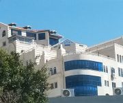
Ararat Hotel
Dome Hotel
Salam Hotel
Videos from this area
These are videos related to the place based on their proximity to this place.
Palestine - A Unique Tourism Destination
This video segment showcases Palestine as a tourism destination that offers selective programs with a wide range of tourism facilities to cater to the needs of all sort of travelers. Disclaimer:...
Boaz Marva - Awakened Thoughts
Hello everyone, I Decided to record some solo tracks, this is the first one. This is merely a try, but i hope you'll like it. Mixed and Mastered by Amit Sadras.
Documentary: Land Closure near Settlements
For years, Israeli authorities have both barred Palestinian access to rings of land surrounding settlements, and have not acted to eliminate settlers piratical blocking of Palestinian access...
البتراء / Petra
اهلاً و سهلاً بكم في البتراء المدينة الساحره Bienvenidos a Petra una ciudad fascinante Welcome to Petra a fascinating city عربي البتراء...
Videos provided by Youtube are under the copyright of their owners.
Attractions and noteworthy things
Distances are based on the centre of the city/town and sightseeing location. This list contains brief abstracts about monuments, holiday activities, national parcs, museums, organisations and more from the area as well as interesting facts about the region itself. Where available, you'll find the corresponding homepage. Otherwise the related wikipedia article.
Judaean Mountains
The Judaean Mountains,;, also Judaean Hills and Hebron Hills, is a mountain range in Israel and the West Bank where Jerusalem and several other biblical cities are located. The mountains reach a height of 1,000 m.
Tekoa, Gush Etzion
Tekoa is an Israeli Jewish communal settlement and Israeli settlement in the northern Judean hills in the West Bank. Tekoa is within the municipal jurisdiction of the Gush Etzion Regional Council. The international community considers Israeli settlements in the West Bank illegal under international law, but the Israeli government disputes this.
Ma'ale Amos
Ma'ale Amos is a Haredi community and Israeli settlement in the southern West Bank, established in 1982. It is named after the Biblical prophet Amos, who lived in the village of Tekoa nearby. It is a member of the Gush Etzion Regional Council. The international community considers Israeli settlements in the West Bank illegal under international law, but the Israeli government disputes this. It is home to around 45 families, with a population of about 350 in total.
Ibei HaNahal
Ibei HaNahal is a haredi Israeli settlement outpost within the Gush Etzion settlement block in the West Bank. Its residents established it as an ecovillage. The outpost is under the jurisdiction of the Gush Etzion Regional Council. The international community considers Israeli settlements in the West Bank illegal under international law, but the Israeli government disputes this.
Outline of Israel
Israel is a sovereign state located along the eastern edge of the Mediterranean Sea in Southwest Asia, an area known historically in the Western World as the Near East or Middle East. It borders Lebanon in the north, Syria in the northeast, Jordan in the east, and Egypt on the southwest, and contains geographically diverse features within its relatively small area.


