Safety Score: 3,3 of 5.0 based on data from 9 authorites. Meaning please reconsider your need to travel to Netherlands.
Travel warnings are updated daily. Source: Travel Warning Netherlands. Last Update: 2024-05-02 08:23:34
Discover Buitenhof
The district Buitenhof of Delft in Gemeente Delft (South Holland) is a district in Netherlands about 35 mi south-west of Amsterdam, the country's capital city.
Looking for a place to stay? we compiled a list of available hotels close to the map centre further down the page.
When in this area, you might want to pay a visit to some of the following locations: The Hague, Haarlem, Heemskerk, Amsterdam and Heiloo. To further explore this place, just scroll down and browse the available info.
Local weather forecast
Todays Local Weather Conditions & Forecast: 22°C / 71 °F
| Morning Temperature | 14°C / 57 °F |
| Evening Temperature | 15°C / 59 °F |
| Night Temperature | 13°C / 55 °F |
| Chance of rainfall | 7% |
| Air Humidity | 59% |
| Air Pressure | 999 hPa |
| Wind Speed | Gentle Breeze with 8 km/h (5 mph) from North-East |
| Cloud Conditions | Scattered clouds, covering 26% of sky |
| General Conditions | Moderate rain |
Friday, 3rd of May 2024
11°C (51 °F)
11°C (51 °F)
Light rain, fresh breeze, overcast clouds.
Saturday, 4th of May 2024
16°C (61 °F)
12°C (54 °F)
Broken clouds, light breeze.
Sunday, 5th of May 2024
18°C (65 °F)
15°C (58 °F)
Broken clouds, light breeze.
Hotels and Places to Stay
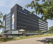
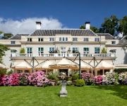
Savarin Hotel & Spa
WestCord Hotel Delft
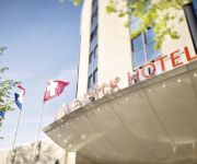
Moevenpick
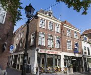
Best Western Museumhotels Delft
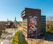
Royal Bridges
Central Park by Ron Blaauw
Novotel Rotterdam Schiedam
Hampshire Hotel Delft Centre
Shanghai Holland
The Hague Teleport Hotel
Videos from this area
These are videos related to the place based on their proximity to this place.
Cabinerit Rotterdam CS - Haarlem via Delft nieuwe spoortunnel
Cabinerit van Rotterdam Centraal via de nieuwe spoortunnel in Delft naar Den Haag Hollands Spoor, Leiden Centraal en (op verzoek) door naar Haarlem. Na vertrek uit Rotterdam Centraal stoppen...
Spoorzone Delft.mp4
Visualisatie van Spoorzone Delft. Voor meer info over het project zie: www.spoorzonedelft.nl.
Nieuwe Spoortunnel in Delft geopend / The brand new Train Station of Delft
Na jaren van bouwen was het vanmorgen eindelijk zo ver: de eerste officiële trein reed door de nieuwe Spoortunnel van Delft. Om 5.51 uur vertrok een Intercity dubbeldekker (VIRM 8703) met...
A Three Minutes Walk in Delft
Delft is a very nice city in the province of South Holland (Zuid-Holland), the Netherlands, very well-known for its typical blue pottery. I have just been there as a visitor at the Delft University...
Dutch Special Forces in Counter Terrorism mission at Legermuseum, Delft
Dutch Special Forces counter terrorism team execute CT operation in Delft, Holland. The mayor of the city of Delft is held hostage and liberated by Dutch commando's, near Legermuseum. They...
BMW Z4 2.5i top speed!
A wonderful exciting trip in my Z4. I had to brake full at the end from 250km/h to 70 km/h! 155 mph.
First spring ride Kawasaki ZX6R 1998 Acceleration
First drive after winter stop in the Netherlands, and this wasn't at full speed. Shot with a SJ4000 on a fat gecko mount. Don't listen to the crap sound :p.
Broken Leg and Ankle Checkup X-Ray and Thrombosis Echo
Broken Leg and Ankle Checkup X-Ray and Thrombosis Echo. Went to the hospital today, Reinier de Graaf, in Delft, to meet with Dr. van der Elst and the other doctors again. It has been over three...
Broken Leg Check Up - 7 Weeks after Operation X-Ray - Surgery Explained
Broken Leg Check Up - 7 Weeks after Operation X-Ray. Surgery explained by the doctor. Had a lot of questions for the good doctor about by broken leg Actually, more about the foot, ankle and...
Videos provided by Youtube are under the copyright of their owners.
Attractions and noteworthy things
Distances are based on the centre of the city/town and sightseeing location. This list contains brief abstracts about monuments, holiday activities, national parcs, museums, organisations and more from the area as well as interesting facts about the region itself. Where available, you'll find the corresponding homepage. Otherwise the related wikipedia article.
Square kilometre
Square kilometre, symbol km, is a decimal multiple of the SI unit of surface area, the square metre, one of the SI derived units. 1 km is equal to: 1,000,000 m 100 ha It is also approximately equal to: 0.3861 square miles 247.1 acres Conversely: 1 m = 0.000001 (10) km 1 hectare = 0.01 (10) km 1 square mile = 2.5899km 1 acre = about 0.004047km, 0.4047ha or 4047 m 2.47 acres/ha Note: "km" means (km), square kilometre or kilometre squared and not k(m), kilo–square metre.
Schipluiden
Schipluiden is a village in the western Netherlands, in the province of South Holland. It is the seat of the council of the municipality of Midden-Delfland. The village was founded relatively late in the 15th century and evolved around the Keenenburg castle, which no longer exists. The current Dutch Reformed church in the village centre belonged to the Catholic Teutonic Knights before 1572, when the Calvinists took over control of the church.
Frederick Henry, Prince of Orange
Frederick Henry, or Frederik Hendrik in Dutch (29 January 1584 – 14 March 1647), was the sovereign Prince of Orange and stadtholder of Holland, Zeeland, Utrecht, Guelders, and Overijssel from 1625 to 1647. As the leading soldier in the Dutch wars against Spain, his main achievement was The successful Siege of 's-Hertogenbosch in 1629, It was the main Spanish base and a well-fortified city protected by an experienced Spanish garrison and by formidable water defenses.
Swing bridge
For other uses, see Swing Bridge (disambiguation) 50x40pxThis article needs additional citations for verification. Please help improve this article by adding citations to reliable sources. Unsourced material may be challenged and removed. Swing bridge File:MovableBridge swing.
Menschen Vereeniging Wolbodo
The Mensenvereniging Wolbodo was founded in 1959 as the PSK (Parochiele Studenten Kring) by 17 students, who were catholic, but did not want to join the catholic student society) Virgiel. In 1960 the name was changed to Sanctus Wolbodo or in Dutch "Sint Wolbodo", referring both to the saint who supposedly is the patron saint of students and to its Catholic nature.
Sion, Netherlands
Sion is a hamlet in the Dutch municipality of Rijswijk. It is located on the border with Delft, and has a population of about 210. In 1345, the monastery Sancta Maria in Monte Sion was built in this area. It was demolished on the orders of the city of Delft in 1572, when Spanish troops approached the city, and was never rebuilt. In the 17th century, an estate was built on the grounds of the former monastery, and in the 19th century, it was divided into small parts and made into farms.
Eastern Gate (Delft)
The Eastern Gate (Oostpoort) in Delft, an example of Brick Gothic northern European architecture, was built around 1400. Around 1510 the towers were enhanced with an additional octagonal floor and high spires. This is the only city gate remaining in Delft; the others were demolished in the 19th century. It currently serves as an art gallery and private residence.
Nieuwe Kerk (Delft)
Nieuwe Kerk is a landmark Protestant church in Delft, Netherlands. The building is located on Delft Market Square (Markt), opposite to the City Hall . In 1584, William the Silent was entombed here in a mausoleum designed by Hendrick and Pieter de Keyser. Since then members of the House of Orange-Nassau have been entombed in the royal crypt. The latest are Queen Juliana and her husband Prince Bernhard in 2004. The private royal family crypt is not open to the public.
The Little Street
The Little Street (Het Straatje) is a painting by the Dutch painter Johannes Vermeer, executed c. 1657-1658. It is housed in the Rijksmuseum of Amsterdam, and signed left below the window with the writing "I V MEER". The exact location of the scene Vermeer painted is not known. However, recent study by the Delft professor F.H. Kreuger found the Voldersgracht as the location of Vermeer’s The Little Street. Nowadays, the Vermeer Centre Delft is located here .
Prinsenhof
The Prinsenhof ("The Court of the Prince") in Delft in the Netherlands is an urban palace built in the Middle Ages as a monastery. Later it served as a residence for William the Silent. The building still exists and now houses the municipal museum. William was murdered in the Prinsenhof in 1584; the holes in the wall made by the bullets at the main stairs are still visible. Today, the building displays a collection of Dutch Golden Age paintings.
UNESCO-IHE
The UNESCO-IHE Institute for Water Education is the largest international postgraduate water education facility in the world and is based in Delft, the Netherlands. The Institute confers fully accredited MSc degrees, and PhD degrees in collaboration with partners in the Netherlands. Since 1957 the Institute has provided postgraduate education to more than 14,500 water professionals from over 160 countries. UNESCO-IHE was created in 2003 from the previous IHE.
Oude Kerk (Delft)
The Oude Kerk (Old Church), nicknamed Oude Jan ("Old John"), is a Gothic Protestant church in the old city center of Delft, the Netherlands. Its most recognizable feature is a 75-meter-high brick tower that leans about two meters from the vertical.
Stedelijk Museum het Prinsenhof
Stedelijk Museum het Prinsenhof is a museum in Delft, in the province of South Holland (Zuid-Holland), the Netherlands. The museum building is a 15th century former monastery (St. Agathaklooster), that was used by Stadtholder William of Orange as his residence. It was also where William of Orange was murdered in 1584: bullet holes in the stone wall can still be seen today.
Delftsche Zwervers
The Studentenstam De Delftsche Zwervers (Dutch: Delft Rovers Student crew) is a student society in Delft, the Netherlands. Dating from 1915, it is the world's oldest student Scouting group, first as a club for former Scouts, from 1920 as a Rover crew. They are housed in the Scout Centre "Kruithuis", the monumental gunpowder ammunition dump of the Dutch Republic, designed in 1660 by Pieter Post.
Den Hoorn, South Holland
Den Hoorn is a village in the southwest of the Netherlands, near the town Delft. The population counts 6785 people. There are three primary schools in Den Hoorn. Every August they have the Varend Corso .
Tanthof
Tanthof is a quarter in the South of Delft, Netherlands. It was built between 1970 and 1980 and consists mainly of low-rise buildings. The area is divided in two parts, Tanthof-East and Tanthof-West.
Hodenpijl
Hodenpijl is a hamlet in the Dutch province of South Holland. It is located 3 km southwest of the centre of Delft, in the municipality of Midden-Delfland. Hodenpijl was a separate municipality between 1817 and 1855, when it merged with Schipluiden.
Hof van Delft
Hof van Delft ("Court of Delft") is a former municipality in the Dutch province of South Holland. It was located to the west of the city of Delft, and covered the villages of Den Hoorn, Abtswoude, and 't Woudt. The municipality existed from 1817 to 1921, when it became a part of Delft. Currently, the name "Hof van Delft" is used for a neighbourhood in the northwest of Delft, west of the railway track to The Hague.
Hoog en Woud Harnasch
Hoog en Woud Harnasch is a former municipality in the Dutch province of South Holland. It was located to the west of the city of Delft. The municipality existed between 1817 and 1833, when it became part of Hof van Delft.
Sint Maartensregt
Sint Maartensregt is a former municipality in the Dutch province of South Holland. It consisted of two former manors: "Sint Maartensregt" and "Dorp-Ambacht". Sint Maartensregt was a separate municipality between 1817 and 1855, when it became part of Schipluiden.
Bacinol
Bacinol is originally a codename for penicillin, used during World War II by researchers in The Netherlands, used to keep investigation secret for the Germans. The research was done at the company Nederlandsche Gist- en Spiritusfabriek in Delft. Since 2001 the name was used for a defunct building (from 1951) near the company plant, which housed small companies in the creative arts sector.
City Hall (Delft)
The City Hall in Delft is a Renaissance style building on the Markt across from the Nieuwe Kerk. It is the former seat of the city's government, and still today the place where residents hold their civic wedding ceremonies. Originally designed by the Dutch architect Hendrick de Keyser, it was heavily changed over the centuries and was restored in the 20th century to its Renaissance appearance.
Legermuseum
Not to be confused with the Koninklijk Legermuseum/Musée Royal de l'Armée in Brussels. The Koninklijk Nederlands Legermuseum (Royal Dutch Army Museum) is the national museum of the Dutch Army. It is currently based in the Armamentarium in Delft.
Le Chevalier (restaurant)
Le Chevalier is a former restaurant located in Delft, in the Netherlands. It was a fine dining restaurant that was awarded one Michelin star in the periods 1980-1989. Cees Helder, was head chef from 1980 to 1984.
Stadsleenbank Delft
The Stadsleenbank Delft is a former Bank van Lening on the Burgwal 45 in Delft, and serves today as a pop music podium for concerts. The gable stone is inscribed '1769 Den Ingangh van de Stadsleenbanck', whereby "Den Ingangh" means entrance. Delft first received rights for a city lombard or "lommerd" bank in 1287 from Floris V. In 1367 similar rights "as in Delft" were granted to Haarlem by Albert I, Duke of Bavaria.


