Safety Score: 3,3 of 5.0 based on data from 9 authorites. Meaning please reconsider your need to travel to Netherlands.
Travel warnings are updated daily. Source: Travel Warning Netherlands. Last Update: 2024-04-28 08:22:10
Explore Barendrechtse Veer
Barendrechtse Veer in Gemeente Barendrecht (South Holland) is located in Netherlands about 40 mi (or 65 km) south of Amsterdam, the country's capital.
Local time in Barendrechtse Veer is now 07:58 AM (Monday). The local timezone is named Europe / Amsterdam with an UTC offset of 2 hours. We know of 10 airports in the wider vicinity of Barendrechtse Veer, of which 5 are larger airports. The closest airport in Netherlands is Rotterdam Airport in a distance of 9 mi (or 15 km), North-West. Besides the airports, there are other travel options available (check left side).
There are several Unesco world heritage sites nearby. The closest heritage site in Netherlands is Mill Network at Kinderdijk-Elshout in a distance of 6 mi (or 10 km), North-East. We found 4 points of interest in the vicinity of this place. If you need a place to sleep, we compiled a list of available hotels close to the map centre further down the page.
Depending on your travel schedule, you might want to pay a visit to some of the following locations: The Hague, Haarlem, Utrecht, Amsterdam and Turnhout. To further explore this place, just scroll down and browse the available info.
Local weather forecast
Todays Local Weather Conditions & Forecast: 17°C / 62 °F
| Morning Temperature | 6°C / 44 °F |
| Evening Temperature | 17°C / 63 °F |
| Night Temperature | 12°C / 54 °F |
| Chance of rainfall | 0% |
| Air Humidity | 54% |
| Air Pressure | 1019 hPa |
| Wind Speed | Moderate breeze with 10 km/h (6 mph) from North |
| Cloud Conditions | Clear sky, covering 6% of sky |
| General Conditions | Sky is clear |
Tuesday, 30th of April 2024
18°C (64 °F)
15°C (59 °F)
Light rain, moderate breeze, overcast clouds.
Wednesday, 1st of May 2024
21°C (70 °F)
14°C (56 °F)
Light rain, gentle breeze, broken clouds.
Thursday, 2nd of May 2024
14°C (58 °F)
11°C (52 °F)
Light rain, moderate breeze, overcast clouds.
Hotels and Places to Stay
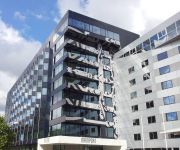
Mainport Hotel
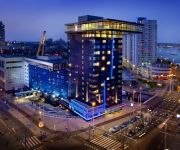
Inntel Hotels Rotterdam Centre
Quartier du Port
Van der Valk Hotel Ridderkerk
citizenM Rotterdam
Suitehotel Pincoffs
nhow Rotterdam
Hotel New York
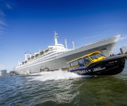
ss Rotterdam Hotel
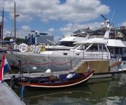
Maria Callas Yachthotel
Videos from this area
These are videos related to the place based on their proximity to this place.
25/03/15 Ambulance 17-165 met spoed naar melding in Ridderkerk
25/03/15 Ambulance 17-165 met spoed naar melding in Ridderkerk Bedankt voor het kijken! Volg ons ook op Twitter en Facebook! Twitter: @BdrechtNieuws Facebook: BarendrechtNieuws Website: ...
LED reclamezuil BUVA | DATA DISPLAY
BUVA is een producent en leverancier van bouwproducten, zoals hang- en sluitwerk, dorpels en ramen. Voor hun pand aan de snelweg A29 wilde men graag een echte eyecatcher realiseren. Met dat...
[JF] [HD] Knip Demonstratie - Open dag Brandweer Barendrecht (27-10-2012)
Een demonstratie van hoe de brandweer te werk gaat bij een ongeval met beknelling in een auto tijdens de open dag van de Brandweer Barendrecht.
[JF] [HD] Jeugdbrandweer Demonstratie - Open dag Brandweer Barendrecht (27-10-2012)
Een demonstratie van een voertuigbrand door de jeugdbrandweer van Barendrecht.
Stormschade IKEA Barendrecht
http://barendrechtnu.nl/incidenten/6748/stormschades-loshangend-reclamebord-ikea-en-omgewaaide-boom.
[JF] [HD] Verkeerssituatie eerste wekelijkse koopzondag IKEA Barendrecht (30-11-2014)
BarendrechtNU Artikel: http://barendrechtnu.nl/nieuws/barendrecht/6136/geen-sprake-van-verkeerschaos-bij-eerste-wekelijkse-koopzondag-ikea-barendrecht.
Herdenking Jack Dawson Green
Het monument voor Jack Dawson Green in Heinenoord (gemeente Binnenmaas) herinnert aan de Australische piloot Jack Dawson Green. Behalve dit monument is er ook een pad naar Green ...
Videos provided by Youtube are under the copyright of their owners.
Attractions and noteworthy things
Distances are based on the centre of the city/town and sightseeing location. This list contains brief abstracts about monuments, holiday activities, national parcs, museums, organisations and more from the area as well as interesting facts about the region itself. Where available, you'll find the corresponding homepage. Otherwise the related wikipedia article.
IJsselmonde (island)
IJsselmonde is a river island between the Nieuwe Maas, Noord and Oude Maas branches rivers of the Rhine-Meuse delta in the Dutch province of South Holland. The city of Rotterdam now occupies most of the northern part of the island and includes the eponymous former village of IJsselmonde, once a separate community. The island was once a rich agricultural region, but is mostly suburbs today. Only the mid-south parts of the island have retained their agricultural character.
Heerjansdam
Heerjansdam is a village in the western Netherlands, in the province of South Holland. It has a population of 3,590. It is a former municipality that merged with Zwijndrecht in 2003.
Oost-Barendrecht
Oost-Barendrecht is a former municipality in the Dutch province of South Holland. It covered the eastern part of the current municipality of Barendrecht. The municipality existed between 1817 and 1837, when it merged with West-Barendrecht to form the new municipality "Oost- en West-Barendrecht", now just called "Barendrecht".
West-Barendrecht
West-Barendrecht is a former municipality in the Dutch province of South Holland. It covered the western part of the current municipality of Barendrecht, including the village of Carnisse. The municipality existed between 1817 and 1837, when it merged with Oost-Barendrecht to form the new municipality "Oost- en West-Barendrecht", now just called "Barendrecht".
Sint Anthoniepolder
Sint Anthoniepolder is a small village in the Dutch province of South Holland. It is located about 14 km south of the city of Rotterdam, in the municipality of Binnenmaas. Sint Anthoniepolder was a separate municipality from 1817 to 1839, when it became part of Maasdam.
Blaaksedijk
Blaaksedijk is a small village on a dike in the Dutch province of South Holland. The village partially lies in the municipality of Binnenmaas. Blaaksedijk lies between Puttershoek, Mijnsheerenland and Heinenoord. At the nearby industrial area Boonsweg the "Nettorama" is located, one of the largest supermarkets of the Hoekse Waard, formerly known as the "Witte Boerderij" (White Farm).
Kuipersveer
Kuipersveer is a hamlet in the Dutch province of South Holland and is part of the municipality Binnenmaas. The village lies next to the Oude Maas between the villages of Puttershoek and Heinenoord.
Barendrecht train accident
In the Barendrecht train accident of 24 September 2009 near Barendrecht, Netherlands two freight trains collided head-on. One of the drivers was killed, the other was seriously injured. A passenger train narrowly avoided colliding with the freight trains by making an emergency stop; it was slightly damaged when it struck debris. One train with oil and gasoline caught fire, but this caused no injuries, as all the citizens living near the tracks were evacuated when the fire started.






!['[JF] [HD] Knip Demonstratie - Open dag Brandweer Barendrecht (27-10-2012)' preview picture of video '[JF] [HD] Knip Demonstratie - Open dag Brandweer Barendrecht (27-10-2012)'](https://img.youtube.com/vi/9kduRRqaczw/mqdefault.jpg)
!['[JF] [HD] Jeugdbrandweer Demonstratie - Open dag Brandweer Barendrecht (27-10-2012)' preview picture of video '[JF] [HD] Jeugdbrandweer Demonstratie - Open dag Brandweer Barendrecht (27-10-2012)'](https://img.youtube.com/vi/_2AO2J9ag28/mqdefault.jpg)


!['[JF] [HD] Verkeerssituatie eerste wekelijkse koopzondag IKEA Barendrecht (30-11-2014)' preview picture of video '[JF] [HD] Verkeerssituatie eerste wekelijkse koopzondag IKEA Barendrecht (30-11-2014)'](https://img.youtube.com/vi/4E_cy3cmdkA/mqdefault.jpg)


