Safety Score: 2,8 of 5.0 based on data from 9 authorites. Meaning we advice caution when travelling to Croatia.
Travel warnings are updated daily. Source: Travel Warning Croatia. Last Update: 2024-05-01 08:01:32
Touring Sušak
The district Sušak of in Grad Rijeka (Primorsko-Goranska Županija) is a subburb located in Croatia about 82 mi south-west of Zagreb, the country's capital place.
Need some hints on where to stay? We compiled a list of available hotels close to the map centre further down the page.
Being here already, you might want to pay a visit to some of the following locations: Rijeka, Cavle, Jelenje, Kostrena and Bakar. To further explore this place, just scroll down and browse the available info.
Local weather forecast
Todays Local Weather Conditions & Forecast: 14°C / 57 °F
| Morning Temperature | 14°C / 57 °F |
| Evening Temperature | 15°C / 58 °F |
| Night Temperature | 12°C / 53 °F |
| Chance of rainfall | 13% |
| Air Humidity | 91% |
| Air Pressure | 1009 hPa |
| Wind Speed | Gentle Breeze with 7 km/h (5 mph) from North-West |
| Cloud Conditions | Overcast clouds, covering 100% of sky |
| General Conditions | Moderate rain |
Friday, 3rd of May 2024
10°C (51 °F)
12°C (54 °F)
Moderate rain, light breeze, overcast clouds.
Saturday, 4th of May 2024
15°C (59 °F)
13°C (56 °F)
Light rain, light breeze, overcast clouds.
Sunday, 5th of May 2024
14°C (57 °F)
12°C (53 °F)
Light rain, light breeze, overcast clouds.
Hotels and Places to Stay
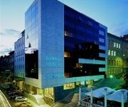
Grand Hotel Bonavia
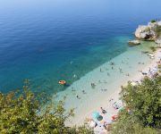
Jadran
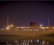
BOTEL MARINA
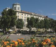
Continental
Neboder
Videos from this area
These are videos related to the place based on their proximity to this place.
2012 FIM Supermoto World Championship - Rijeka - (CRO)
2012 FIM Supermoto World Championship - Rijeka - (CRO)
2012 FIM Sidecar World Championship - Rijeka (CRO)
2012 FIM Sidecar World Championship - Rijeka (CRO)
rirock.net: Repetitor - Zli sin (24/1/2013 Live @ Klub Palach, Rijeka)
Repetitor - Zli sin http://repetitor.bandcamp.com Live @ Klub Palach 24.01.2013. Rijeka, Croatia http://www.facebook.com/klub.palach Video by: http://rirock.net.
Night ride in Rijeka, Croatia, time-lapse photography
New time-lapse photography project. The city of Rijeka in Croatia, night in the urban move. This is an urban exploration of my home city, the video is produced from 1800 photos from Pentax...
SR 500 - Grab The Flag 2011 - Rijeka - Training
Mit der SR500 auf Grab The Flag im Training in Rijeka.
Rijeka na starima razglednicama, Rijeka in old postcards.
Grad Rijeka na starima razglednicama, the city of Rijeka in old postcards. More about Rijeka http://martinmayhew.com.
Videos provided by Youtube are under the copyright of their owners.
Attractions and noteworthy things
Distances are based on the centre of the city/town and sightseeing location. This list contains brief abstracts about monuments, holiday activities, national parcs, museums, organisations and more from the area as well as interesting facts about the region itself. Where available, you'll find the corresponding homepage. Otherwise the related wikipedia article.
Novi list
Novi list (trans. "new paper") is the oldest Croatian daily newspaper published in Rijeka. It is most read in Primorje-Gorski Kotar County of Croatia, but it is distributed throughout the country. Novi list had the distinction of being the only Croatian daily newspaper to keep critical distance towards the government of Franjo Tuđman during 1990s. Today it is considered a centre-left newspaper.
Stadion Kantrida
Stadion Kantrida is a football stadium in the Croatian city of Rijeka. It is named after the Kantrida neighborhood in which it is located, in the western part of the city. It has served as home of the football club HNK Rijeka since 1946. The stadium has a distinctive appearance as it is situated between steep cliffs just north of the stadium and the shore of the Adriatic on its south side.
Free State of Fiume
The Free State of Fiume was an independent free state which existed between 1920 and 1924. Its territory of 28 km comprised the city of Fiume (now in Croatia and, since the end of World War II, known as Rijeka) and rural areas to its north, with a corridor to its west connecting it to Italy.
Sušak, Rijeka
Sušak is a part of the city of Rijeka in Croatia, where it composes the eastern part of the city. In 1924, Rijeka belonged to the independent Free State of Fiume, which had been created four years earlier under the Treaty of Rapallo, but in the Treaty of Rome the Kingdom of Serbs, Croats, and Slovenes and Italy agreed to dissolve the free state.
Trsat
Trsat is part of the city of Rijeka, Croatia. It has a historic castle or fortress in a strategic location and several historic churches. The Croatian noble Prince Vuk Krsto Frankopan is buried in one of the churches. Trsat is a steep hill, 138 m high, rising over the gorge of the Rječina river, about a kilometre away from the sea. It was strategically significant from the earliest times right up to the 17th century.
Rječina
Rječina is a river in Croatia that flows into the Adriatic Sea at the city of Rijeka (Fiume). It is about 19 km long, with an average width of 9–16 m. It springs from the cave at a height of 325 m above sea level, below the high cliff of Kičej hill (606 m above sea level). Until 1870 the river's spring was below the next hill, Podjavorje, but it collapsed in an earthquake near the village of Klana.
University of Rijeka
The University of Rijeka (Croatian: Sveučilište u Rijeci) is in the city of Rijeka with faculties in cities throughout the regions of Primorje, Istria and Lika. The University of Rijeka is composed of nine faculties, one art academy, four departments, university libraries and the Students Centre.
Kostrena
Kostrena is a Croatian municipality east of Rijeka on the Kvarner Bay. It is famous for its beaches and a long tradition of seafaring and seamanship. Because of its beautiful rocky beaches and a walkway that goes along the shoreline, it is very popular for recreation and sports. A scenic hill walk called Trim-staza is located on the northeast side of Kostrena. There have been some archeological excavations in Kostrena, discovering ruins from the Roman times.
Čavle
Čavle is a municipality in the Primorje-Gorski Kotar County in western Croatia. There are 6,749 inhabitants, with 86% Croats.
Jelenje
Jelenje is a municipality in the Primorje-Gorski Kotar County in western Croatia. There are 4,877 inhabitants, with 94.6% Croats.
Viškovo
Viškovo is a municipality in the Primorje-Gorski Kotar County in western Croatia. There are 8,907 inhabitants, with 85% Croats.
1995 Rijeka bombing
The 1995 Rijeka bombing occurred on 20 October 1995 in Rijeka, Croatia, when an Islamic terrorist organization attempted to destroy a police station by driving a car with a bomb into the wall of the building. Twenty-seven employees in the police station and two bystanders on the street were injured, although the only person killed was the attacker.
Stadion Rujevica
Rujevica Stadium is a stadium that was planned to be built in the city of Rijeka. This is the prototype stadium that would have replaced the old Kantrida Stadium. Planned Construction the planned construction of this stadium won't begin so soon.
Yugoslavian motorcycle Grand Prix
The Yugoslavian motorcycle Grand Prix is a motorcycling event that was part of the Grand Prix motorcycle racing season from 1970 to 1990,
Siege of Trsat
The Siege of Trsat was a battle fought over possession of the town of Trsat in Liburnia, near the Croatian–Frankish border. The battle was fought in the autumn of 799 between the defending forces of the Dalmatian Croatia under the leadership of Croatian duke Višeslav and the invading Frankish army of the Carolingian Empire led by Eric of Friuli. The battle was a Croatian victory, and the Frankish commander Eric was killed during the siege.
Trsat Castle
Trsat Castle is a castle in Trsat, Croatia. It is thought that the castle lies at the exact spot of an ancient Illyrian and Roman fortress. The Croatian noble Vuk Krsto Frankopan is buried in one of the churches. The Trsat castle was completely reconstructed and renovated in the 19th century when the mausoleum of the military commander Laval Nugent was built in its interior.
Rijeka Cathedral
The St. Vitus Cathedral (Croatian: Katedrala Svetog Vida) is a Roman Catholic cathedral in Rijeka, Croatia. The Church of St. Vitus was in Middle Ages a small and one-sided, romanesque church dedicated to the patron saint and protector of Rijeka. It had a semi-circular apse behind the altar, and covered porch. With the arrival of the Jesuits in Rijeka, the Cathedral as we see it today was founded in 1638. First, it became the Jesuits' church.
Automotodrom Grobnik
Automotodrom Grobnik is a motorsport race track located in Rijeka, Croatia. From 1978 to 1990, it hosted the Yugoslavian motorcycle Grand Prix of MotoGP.
Soboli
Soboli is a village in Croatia. It is connected by the D3 highway.
Podhum, Croatia
Podhum is a village in Croatia. It is connected by the D52 highway.
Škrljevo
Škrljevo is a village in Croatia.
Orehovica interchange
The Orehovica interchange is a trumpet interchange in Rijeka, Croatia. The interchange represents the southern terminus of the A6 motorway and it connects the A6 route to the A7 motorway between Škurinje and Draga exits, also representing a part of Rijeka bypass. The interchange is a part of Pan-European corridor Vb. It also represents a junction of European routes E61 and E65.
Dvorana Mladosti
Dvorana Mladosti (English: Youth Hall) is a sports hall in Rijeka, with sporting, cultural, business and entertainment events. The hall was built in Trsat in 1973. The size of the hall is 5,458 m², and the surface of outer space is 10,486 m².
Port of Rijeka
The Port of Rijeka is a seaport in Rijeka, Croatia, located on the shore of the Kvarner Gulf in the Adriatic Sea. The first records of the port date to 1281. It was the main port of the Kingdom of Hungary in the 19th century and the beginning of the 20th century, of Yugoslavia between World War II and 1991, and of Croatia after its independence.
Northern Croatian Littoral
Northern Croatian Littoral (Croatian: Sjeverno hrvatsko primorje) is a geographical macroregion of Croatia, comprising area between Dalmatia to its south, Mountainous Croatia to the northeast and east, Slovenia to its north and the Adriatic Sea to the west and southwest. The region encompasses entire Istria County and a large part of the Primorje-Gorski Kotar County, as well as a coastal part of the Lika-Senj County.


