Safety Score: 3,0 of 5.0 based on data from 9 authorites. Meaning we advice caution when travelling to Austria.
Travel warnings are updated daily. Source: Travel Warning Austria. Last Update: 2024-05-02 08:23:34
Explore Weinebene
Weinebene in Politischer Bezirk Wolfsberg (Kärnten) is located in Austria about 114 mi (or 183 km) south-west of Vienna, the country's capital.
Local time in Weinebene is now 03:46 AM (Friday). The local timezone is named Europe / Vienna with an UTC offset of 2 hours. We know of 10 airports in the wider vicinity of Weinebene, of which 4 are larger airports. The closest airport in Austria is Graz Airport in a distance of 23 mi (or 36 km), North-East. Besides the airports, there are other travel options available (check left side).
There are several Unesco world heritage sites nearby. The closest heritage site in Austria is City of Graz – Historic Centre and Schloss Eggenberg in a distance of 24 mi (or 39 km), North-East. If you need a place to sleep, we compiled a list of available hotels close to the map centre further down the page.
Depending on your travel schedule, you might want to pay a visit to some of the following locations: Osterwitz, Kloster, Gressenberg, Modriach and Freiland bei Deutschlandsberg. To further explore this place, just scroll down and browse the available info.
Local weather forecast
Todays Local Weather Conditions & Forecast: 11°C / 51 °F
| Morning Temperature | 10°C / 50 °F |
| Evening Temperature | 8°C / 47 °F |
| Night Temperature | 8°C / 47 °F |
| Chance of rainfall | 23% |
| Air Humidity | 96% |
| Air Pressure | 1011 hPa |
| Wind Speed | Light breeze with 5 km/h (3 mph) from South-East |
| Cloud Conditions | Overcast clouds, covering 100% of sky |
| General Conditions | Heavy intensity rain |
Saturday, 4th of May 2024
12°C (54 °F)
9°C (49 °F)
Moderate rain, light breeze, overcast clouds.
Sunday, 5th of May 2024
18°C (64 °F)
11°C (52 °F)
Light rain, light breeze, overcast clouds.
Monday, 6th of May 2024
17°C (63 °F)
11°C (51 °F)
Light rain, light breeze, broken clouds.
Hotels and Places to Stay
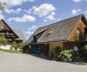
Bauernhof Schoberhof
Videos from this area
These are videos related to the place based on their proximity to this place.
should i loose or gain wieght??????????
ok so lately iv been stuffing my face with un healthy foods so i wanna know should i loose or gain weight.
schwammerlzeit
suche nach pilzen, wald und wiesen, steiermark, hilfe-die städter kommen - http://www.peter-gnad.de.
Ruperti-Kirta in Modriach 2014
Vom 20 bis 21 September fand zum 182 Mal der Kirtag im schönen Bergdorf Modriach statt. Hier ein paar Eindrücke. - TOC Traktor und Oldimer Club - Ponyreiten - Holzschnitzen mit der Motorsäge...
Apfelblüten Open Air 2012 in St. Georgen i. Lavanttal
http://www.lovntol.at/videos/video.html?tv=apfelblueten-openair-st-georgen-2012 Am 19. Mai 2012 fand wieder das Apfelblüten Open Air in St. Georgen i. Lavanttal statt. Mit dabei waren diesmal:...
Videos provided by Youtube are under the copyright of their owners.
Attractions and noteworthy things
Distances are based on the centre of the city/town and sightseeing location. This list contains brief abstracts about monuments, holiday activities, national parcs, museums, organisations and more from the area as well as interesting facts about the region itself. Where available, you'll find the corresponding homepage. Otherwise the related wikipedia article.
Koralpe
The Koralpe, also referred to as Koralm, is a mountain range in southern Austria which separates eastern Carinthia from southern Styria. Running from north to south, it drains to the river Lavant in the west, and to the river Sulm in the east. Its highest elevation (2,140 meters) is the Große Speikkogel, a popular hiking destination and also a node for military radar airspace surveillance. In the south, towards the Slovenian border, it is contiguous with the Poßruck mountain range.


