Safety Score: 2,7 of 5.0 based on data from 9 authorites. Meaning we advice caution when travelling to United States.
Travel warnings are updated daily. Source: Travel Warning United States. Last Update: 2024-05-20 08:01:38
Touring Perryville
Perryville in Washington County (Rhode Island) is a town located in United States about 337 mi (or 542 km) north-east of Washington DC, the country's capital place.
Time in Perryville is now 09:03 AM (Monday). The local timezone is named America / New York with an UTC offset of -4 hours. We know of 12 airports nearby Perryville, of which 5 are larger airports. The closest airport in United States is Theodore Francis Green State Airport in a distance of 24 mi (or 39 km), North. Besides the airports, there are other travel options available (check left side).
Also, if you like the game of golf, there are several options within driving distance. We collected 4 points of interest near this location. Need some hints on where to stay? We compiled a list of available hotels close to the map centre further down the page.
Being here already, you might want to pay a visit to some of the following locations: Cranston, Johnston, Providence, North Providence and Taunton. To further explore this place, just scroll down and browse the available info.
Local weather forecast
Todays Local Weather Conditions & Forecast: 16°C / 61 °F
| Morning Temperature | 11°C / 52 °F |
| Evening Temperature | 15°C / 60 °F |
| Night Temperature | 11°C / 52 °F |
| Chance of rainfall | 0% |
| Air Humidity | 76% |
| Air Pressure | 1018 hPa |
| Wind Speed | Gentle Breeze with 8 km/h (5 mph) from South-West |
| Cloud Conditions | Overcast clouds, covering 99% of sky |
| General Conditions | Overcast clouds |
Monday, 20th of May 2024
19°C (67 °F)
13°C (55 °F)
Overcast clouds, moderate breeze.
Tuesday, 21st of May 2024
21°C (70 °F)
14°C (57 °F)
Broken clouds, moderate breeze.
Wednesday, 22nd of May 2024
20°C (69 °F)
13°C (56 °F)
Light rain, moderate breeze, broken clouds.
Hotels and Places to Stay
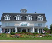
The Break
Lighthouse Inn of Galilee
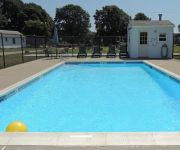
Phil & Anns Sunset Motel
Videos from this area
These are videos related to the place based on their proximity to this place.
Street Stories: Sharing grief amid fun and activity
A Wakefield summer mini-camp is giving local kids the chance to share memories and get through the grief together.
MAKO II - Rhode Island Striped Bass & Sportfishing Charters - Striper Fishing!
The Rhode Island charter boat Mako II sails from Galilee, RI. The 43′ Mako II is built for sportfishing and comfort. Learn more at: http://www.makoII.com.
Part-3... Swimmer in Trouble, Hurricane Bill_Matunuck Beach RI_08-23-2009_DSCN0886
Part-3... As seen from The Ocean Mist, some really big dude having trouble in the surf. The several people around him had just pulled him from the ocean... all one day after Hurricane Bill...
Dressed Up to Get Messed Up: Roomful of Blues
Live album recording, March 16, 2013 at the Ocean Mist, South Kingstown, RI.
MVI_6641.MOV_With Tom - Papa's First Ride in a Big Rig, Part-2
2008 Kenworth, Werner Enterprises, Family Dollar Stores, New England Tractor Trailer Training School, NETTTS.
Surfing Matunuck, Rhode Island, Nose Ride
Surfing at Matunuck on May 19th 2012 Nice video, Nice nose ride. Nice view of Block Island in the background.
Receding beaches reveal old ship
An old wooden ship that has been buried for decades is being unburied as a side effect of beach erosion.
Videos provided by Youtube are under the copyright of their owners.
Attractions and noteworthy things
Distances are based on the centre of the city/town and sightseeing location. This list contains brief abstracts about monuments, holiday activities, national parcs, museums, organisations and more from the area as well as interesting facts about the region itself. Where available, you'll find the corresponding homepage. Otherwise the related wikipedia article.
Pawcatuck River
The Pawcatuck River is a river in the U.S. states of Rhode Island and Connecticut flowing approximately 34 miles . There are eight dams along the river's length. The former USS Pawcatuck (AO-108) was named after the river.
Matunuck, Rhode Island
Matunuck is a village in South Kingstown, Rhode Island, United States near Charlestown, Rhode Island. The village is located on a point along the southern Atlantic coast of Rhode Island off of U.S. Route 1. The village takes its name from a Native American word meaning "look out. " The Narragansett tribe made a summer encampment at this location before the land was sold to colonists as part of the Pettaquamscutt purchase.
North Cape oil spill
The North Cape Oil Spill occurred on January 19, 1996 when the tank barge North Cape and the tug Scandia grounded on Moonstone Beach {{#invoke:Coordinates|coord}}{{#coordinates:41.369712|N|71.578100|W||||| | |name= }} in South Kingstown, Rhode Island after the tug caught fire in its engine room during a winter storm. An estimated 828,000 gallons of home heating oil was spilled.
Potter Pond
Potter Pond (formerly Fish Pond) is a saltwater pond in the town of South Kingstown, Washington County, Rhode Island, United States. Its tidal inlet connects to Point Judith Pond. It is one of nine coastal lagoons, referred to as "salt ponds" by locals, in southern Rhode Island.
Trustom Pond
Trustom Pond is a closed lagoon in South Kingstown, Washington County, Rhode Island, United States. It is one of nine coastal lagoons (referred to as "salt ponds" by locals) in southern Rhode Island. It has a surface area of 800 acres, and is the only undeveloped salt pond in the state. The pond averages 1.3 feet deep, and has a salinity level of 5 parts per thousand. It is non-tidal, except when breached by storms.
Cards Pond
Cards Pond, or Card Pond, is a coastal lagoon in South Kingstown, Washington County, Rhode Island, United States. It is one of nine such lagoons (often referred to as "salt ponds") in southern Rhode Island. According to the Rhode Island Sea Grant program, "[i i]ts breachway is only intermittently open to the sea", and it receives large quantities of freshwater from Moonstone Stream; only two other salt ponds, Point Judith and Greenhill, have significant streams flowing into them.


