Safety Score: 2,7 of 5.0 based on data from 9 authorites. Meaning we advice caution when travelling to United States.
Travel warnings are updated daily. Source: Travel Warning United States. Last Update: 2024-05-23 08:16:57
Delve into Galilee
Galilee in Washington County (Rhode Island) is a city located in United States about 338 mi (or 545 km) north-east of Washington DC, the country's capital town.
Current time in Galilee is now 07:37 AM (Thursday). The local timezone is named America / New York with an UTC offset of -4 hours. We know of 12 airports closer to Galilee, of which 5 are larger airports. The closest airport in United States is Theodore Francis Green State Airport in a distance of 25 mi (or 40 km), North. Besides the airports, there are other travel options available (check left side).
Also, if you like playing golf, there are some options within driving distance. We saw 4 points of interest near this location. In need of a room? We compiled a list of available hotels close to the map centre further down the page.
Since you are here already, you might want to pay a visit to some of the following locations: Cranston, Johnston, Providence, North Providence and Taunton. To further explore this place, just scroll down and browse the available info.
Local weather forecast
Todays Local Weather Conditions & Forecast: 23°C / 73 °F
| Morning Temperature | 15°C / 59 °F |
| Evening Temperature | 18°C / 64 °F |
| Night Temperature | 17°C / 62 °F |
| Chance of rainfall | 2% |
| Air Humidity | 71% |
| Air Pressure | 1012 hPa |
| Wind Speed | Gentle Breeze with 9 km/h (5 mph) from North |
| Cloud Conditions | Overcast clouds, covering 100% of sky |
| General Conditions | Moderate rain |
Thursday, 23rd of May 2024
23°C (73 °F)
15°C (58 °F)
Moderate rain, gentle breeze, broken clouds.
Friday, 24th of May 2024
20°C (69 °F)
14°C (57 °F)
Overcast clouds, gentle breeze.
Saturday, 25th of May 2024
20°C (68 °F)
14°C (58 °F)
Scattered clouds, gentle breeze.
Hotels and Places to Stay
The Break
Ocean Rose Inn
Hampton Inn South Kingstown - Newport Area
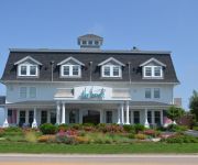
Lighthouse Inn of Galilee
VILLAGE INN HOTEL CONF CENTER
ATLANTIC HOUSE
Videos from this area
These are videos related to the place based on their proximity to this place.
MapCoast Bottom of Point Judith Pond, RI - 5
Video showing the bottom of Point Judith Pond in Rhode Island (east of Snug Harbor). Part of data being collected by the Mapping Partnership for Coastal Soil and Sediment (www.mapcoast.org)....
Striped Bass Fishing Hot Spot Short Wall Galilee Narragansett RI Excellent Striper Fishing Location
Striped Bass Fishing Hot Spot Short Wall Galilee Narragansett RI Short Wall Galilee is an excellent striped bass fishing location The Short Wall is sheltered but highly productive jetty that...
Parking garage planned for Galilee
The DEM is accepting bids for the construction of a new parking garage in Galilee.
Rich Fuka - www.Over50andOutofWork.com
www.Over50andOutofWork.com AGE: 50 - 54 LOCATION: Port of Galilee, Rhode Island INDUSTRY: Self-employed and unpaid family workers JOB: Lobsterman and Boat builder UNEMPLOYED ...
Hurricane Sandy, Rhode Island - Day 2
Here is a video I shot of the southern Rhode Island coast getting pounded by huge surf an storm surge as Hurricane Sandy moves in. Sorry about the blur, but my lens was totally hammered at...
Cruising to a different fishing spot.
Summer of 2012 Striper fishing , coming back from the mouth of Narrow River.
C-Devil II Sportfishing Season 2013 Highlights
Highlights from our 2013 fishing season aboard the C-Devil II sailing from Pt. Judith Rhode Island.
High Tide in Champlin's Cove Narragansett Salt Pond after Hurricane Sandy
High Tide in Champlin's Cove Narragansett Salt Pond after Hurricane Sandy.
Videos provided by Youtube are under the copyright of their owners.
Attractions and noteworthy things
Distances are based on the centre of the city/town and sightseeing location. This list contains brief abstracts about monuments, holiday activities, national parcs, museums, organisations and more from the area as well as interesting facts about the region itself. Where available, you'll find the corresponding homepage. Otherwise the related wikipedia article.
Point Judith, Rhode Island
Point Judith is a village and a small cape, on the coast of Narragansett, Rhode Island, on the western side of Narragansett Bay where it opens out onto Rhode Island Sound. It is the location for the principal year-round ferry service that connects Block Island to the mainland and contains the fishing hamlet of Galilee, Rhode Island.
Point Judith Pond
Point Judith Pond is a shallow, four-mile (6 km)-long salt body of water lying behind the barrier beaches and sand dunes that form Point Judith Harbor, which lies immediately west of Point Judith in Narragansett, Rhode Island at the southwestern tip of Narragansett Bay.
Matunuck, Rhode Island
Matunuck is a village in South Kingstown, Rhode Island, United States near Charlestown, Rhode Island. The village is located on a point along the southern Atlantic coast of Rhode Island off of U.S. Route 1. The village takes its name from a Native American word meaning "look out. " The Narragansett tribe made a summer encampment at this location before the land was sold to colonists as part of the Pettaquamscutt purchase.
Potter Pond
Potter Pond (formerly Fish Pond) is a saltwater pond in the town of South Kingstown, Washington County, Rhode Island, United States. Its tidal inlet connects to Point Judith Pond. It is one of nine coastal lagoons, referred to as "salt ponds" by locals, in southern Rhode Island.
Galilee, Rhode Island
Galilee is a fishing village within the town of Narragansett, Rhode Island on Point Judith. It is across the harbor from Jerusalem, Rhode Island. The village is named after the fishing village of Galilee, the hometown of Jesus according to the Bible.


