Safety Score: 2,7 of 5.0 based on data from 9 authorites. Meaning we advice caution when travelling to United States.
Travel warnings are updated daily. Source: Travel Warning United States. Last Update: 2024-05-04 08:22:41
Delve into Jamestown
Jamestown in Newport County (Rhode Island) with it's 5,755 habitants is located in United States about 349 mi (or 562 km) north-east of Washington DC, the country's capital town.
Current time in Jamestown is now 06:46 AM (Saturday). The local timezone is named America / New York with an UTC offset of -4 hours. We know of 12 airports close to Jamestown, of which 5 are larger airports. The closest airport in United States is Theodore Francis Green State Airport in a distance of 17 mi (or 27 km), North. Besides the airports, there are other travel options available (check left side).
Also, if you like playing golf, there are some options within driving distance. We encountered 4 points of interest near this location. If you need a hotel, we compiled a list of available hotels close to the map centre further down the page.
While being here, you might want to pay a visit to some of the following locations: Cranston, Providence, Johnston, North Providence and Taunton. To further explore this place, just scroll down and browse the available info.
Local weather forecast
Todays Local Weather Conditions & Forecast: 14°C / 58 °F
| Morning Temperature | 6°C / 43 °F |
| Evening Temperature | 12°C / 54 °F |
| Night Temperature | 8°C / 46 °F |
| Chance of rainfall | 0% |
| Air Humidity | 62% |
| Air Pressure | 1027 hPa |
| Wind Speed | Gentle Breeze with 8 km/h (5 mph) from West |
| Cloud Conditions | Overcast clouds, covering 100% of sky |
| General Conditions | Overcast clouds |
Saturday, 4th of May 2024
11°C (51 °F)
10°C (50 °F)
Moderate rain, gentle breeze, overcast clouds.
Sunday, 5th of May 2024
16°C (60 °F)
13°C (56 °F)
Moderate rain, gentle breeze, overcast clouds.
Monday, 6th of May 2024
20°C (69 °F)
12°C (53 °F)
Scattered clouds, gentle breeze.
Hotels and Places to Stay
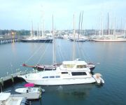
Ocean Romance Dockside B and B Yacht Hotel
Grace Vanderbilt
Newport Marriott
Almondy Inn
OceanCliff Hotel & Resort
Admiral Farragut Inn
Elm Street Inn
NEWPORT HARBOR HOTEL AND MARINA
Pelham Court Hotel
JAILHOUSE INN
Videos from this area
These are videos related to the place based on their proximity to this place.
Driving Over the Claiborne Pell Newport Bridge to Newport, RI
Driving Over the Claiborne Pell Newport Bridge to Newport, RI.
Newport Harbor Cruise
Take a trip around the historic harbor on a restored lobster boat in this edition of Daytrippers.
rustler 24 in Newport
evening sail in a Rustler 24 daysailer. Call Scandinavian Yachts Inc 401 846 8404 for more details.
Commercial Fishing near Newport R.I. aboard F/V Five J's
F/V Five J's Commercial Fishing for Skate near Newport Rhode Island. Skate is used for bait By New England Lobster Boats. The Five J's makes 3 tows for fish then heads home. It shows how...
Driving onto Goat Island, RI to the Hyatt Regency Newport
Driving onto Goat Island, RI to the Hyatt Regency Newport in Narragansett Bay of Newport, Rhode Island.
Newport RFC vs Old Gold RFC - 28 March 2015
Newport RFC (Home) vs Old Gold RFC (Away) Final Score: Newport 30, Old Gold 0.
Najad 570 sailing off Newport RI
A powerful Najad 570 leaves Narragansett Bay, and sails out past Hammersmith Farm, and Castle Hill, and then reaches back into the bay.
Riding across the old Jamestown bridge 1.mpeg
Riding across the old Jamestown, RI bridge, eastbound in 1985, westbound in 1988, and its destruction in 2006.
Why We Belong, Jamestown RI Fire Department 1891-2005
Why We Belong, Jamestown RI Fire Department 1891-2005 Pictorial History of the Jamestown RI Fire Department and it's members.
Fort Weatherill, Jamestown RI
Footage from DJI Phantom 2 Vision Plus, recorded at Fort Weatherill State Park, Jamestown Rhode Island on September 27, 2014.
Videos provided by Youtube are under the copyright of their owners.
Attractions and noteworthy things
Distances are based on the centre of the city/town and sightseeing location. This list contains brief abstracts about monuments, holiday activities, national parcs, museums, organisations and more from the area as well as interesting facts about the region itself. Where available, you'll find the corresponding homepage. Otherwise the related wikipedia article.
Conanicut Island
Conanicut Island is the second largest island in Narragansett Bay, in the US state of Rhode Island. It is connected on the east to Newport, Rhode Island, on Aquidneck Island by the Claiborne Pell Bridge, commonly known as the Newport Bridge, and on the west to North Kingstown, Rhode Island, on the mainland by the Jamestown-Verrazano Bridge. The island comprises the town of Jamestown, Rhode Island, Newport County, Rhode Island.
Newport Jazz Festival
The Newport Jazz Festival is a music festival held every summer in Newport, Rhode Island, USA. It was established in 1954 by socialite Elaine Lorillard, who, together with husband Louis Lorillard, financed the festival for many years. The couple hired jazz impresario George Wein to organize the event to help them bring jazz to the resort town. Most of the early festivals were broadcast on Voice Of America radio and many performances were recorded and have been issued by various record labels.
Claiborne Pell Newport Bridge
The Claiborne Pell Bridge, commonly known as the Newport Bridge, is a suspension bridge operated by the Rhode Island Turnpike and Bridge Authority that spans the East Passage of the Narragansett Bay in Rhode Island. The bridge, part of RI 138, connects the City of Newport on Aquidneck Island and the Town of Jamestown on Conanicut Island, which in turn is connected to the mainland by the Jamestown Verrazzano Bridge.
Dutch Island (Rhode Island)
Dutch Island is an island lying west of Conanicut Island at an entrance to Narragansett Bay in Rhode Island, USA. The island is a part of the town of Jamestown, Rhode Island, and has a land area of 0.4156 km². It was uninhabited as of the 2000 census.
Watson Farm
Watson Farm in Jamestown, Rhode Island, USA, was established in 1789. Job Watson purchased a piece of the farmland, and for the next two centuries, five successive generations of the Watson family cultivated the land, changing their crops and practices as needed to adapt to the evolving market. Today, the property is still a working family farm, and the 1796 house is still used as the farmers' residence.
Rose Island (Rhode Island)
Rose Island is an 18.5-acre island in Narragansett Bay off Newport, Rhode Island, United States. The name of the island is allegedly named "Rose Island" because at low tide the island appears to be shaped like a rose. The Island is only accessible by boat. The island and its lighthouse are run by the private, non-profit Rose Island Lighthouse Foundation.
Windmill Hill Historic District
Windmill Hill Historic District is a historic district at Eldred Avenue and North Main Road in Jamestown, Rhode Island. The area contains several Colonial American buildings including the Old Jamestown Windmill which operated from 1787 until 1896 on Windmill Hill. There is also an active Quaker Meetinghouse built in 1787. The district was added to the National Register in 1978. \t\t \t\t\tJamestown Rhode Island Friends Meeting House 2.
Clingstone
Clingstone is a house built in 1905, perched atop a small, rocky island in an island group called "The Dumplings" in Narragansett Bay, near Jamestown, Rhode Island.


