Safety Score: 3,3 of 5.0 based on data from 9 authorites. Meaning please reconsider your need to travel to Netherlands.
Travel warnings are updated daily. Source: Travel Warning Netherlands. Last Update: 2024-05-05 08:24:42
Discover De Hoek
The district De Hoek of Hoofddorp in Gemeente Haarlemmermeer (Provincie Noord-Holland) is a subburb in Netherlands a little south-west of Amsterdam, the country's capital city.
If you need a hotel, we compiled a list of available hotels close to the map centre further down the page.
While being here, you might want to pay a visit to some of the following locations: Haarlem, Amsterdam, Heemskerk, Heiloo and Utrecht. To further explore this place, just scroll down and browse the available info.
Local weather forecast
Todays Local Weather Conditions & Forecast: 14°C / 57 °F
| Morning Temperature | 10°C / 50 °F |
| Evening Temperature | 14°C / 57 °F |
| Night Temperature | 11°C / 51 °F |
| Chance of rainfall | 5% |
| Air Humidity | 69% |
| Air Pressure | 1010 hPa |
| Wind Speed | Gentle Breeze with 7 km/h (4 mph) from East |
| Cloud Conditions | Broken clouds, covering 75% of sky |
| General Conditions | Moderate rain |
Monday, 6th of May 2024
16°C (62 °F)
12°C (54 °F)
Overcast clouds, gentle breeze.
Tuesday, 7th of May 2024
15°C (60 °F)
11°C (52 °F)
Broken clouds, gentle breeze.
Wednesday, 8th of May 2024
16°C (60 °F)
11°C (52 °F)
Light rain, gentle breeze, broken clouds.
Hotels and Places to Stay
Hyatt Place Amsterdam Airport
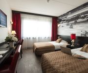
Bastion Hotel Amsterdam Airport
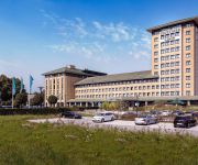
Park Plaza Amsterdam Airport
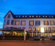
Chariot
Ramada Amsterdam Airport Schiphol
Courtyard Amsterdam Airport
Van der Valk Hotel Schiphol A4
Sheraton Amsterdam Airport Hotel and Conference Center
citizenM Schiphol Airport
Hilton Amsterdam Airport Schiphol
Videos from this area
These are videos related to the place based on their proximity to this place.
[cabinerit] A train driver's view: Hoofddorp - Utrecht CS, 27-Apr-2014.
This is a train cabin ride from Hoofddorp to Utrecht CS. See what the train drivers sees and experience the railroad tracks in a whole new way. The movie is unedited, that is to say, you see...
Grote brand in kantoorgebouw Crocs aan de Planetenbaan in Hoofddorp
Video: Mizzle Media © 2015 http://www.mizzlemedia.nl Hoofddorp – In een kantoorpand aan de Planetenbaan in Hoofddorp is donderdagochtend een grote brand uitgebroken. Het vuur werd rond...
[cabinerit] A train driver's view: Almere Centrum - Hoofddorp, 27-Apr-2014.
This is a train cabin ride from Almere Centrum to Hoofddorp . See what the train drivers sees and experience the railroad tracks in a whole new way. The movie is unedited, that is to say, you...
Kermis Hoofddorp 2012
De kermis in Hoofddorp vindt plaats van vrijdag 16 maart t/m zondag 25 maart 2012. Op zoek naar meer kermisinformatie of benieuwd wanneer er kermis bij jou in de buurt is? Kijk dan op ...
[cabinerit] A train driver's view: Hoofddorp - Almere Oostvaarders, SLT, 15-Sep-2014.
This is a train cabin ride from Hoofddorp to Almere Oostvaarders in a SLT. See what the train drivers sees and experience the railroad tracks in a whole new way. The movie is unedited, that...
[cabinerit] A train driver's view: Hoofddorp Midden - Hoorn Kersenboogerd, SLT, 03-Feb-2015.
This is a train cabin ride from Hoofddorp Midden to Hoorn Kersenboogerd in a SLT. See what the train drivers sees and experience the railroad tracks in a whole new way. The movie is unedited,...
[cabinerit] A train driver's view: Hoofddorp - Hoorn, SLT, 09-Jun-2014.
This is a train cabin ride from Hoofddorp to Hoorn in a SLT. See what the train drivers sees and experience the railroad tracks in a whole new way. The movie is unedited, that is to say, you...
[cabinerit] A train driver's view: Hoofddorp - Almere Oostvaarders, 27-Apr-2014.
This is a train cabin ride from Hoofddorp to Almere Centrum. See what the train drivers sees and experience the railroad tracks in a whole new way. The movie is unedited, that is to say, you...
[cabinerit] A train driver's view: Hoofddorp Midden - Hoorn, SLT, 07-Mar-2015.
This is a train cabin ride from Hoofddorp Midden to Hoorn in a SLT. See what the train drivers sees and experience the railroad tracks in a whole new way. The movie is unedited, that is to...
Hoofddorp-Centraal | deel 2 Resultaten
De gemeente Haarlemmermeer is de initiatiefnemer van het open plan proces 'Hoofddorp-Centraal' Vanaf najaar 2014 wordt door betrokken partijen samengewerkt aan het vormgeven van een ...
Videos provided by Youtube are under the copyright of their owners.
Attractions and noteworthy things
Distances are based on the centre of the city/town and sightseeing location. This list contains brief abstracts about monuments, holiday activities, national parcs, museums, organisations and more from the area as well as interesting facts about the region itself. Where available, you'll find the corresponding homepage. Otherwise the related wikipedia article.
Holland
Holland Holland is a region in the western part of the Netherlands. The term Holland is also frequently used as a pars pro toto to refer to the whole of the Netherlands. This usage is generally accepted but disliked by part of the Dutch population, especially in the other parts of the Netherlands. From the 10th to the 16th century, Holland proper was a unified political region within the Holy Roman Empire, a county ruled by the Counts of Holland.
Amsterdam Airport Schiphol
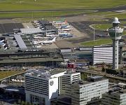
Amsterdam Airport Schiphol is the Netherlands' main international airport, located 20 minutes southwest of Amsterdam, in the municipality of Haarlemmermeer. The airport's official English name, Amsterdam Airport Schiphol, reflects the original Dutch word order (Luchthaven Schiphol). The airport used to have the IATA code of SPL, which has fallen into disuse and has been replaced by AMS.
Nieuw-Vennep
Nieuw-Vennep is a town in the Dutch province of North Holland. It is a part of the municipality of Haarlemmermeer, and lies about 10 km southwest of Amsterdam Airport Schiphol. In 2006 it had about 30,000 inhabitants. The built-up area of the town was 3.71 km, and contained 7,513 residences. The wider statistical area of Nieuw-Vennep has a population of around 40,000. In 2001, the town of Nieuw-Vennep had 17,886 inhabitants.
Burgerveen
Burgerveen is a hamlet in the Dutch province of North Holland. It is a part of the municipality of Haarlemmermeer, and lies about 7 km south of Hoofddorp. In 2001, the hamlet of Burgerveen had 215 inhabitants. The built-up area of the town was 0.06 km², and contained 90 residences. The wider statistical area of Burgerveen has a population of around 300.
Boesingheliede
Boesingheliede is a hamlet in the Dutch province of North Holland. It is a part of the municipality of Haarlemmermeer, and lies about 12 km west of Amsterdam. Boesingheliede has a population of around 140.
Badhoevedorp
Badhoevedorp is a town in the Dutch province of North Holland. It is a part of the municipality of Haarlemmermeer, and lies on the other side of the Ringvaart of Amsterdam. Badhoevedorp has a population of around 11,370. Notable residents include Björn Ottenheim of the band zZz, former Dutch national team footballer Marco van Basten, Jack van Gelder, Tonny Eyk and Toon van Driel.
Sloten, Amsterdam
Sloten is a village in the Dutch province of North Holland. It is a part of the municipality of Amsterdam, and lies about 6 km west of the city centre. Sloten was a separate municipality until 1921. During the 1928 Summer Olympics, it hosted the rowing events.
Kudelstaart
Kudelstaart is a town in the Dutch province of North Holland. It is a part of the municipality of Aalsmeer, and lies about 10 km southeast of Hoofddorp. In 2001, the town of Kudelstaart had 5,889 inhabitants. The built-up area of the town was 0.96 km², and contained 2203 residences. The statistical area "Kudelstaart", which also can include the peripheral parts of the village, as well as the surrounding countryside, had a population of around 6,530.
Calslagen
Calslagen is a hamlet in the Dutch province of North Holland. It is a part of the municipality of Aalsmeer, and lies about 9 km south of Hoofddorp. Until 1854, Calslagen (then spelled "Kalslagen") was a separate municipality, under the name of Kalslagen en Bilderdam. The statistical area "Calslagen", which covers the hamlet and a large part of the lake area Westeinderplassen, has a population of around 550.
Aalsmeer Flower Auction
Aalsmeer Flower Auction (Bloemenveiling Aalsmeer) is a flower auction, located in Aalsmeer, the Netherlands. It is the largest flower auction in the world. The auction building of the flower auction in Aalsmeer is the 4th largest building by floor space in the world, covering 990,000 m² (10.6 million sq ft; 243 acres). Flowers from all over the world are traded on a daily basis at the Aalsmeer facilities.
Kalslagen en Bilderdam
Kalslagen en Bilderdam is a former municipality in the Dutch province of North Holland. It existed between 1817 and 1854, and was sometimes simply called Kalslagen. The municipality covered the hamlet of Calslagen and a number of polders to the south, including part of the hamlet of Bilderdam. In 1854, the municipality was divided between Aalsmeer, Uithoorn, and Leimuiden; the hamlet Calslagen itself became a part of the municipality Aalsmeer.
Zuidschalkwijk
Zuidschalkwijk was a hamlet in the northwestern Netherlands. It has been annexed by the city of Haarlem and is located about 4 km south of the city centre. Zuidschalkwijk was a separate municipality between 1817 and 1863, when it was merged with Haarlemmerliede en Spaarnwoude. On October 1, 1963 Zuidschalkwijk was transferred to Haarlem and became part of the Schalkwijk neighbourhood.
Museum De Cruquius
The Museum De Cruquius (or Cruquiusmuseum) occupies the old Cruquius steam pumping station in Cruquius, the Netherlands. It derives its name from Nicolaas Kruik (1678–1754), a Dutch land-surveyor and one of many promotors of a plan to pump the Haarlemmermeer (Haarlem lake) dry. Like many well-educated men of his time, he latinized his name to Nicolaus Samuel Cruquius.
Fort Vijfhuizen
Fort Vijfhuizen is one of forty-two forts in the Defense Line of Amsterdam, a World Heritage Site. It is located in the town of Vijfhuizen on the ringvaart which surrounds the Haarlemmermeer polder. The main fort is currently maintained by a charitable foundation called Kunstfort Vijfhuizen which leases space for twelve artist studios and a restaurant. The fort is situated on a hill surrounded by a moat and accessible during opening hours.
De Kwakel
De Kwakel is a village in the municipality of Uithoorn, North Holland, the Netherlands, near the border with South Holland. Having 3880 inhabitants in 2006, it's close to Kudelstaart and Aalsmeer.
Schiphol-Rijk
Schiphol-Rijk is an industrial estate in the Dutch province of North Holland. It is a part of Amsterdam Schiphol Airport and lies in the municipality of Haarlemmermeer. Schiphol-Rijk is named after the village Rijk that was demolished in the 1950s to make way for an extension of Schiphol Airport. Arkefly has its head office in Schiphol-Rijk. Before its dissolution, Amsterdam Airlines also had its head office in Schiphol-Rijk.
Leimuiden
Leimuiden is a village in the Dutch province of South Holland. It is located about 9 km south of the town of Hoofddorp, in the municipality of Kaag en Braassem. Leimuiden was a separate municipality until 1991, when it became part of Jacobswoude. The village was part of North Holland until 1865.
Osdorp
Osdorp is neighbourhood of Amsterdam, the Netherlands. A larger area was, from 1981 until 2010, a stadsdeel (borough) of Amsterdam and in 2010 was merged into the new borough of Amsterdam Nieuw-West.
Dijkgraafplein
The Dijkgraafplein is a square in Amsterdam-Osdorp in the Netherlands, lying at the end of Tussen Meer. The square is named after the office of dijkgraaf (the chairman of a waterboard) in 1962. The Dijkgraafplein lies in the neighborhood that is now known as 'De Sharpen' and where many street are named after waterways. Since 1962 tramline 17 terminates on this square. From 1971 tram line 1 also began here.
Turkish Airlines Flight 1951
Turkish Airlines Flight 1951 (also known as the Poldercrash) was a passenger flight which crashed during landing to Amsterdam Schiphol Airport, Netherlands, on 25 February 2009, killing nine passengers and crew including all three pilots. The aircraft, a Turkish Airlines Boeing 737-800, crashed into a field approximately 1.5 kilometres north of runway 18R, prior to crossing the A9 motorway inbound, at 9:31 UTC, having flown from Istanbul, Turkey. The aircraft broke into three pieces on impact.
Schalkwijk, Haarlem
Schalkwijk is the largest neighbourhood of Haarlem, Netherlands. It has about 30.000 inhabitants, and covers about 25% of the municipality of Haarlem. Until 1963, Schalkwijk was a part of the municipality of Haarlemmerliede en Spaarnwoude. It consisted of two hamlets, North Schalkwijk and South Schalkwijk. The latter still exists as a separate hamlet; the area of North Schalkwijk is now covered by the residential area Schalkwijk that was built in the 1960s.
Westeinderplassen
The Westeinderplassen ("West End Lakes") are a complex of lakes belonging mostly to the territory of Aalsmeer, the Netherlands. Their total area is circa 10 km, making it the largest freshwater body of water in the Randstad area.
Battle of Haarlemmermeer
The Battle of Haarlemmermeer was a naval engagement fought on May 26, 1573, during the Dutch War of Independence. It was fought on the waters of the Haarlemmermeer - a large lake which at the time was a prominent feature of north Holland (it would be drained in the 19th Century). A Spanish fleet, commanded by the count of Bossu, fought a Dutch fleet of rebellious Sea Beggars, commanded by Marinus Brandt, who were trying to break the Siege of Haarlem.
De Aker
De Aker is a neighborhood of Amsterdam, Netherlands.
Meerewijck
Meerewijck is the name of a recreation and living quarter in the Dutch province of South Holland. It is a part of the municipality of Kaag en Braassem, and is situated about 12 km south-west of Amsterdam. Meerewijck consists of about 100 semi-bungalows which are grouped around a marina at the Ringvaart. Via the Ringvaart, several lakes such as the Braassemer Meer, the Westeinderplassen, and the Kagerplassen can be reached by boat within minutes.






!['[cabinerit] A train driver's view: Hoofddorp - Utrecht CS, 27-Apr-2014.' preview picture of video '[cabinerit] A train driver's view: Hoofddorp - Utrecht CS, 27-Apr-2014.'](https://img.youtube.com/vi/AexzPt4SYMk/mqdefault.jpg)

!['[cabinerit] A train driver's view: Almere Centrum - Hoofddorp, 27-Apr-2014.' preview picture of video '[cabinerit] A train driver's view: Almere Centrum - Hoofddorp, 27-Apr-2014.'](https://img.youtube.com/vi/z35IGsXpIOc/mqdefault.jpg)

!['[cabinerit] A train driver's view: Hoofddorp - Almere Oostvaarders, SLT, 15-Sep-2014.' preview picture of video '[cabinerit] A train driver's view: Hoofddorp - Almere Oostvaarders, SLT, 15-Sep-2014.'](https://img.youtube.com/vi/seedjG7CjME/mqdefault.jpg)
!['[cabinerit] A train driver's view: Hoofddorp Midden - Hoorn Kersenboogerd, SLT, 03-Feb-2015.' preview picture of video '[cabinerit] A train driver's view: Hoofddorp Midden - Hoorn Kersenboogerd, SLT, 03-Feb-2015.'](https://img.youtube.com/vi/v295mEQNwg0/mqdefault.jpg)
!['[cabinerit] A train driver's view: Hoofddorp - Hoorn, SLT, 09-Jun-2014.' preview picture of video '[cabinerit] A train driver's view: Hoofddorp - Hoorn, SLT, 09-Jun-2014.'](https://img.youtube.com/vi/cBTHyeRUfxM/mqdefault.jpg)
!['[cabinerit] A train driver's view: Hoofddorp - Almere Oostvaarders, 27-Apr-2014.' preview picture of video '[cabinerit] A train driver's view: Hoofddorp - Almere Oostvaarders, 27-Apr-2014.'](https://img.youtube.com/vi/hUawHtTknY0/mqdefault.jpg)
!['[cabinerit] A train driver's view: Hoofddorp Midden - Hoorn, SLT, 07-Mar-2015.' preview picture of video '[cabinerit] A train driver's view: Hoofddorp Midden - Hoorn, SLT, 07-Mar-2015.'](https://img.youtube.com/vi/Ke7IcvT5lrE/mqdefault.jpg)


