Safety Score: 3,3 of 5.0 based on data from 9 authorites. Meaning please reconsider your need to travel to Netherlands.
Travel warnings are updated daily. Source: Travel Warning Netherlands. Last Update: 2024-05-16 08:19:50
Discover Kerensheide
The district Kerensheide of Stein in Gemeente Stein (Limburg) with it's 2,740 citizens Kerensheide is a subburb in Netherlands about 104 mi south of Amsterdam, the country's capital city.
If you need a hotel, we compiled a list of available hotels close to the map centre further down the page.
While being here, you might want to pay a visit to some of the following locations: Maastricht, Selfkant, Gangelt, Waldfeucht and Heinsberg. To further explore this place, just scroll down and browse the available info.
Local weather forecast
Todays Local Weather Conditions & Forecast: 14°C / 58 °F
| Morning Temperature | 13°C / 56 °F |
| Evening Temperature | 14°C / 57 °F |
| Night Temperature | 13°C / 55 °F |
| Chance of rainfall | 26% |
| Air Humidity | 94% |
| Air Pressure | 1005 hPa |
| Wind Speed | Gentle Breeze with 6 km/h (4 mph) from North-East |
| Cloud Conditions | Overcast clouds, covering 100% of sky |
| General Conditions | Heavy intensity rain |
Friday, 17th of May 2024
16°C (62 °F)
13°C (56 °F)
Moderate rain, gentle breeze, overcast clouds.
Saturday, 18th of May 2024
19°C (66 °F)
13°C (55 °F)
Moderate rain, light breeze, broken clouds.
Sunday, 19th of May 2024
21°C (69 °F)
12°C (54 °F)
Light rain, light breeze, broken clouds.
Hotels and Places to Stay
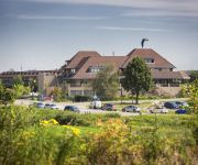
Van der Valk Stein-Urmond
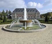
City Resort Hotel Sittard
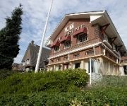
Huyze Max
Terhills Hotel Different hotels
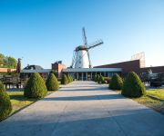
Al Mulino
Amrâth Hotel & Thermen Born-Sittard
Bastion Geleen
Hotel De Prins
Oranje
Hotel de Maretak & Wellness la Myrrhe
Videos from this area
These are videos related to the place based on their proximity to this place.
Fietsen langs de Maas bij Urmond
Het is geweldig fietsen langs de Maas rond het schilderachtige stadje Urmond.
Expositie Mariet Giesbertz Terpkerk 2009 Oud-Urmond
TIP: gebruik voor het afspelen de HQ optie ("bekijken op hoge kwaliteit") Expositie van schilderijen gemaakt door de in Nieuwstadt wonende kunstenares Mariet Giesbertz samen met haar cursisten....
Zangeres DAILY . all most persauded
Zangeres DAILY zingt ( speciaal voor Giel ) ,, All most persauded ,, op de open dag 2009 in STONE CITY Stein (LB )
Brand winkelcentrum Stein - in HD
Verschillende filmpjes van de brand in het winkelcentrum van Stein. Helaas trilt af en toe het beeld, daar kon ik helaas niets aan doen, het was nogal koud ;). Let vooral niet op het commentaar!...
Okie from Muskogee @ The Ghost Riders [Rene Guylline]
Okie from Muskogee @ "The Ghost Riders" Schietsport-center te STEIN (NL), a keepsake. [Rene Guylline]
Black ops Nazi Zombie deel4 Rick en ik hentai King
Serpentgameplay.nl yolo water polo van rick broers dankje dabkje mense.
Pile driving with a BM700 PD and PvE110M vibration hammer.
Driving piles with a Kobelco BM700 and a PvE 110M vibration hammer in Limburg, Netherlands. --------------------------------------------------------- Damwand trillen met een Kobelco BM700 en...
Videos provided by Youtube are under the copyright of their owners.
Attractions and noteworthy things
Distances are based on the centre of the city/town and sightseeing location. This list contains brief abstracts about monuments, holiday activities, national parcs, museums, organisations and more from the area as well as interesting facts about the region itself. Where available, you'll find the corresponding homepage. Otherwise the related wikipedia article.
Geleen
Geleen is a city in the southern part of the province of Limburg in the Netherlands. With 33,960 inhabitants, it is part of the municipality of Sittard-Geleen. Geleen is situated along the river Geleenbeek, a right tributary to the river Meuse. The town centre is situated at about 60 m above sea level.
Elsloo, Limburg
Elsloo is a town in the Dutch province of Limburg. It is located in the municipality of Stein, about 2 km west of the town of Stein itself. Beek-Elsloo railway station serves Elsloo. Until 1982, when it was merged with Stein, Elsloo was a separate municipality.
Lutterade
Lutterade is a district of Geleen and later Sittard-Geleen (a municipality in the southeastern Netherlands, in the province of Limburg).
Maastricht Aachen Airport
Maastricht Aachen Airport is a regional airport in Beek, the Netherlands, located 5 NM northeast of Maastricht and 15 NM northwest of Aachen, Germany. It is the second-largest hub for cargo flights in the Netherlands. As of 2011, the airport had a passenger throughput of 360,000 and handled 92,500 tons of cargo. The Maastricht Upper Area Control Centre (MUAC) of the European Organisation for the Safety of Air Navigation (EUROCONTROL) is also located on the airport.
Nieuwstadt
Nieuwstadt is a city in the Dutch province of Limburg. It is a part of the municipality of Echt-Susteren, and lies about 5 km north of Sittard. In 2001, Nieuwstadt had 3088 inhabitants. The built-up area of the town was 0.74 km², and contained 1235 residences. Nieuwstadt received city rights in 1271. It was a separate municipality until 1982, when it was merged with Susteren.
Spaubeek
Spaubeek is a village in the Dutch province of Limburg. It is located in the municipality of Beek, about 3 km south of the town of Geleen. Spaubeek was a separate municipality until 1982, when it was merged with Beek.
Geul
The Geul is a river in Belgium and in the Netherlands, where it is a right-bank tributary to the river Meuse. The source of the Geul is located at approx. 300 m altitude in north eastern Belgium near the German border, south of the German town of Aachen. From there, after flowing some 20 km in northwestern direction, it leaves Belgium and enters into the Netherlands at Cotessen in the Vaals municipality.
Limbricht
Limbricht is a town in the Dutch province of Limburg. It is a part of the municipality of Sittard-Geleen, and lies about three kilometres northwest of Sittard. Limbricht was a separate municipality until 1982, when it was merged with Sittard. In 2001, Limbricht had 2787 inhabitants. The built-up area of the town was 0.62 km², and contained 1052 residences.
Itteren
Itteren is a town in the Dutch province of Limburg. It is a part of the municipality of Maastricht, and lies about 6 km north of Maastricht. Itteren was a separate municipality until 1970, when it was merged with Maastricht. In 2001, Itteren had 977 inhabitants. The built-up area of the town was 0.25 km², and contained 396 residences.
Berg aan de Maas
Berg, often called Berg aan de Maas, is a town in the Dutch province of Limburg. It is a part of the municipality of Stein, and lies about 6 km northwest of Geleen. In 2001, Berg had 2090 inhabitants. The built-up area of the town was 0.48 km², and contained 895 residences. Berg is situated on the right bank of the river Meuse, Maas in Dutch. The opposite, left bank of the Meuse is Belgian territory, municipality Dilsen-Stokkem. There is a ferry between Berg and Dilsen-Stokkem.
Trendwork Arena
Trendwork Arena is a multi-use stadium in Sittard, Netherlands. It is currently used mostly for football matches and is the home stadium of Fortuna Sittard. The stadium is able to hold 12,500 people and was built on the site of an industrial estate in 1999. From its inauguration until 2008, the stadium was known as Wagner & Partners Stadion. It replaced Fortuna Sittard's old stadium De Baandert.
Grevenbicht
Grevenbicht is a town in the Dutch province of Limburg. It is a part of the municipality of Sittard-Geleen. It lies about 8 km north-west of Sittard, on the right bank of the river Meuse. Grevenbicht was a separate municipality until 1982, when it was merged with Born.
Born, Netherlands
Born is a town of approximately 6,000 inhabitants in the Dutch municipality of Sittard-Geleen. It has a port on the Julianakanaal (Juliana canal). Born is also the site of the car factory Nedcar. It has a zoo. Until 2001, Born was a separate municipality (population about 15,000), that included the villages Born, Buchten, Holtum, Grevenbicht, Papenhoven and Obbicht.
Juliana Canal
The Juliana Canal, named after Queen Juliana of the Netherlands, is a 36 km long canal in the southern Netherlands, providing a bypass of an unnavigable section of the river Meuse between Maastricht and Maasbracht. It is an important transport connection between the ports of the Rhine delta and the industrial areas of southern Limburg and southern Belgium. The Juliana Canal was constructed in the 1920s and 1930s, and opened in 1935.
Geulle
Geulle is a village in the Dutch province of Limburg. It is located in the municipality of Meerssen, about 8 km southwest of Geleen. Geulle was a separate municipality until 1982, when it was merged with Meerssen.
Obbicht en Papenhoven
Obbicht en Papenhoven is a former municipality in the Dutch province of Limburg. It consisted of the villages Obbicht and Papenhoven, located on the River Meuse about 8 km northwest of Sittard. Obbicht en Papenhoven merged with the municipality of Born in 1982.
Schimmert
Schimmert is a village in the Dutch province of Limburg. It is located in the municipality of Nuth. Schimmert was a separate municipality until 1982, when it was merged with Nuth. Schimmert is after Ubachsberg the highest church village from the Netherlands. Schimmert is known for its water tower (1926) And for the Church in the center of the village.
Urmond
Urmond is a village in the Dutch province of Limburg. It is located in the municipality of Stein. Urmond was a separate municipality until 1982, when it was merged with Stein.
Ulestraten
Ulestraten is a village in the Dutch province of Limburg. It is located in the municipality of Meerssen. It is surrounded by several forests. Ulestraten was a separate municipality until 1982, when it was merged with Meerssen.
Jansgeleen Castle
Jansgeleen Castle, now erroneously called Sint-Jansgeleen or Sint Jansgeleen, was a medieval castle in the little village of Spaubeek, in the Dutch province of Limburg. Spaubeek is located in the municipality of Beek, about 3 km south of the town of Geleen. Spaubeek was a separate municipality until 1982, when it was merged with Beek. The history of Spaubeek was closely connected to that of Jansgeleen Castle.
Terstraten
Terstraten, known as Tersjtraote in Limburgish, is a hamlet in the municipality of Nuth in the province of Limburg, the Netherlands. It is one of the so called Bovengehuchten, or Upper Hamlets, of Nuth. All the houses are situated along the street Terstraten, which runs from the neighboring hamlet Brand via a hollow way towards the Maastrichterweg. In between the houses is a little square with a Christian cross underneath a tree. The houses in Terstraten are officially preserved heritage.
Brand, Nuth
Brand is a hamlet in the municipality of Nuth in the province of Limburg, the Netherlands. It is one of the so called Bovengehuchten, or Upper Hamlets, of Nuth. Brand is located south of the stream Platsbeek. The hamlet consists of five houses along the Branterweg. This road connects the hamlets Tervoorst and Helle. Some houses, including a farm named Op genne Brant, are constructed with timber framing. Brand is often mistakenly regarded as part of the nearby hamlet Terstraten.
Helle, Nuth
Helle, known as G'n Hèl in Limburgish, is a hamlet in the municipality of Nuth in the province of Limburg, the Netherlands. It is one of the so called Bovengehuchten, or Upper Hamlets, of Nuth. It is located between the village of Schimmert and the hamlet Terstraten. The name Helle probably originates from helde, or hill. This could be a reference to the many hills and hollow ways near the hamlet.
Ommerstein Castle
Ommerstein Castle (Dutch: Kasteel van Ommerstein) is a castle in the village of Rotem in the municipality of Dilsen-Stokkem, province of Limburg, Belgium. The history of the castle goes back to the 13th century, but most of the present Neo-classical building dates from the 18th century, although the donjon survives from earlier. The surrounding park is distinguished by its possession of a number of giant sequoias and cedars of Lebanon, including one believed to be the thickest in Belgium.
La Diligence (restaurant)
Restaurant La Diligence is a former restaurant located in Beek, in the Netherlands. It was a fine dining restaurant that was awarded one Michelin star in the periods 1974-1975 and 1979-1985. In 1985, Bèr Smeets was head chef. The restaurant was located in a villa on the Maastrichterlaan, which was demolished in 1992.


!['Okie from Muskogee @ The Ghost Riders [Rene Guylline]' preview picture of video 'Okie from Muskogee @ The Ghost Riders [Rene Guylline]'](https://img.youtube.com/vi/wN4fLn6NXZc/mqdefault.jpg)


