Safety Score: 3,3 of 5.0 based on data from 9 authorites. Meaning please reconsider your need to travel to Netherlands.
Travel warnings are updated daily. Source: Travel Warning Netherlands. Last Update: 2024-05-10 08:04:54
Touring Nattenhoven
Nattenhoven in Gemeente Stein (Limburg) with it's 155 residents is a town located in Netherlands about 101 mi (or 163 km) south of Amsterdam, the country's capital place.
Time in Nattenhoven is now 07:46 PM (Friday). The local timezone is named Europe / Amsterdam with an UTC offset of 2 hours. We know of 8 airports nearby Nattenhoven, of which 5 are larger airports. The closest airport in Netherlands is Maastricht Aachen Airport in a distance of 7 mi (or 11 km), South. Besides the airports, there are other travel options available (check left side).
There are several Unesco world heritage sites nearby. The closest heritage site is Aachen Cathedral in Germany at a distance of 21 mi (or 34 km). The closest in Netherlands is Mill Network at Kinderdijk-Elshout in a distance of 77 mi (or 34 km), South-East. Also, if you like the game of golf, there are several options within driving distance. We collected 2 points of interest near this location. Need some hints on where to stay? We compiled a list of available hotels close to the map centre further down the page.
Being here already, you might want to pay a visit to some of the following locations: Selfkant, Maastricht, Waldfeucht, Gangelt and Heinsberg. To further explore this place, just scroll down and browse the available info.
Local weather forecast
Todays Local Weather Conditions & Forecast: 21°C / 70 °F
| Morning Temperature | 11°C / 51 °F |
| Evening Temperature | 21°C / 69 °F |
| Night Temperature | 13°C / 56 °F |
| Chance of rainfall | 0% |
| Air Humidity | 56% |
| Air Pressure | 1023 hPa |
| Wind Speed | Light breeze with 5 km/h (3 mph) from South |
| Cloud Conditions | Broken clouds, covering 62% of sky |
| General Conditions | Broken clouds |
Saturday, 11th of May 2024
21°C (71 °F)
18°C (65 °F)
Overcast clouds, gentle breeze.
Sunday, 12th of May 2024
23°C (74 °F)
18°C (64 °F)
Light rain, gentle breeze, overcast clouds.
Monday, 13th of May 2024
22°C (71 °F)
16°C (61 °F)
Moderate rain, gentle breeze, broken clouds.
Hotels and Places to Stay
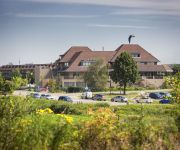
Van der Valk Stein-Urmond
Huyze Max
Amrâth Hotel & Thermen Born-Sittard
Terhills Hotel Different hotels
City Resort Hotel Sittard
Hotel Restaurant de Roosterhoeve
Van Eyck
Kasteel Wurfeld
Al Mulino
Bastion Geleen
Videos from this area
These are videos related to the place based on their proximity to this place.
Fietsen langs de Maas bij Urmond
Het is geweldig fietsen langs de Maas rond het schilderachtige stadje Urmond.
Expositie Mariet Giesbertz Terpkerk 2009 Oud-Urmond
TIP: gebruik voor het afspelen de HQ optie ("bekijken op hoge kwaliteit") Expositie van schilderijen gemaakt door de in Nieuwstadt wonende kunstenares Mariet Giesbertz samen met haar cursisten....
TV-Uitzending Omroep Stein 25 jan 2013
Leedjes Konkoer Urmond (29 min.). - Doeme dreije voor het LVK (15 min.).
Watertappunt Maasband
Tijdens je wandeling of fietstocht even je bidon of leeg flesje met water bijvullen. Mogelijk gemaakt door WML, gemeente Stein en met hulp van de DOP-vrijwilligers en bewoners van de Maasband.
traktor op veerboot Berg - Meeswijk (veerpont op de maas)
Hier zie je een traktor die de maas oversteekt.
TV Uitzending 22 februari 2013
Grensmaas project Berg a/d Maas Mooder Maas, film van Jan Janssen Tiener Vasteloavend Leedjes Konkoer, Claire.
DJI Phantom 2 with Boscam HD19 FPV test flight.
A short test flight with my DJI Phantom 2 with a Boscam HD19 cam. Berg aan de maas (Netherlands, Limburg)
Videos provided by Youtube are under the copyright of their owners.
Attractions and noteworthy things
Distances are based on the centre of the city/town and sightseeing location. This list contains brief abstracts about monuments, holiday activities, national parcs, museums, organisations and more from the area as well as interesting facts about the region itself. Where available, you'll find the corresponding homepage. Otherwise the related wikipedia article.
Berg aan de Maas
Berg, often called Berg aan de Maas, is a town in the Dutch province of Limburg. It is a part of the municipality of Stein, and lies about 6 km northwest of Geleen. In 2001, Berg had 2090 inhabitants. The built-up area of the town was 0.48 km², and contained 895 residences. Berg is situated on the right bank of the river Meuse, Maas in Dutch. The opposite, left bank of the Meuse is Belgian territory, municipality Dilsen-Stokkem. There is a ferry between Berg and Dilsen-Stokkem.
Grevenbicht
Grevenbicht is a town in the Dutch province of Limburg. It is a part of the municipality of Sittard-Geleen. It lies about 8 km north-west of Sittard, on the right bank of the river Meuse. Grevenbicht was a separate municipality until 1982, when it was merged with Born.
Born, Netherlands
Born is a town of approximately 6,000 inhabitants in the Dutch municipality of Sittard-Geleen. It has a port on the Julianakanaal (Juliana canal). Born is also the site of the car factory Nedcar. It has a zoo. Until 2001, Born was a separate municipality (population about 15,000), that included the villages Born, Buchten, Holtum, Grevenbicht, Papenhoven and Obbicht.
Juliana Canal
The Juliana Canal, named after Queen Juliana of the Netherlands, is a 36 km long canal in the southern Netherlands, providing a bypass of an unnavigable section of the river Meuse between Maastricht and Maasbracht. It is an important transport connection between the ports of the Rhine delta and the industrial areas of southern Limburg and southern Belgium. The Juliana Canal was constructed in the 1920s and 1930s, and opened in 1935.
Obbicht en Papenhoven
Obbicht en Papenhoven is a former municipality in the Dutch province of Limburg. It consisted of the villages Obbicht and Papenhoven, located on the River Meuse about 8 km northwest of Sittard. Obbicht en Papenhoven merged with the municipality of Born in 1982.
Urmond
Urmond is a village in the Dutch province of Limburg. It is located in the municipality of Stein. Urmond was a separate municipality until 1982, when it was merged with Stein.
Ommerstein Castle
Ommerstein Castle (Dutch: Kasteel van Ommerstein) is a castle in the village of Rotem in the municipality of Dilsen-Stokkem, province of Limburg, Belgium. The history of the castle goes back to the 13th century, but most of the present Neo-classical building dates from the 18th century, although the donjon survives from earlier. The surrounding park is distinguished by its possession of a number of giant sequoias and cedars of Lebanon, including one believed to be the thickest in Belgium.


