Safety Score: 3,6 of 5.0 based on data from 9 authorites. Meaning please reconsider your need to travel to Mexico.
Travel warnings are updated daily. Source: Travel Warning Mexico. Last Update: 2024-04-30 08:30:35
Explore Centro
The district Centro of in Cuauhtémoc (Ciudad de México) is located in Mexico a little west of Mexico City, the country's capital.
If you need a place to sleep, we compiled a list of available hotels close to the map centre further down the page.
Depending on your travel schedule, you might want to pay a visit to some of the following locations: Mexico City, Nezahualcoyotl, Los Reyes Acaquilpan, Huixquilucan de Degollado and Chicoloapan. To further explore this place, just scroll down and browse the available info.
Local weather forecast
Todays Local Weather Conditions & Forecast: 26°C / 79 °F
| Morning Temperature | 20°C / 68 °F |
| Evening Temperature | 27°C / 81 °F |
| Night Temperature | 24°C / 75 °F |
| Chance of rainfall | 0% |
| Air Humidity | 21% |
| Air Pressure | 1012 hPa |
| Wind Speed | Gentle Breeze with 7 km/h (5 mph) from North-East |
| Cloud Conditions | Broken clouds, covering 63% of sky |
| General Conditions | Broken clouds |
Wednesday, 1st of May 2024
27°C (81 °F)
23°C (74 °F)
Broken clouds, gentle breeze.
Thursday, 2nd of May 2024
28°C (82 °F)
26°C (79 °F)
Light rain, light breeze, scattered clouds.
Friday, 3rd of May 2024
28°C (83 °F)
21°C (69 °F)
Light rain, moderate breeze, few clouds.
Hotels and Places to Stay
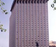
FIESTA AMERICANA REFORMA
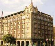
Best Western Hotel Majestic
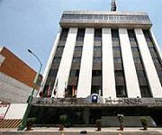
BEST WESTERN ESTORIL
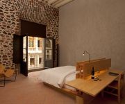
NH CENTRO HISTORICO
Zocalo Central
Gran Hotel Ciudad De Mexico
Downtown México
Hotel Plaza Garibaldi
Hotel Marlowe
Hotel Virreyes
Videos from this area
These are videos related to the place based on their proximity to this place.
Nuevo Hampton Inn and Suites by Hilton Mexico City/Centro Historico (en Español)
Situado a dos cuadras del Zócalo de la Ciudad de México, el hotel Hampton Inn & Suites Mexico City - Centro Historico es un edificio histórico reconocido donde puede admirar el estilo arquitect...
Conferencia Venustiano Carranza 2014
Conferencia. Porque la adversidad es la mejor herramienta de la que disponemos, para que tus más elevados anhelos se conviertan en realidad. Agradezco el apo...
PROMOCIONAL LA COVACHA 2012.
Este promocinal fue realizado en las instalacionaes de la COVACHA/G STORE ubicada en VENUSTIANO CARRANZA NO. 14 - A 100 METROS DE LA ESTACION DEL METRO SAN JUAN DE ...
007 death day in México City
Alegoría de la fiesta más importante de México. Vista por el súper agente 007.
Un mensaje navideño de Santa Claus | #MAME
Un hermoso mensaje navideño de Santa Claus. Contactanos: la.alacena.tv@gmail.com Facebook: www.facebook.com/LaAlacenaTv Twitter: https://twitter.com/LaAlacenaTv Instagram: la_alacena_tv...
SUMMER IN DOWN TOWN OF MEXICO CITY
SUMMER IN DOWN TOWN OF MEXICO CITY 2014 3veces3 Films www.3veces3films.com.
Feria Nacional Del Mole San Pedro Atocpan 2013
Feria Del Mole San Pedro Atocpan 2013 ¿COMO LLEGAR? https://maps.google.com.mx/maps?q=san+pedro+atocpan&hl=es-419&ll=19.215468,-99.049607&spn=0.004139,0.007119&sll=23.554131,-102.6205&sspn=28.6 ...
Discapacidad no es incapacidad, SONIA MIRANDA SE GANA LA VIDA EN EL CORAZÓN DE LA CIUDAD
SONIA MIRANDA SANCHEZ GRACIAS A Therodbenchanel POR AYUDARNOS A GRABAR ESTE BONITO VIDEO. Discapacidad no es incapacidad, SONIA MIRANDA SE GANA LA VIDA EN EL ...
Como Descargar e Instalar Cities XXL Full en Español 2015
No se te olvide Suscribirte y Comentar el vídeo︽™ ™︽No se te olvide Suscribirte y Comentar el vídeo︽™ ▻Download (Cities XXL 2015): http://tumundoconsower.blogspot.mx/p/juegos...
Videos provided by Youtube are under the copyright of their owners.
Attractions and noteworthy things
Distances are based on the centre of the city/town and sightseeing location. This list contains brief abstracts about monuments, holiday activities, national parcs, museums, organisations and more from the area as well as interesting facts about the region itself. Where available, you'll find the corresponding homepage. Otherwise the related wikipedia article.
Metro San Juan de Letrán
Metro San Juan de Letrán is a metro station along Line 8 of the Mexico City Metro. It is located in Mexico City's Cuauhtémoc borough in the city centre, or Centro. The station logo depicts the silhouette of the nearby Torre Latinoamericana, and the name San Juan de Letrán is the name of a church in Rome, Italy. San Juan de Letrán was the former name of Mexico City's central avenue, on which the station stands. Another stretch further south was named Avenida Niño Perdido ("Lost Child").
Metro Isabel la Católica
Metro Isabel La Católica is a metro (subway) station on the Mexico City Metro. It is located in the Colonia Centro neighborhood in the Cuauhtémoc borough in Mexico City's downtown. Its logo represents one of Christopher Columbus's three caravels. Its name comes from nearby Avenida Isabel La Católica, named after Queen Isabel of Castile, who helped Columbus finance his journeys to the Americas. The station was opened on 5 September 1969.
Zócalo
The Zócalo is the main plaza or square in the heart of the historic center of Mexico City. The plaza used to be known simply as the "Main Square" or "Arms Square," and today its formal name is Plaza de la Constitución (Constitution Square). This name does not come from any of the Mexican constitutions that have governed the country but rather from the Cádiz Constitution which was signed in Spain in 1812. However, it is almost always called the Zócalo today.
Greater Mexico City
Greater Mexico City refers to the conurbation around Mexico City, officially called Mexico City Metropolitan Area (Área Metropolitana de la Ciudad de México), constituted by the Federal District—itself composed of 16 boroughs—and 41 adjacent municipalities of the states of Mexico and Hidalgo.
University of the Cloister of Sor Juana
The University of the Cloister of Sor Juana (Spanish Universidad de Claustro de Sor Juana) is a private university located in the former San Jerónimo Convent in the historic center of Mexico City. This convent is best known for having been the home of Sor Juana Inés de la Cruz for over twenty five years, she produced many of her writings here.
Hospital de Jesús Nazareno
The Church and Hospital of Jesús Nazareno are supposedly located at the spot where Hernán Cortés and Moctezuma II met for the first time in 1519, which was then the beginning of the causeway leading to Iztapalapa. Cortés ordered the hospital built to tend to soldiers wounded fighting with the Aztecs. The Jesús Hospital is one of the oldest buildings in Mexico City.
Historic center of Mexico City
The historic center of Mexico City is also known as the "Centro" or "Centro Histórico. " This neighborhood is focused on the Zócalo or main plaza in Mexico City and extends in all directions for a number of blocks with its farthest extent being west to the Alameda Central The Zocalo is the largest plaza in Latin America and the second largest in the world after Moscow's Red Square. It can hold up to nearly 100,000 people.
Church of San Bernardo, Mexico City
The Church of San Bernardo (Spanish: Iglesia de San Bernardo) stands at the corner of Avenida 20 de Noviembre and Venustiano Carranza Street just south of the Zocalo or main plaza of Mexico City. It was part of a convent of the same name that was founded in 1636, but was closed along with all convents and monasteries during the La Reforma period in 1861. Currently, only the church remains of the convent complex.
Federal District buildings
The Federal District buildings are two buildings on the south side of the Zócalo in Mexico City divided by the avenue Avenida 20 de Noviembre. They house offices of the governing authority of the Federal District or Mexico City. The building to the west of 20 de Noviembre is the older one and has been the site of city administration since the Conquest. The one to the east is newer, built in 20th century.
House of Count de la Torre de Cossio
The House of Count de la Torre de Cossio belonged to a rich Spanish merchant named Juan Manuel González de Cossio, which was built over the former residence of Juan Manuel Sotomayor. González de Cossio received his title from the Spanish crown in 1773. The mansion itself was built in 1781. The façade has a symmetrical design with three floors, covered in tezontle (a reddish porous stone) and white stone and is considered a prototype of the palatial constructions to very soon follow.
Palace of Iturbide
The Palace of Iturbide is a large palatial home located in the historic center of Mexico City on Madero Street #17. It was built by the Count of San Mateo Valparaíso as a wedding gift for his daughter. It gained the name “Palace of Iturbide” because Agustín de Iturbide lived and accepted the crown of the First Mexican Empire (as Agustin I) there after independence from Spain. Today, the restored building houses the Fomento Cultural Banamex and has been renamed the Palacio de Cultura Banamex.
Old Portal de Mercaderes (Mexico City)
Old Portal de Mercaderes in the historic center of Mexico City was and is the west side of the main plaza (otherwise known as the "Zócalo"). This side of the plaza has been occupied by commercial structures since the Spanish Conquest of Mexico in 1521. Today the west side of the square is dominated by two sets of buildings with Madero Street dividing them as it runs west from the Zocalo to the Palace of Bellas Artes.
Saint Augustine House
It is a monument located in the Historic center of Mexico City, on the corner of the streets Republic of Uruguay and 5 of February, (previously streets of Don Juan Manuel and la Joya respectively), it got its name because it was property of the order of the Augustinians, whose convent was located next to this building.
Temple of San Felipe Neri "La Profesa"
The Temple of San Felipe Neri, commonly known as "La Profesa" (English: the Professed house), is a Roman Catholic parish church that was established by the Society of Jesus late in the 16th century as the church of a community of professed Jesuits. The church is considered to be an important transitional work between the more sober or moderate Baroque style of the 17th century and the extremely decorated manifestations of the Baroque of the 18th century in Mexico.
House of the Marquis of Uluapa, Mexico City
The House of the Marquis of Uluapa is located on 5 de Febrero Street in the historic center of Mexico City, Mexico. No one knows who originally owned the house but it has been proven that it never belonged to the Marquis of Uluapa. For this reason, it is officially archived only as “the house at number 18, 5 de Febrero Street. ” However, the house remains popularly known as the House of the Marquis of Uluapa.
House of the Count De la Torre Cosío y la Cortina, Mexico City
The house of the Counts of la Torre Cosío y la Cortina, located on 94 Republica de Uruguay Street in the historic center of Mexico City was built in 1781 and the scene for one of Mexico City’s legends. The house is considered to be a fine example of civil architecture of the 18th century, shortly after the First Count De la Cortina received his noble title in 1773.
Church of San Francisco, Madero Street, Mexico City
The Church of San Francisco is located at the western end of Madero Street in the historic center of Mexico City, near the Torre Latinoamericana and is all that remains of the church and monastery complex. This complex was the headquarters of the first twelve Franciscan monks headed by Martín de Valencia who came to Mexico after receiving the first authorization from the Pope to evangelize in New Spain.
Museum of the City of Mexico
The Museum of the City of Mexico (Museo de la Ciudad de Mexico) is located at Pino Suarez 30, a few blocks south of the Zocalo, on what was the Iztapalapa Causeway, near where Hernán Cortés and Moctezuma II met for the first time. This building used to be the palace of the Counts of Santiago de Calimaya, who were the descendents of one of the conquistadors with Cortés.
United Mexican States (1824–1864)
For the current entity named United Mexican States, see Mexico. United Mexican States ← 30px 1824–1864 ↓ Flag Coat of arms Flag Coat of arms MottoReligión, Independencia, Unión AnthemHimno Nacional Mexicano Location of MexicoThe United Mexican States in 1824.
Colegio de San Ignacio de Loyola Vizcaínas
Colegio de San Ignacio de Loyola Vizcaínas is a non-profit educational institution which was established in the mid 18th century in a Baroque building that occupies an entire city block in the historic center of Mexico City. The school has maintained most of its mission and organization and is the only continuously operating colonial era institution in Mexico. It was originally established for the education of orphaned girls and widows, but now it is co-educational.
Trolleybuses in Mexico City
The Mexico City trolleybus system (Spanish: Red de Trolebuses de la Ciudad de México) serves Mexico City, the capital city of Mexico. Opened on 9 March 1951, the system had 10 lines as of 2011.
Borda House, Mexico City
The Borda House, located on 27, 29 and 33 Madero, and 26-28 Bolivar streets in the historic center of Mexico City, originally belonged to the Frenchman José de la Borda (Joseph de Laborde) who was one of the richest men in New Spain in the 18th century. It stands out due to its notable architectural features such as the sculpted stone decorative details on the ground floor. The original building encompassed the entire city block.
Regina Coeli Church, Mexico City
The Regina Coeli Church is a Roman Catholic parish church built in the historic center of Mexico City, on the corner of Regina and Bolivar Streets. The building is the only functioning portion of a former 16th century convent. The church is Churrigueresque in style from the 18th century and was part of the convent of Regina Coeli Conceptionist nuns. The former convent was closed during the Reform War and is generally not open to the public.
Second Federal Republic of Mexico
The Second Federal Republic of Mexico (1846 – 1864) is the name given to the second attempt to achieve a federalist government in Mexico. Officially called the United Mexican States, a federal republic was implemented again on August 22, 1846 when interim president José Mariano Salas issued a decree restoring the 1824 constitution.
Mexico City Alebrije Parade
The Mexico City Alebrije Parade is an annual event to honor Mexican handcrafts and folk art, especially a hard kind of papier-mâché called “cartonería” and the creation of fantastic figures with it called “alebrijes. ” Alebrijes are chimera-like creatures credited to artisan Pedro Linares painted in bright colors. The alebrijes for the parade are larger than anything Linares created, up to four meters in height and three meters in width.


