Safety Score: 3,6 of 5.0 based on data from 9 authorites. Meaning please reconsider your need to travel to Mexico.
Travel warnings are updated daily. Source: Travel Warning Mexico. Last Update: 2024-05-04 08:22:41
Delve into Col. Extremadura Insurgentes
The district Col. Extremadura Insurgentes of Benito Juarez in Benito Juárez (Ciudad de México) is a district located in Mexico a little south-west of Mexico City, the country's capital town.
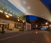
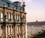
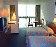
In need of a room? We compiled a list of available hotels close to the map centre further down the page.
Since you are here already, you might want to pay a visit to some of the following locations: Mexico City, Huixquilucan de Degollado, Nezahualcoyotl, Los Reyes Acaquilpan and Santa Ana Jilotzingo. To further explore this place, just scroll down and browse the available info.
Local weather forecast
Todays Local Weather Conditions & Forecast: 26°C / 79 °F
| Morning Temperature | 21°C / 69 °F |
| Evening Temperature | 22°C / 72 °F |
| Night Temperature | 23°C / 73 °F |
| Chance of rainfall | 0% |
| Air Humidity | 25% |
| Air Pressure | 1017 hPa |
| Wind Speed | Moderate breeze with 11 km/h (7 mph) from North-East |
| Cloud Conditions | Clear sky, covering 2% of sky |
| General Conditions | Light rain |
Sunday, 5th of May 2024
28°C (83 °F)
21°C (70 °F)
Light rain, gentle breeze, clear sky.
Monday, 6th of May 2024
29°C (83 °F)
24°C (74 °F)
Light rain, gentle breeze, few clouds.
Tuesday, 7th of May 2024
29°C (84 °F)
24°C (75 °F)
Light rain, moderate breeze, scattered clouds.
Hotels and Places to Stay
Filadelfia Suites Hotel Boutique
Crowne Plaza HOTEL DE MEXICO
FIESTA INN INSURGENTES SUR
CITY EXPRESS PLUS PATIO UNIV
City Express Plus Insurgente
GRAN HOTEL CIUDAD DE MEXICO
Pennsylvania Suites
Holiday Inn MEXICO CITY-PLAZA UNIVERSIDAD
EL DIPLOMATICO HOTEL
Casa Azul B & B
Videos from this area
These are videos related to the place based on their proximity to this place.
Parque dos Veados( Parque de los venados.).
Parque muito bonito, localizado na deleg.de Benito Juarez na Ciudad de México.
Corrupción de inmobiliarias en Benito Juárez - SEDUVI
Diversas empresas desarrolladoras de viviendas están realizando diferentes fraudes con el pleno conocimiento de las autoridades. En esta ocación una denuncia ciudadana en redes sociales que...
Trabajan en edificio Clausurado en Benito Juárez
Veanlo en la compu, en los celulares no se distinguen los detalles. Video tomado el 16 de febrero a las 10:30 am en donde claramente se ven personas trabajando dentro de Cerrada de Empresa...
En Benito Juárez no se quiere ni una vivienda más
La construcción excesiva de vivienda en la Delegación Benito Juárez ha generado una problemática muy difícil de revertir. No hay agua potable, hay cortes en la energía eléctrica, el...
Libro taquero la margarita 1.AVI
Un clásico entre los chilangos, desayunadero obligatorio con ricos guisados de rechupete. Para madrugar o cerrar la mañana con mucho sabor en la colonia del Valle.
Fiesta del Señor del Buen Despacho
Cada año, en julio, la insípida colonia del Valle tiene su pequeña fiesta patronal que no le pide nada a las de ningún otro sitio. Castillos y fuegos artificiales. Comida grasienta. Juegos...
Liya BESPALOVA (2)
Mi universo” de la rusa mexicana Liya Bespalova Roberto Ponce Si bien al cambio de siglo la versátil intérprete y letrista rusa Liya Bespalova decidió adoptar como su segunda patria...
Bicigato
En una muestra de recorridos en bicicleta en la Ciudad de México hay que destacar al tradicional "Gato" o como algunos lo llaman, el SuiciGato. Para quienes quieran disfrutar de una salida...
Recorrido de Miguel en bicicleta con GoPro Hero 3+.
Recorrido en bicicleta en la Ciudad de México, por las colonias Nápoles, Del Valle y Roma. Grabado con una GoPro Hero 3+.
Videos provided by Youtube are under the copyright of their owners.
Attractions and noteworthy things
Distances are based on the centre of the city/town and sightseeing location. This list contains brief abstracts about monuments, holiday activities, national parcs, museums, organisations and more from the area as well as interesting facts about the region itself. Where available, you'll find the corresponding homepage. Otherwise the related wikipedia article.
Metro Observatorio
Metro Observatorio is a station on Line 1 of the Mexico City Metro system. It is located in the Álvaro Obregón borough of Mexico City, west of the city centre. This station is the western terminus of Line 1. The station logo represents the stylised dome of an astronomical observatory. It is named after the National Astronomical Observatory of the Universidad Nacional Autónoma de México located at the top of a hill near the station.
Polyforum Cultural Siqueiros
The Polyforum Cultural Siqueiros is a cultural, political and social facility located in Mexico City as part of the World Trade Center Mexico City. It was designed and decorated by David Alfaro Siqueiros in the 1960s and hosts the largest mural work in the world called “La Marcha de la Humanidad. ” The building has a theatre, galleries and more, but the main focus is the Foro Universal, which contains the interior portion of Siqueiros mural work.
Metro Barranca del Muerto
Metro Barranca del Muerto is a station on the Mexico City Metro, Mexico. It is located in the Álvaro Obregón borough. Its logo represents two eagles, some say buzzards. The metro station is named after Avenida Barranca del Muerto, that was once a big depression, the same length of the actual avenue (barranca means gully or ravine). During the Mexican Revolution (1910 – 1921) this was a place where revolutionary soldiers dropped many corpses.
Metro Viveros
Metro Viveros / Derechos Humanos (formerly known as Metro Viveros) is a metro station along Line 3 of the Mexico City Metro. It is located between the Álvaro Obregón and Coyoacán boroughs of Mexico City.
Metro Coyoacán
Metro Coyoacán is a metro station along Line 3 of the Mexico City Metro. It is located in the Benito Juárez borough of Mexico City. It is at the intersection of Universidad and Coyoacan avenues. Right outside the station lies the "Centro Coyoacan" shopping mall, Radio Formula and Bancomer headquarters. It is also close to the Cineteca Nacional and Coyoacán district. The station logo depicts a coyote. In fact, the Náhuatl word of Coyohuacan means place of coyotes.
Metro Zapata
Metro Zapata is a station on Line 3 and Line 12 of the Mexico City Metro. The station serves both lines as a transfer station and as the northwestern terminus of Line 12. The station logo depicts Emiliano Zapata, a national hero from the Mexican Revolution of 1910–1921. This station used to be the terminus of Line 3; while the line has since been extended south, it still plays an important role in the transportation of the city's inhabitants. The metro station was opened on 25 August 1980.
Metro División del Norte
Metro División del Norte is a metro station along Line 3 of the Mexico City Metro. It is located in the Benito Juárez borough of Mexico City. The station logo represents Revolutionary hero Pancho Villa, leader of the División del Norte of revolutionary soldiers during the Mexican Revolution of 1910. Its name is taken from the nearby Avenida División del Norte. The station has a cultural display. The station opened on 25 August 1980.
Metro Eugenia
Metro Eugenia is a metro station along Line 3 of the Mexico City Metro. It is located in the Colonia Vertiz Narvarte and Colonia del Valle neighbourhoods of the Benito Juárez borough of Mexico City. The station logo depicts a stork, and its name refers to the avenue above the station. The name Eugenia literally means "The well born", so the stork is a birth symbol. The station opened on 25 August 1980.
Estadio Azul
The Estadio Azul, is a 35,000-seat stadium located in Mexico City. This sports facility is currently used for association football matches and previously (until 1990) for American football. It is the home of Mexican football club Cruz Azul; it has been also home for Atlante F.C. (hence the nickname Estadio Azulgrana) and several home matches of the Mexico national football team, especially in the early 1990s.
Plaza México
The Plaza México, situated in Mexico City, is the world's largest bullring. This 41,262-seat facility is usually dedicated to bullfighting, but many boxing fights have been held there as well, including Julio César Chávez's third bout with Frankie Randall http://www. wbcboxing. com/WBCboxing/portal/cfpages/contentmgr. cfm?docId=643&docTipo=1&orderby=docid&sortby=ASC.
Secretariat of Energy (Mexico)
The Secretariat of Energy is the government department in charge of energy production and regulation in Mexico, this secretary is a member of the Executive Cabinet.
Instituto Nacional de Estudios Históricos de la Revolución Mexicana
The Instituto Nacional de Estudios Históricos de la Revolución Mexicana (English: National Institute of Historical Studies on the Mexican Revolution; INEHRM) is a research institute of the Mexican Secretariat of Public Education (Spanish: Secretaría de Educación Pública), dedicated to studying the Mexican Revolution (1910–1920).
Teatro de los Insurgentes
Teatro de los Insurgentes (English: Theater of the Insurgents) is a theater located on Mexico City's Avenida de los Insurgentes. It was built by José María Dávila in 1953 as part of President Miguel Alemán's program of urban renewal. Dávila commissioned muralist Diego Rivera to paint La historia del teatro, a visual history of the theatre in Mexico on the building's façade.
Colonia del Valle
Colonia del Valle is a neighborhood in the Benito Juarez borough of Mexico City. It includes "... a great number of parks, vast and tree-lined streets, prestigious shopping malls, and some city landmarks...". However, Colonia del Valle has been referred to as a "crime-ridden neighborhood", and it is the second most dangerous neighborhood in Mexico City. It has been mentioned to be as dangerous as Tepito and Colonia Doctores.
Metro San Pedro de los Pinos
Metro San Pedro de los Pinos (Spanish: Estación San Pedro de los Pinos) is a station on Line 7 of the Mexico City Metro system. It is located in the Miguel Hidalgo borough of Mexico City, west of the city centre. The station opened on 19 December 1985. The logo of the station features a silhouette of two pine trees.
Metro San Antonio
Metro San Antonio (Spanish: Estación San Antonio) is a metro station on Line 7 of the Mexico City Metro. The station opened on 19 December 1985.
Metro Mixcoac
Metro Mixcoac is a station on Line 7 and Line 12 of the Mexico City Metro. The station serves both lines as a transfer station and as the northwestern terminus of Line 12. It runs deep under Avenida Revolución, a main thoroughfare in Mexico City. It serves the Colonia Mixcoac neighborhood of the city.
Escuela Nacional Preparatoria (Mexico)
The Escuela Nacional Preparatoria (English: National Preparatory School) (ENP), the oldest senior high school system in Mexico, belonging to the National Autonomous University of Mexico (UNAM), opened its doors on February 1, 1868. It was founded by Gabino Barreda, M.D. , following orders of then President of Mexico Benito Juárez. It is also modern UNAM's oldest institution.
Torre AXA México
Torre AXA México, previously Mexicana de Aviación Tower, was the worldwide headquarters of Mexicana de Aviación and a landmark located in Colonia del Valle in Benito Juárez, Mexico City, Mexico. The 32-storey building is 132 metres tall. It was designed by Rafael Mijares and Andrés Giovanni. In 2003, the airline announced plans to sell the tower, considered to be a landmark in the city, for US$35 million as an initial offer.
Parque Hundido
Parque Hundidois a park in Mexico City.
Universidad Autónoma de la Ciudad de México
The Universidad Autónoma de la Ciudad de México (UACM) (Autonomous University of Mexico City) is a public university from the México City founded in 2001. Before, the Federal District was the only federal entity without a state university.
Frida Kahlo Museum
The Frida Kahlo Museum, also known as the Blue House (La Casa Azul) for the structure's cobalt-blue walls, is a historic house museum and art museum dedicated to the life and work of Mexican artist Frida Kahlo. It is located in the Colonia del Carmen neighborhood of Coyoacán in Mexico City. The building was the birthplace of Kahlo and is also the home where she grew up, lived with her husband Diego Rivera for a number of years, and eventually died, in one of the rooms on the upper floor.
Leon Trotsky Museum, Mexico City
The Leon Trotsky House Museum is a museum honoring Leon Trotsky and an organization that works to promote political asylum, located in the Coyoacán borough of Mexico City. The center of the complex is the house in which Trotsky lived with his wife from 1939 to 1940, and where the Russian dissident was murdered. The house has been kept as it was at that time, especially the study in which a Stalin supporter killed Trotsky with an ice axe to the back of the head.
Viveros de Coyoacán
Viveros de Coyoacán is a combination tree nursery and public park which covers 38.9 hectares in the Coyoacán borough of Mexico City. The nursery was founded by Miguel Angel de Quevedo in the early 20th century as a way to provide seedlings for the reforestation of Mexico’s badly damaged forests, especially around Mexico City. The first lands were donated by Quevedo himself with the federal government then getting involved, allowing for the planting of 140,000 trees between 1913 and 1914 alone.
Instalaciones Club América en Coapa
Facilities at the Club de Futbol America, also known as the "Eagles Nest" where every day they prepare and train future current figures Americanists, are located south of the city, on land that was cultivated farms and establos. Actualmente surface square is 70,049.957 meters long, and has been adapted for both players of all categories as the administrative and technical staff have the greatest possible comfort.


