Safety Score: 3,6 of 5.0 based on data from 9 authorites. Meaning please reconsider your need to travel to Mexico.
Travel warnings are updated daily. Source: Travel Warning Mexico. Last Update: 2024-04-30 08:30:35
Touring Patrimonio Familiar
The district Patrimonio Familiar of in Azcapotzalco (Ciudad de México) is a subburb located in Mexico a little north-west of Mexico City, the country's capital place.
Need some hints on where to stay? We compiled a list of available hotels close to the map centre further down the page.
Being here already, you might want to pay a visit to some of the following locations: Mexico City, Nezahualcoyotl, Los Reyes Acaquilpan, Huixquilucan de Degollado and Chicoloapan. To further explore this place, just scroll down and browse the available info.
Local weather forecast
Todays Local Weather Conditions & Forecast: 26°C / 79 °F
| Morning Temperature | 20°C / 68 °F |
| Evening Temperature | 27°C / 81 °F |
| Night Temperature | 24°C / 75 °F |
| Chance of rainfall | 0% |
| Air Humidity | 21% |
| Air Pressure | 1012 hPa |
| Wind Speed | Gentle Breeze with 7 km/h (5 mph) from North-East |
| Cloud Conditions | Broken clouds, covering 63% of sky |
| General Conditions | Broken clouds |
Wednesday, 1st of May 2024
27°C (81 °F)
23°C (74 °F)
Broken clouds, gentle breeze.
Thursday, 2nd of May 2024
28°C (82 °F)
26°C (79 °F)
Light rain, light breeze, scattered clouds.
Friday, 3rd of May 2024
28°C (83 °F)
21°C (69 °F)
Light rain, moderate breeze, few clouds.
Hotels and Places to Stay
Santa Fe
BRISTOL HOTEL
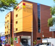
City Express Buenavista
Hotel & Villas Panamá
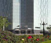
Hilton Mexico City Reforma
Holiday Inn MEXICO BUENAVISTA
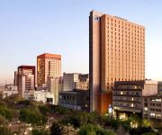
Le Meridien Mexico City
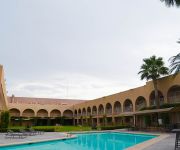
Hotel Villa de Madrid
City Express La Raza
Hotel New York
Videos from this area
These are videos related to the place based on their proximity to this place.
Parque Jardín - Azcapotzalco - Un nuevo estilo de vida
Parque Jardín es un nuevo concepto de desarrollo integral que combina un conjunto de 11 torres a un paso del Centro Comercial que garantiza la plusvalía del conjunto y de la zona. Cada torre...
La región más transparente 1
Celebración del 40 Aniversario de La región más transparente, del escritor mexicano Carlos Fuentes, en El Salón Los Angeles.
MEXICO CITY, UNA BODA. A LA VIBORA, VIBORA DE LA MAR
Fiesta-boda Victor y Ellie, cuando avienta el ramo a las chicas.
Unboxing Star Wars en Blu-ray Edicion para México [HD]
pequeña reseña de como es la edicion para México (y latinoamerica) de la saga de star wars en el formato Blu-ray. nota en el blog: http://binhextech.com/?p=1269 no olviden seguir visitando...
MEXICAN FLAG VIDEO LOOP -BANDERA MEXICANA EN VIDEO LOOP-
I TOOK THIS VIDEO OF THE MEXICAN FLAG, IN THE CITY OF MEXICO FROM THE WINDOW OF A HOTEL LOCATED IN THE HISTORICAL CENTER IN MEXICO CITY. -THIS VIDEO LOOP IN HD IS ...
Vildosola Racing Red Bull X Fighters
Fuimos invitados especiales para el evento de Red Bull X-Fighters este año en la Plaza de Toros en Mexico DF! We were special guests at the Red Bull X-Fighters event this year at the Plaza...
Videos provided by Youtube are under the copyright of their owners.
Attractions and noteworthy things
Distances are based on the centre of the city/town and sightseeing location. This list contains brief abstracts about monuments, holiday activities, national parcs, museums, organisations and more from the area as well as interesting facts about the region itself. Where available, you'll find the corresponding homepage. Otherwise the related wikipedia article.
Metro Buenavista
Metro Buenavista is a station on the Mexico City Metro, in the Colonia Buenavista neighborhood of the Cuauhtémoc borough. It is the southwestern terminal station of Line B (the green-on-silver line, Buenavista-Ciudad Azteca). It also offers connections to the Insurgentes Metrobús bus rapid transit line. The station logo represents the front of an ALCO type diesel locomotive.
Metro La Raza
Metro La Raza (in English, "Metro The Race") is a station on the Mexico City Metro. It is a combined subway and surface station, located in the Colonia Vallejo and Colonia Héroes de Nacozari neighbourhoods of the Gustavo A. Madero borough, in the north of Mexico City. The station logo depicts the nearby La Raza Monument, a pyramid-shaped construction erected in honor to Mexico's many native peoples and cultures.
Metro Autobuses del Norte
Autobuses del Norte is a station on Line 5 of the Mexico City Metro. It is located in the north of Mexico City, in Gustavo A. Madero borough. The station's logo is a front view of an intercity bus, and the station's name means "northern buses". The name and the logo come from the fact that the Northern intercity bus station is located in front of this metro station. The metro station has an information desk and office with pamphlets about the metro.
Metro Potrero
Metro Potrero is a metro station on the Mexico City Metro. It is located in the Gustavo A. Madero borough, in the northern part of Mexico City. The station logo depicts a colt behind a fence. The Spanish word potrero means pasture land used for breeding horses (potros). The name of this station refers to the nearby potreros that existed in the zone in early 20th century.
Metro Guerrero
Metro Guerrero is a metro station on the Mexico City Metro. It is located in the Colonia Guerrero neighborhood of Cuauhtémoc borough of Mexico City, on the intersecion of Zarco street and Eje 1 Norte Mosqueta Avenue. It is a transfer station for both Lines 3 and B. The station logo depicts the bust of Vicente Guerrero (1782-1831), a national hero who participated in the Mexican War of Independence. The name of this station refers to the neighbourhood which it serves.
Metro Tlatelolco
Metro Tlatelolco is a metro station along Line 3 of the Mexico City Metro. It is located in the Tlatelolco neighbourhood of the Cuauhtémoc borough of Mexico City, to the north of the downtown area. It serves the Unidad Habitacional Nonoalco-Tlatelolco mega apartment complex, famous for its Plaza de las Tres Culturas square (with buildings from the pre-Hispanic, colonial, and modern eras) and infamous for the 1968 Tlatelolco massacre of demonstrating students.
Plaza de las Tres Culturas
The Plaza de las Tres Culturas ("Square of the Three Cultures") is the main square within the Tlatelolco neighbourhood of Mexico City. The name "Three Cultures" is in recognition of the three periods of Mexican history reflected by those buildings pre-Columbian, Spanish colonial, and the independent "mestizo" nation. The plaza, designed by Mexican architect and urbanist Mario Pani, was completed in 1966.
Metro Instituto del Petróleo
Metro Instituto del Petróleo is a station along Line 5 and Line 6 of the metro of Mexico City serving the Colonia Valle del Tepeyac, Colonia San Bartolo Atepehuapan, and Colonia Nueva Industrial districts of the Gustavo A. Madero delegation of Mexico City. The connection between platforms of Line 5 and Line 6 is made via a long passage decorated with sculptures made of oil barrels. The station logo represents an oil derrick. The station was named after the nearby Mexican Institute of Petroleum.
Metro Misterios
Metro Misterios is a station on Line 5 of the Mexico City Metro. The station was opened on 1 July 1982. The station serves the Colonia Vallejo and Colonia Peralvillo neighborhoods of the Azcapotzalco borough in the northern portion of Mexico City. The logo represents the silhouette of a misterio, a hermitage, of which fifteen were built along the Calzada de los Misterios – a road that can be considered a northeastern extension of the Paseo de la Reforma.
Metro Vallejo
Metro Vallejo is a station along Line 6 of the Mexico City Metro. It is located in the Colonia Vallejo neighborhood of the Azcapotzalco borough of northwestern Mexico City. Its logo represents a silhouette of a factory. The station opened on 21 December 1983.
José Vasconcelos Library
Mexico City's Vasconcelos Library, labeled by the press as the "Megabiblioteca" ("megalibrary"), is dedicated to José Vasconcelos, the former philosopher, presidential candidate and president of the National Library of Mexico. The library is spread across 38,000 square metres (409,000 sq ft) and had an initial planned cost of 954 million pesos (roughly US$98 million). The Congress of Mexico proposed plans to reduce the budget of 2006 that included cuts for all three branches of government.
Battle of Tlatelolco
The Battle of Tlatelolco was an attack in 1473 on the Mexica altepetl of Tlatelolco by Tenochtitlan and its allies. It resulted in a Tenochca victory, and the deaths of Moquihuixtli, tlatoani ("ruler" or "king") of Tlatelolco and Xilomantzin, tlatoani of Culhuacan, who had conspired to conquer Tenochtitlan.
Colonia Santa María la Ribera
Colonia Santa María la Ribera is a colonia located in the Cuauhtémoc borough of Mexico City, just west of the historic center. It was created in the late 19th century for the affluent who wanted homes outside of the city limits. The colonia reached its height between 1910 and 1930. In the 1930s, the middle class moved in and a new era of construction began. The colonia began to deteriorate in the 1950s, as the city grew around it and apartment buildings were constructed.
Mexican Institute of Petroleum
The Mexican Institute of Petroleum is a public research organization dedicated to develop technical solutions, conduct basic and applied research and provide specialized training to Pemex, the state-owned government-granted monopoly in Mexico's petroleum industry. The Institute was founded on 23 August 1965 by federal decree and is based in Mexico City.
Tlatelolco (Mexico City)
Tlatelolco (or Tlatilōlco, from tlalli land; telolli hill; co place; literally translated "In the little hill of land") is an area in the Cuauhtémoc borough of Mexico City, centered on the Plaza de las Tres Culturas, a square surrounded on three sides by an excavated Aztec archaeological site, a 17th century church called Templo de Santiago, a former convent, and office complexes that used to belong to the Ministry of foreign relations and now are property of the National Autonomous University of Mexico.
Tlatelolco (archaeological site)
Tlatelolco is an archaeological excavation site in Mexico City, Mexico where remains of the pre-Columbian city-state of the same name have been found. It is centered on the Plaza de las Tres Culturas, a square surrounded on three sides by an excavated Aztec site, a seventeenth-century church called the Templo de Santiago, and the modern office complex of the foreign ministry.
Buenavista Station
Buenavista Station is a passenger rail station in Mexico City. The station provided intercity passenger rail service until those services were discontinued by Ferrocarriles Nacionales de México in 1997. In June 2008, the station was reopened to serve as the terminus of the newly inaugurated commuter rail service, the Ferrocarril Suburbano de la Zona Metropolitana del Valle de México.
Unidad Habitacional Nonoalco-Tlatelolco
The Unidad Habitacional Nonoalco-Tlatelolco is the largest apartment complex in Mexico, located in the Cuautemoc borough of Mexico City. It was built in the 1960s by architect Mario Pani. Originally, the complex had 102 apartment buildings, with its own schools, hospitals, stores and more, to make it a city within a city. It was also created to be a kind of human habitat and includes artwork such as murals and green spaces such as the Santiago Tlatelolco Garden.
Colonia Atlampa
Colonia Atlampa is a colonia or neighborhood located in the Cuauhtémoc borough, northwest of the historic center of Mexico City. The boundaries of the area are marked by the following streets: Calzada de Nonoalco or Ricardo Flores Magón Street to the south, Circuito Interior Paseo de las Jacarandas to the north, Avenida Insurgentes Norte to the east and Circuito Interior Instituto Politécnico Industrial to the west. The neighborhood is considered lower class and working class.
Colonia Buenavista
Colonia Buenavista is a colonia or neighborhood in the Cuauhtémoc borough located northwest of the historic center of Mexico City. It has historically been a train terminal, and still is as the southern terminal of the Tren Suburbano commuter rail. The colonia is also home to the offices of the Cuautémoc borough and the mega José Vasconcelos Library.
Colonia Exhipódromo de Peralvillo
Colonia Exhipodromo del Peralvillo is a colonia or neighborhood of the Cuauhtémoc borough of Mexico City, located north of the historic center. It is part of an area of the city that is noted for crime and lower income residents. One area of the colonia around Calzado de la Ronda is noted for stored selling used auto parts, frequently from stolen cars.
Colonia Guerrero, Mexico City
Colonia Guerrero is a colonia of Mexico City located just north-northwest of the historic center. Its borders are formed by Ricardo Flores Magón to the north, Eje Central Lazaro Cardenas and Paseo de la Reforma to the east, Eje1 Poniente Guerrero to the west and Avenida Hidalgo to the south. The colonia has a long history, beginning as an indigenous neighborhood in the colonial period called Cuepopan.
Colonia Peralvillo
Colonia Peralvillo is a colonia located in the Cuauhtémoc borough of Mexico City, just northwest of the city’s historic center. It has been a poor area since colonial times, but the modern colonia was not established until the late 19th and early 20th centuries. Although the area has been the setting for a number of literary works and films, today the area is known for violence and crime, especially shootings and the selling of stolen auto parts.
Colonia San Simón Tolnahuac
Colonia San Simón Tolnahuac is a colonia in the Cuauhtémoc borough of Mexico City, just north of the city’s historic center. The colonia’s borders are marked by the following streets: Eje 1 Poniente to the south, Avenida Rio Consulado to the north, Lerdo Street and Calzada Vallejo to the east and Avenida de los Insurgentes Norte to the west. This area originally was part of the Tlatelolco dominion and functioned as communal farmland through most of the pre-Hispanic and colonial periods.
Colonia Santa María Insurgentes
Colonia Santa María Insurgentes is a colonia in the Cuauhtémoc borough north east of the Mexico City’s historic center. The colonia’s borders are formed by the following roads: Calzada de San Simon to the south, Jacarandas to the north, Avenida de los Insurgentes Norte to the east and Jacarandas to the west. The official establishment of the colonia occurred in 1910, but there had been named streets and laid out blocks for some time before this.









!['Unboxing Star Wars en Blu-ray Edicion para México [HD]' preview picture of video 'Unboxing Star Wars en Blu-ray Edicion para México [HD]'](https://img.youtube.com/vi/4LHTcKg2UMo/mqdefault.jpg)


