Safety Score: 3,6 of 5.0 based on data from 9 authorites. Meaning please reconsider your need to travel to Mexico.
Travel warnings are updated daily. Source: Travel Warning Mexico. Last Update: 2024-04-25 08:17:04
Explore Santa Clara Coatitla
Santa Clara Coatitla in Ecatepec de Morelos (Estado de México) is located in Mexico a little north-east of Mexico City, the country's capital.
Local time in Santa Clara Coatitla is now 01:02 AM (Friday). The local timezone is named America / Mexico City with an UTC offset of -5 hours. We know of 8 airports in the wider vicinity of Santa Clara Coatitla, of which one is a larger airport. The closest airport in Mexico is Licenciado Benito Juarez International Airport in a distance of 7 mi (or 12 km), South. Besides the airports, there are other travel options available (check left side).
There are several Unesco world heritage sites nearby. The closest heritage site in Mexico is Historic Centre of Mexico City and Xochimilco in a distance of 16 mi (or 25 km), South-East. We found 3 points of interest in the vicinity of this place. If you need a place to sleep, we compiled a list of available hotels close to the map centre further down the page.
Depending on your travel schedule, you might want to pay a visit to some of the following locations: Mexico City, Tezoyuca, Nezahualcoyotl, Texcoco and Tecamac. To further explore this place, just scroll down and browse the available info.
Local weather forecast
Todays Local Weather Conditions & Forecast: 26°C / 79 °F
| Morning Temperature | 20°C / 69 °F |
| Evening Temperature | 26°C / 78 °F |
| Night Temperature | 23°C / 74 °F |
| Chance of rainfall | 0% |
| Air Humidity | 19% |
| Air Pressure | 1011 hPa |
| Wind Speed | Gentle Breeze with 8 km/h (5 mph) from East |
| Cloud Conditions | Scattered clouds, covering 44% of sky |
| General Conditions | Scattered clouds |
Friday, 26th of April 2024
26°C (78 °F)
22°C (71 °F)
Scattered clouds, gentle breeze.
Saturday, 27th of April 2024
26°C (78 °F)
24°C (76 °F)
Few clouds, gentle breeze.
Sunday, 28th of April 2024
26°C (78 °F)
24°C (76 °F)
Sky is clear, light breeze, clear sky.
Hotels and Places to Stay
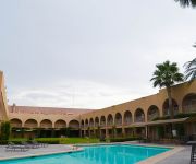
FIESTA INN ECATEPEC
BRISTOL HOTEL
Hotel Villa de Madrid
Santa Fe
Bahia del Sol Beach Front Boutique Hotel
Hotel Brasilia
Motel Cartagena
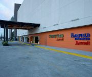
Fairfield Inn & Suites Mexico City Vallejo
Gran Hotel Panorama
City Express La Raza
Videos from this area
These are videos related to the place based on their proximity to this place.
Los Chavos Musical De Mexico ♪♫ La San Marqueña ♫♪ ( en vivo )
saludos a todos los paisanos de oaxaca, guerrero , y toda la union americana de sus amigos los chavos musical de mexico desde yuteyuvi sta maria yucuhiti tlaxiaco oaxca... siguenos en ...
Fuegos artificiales en San Francisco Xalostoc
Fuegos artificiales en la colonia San Francisco Xalostoc.
View of Mexico City from Chapultepec Fort
Glimpses of Mexico: The Chapultepec Fort (Castillo de Chapultepec) and panoramic view of Mexico City from this Fort, Sunday, 3 June 2012.
california blues-perdoname y atraves de la ventana-primer festival rocanrolero tulpetlac 2013.
se iso lo mejor con el audio.
México - D.F - Plaza Garibaldi - ¿Manuel el valiente? - 16.07.14
Una noche fuimos a recorrer Plaza Garibaldi y comimos en uno de estos restaurantes llenos de Mariachis, imágenes típicas mexicanas y música de ranchera. Manuel, un muchacho peruano a quien...
Jolly Old Saint Nicholas
Escuela Secundaria Federalizada "Quetzalcóatl" Nº 53 Coro Escolar del Turno Matutino y Alumnas del Turno Vespertino Festival de Navidad: Diciembre de 2008 Villancios y Pastorela Academia:...
Inundación en Santa Clara, Estado de México
Así se pone esta zona en la epoca de lluvias, y eso que no llovio muy fuerte.
1destino perdido-ya no me busques mas (centro cívico de santa clara) 9/03/14
para los que creen en el destino y yo soy uno de ellos.
Videos provided by Youtube are under the copyright of their owners.
Attractions and noteworthy things
Distances are based on the centre of the city/town and sightseeing location. This list contains brief abstracts about monuments, holiday activities, national parcs, museums, organisations and more from the area as well as interesting facts about the region itself. Where available, you'll find the corresponding homepage. Otherwise the related wikipedia article.
Tlalnepantla de Baz
Tlalnepantla de Baz (better known as Tlanepantla) is a city and a municipality of the State of Mexico, north of Mexico City (Ciudad de Mexico). Tlalnepantla comes from the Náhuatl words tlalli (land) and nepantla (middle) to mean the middle land. The city was known in prior times as Tlalnepantla de Galeana and Tlalnepantla de Comonfort, to honor Hermenegildo Galeana and Ignacio Comonfort, respectively.
Metro Múzquiz
Múzquiz is a station on Line B of the Mexico City Metro system. The station was opened on 30 November 2000. It is named after Melchor Múzquiz who served as President of Mexico during the second half of 1832.
Metro Ecatepec
Ecatepec is a station on Line B of the Mexico City Metro system. It is in the Ecatepec de Morelos city in the State of Mexico adjacent to Mexico City. The station opened on November 30, 2000, under its original name, Metro Tecnológico. The station's icon was the emblem of the Tecnológico de Estudios Superiores de Ecatepec, whose facilities are located nearby.
Metro Olímpica
Olímpica is a station on Line B of the Mexico City Metro system. The station is located at Avenida Central and Avenida Valle de Santiago in the Colonia Jardines de Aragón neighborhood and Avenida Grecia in the Colonia La Olimpica II neighborhood in the State of Mexico adjacent to Mexico City. The logo of the station features the five interlaced Olympic rings of the Olympic Games logo. The station was opened on 30 November 2000.
Metro Plaza Aragón
Plaza Aragón is a surface station on Line B of the Mexico City Metro system. The station was opened on 30 November 2000. It is located in the median of Avenida Carlos Hank González in the Colonia Rinconada de Aragón neighborhood in the State of Mexico adjacent to Mexico City. The station logo depicts pots for sale at a tianguis style open air market.
Metro Ciudad Azteca
Ciudad Azteca (English: Aztec City) is a surface terminal station on Line B of the Mexico City Metro system. It is located in the median of Avenida Carlos Hank González in the Colonia Ciudad Azteca neighborhood of Ecatepec de Morelos in the State of Mexico adjacent to Mexico City. It offers connections to the Terminal Multimodal Azteca Bicentenario bus station. The logo represents a hieroglyph typical of the Aztec city of Tenochtitlán. The station was opened on 30 November 2000.
San Juanico disaster
The San Juanico disaster was an industrial disaster caused by a massive series of explosions at a liquid petroleum gas (LPG) tank farm in San Juanico, Mexico on 19 November 1984. The explosions consumed 11,000 cu. meters of gas, representing one third of Mexico City's entire liquid petroleum gas supply. The explosions destroyed the facility and devastated the local town of San Juan Ixhuatepec, with 500–600 people killed, and 5000–7000 others suffering severe burns.


