Safety Score: 3,0 of 5.0 based on data from 9 authorites. Meaning we advice caution when travelling to France.
Travel warnings are updated daily. Source: Travel Warning France. Last Update: 2024-05-06 08:04:52
Discover Pont Haut
Pont Haut in Alpes-Maritimes (Provence-Alpes-Côte d'Azur Region) is a city in France about 383 mi (or 616 km) south-east of Paris, the country's capital city.
Local time in Pont Haut is now 12:12 AM (Tuesday). The local timezone is named Europe / Paris with an UTC offset of 2 hours. We know of 12 airports in the vicinity of Pont Haut, of which 5 are larger airports. The closest airport in France is Barcelonnette - Saint-Pons Airport in a distance of 16 mi (or 26 km), North-West. Besides the airports, there are other travel options available (check left side).
There are two Unesco world heritage sites nearby. The closest heritage site is Vineyard Landscape of Piedmont: Langhe-Roero and Monferrato in Italy at a distance of 57 mi (or 92 km). Looking for a place to stay? we compiled a list of available hotels close to the map centre further down the page.
When in this area, you might want to pay a visit to some of the following locations: Bersezio, Pietraporzio, Sambuco, Acceglio and Canosio. To further explore this place, just scroll down and browse the available info.
Local weather forecast
Todays Local Weather Conditions & Forecast: 7°C / 44 °F
| Morning Temperature | 8°C / 46 °F |
| Evening Temperature | 9°C / 49 °F |
| Night Temperature | 8°C / 47 °F |
| Chance of rainfall | 14% |
| Air Humidity | 99% |
| Air Pressure | 1015 hPa |
| Wind Speed | Gentle Breeze with 5 km/h (3 mph) from North-West |
| Cloud Conditions | Overcast clouds, covering 100% of sky |
| General Conditions | Moderate rain |
Tuesday, 7th of May 2024
7°C (45 °F)
6°C (43 °F)
Heavy intensity rain, light breeze, overcast clouds.
Wednesday, 8th of May 2024
12°C (54 °F)
7°C (45 °F)
Light rain, gentle breeze, scattered clouds.
Thursday, 9th of May 2024
15°C (59 °F)
11°C (51 °F)
Light rain, light breeze, few clouds.
Hotels and Places to Stay
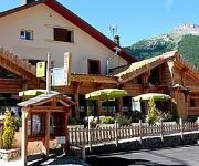
L Ecureuil Logis
Hotel Le Chastellares
Videos from this area
These are videos related to the place based on their proximity to this place.
Terrain constructible
SAINT ETIENNE DE TINEE Secteur Hors agglomération Terrain constructible Prix 290 000€ Surface 5400 m² Terrain Topographie En pente douce, Vue Montagne, Exposition Sud, Viabilités principales ...
Rando Vol Saint Etienne de Tinée, le Claï inférieur
Jeudi 28 Septembre 2014 en compagnie de Jacques, Très beau vol rando près des Lacs de Vens. Original Soundtrack: COLDPLAY, A Sky Full of Stars.
Animaux / Montagne : Cavalcade mouflonnesque
Au printemps les femelles mouflon descendent aux portes des villages pour manger l'herbe verte. Pendant que les mamans broutent, les petits, pas encore sevrés font les fous... Saint Etienne...
Bienvenue dans le Mercantour... séjour authentique aux chambres et table d'hôtes de l'étoile
Petit film réalisé à Saint Dalmas le Selvage par un client Hollandais super sympa et passionné... Merci de laisser un commentaire et cliquez sur "j'aime" .... Le massif du Mercantour aux...
Videos provided by Youtube are under the copyright of their owners.


