Safety Score: 3,0 of 5.0 based on data from 9 authorites. Meaning we advice caution when travelling to France.
Travel warnings are updated daily. Source: Travel Warning France. Last Update: 2024-05-01 08:01:32
Touring Les Agneliers Bas
The district Les Agneliers Bas of Les Agneliers in Alpes-de-Haute-Provence (Provence-Alpes-Côte d'Azur Region) is a subburb located in France about 371 mi south-east of Paris, the country's capital place.
Need some hints on where to stay? We compiled a list of available hotels close to the map centre further down the page.
Being here already, you might want to pay a visit to some of the following locations: Barcelonnette, Bersezio, Digne-les-Bains, Acceglio and Pietraporzio. To further explore this place, just scroll down and browse the available info.
Local weather forecast
Todays Local Weather Conditions & Forecast: 8°C / 47 °F
| Morning Temperature | 7°C / 44 °F |
| Evening Temperature | 7°C / 45 °F |
| Night Temperature | 7°C / 44 °F |
| Chance of rainfall | 13% |
| Air Humidity | 93% |
| Air Pressure | 1007 hPa |
| Wind Speed | Gentle Breeze with 7 km/h (4 mph) from South-West |
| Cloud Conditions | Overcast clouds, covering 100% of sky |
| General Conditions | Moderate rain |
Thursday, 2nd of May 2024
6°C (42 °F)
4°C (39 °F)
Rain and snow, light breeze, overcast clouds.
Friday, 3rd of May 2024
8°C (46 °F)
5°C (41 °F)
Few clouds, light breeze.
Saturday, 4th of May 2024
9°C (48 °F)
7°C (44 °F)
Light rain, light breeze, overcast clouds.
Hotels and Places to Stay
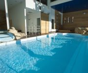
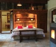
Marmotel
Club du Soleil les Bergers
de la Placette
Azteca
Godille Immobilier
Pra Loup Vacances
Chambres d'Hôtes Les Méans
Videos from this area
These are videos related to the place based on their proximity to this place.
Tournée Tennis Pra Loup Aout 2012
Le Tennis Etudes des Hauts de Nîmes vous emmène dans la valée de l'Ubaye (Pra-Loup et Barcelonnette) pour une tournée qui vient concrétiser une année sportive riche en Travail, Rigueur,...
praloup dans la poudreuse film et tombe dans la poudreuse avec la gopro
j'avais chaud alors pour me rafraichir je suis tombé dans la poudreuse en hors piste.
Descente en ski gopro HD Hero.
Et encore une descente en ski ! cette fois a pra-loup avec ma gopro HD hero. Abonnez vous a ma chaîne svp pour plus de videos et laissez un petit pouce vert apres l'avoir regardée en entier......
Praloup ... ma station de ski - Alpes du Sud
Pra Loup compte parmi les plus beaux domaines skiables avec 180 km de pistes reliées au Val d'Allos et 50 remontées mécaniques. Pra Loup 1500, sous le charme des chalets nichés dans...
Team Snowscoot PraLoup 2
"BIM" avec les premiers épisodes neigeux encore une belle video du team praloup!!!!!
Amazing - Praloup - la Foux d'allos - Ouverture -
Première journée de la saison à Praloup & la Foux d'Allos. 1er jour d'ouverture de la liaison. Bonne petite poudeuse. Video de GOPRO 3 Black Edition. Filmé en 960 / 100 Fps Ralentis à 25%
Gilles Coustellier - Coupe du Monde UCI Trial Pra Loup - Finale 26 - Trial Inside
Gilles Coustellier - Coupe du Monde UCI Trial Pra Loup - Finale 26 pouces - Trial Inside.
Videos provided by Youtube are under the copyright of their owners.
Attractions and noteworthy things
Distances are based on the centre of the city/town and sightseeing location. This list contains brief abstracts about monuments, holiday activities, national parcs, museums, organisations and more from the area as well as interesting facts about the region itself. Where available, you'll find the corresponding homepage. Otherwise the related wikipedia article.
Ubaye Valley
The Ubaye Valley is an area in the Alpes de Haute-Provence département, in the French Alps and has approximately 7,700 residents. Its residents are called Ubayens. Its chief town is the sous-préfecture of Barcelonnette.
Fort de Tournoux
The Fort de Tournoux is a fortification complex in the Ubaye Valley in the French Alps. It was built between 1843 and the early 20th century to defend France against invasion from Italy and Savoy. It was described as the "Military Versailles of the 19th century," resembling a Tibetan monastery on the mountainside above the Ubaye. The fort is actually an ensemble of fortifications, including some "batteries" that rival the main fort in size and power.
Bourdous
The Bourdous is a short mountain river that flows through the Alpes-Maritimes department of southeastern France. Its source is in the Maritime Alps, and it flows into the river Var in Entraunes.
Canton of Barcelonnette
The canton of Barcelonnette is an administrative division in southeastern France. It includes the following communes: Commune Inhabitants Postal code INSEE code Barcelonnette 2 819 04400 04019 La Condamine-Châtelard 166 04530 04062 Enchastrayes 504 04400 04073 Faucon-de-Barcelonnette 208 04400 04086 Jausiers 896 04850 04096 Larche 83 04530 04100 Meyronnes 44 04530 04120 Saint-Paul-sur-Ubaye 190 04530 04193 Saint-Pons 641 04400 04195 Les Thuiles 344 04400 04220 Uvernet-Fours 614 04400 04226
Canton of Le Lauzet-Ubaye
The canton of Le Lauzet-Ubaye is an administrative division in southeastern France. It includes the following communes: Commune Inhabitants Postal code INSEE code La Bréole 325 04340 04033 Le Lauzet-Ubaye 203 04340 04102 Pontis 45 05160 04154 Méolans-Revel 284 04340 04161 Saint-Vincent-les-Forts 203 04340 04198
Canton of Allos-Colmars
The canton of Allos-Colmars is an administrative division in southeastern France. It includes the following communes: Commune Inhabitants Postal code INSEE code Allos 637 04260 04006 Beauvezer 278 04370 04025 Colmars 378 04370 04061 Thorame-Basse 151 04170 04218 Thorame-Haute 174 04170 04219 Villars-Colmars 209 04370 04240
Pra Loup
Pra Loup, is a ski resort in France, at Uvernet-Fours in the Alpes-de-Haute-Provence, 7 km from the town of Barcelonnette. The ski station has two separate base areas, 2 km apart: Pra Loup 1600 - primary base area at 1,600 m above sea level Pra Loup 1500 - (Les Molanès) The lift-served summit elevation is 2,500 m, for a vertical drop of 900 m to Pra Loup 1600. The resort has 53 lifts, 165 km of tracks, and its ski area is linked to that of the Foux-d'Allos through the valley of Agneliers.
Bléone
The Bléone is a 67.5 km long river in the Alpes-de-Haute-Provence département, southeastern France. Its source is several small streams converging near the refuge de l'Estrop, a mountain shelter in Prads-Haute-Bléone. It flows generally southwest. It is a left tributary of the Durance into which it flows between L'Escale and Les Mées.


